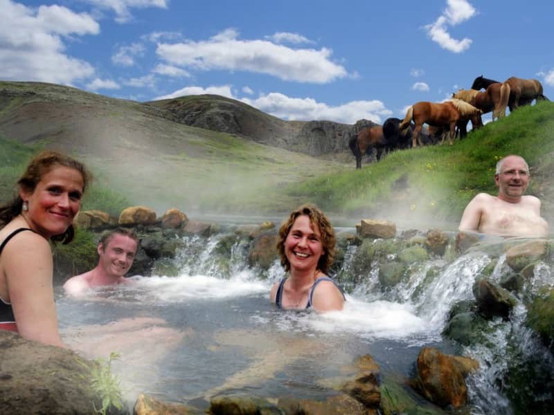
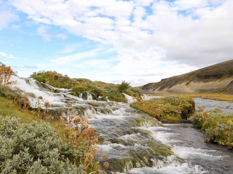
Reykjadalur valley
Reykjadalur valley is the most popular and arguably the most beautiful hiking area in Ölfus. Hot springs and colorful areas full of geothermal activity entertain along a hiking trail that leads to a hot river. For some of the river's length, the temperature is perfect for bathing, and that's a wonderful natural experience.
The trail by Reykjadalur can be closed, so it's good to check the conditions before going. To check whether the valley is open or closed to visitors, check out the website of Safetravel.is. Those who plan on visiting the valley need to respect the rules and stay on the paths. Please help us to protect the fragile vegetation around the area!
View
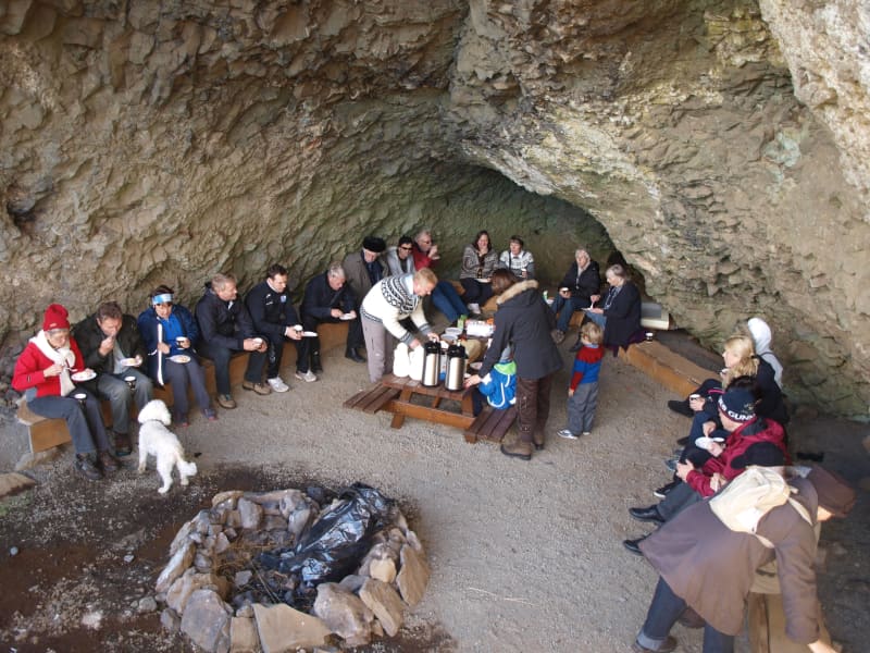
Hellisskógur forest
Hellisskógur is a small forest just outside of the town of Selfoss. In Hellisskógur are roads, walking paths around the area, and benches so visitors can relax and enjoy the site.
The cave in Hellisskógur forest was formed during a latter glacial period by sea erosion. Sea levels have been higher than now several times, and signs of sea erosion can be seen on more cliffs in the area, made of around 0, 7 – 3, 1 million-year-old basalt. The cave was previously used to store hay in the back and as a sheepcote in the front.
It was once believed that the cave was haunted by a ghost wearing a blue scarf. The story tells of a young man who was broken hearted and hung himself in the cave using a long blue scarf.
Here is a map of Hellisskógur
View
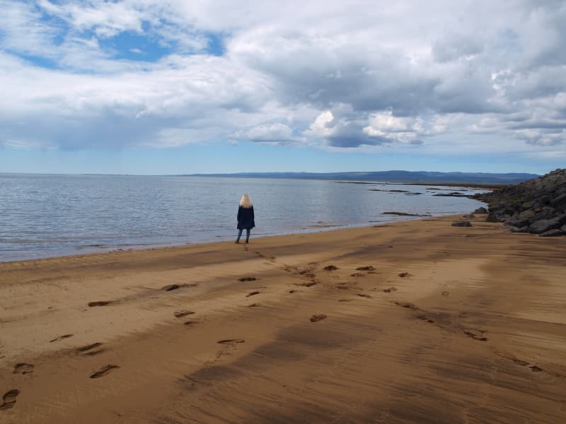
The coastline between Stokkseyri and Eyrarbakki
The coastline between the rivers Þjórsá and Ölfusá (25 km/15 mi) forms the outskirt of the great Þjórsárhraun lava field. Eyrarbakki and Stokkseyri provide easy access to the coastline as well as a path between the two villages where you can see the Atlantic Ocean and marvel at the fact the South Pole is directly to the south. This spot has a great view of both the ocean and mountains. Information signs can be found in both villages as well as an observation platform in Stokkseyri.
View
Knarrarósviti Lighthouse
Built-in 1938-1939, the lighthouse was the first one in Iceland to be built out of reinforced concrete. For a long time, the lighthouse was the tallest building in South Iceland, 26,2 meters (86 feet) high. It was designed by the engineer Axel Sveinsson as a blend of functionalism and art nouveau (jugendstil). In summertime (mid of June to start August) the lighthouse is open every day.
Knarrarósviti lighthouse is part of the beautiful South Coast Lighthouse trail that you can find more information about here.
View
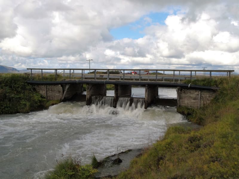
Flóaáveita - canals
Flóaáveitan are canals that run through the entire Flói region, from Ölfusá in the west to Þjórsá River in the east. This monumental construction consisted of 300 km long canals and 900 km of embankments. The Flói irrigation system reached over 12 thousand hectares of land and became a major transition in farming and production in the area at the time. The construction of Flói irrigation system began in 1922 and irrigation began its activities in 1927. When the irrigation was inaugurated in 1927 it was one of the greatest structures in Europe and to this day it plays an important role in transferring water between farms. Beside the sluice gate you will find an information board with more details about the Flói irrigation system. To the east of the sluice gate is a marked hiking trail along Hvítá (about 4,4 km, one way).
View
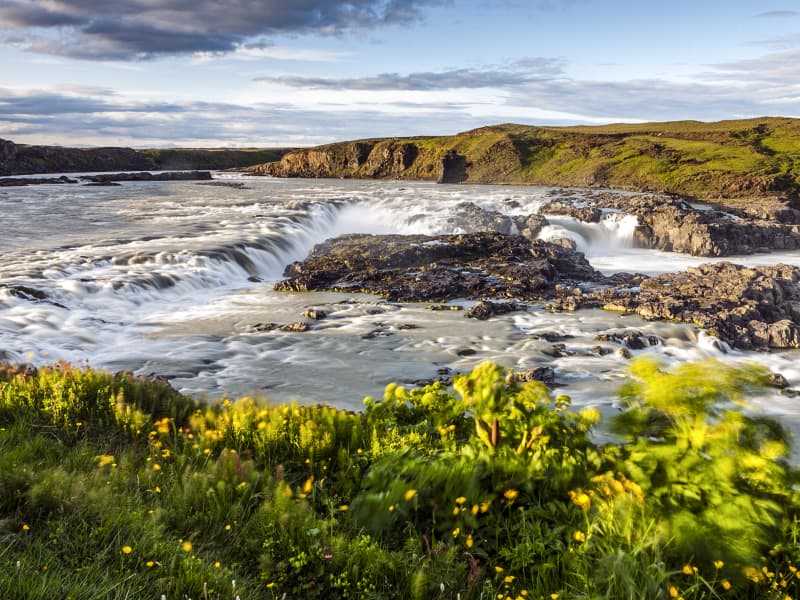
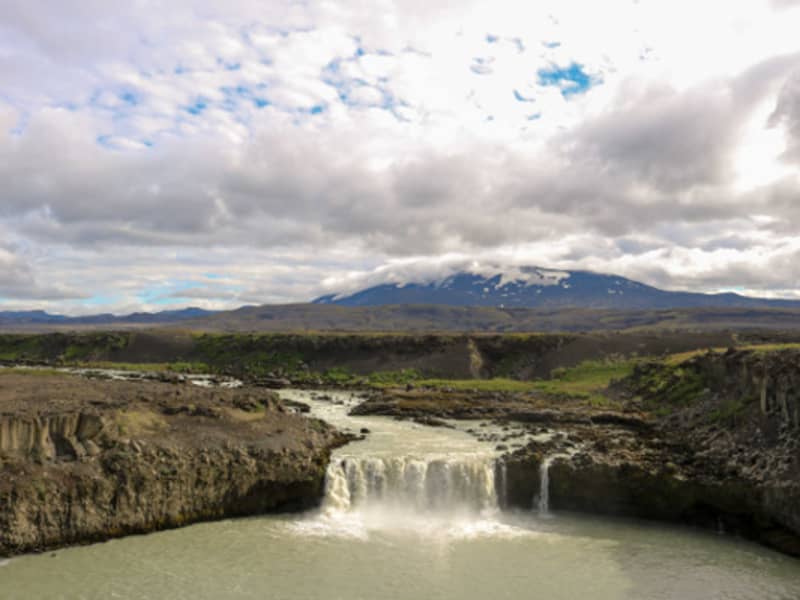
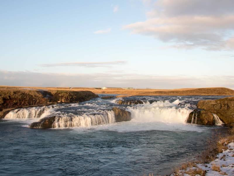
Urriðafoss waterfall
Urriðafoss is a waterfall in the Þjórsá River. Þjórsá is Iceland's longest river, 230 km, and Urriðafoss is the most voluminous waterfall in the country. This mighty river drops down (360 m3/sec) by the edge of the Þjórsárhraun lava field in beautiful and serene surroundings. Þjórsárhraun lava field is the result of the greatest lava flow on earth since the Ice Age. It is located right off highway 1.
View
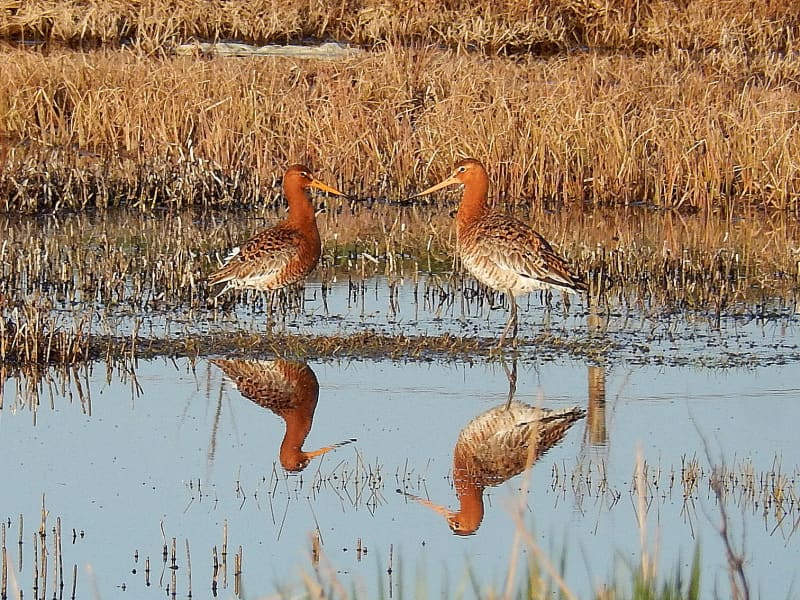
The Flói Bird Reserve
Northwest to the town of Eyrarbakki is a wetland area, rich in birdlife. The reserve has walking paths and a bird hide, an ideal spot for bird watching. The Flói Bird Reserve is listed in the Bird Life international Association. The Reserve is characterized by its flood meadows and numerous small ponds. Approximately 70 species of birds have been recorded in the Reserve. During spring and autumn migration Greylag Geese and White-fronted Geese can be found as well as Wigeon and Tufted Duck and various waders such as Snipe and passerines like Wheatear. During winter, birds, chiefly gulls and sometimes Long-tailed Duck and Common Eider, are concentrated in the estuary of the river Ölfusá. Whooper Swan, Teal, Mallard and Goosander are attracted to open water in winter.
View
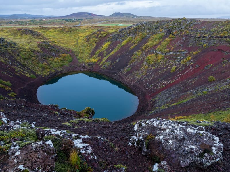
Kerið Crater
Kerið is a 55 m deep volcanic crater, about 3000 years old. It is a part of a group of volcanic hills called Tjarnarhólar and is now filled with water, creating a lake whose steep circular slopes resemble an ancient amphitheater.
View
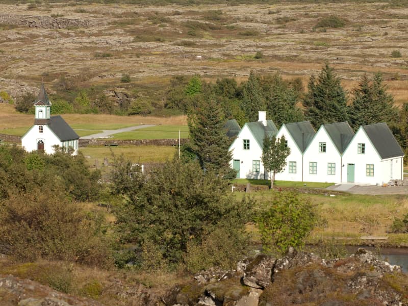
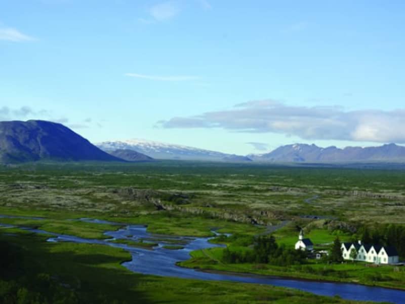
Þingvellir National Park
Þingvellir National Park is a designated UNESCO World Heritage site. It is one of the most important places in Icelandic history, as well as being famous for its unique geological features. It is among the three key locations on The Golden Circle.
The parliament plainsThe site has historical importance spanning over 1000 years. In 930, the Alþingi, one of the oldest parliamentary institutions in the world, was founded. In fact, Þingvellir literally translates to "parliament plains". The Alþingi met annually, and the Lawspeaker recited the law to all the gathered people and resolved disputes as well. This is where Christianity was made the official religion of Iceland around the year 1000. On June 17th, 1944, the independence of The Republic of Iceland was proclaimed in Þingvellir.Where Eurasia meets North AmericaÞingvellir has been a national park since 1928 because of its special tectonic and volcanic environment. The effect of the continental drift can be clearly seen in the cracks and faults traversing the region, the most famous one, Almannagjá, being a veritable canyon.
By Iceland's largest lakeÞingvellir is situated on the northern shore of Þingvallavatn, the biggest lake in Iceland. The river Öxará traverses the national park and forms a waterfall at the Almannagjá called Öxaráfoss. Together with Gullfoss waterfall and the Geysir hot spring area, Þingvellir is part of the famous Golden Circle travel route.
What to seeThe national park contains several points of interest, including Almannagjá Gorge, which showcases the effects of continental drift; Lögberg cliff, where the assembly of Alþing met; Öxarárfoss waterfall; and Peningagjá, a deep fissure with crystal clear water where visitors like to throw a coin and make a wish. A quaint wooden church stands in a picturesque location, and the national park offers a network of walking paths.
Activities and servicesGuests may opt to enter the park's visitor center and exhibition to learn more about Þingvellir's unique history and nature. Along with varied hiking options, visitors may enjoy bird-watching or angling. Fishing permits can be bought on location. Another popular activity at Þingvellir is snorkeling or diving with experienced local tour operators.
CampingÞingvellir is ideal for camping. There are several camping grounds at the national park, some of which offer showers and electricity.
View
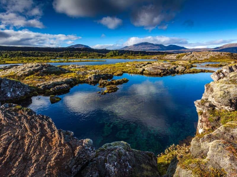
Þingvallavatn Lake
Lake Þingvallavatn lies in a rift valley that extends south from the Langjokull glacier to mount Hengill and from Botnssulur mountains in the west to Lyngdalsheidi heath in the east. The lake is the largest natural lake in Iceland, about 84 square kilometers, at an altitude of approximately 100 meters above sea level. The deepest part of the lake measures 114 meters, which means it reaches below sea level. The catchment area of Lake Thingvallavatn, about 1300 square kilometers, lies in the same direction as the fissure in the area, and its existence is closely connected with its geological history. The water in the lake is very cold and therefore very pure, so snorkeling and diving are popular. Silfra, one of the fissures in the northern part of the lake, is one of the most popular diving spots in Iceland.
View
Thingvellir National park
At the campground there are WC´s, showers, washing machines and a outside grill. In the service centre visitors can pay for camping and fishing permit and seek further information about the area.There is a small cafeteria which services soup, sandwiches and pizza.Summer opening hours (June-August):09:00-20:00
Winter opening hours (September - May):Information desk: 09:00-16:00Store and Service Centre at Leirar: 09:00-18:00
View
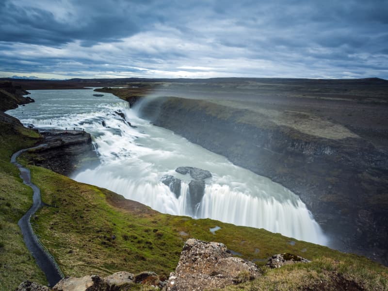
Gullfoss waterfall
Gullfoss is two separate waterfalls; the upper one has a drop of 11 meters and the lower one 21 meters. The rock of the river bed was formed during an interglacial period.
Water flows over Gullfoss at an average rate of 109 cubic meters per second. The heaviest floods have recorded a flow of 2000 cubic meters per second. During the summer, the flow is 130 cubic meters per second, which would take only 3 seconds to fill this building. People were eager to exploit the power potential of Gullfoss, and many plans for hydroelectric developments on the river Hvítá have been proposed.
The trails by Gullfoss can be closed, so it's good to check the conditions before going. To check whether it is open or closed to visitors, check out the website of Safetravel.is.
View
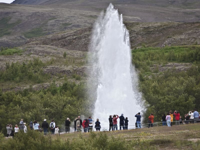
Geysir Geothermal area
One of the greatest natural attractions of Iceland and part of the famous "Golden Circle Tour," The Great Geysir, or Stori-Geysir, has been dormant since 1916 when it suddenly ceased to spout. It came to life only once in 1935 and quickly went back to sleep. Since then, its repose has sporadically been disturbed by the dumping of tons of carbolic soap powder into its seething orifice to tickle it to spout.
It is not exactly known when Geysir was created. It is believed that it came into existence around the end of the 13th century when a series of strong earthquakes, accompanied by a devastating eruption of Mt. Hekla, hit Haukadalur. In this geothermal valley, Geysir is located. What is known is that it regularly spouted every third hour or so up to the beginning of the 19th century and, after that, progressively at much longer intervals until it completely stopped in 1916. Whether its silence is eternal or temporary, no one knows.
When it was alive and shooting, it could thunderously blast a spectacular jet of superheated water and steam into the air as high as 60 to 80 meters, according to different sources. Its opening is 18 meters wide and its chamber 20 meters deep. One reason for cessation is believed to be the accumulated rocks and foreign objects thrown into it by thousands of tourists throughout the years. Though definitely damaging, this could not be the only reason for its dormancy.
The Great Geysir was among the most notable geysers in the world, such as those in Yellowstone Park, New Zealand, and North Iceland. The English word "geyser" is derived from the Icelandic word "geysir," which means gusher. Though the Great Geysir itself is now more or less inactive, the area surrounding it is geothermically very active with many smaller hot springs.
The attraction of the area is now Strokkur (The Churn), another geyser 100 meters south of the Great Geysir, which erupts at regular intervals every 10 minutes or so, and its white column of boiling water can reach as high as 30 meters. The whole area is a geothermal park sitting on top of a vast boiling cauldron. Belching sulfurous mud pots of unusual colors, hissing steam vents, hot and cold springs, warm streams, and primitive plants can all be found here.
A short distance away to the west stands the small Laugarfjall Mountain with a panoramic view overlooking the Geysir area. King Christian IX of Denmark visited the area in 1874 and by the foot of the mountain are the rocks where he leaned while his hosts tried to impress and amuse him by boiling eggs in the hot springs. The rocks are now called Konungssteinar ("The King's Stones").
View
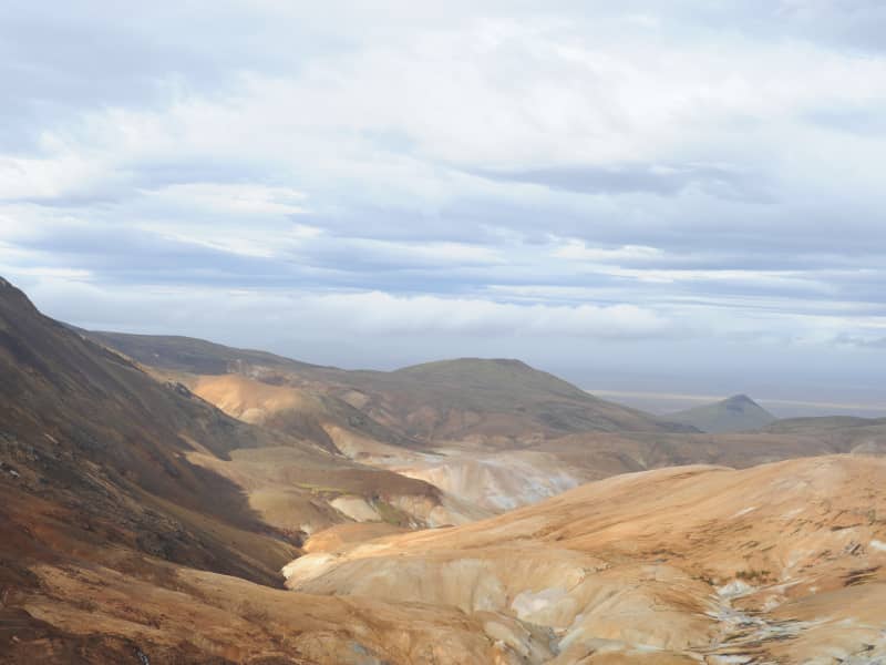
Kerlingarfjöll Mountains
The mountain massif Kerlingarfjöll (The Giantess Mountains; 800 - 1500 m) is the main ornament in the chain of mountains and glaciers framing the Kjölur area. It covers about 150 km² area southeast of The Temple Glacier (Hofsjökull) It derives its name from a single, 25 m high and dark hyaloclastite pillar protruding from the light-colored, rhyolite scree of the peak Kerlingartindur. The aforementioned types of rock represent the main structure of the mountain massif and this yellowish tint is the dominant color in the area.The area is full of small steaming hot springs, mud pools, and water fountains. It is truly a hiker's paradise. It is one of the largest geothermal areas in all of Europe and there are future plans to construct a large geothermal steam plant here for electricity to harness the massive amounts of energy stored here. The area is very unique, sensitive, and beautiful - why such a decision may be controversial if proper conservational steps are not taken when doing so.It is recommended to use 4wd vehicles because of the various and changing condition of the tracks and unbridged rivers, which have to be forded with the greatest of care. It is also recommended that people read the special brochure on driving in the interior before heading up there and remember, that off-road driving is strictly forbidden. Many of those who have visited the interior catch the bug and the only remedy is to come back again and again. It is like an incurable disease. Traveling across the interior was common during the Saga period, but after that up to the middle of the 18th century, superstition kept people away. Nowadays - more and more people enjoy this part of the country the whole year-round.
The small glacier patches up there have been retreating fast and now the summer skiing school, which was operated for decades, exists no more. Its complex of houses is now being used to accommodate travelers in the area during the summer months.
View
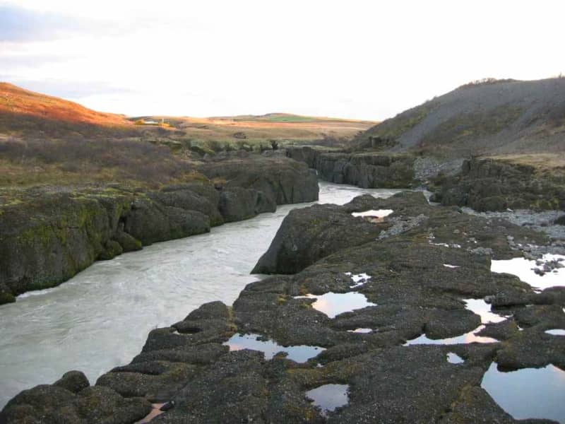
Brúarhlöð
Brúarhlöð is a narrow gorge in the Hvitá River about three kilometers south of the Golden Waterfalls (Gullfoss). The river has formed the rocks into beautiful pillars and formations through the centuries. The name of the rocks is Breccias (Hyaloclastite).
Just above Brúarhlöð is a bridge over the river, built in 1959 after the first two bridges washed away, the first one in 1929 and the second in 1930. When driving over the bridge, we can only imagine the forces needed to wash away a bridge of that size.
Hvita River is a popular place for river rafting, and rafting through Brúarhlöð is an adventure that is difficult to describe with words. Travelers should make a note to stop at Brúarhlöð and view the magnificent nature and the rock formations.
View

Hjálparfoss Waterfall
Hjálparfoss is a beautiful, two-stepped waterfall near the confluence of Rivers Thjorsa and Fossa in the Thjorsa Valley. The surrounding area is called Hjalp (Help) because the travelers across the Sprengisandur Route found great help reaching a vegetated area to graze their horses after a long journey in the barren interior.
As elsewhere in the valley, the signs of the eruptions of Mt. Hekla are very prominent by the waterfall, with ashes everywhere.
View
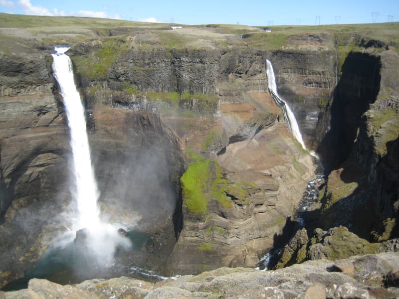
Háifoss Waterfall
The waterfall Háifoss is situated near the volcano Hekla in the south of Iceland. The river Fossá, a tributary of Þjórsá, drops here from a height of 122 m. This is the third-highest waterfall on the island. For a long time, the waterfall had no name, but in 1912 Dr. Helgi Pétursson, a geologist, came and named him.
From the historical farm Stöng, destroyed by a volcanic eruption of Hekla in the Middle Ages and reconstructed, it is possible to hike to the waterfall along the Fossá (6km each way). Above the waterfall, there is also a parking lot, so the hiking can also be done in the other direction.
View
Fossabrekkur
The uppermost falls in the Ytri-Rangá river are called Fossabrekkur. The falls are just below the western source of the river just after entering the common land of the Landmannaafréttur.
Fossabrekkur is a fertile oasis in the barren pumice landscape. It is necessary to drive to the location to see this gem, as it is well hidden.
Fossabrekkur is a unique and beautiful location where the western arm of Ytri-Rangá falls off the rocks into the eastern cape and runs after that in a single channel almost to the sea.
View
Þjófafoss waterfall
Þjófafoss is in the river Þjórsá, to the east of the Merkurhraun lava field. The waterfall's name translates as "thieves' waterfall," as thieves used to be executed by drowning in its pool. The waterfall is one of the three main waterfalls in Þjórsá. The Þjórsá river forms the boundary between Rangárvallasýsla and Árnessýsla and is the longest river in Iceland.
Þjófafoss is to the south of Búrfell mountain, not far from the Búrfell Power Plant and somewhat lower down from Tröllkonuhlaup in Þjórsá. The flow rate in Þjófafoss is relatively low during winter but greater during the summer. This is due to the power plants on the river, as a large proportion of the water is diverted past the falls. The river is dammed at Sultartangi, forming the Sultartangalón reservoir. The water is first channeled through Sultartangi Power Plant and then into the Bjarnarlón reservoir and through the Búrfell Power Plant. As a result, it is first and foremost when the Sultartangalón reservoir is full in late summer that the excess water can flow over Þjófafoss.
With the construction of the Búrfell Power Plant 2, water flow over Þjófafoss has decreased, even more during summer and winter.
View
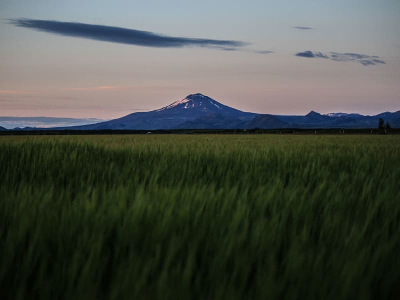
Hekla volcano
The volcano Mt. Hekla is Iceland’s most famous volcano and the one that has erupted most frequently in recent years. Mt. Hekla rises 1,491 m over sea level and can widely be seen in the south of Iceland. Hekla has been dubbed the Queen of Icelandic Volcanos and is well known internationally.
Considerable superstitions have been attached to the mountain, with the most famous legend being that it is the entrance to Hell and might even be Hell itself. The first documented expedition onto the mountain is from 1750 when the naturalists Eggert Ólaffson and Bjarni Pálsson scaled the mountain. The route to the top of Hekla is quite popular, although hikers must be aware of the danger that can occur if the mountain should erupt. The route taken normally starts from Skjólkvíar.
Hekla is located in an area where the South Iceland fracture zone meets the South Iceland volcanic zone, which probably accounts for its frequent eruptions. Hekla has erupted in the following years since Iceland was settled: 1104, 1158, 1206, 1222, 1300, 1341, 1389, 1501, 1597, 1636, 1693, 1766, 1845, 1947, 1970, 1980, 1981, 1991 and 2000. Geologists have repeatedly reiterated in recent years that Hekla is ready to erupt and can erupt at any time. However, the mountain does generally provide an hour’s warning.
View
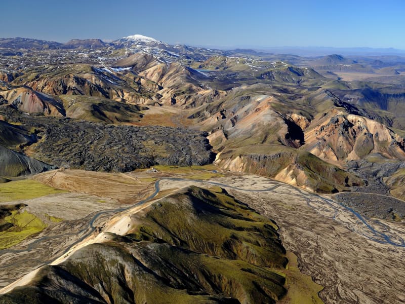
Landmannalaugar - Nature Reserve
Landmannalaugar derives its name from a hot pool that rises under the Laugahraun lava field. Landmannalaugar has been a stopping point for people for centuries, and the mountain shepherds on Landmannaafréttur have stayed there while herding sheep off the mountain for as long as there have been reports of such travel.
Many beautiful mountains can be seen from Landmannalaugar: Barmur, Bláhnúkur, Brennisteinsalda, Suðurnám, and Norðurnám. The area has considerable deposits of rhyolite, obsidian, and rhyolite lava, and the Landmannalaugar landscape is famous for its colorfulness and unique environs.
The start of one of the most popular hiking trails in Iceland, Laugavegurinn, is at Landmannalaugar. The trail proceeds along Hrafntinnusker, Álftavatn, Hvanngil, and Emstrur and ends in Þórsmörk.
Ferðafélag Íslands (the Iceland Touring Association) provides facilities, such as showers and accommodation, for travelers at Landmannalaugar. In addition, there is a horse rental and a small café operated during the summer.
Fees:The Environmental Agency will implement a booking system for parking in Landmannalaugar for the summer of 2024. It will be necessary to book parking spaces in advance and pay a service fee.
The system will be used from June 20th to September 15th, every day of the week. During this period, all visitors planning to come to Landmannalaugar on their own in a private or rental car between 8 am and 3 pm will need to book a parking space in advance. More information here:
View
Ægissíðufoss waterfall
The Ægissíðufoss waterfall in Ytri-Rangá is a few kilometers further down the river from Hella. The waterfall is a well-known fishing location on the river and has a salmon ladder. The waterfall is magnificent all year round, as the flow is quite steady throughout the year given that Ytri-Rangá is a spring-fed river. Any changes to its flow rate can for the most part be attributed to spring thaws.
When thoughts turned to bridge the Ytri-Rangá river, Jón Þorláksson, the then Chief Civil Engineer and later Prime Minister, examined the option of building a bridge just above Ægissíðufoss. This construction did not materialize, and the bridge was ultimately built where the village of Hella stands today.
A popular hiking trail lies from Hella down to Ægissíðufoss along the Ytri-Rangá river and is much used by both locals and visitors.
View