Signature cascades that reveal the power and rhythm of South Iceland’s rivers. From delicate veils to thunderous drops, each waterfall has its own setting and story.
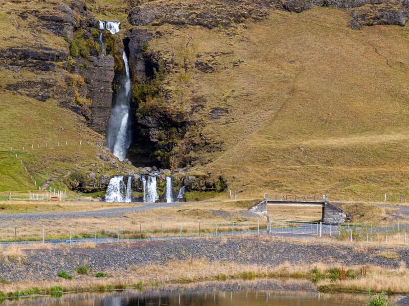
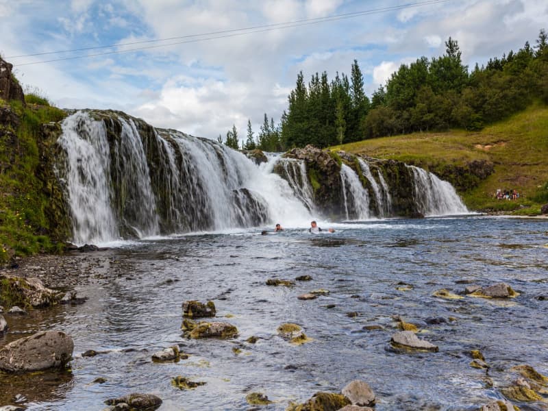
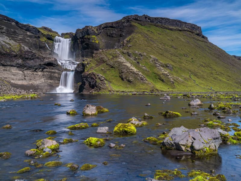
Gluggafoss waterfall
The Merkjá River has several beautiful waterfalls, but the most outstanding is Gluggafoss or Window Falls(also known as Merkjárfoss). The upper half of the cliff is palagonite or tuff rock, and the lower ledge is basalt. The river has formed tunnels and grooves through the soft rock and a series of ‘windows’ in the tunnels, thereby earning the name ‘Gluggafoss.’
The river passes under a stone arch at the very top of the falls. As the rock is relatively soft, the waterfall has changed over time. Around 1947 the upper half of the waterfall could hardly be seen as the water flowed into a vertical tunnel behind the cliff. It was only visible through three different openings or ‘windows’ one above the other. The water came out through the bottom ‘window’, forming a beautiful arch, except when the water rose in the river, forcing it through all three windows.
Further changes occurred when Hekla erupted in 1947, causing a 20 cm thick layer of volcanic ash to be carried downstream by the river. The vertical tunnel formation nearly disappeared as it filled with ash. It has taken almost 50 years for the falls to return to their former glory.
More geosites in the neighborhood: www.katlageopark.com
View
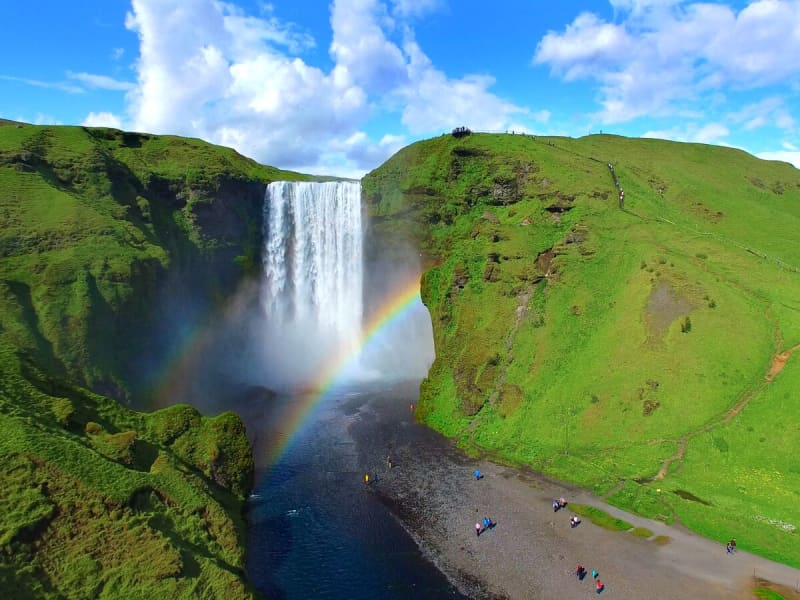
Skógafoss - Waterfall
Only a few kilometers away from the south shores of Iceland lies the village of Skógar along the Southern Ring Road. It is a popular summer resort center surrounded by unusual scenic beauty. The breathtaking view of Skogáfoss waterfall and picturesque surroundings and the snow-capped heights of two towering glaciers are Skógar's major summer attractions. There are two settlements by this name. One is Ytri-Skógar (outer or western Skógar) and the other Eystri-Skógar (eastern Skógar), located at a short distance from each other. Ytri-Skógar, commonly referred to as Skógar, is the main settlement. It is an old farm and has a church from 1890. It is located between the Skógá and Kverná rivers.
The greatest attraction of Skógar is, of course, the beautiful 60-meter high Skogáfoss waterfall in the river Skógá. Like the legends of buried treasures of Egill Skallagrímsson in Mosfell near Reykjavík and Ketilbjörn in Mosfell near Skálholt, there is a similar legend about the settler Þrasi who is believed to have buried his chest of gold under the Skogáfoss waterfall.
If the sun conditions are favorable - one can see a vivid rainbow in front of the waterfalls. The river below the falls holds a large salmon and char population, and fishermen are seen here fishing from July - October. The path leading to the top of the waterfalls continues following the river upstream - where numerous more dramatic waterfalls of sheer beauty are found. A great hike - to say the least!
One of the finest folk museums in Iceland is situated in extraordinarily beautiful natural surroundings. The fascinating local folk museum has a collection of over 6000 artifacts and examples of various types of dwellings in Iceland since the early times. The collection of tools and equipment used on land and sea is outstanding. The museum also has an old turf farmhouse, where guests can experience the standards of living in Iceland in past centuries.
From Skógar, the Ring Road runs eastwards along the foot of Mýrdalsjökull glacier, across the southern sandy plains and over glacial rivers, passes Seljavellir, and continues along with the soaring glaciated massive of Eyjafjöll and the two waterfalls Seljalandsfoss and Gljúfrabúi. From here runs a 10 km long trek along the river Skógá over the Fimmvörðuháls Pass between the Eyjafjallajökull and Mýrdalsjökull glaciers to the mountain oasis of Þórsmörk.
Skógar is a place to explore the natural diversity of the south or, if the weather is good, to spend a holiday amid beautiful and rugged landscapes. It is also very close to the ocean and the unique black beach.
View
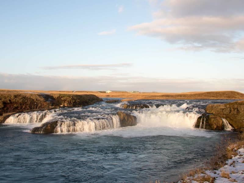
Dynkur in Þjórsá river
Dynkur is a majestic waterfall, about 38 m. High in Þjórsá. The river falls from many pedestals in small waterfalls, forming a single waterfall system. There are beautiful shapes, but these tiny waterfalls also create many beautiful rainbows when the sun shines. Dynkur can be reached from both sides of the river, but it is more accessible to reach it from the east at Búðarháls.
The road is signed but only suitable for jeeps and off-road vehicles. It is also an excellent trip to drive down to the waterfall Fagrifoss in the Kaldakvísl canyon on the way. There are also many other waterfalls to visit in the waterfilled flowing region.
View
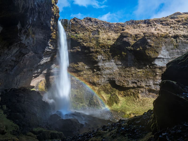
Kvernufoss waterfall
Is in a small canyon 1.5 km to the east of Skógafoss. A hiking path leads up to it from the car park of the museum at Skógar. We recommend checking out the museum along the way, where you can learn about the history of the area and how people traversed the glacial rivers before they were bridged.
Find information about more geosites in Katla UNESCO Global Geopark at www.katlageopark.com
View
Ægissíðufoss waterfall
The Ægissíðufoss waterfall in Ytri-Rangá is a few kilometers further down the river from Hella. The waterfall is a well-known fishing location on the river and has a salmon ladder. The waterfall is magnificent all year round, as the flow is quite steady throughout the year given that Ytri-Rangá is a spring-fed river. Any changes to its flow rate can for the most part be attributed to spring thaws.
When thoughts turned to bridge the Ytri-Rangá river, Jón Þorláksson, the then Chief Civil Engineer and later Prime Minister, examined the option of building a bridge just above Ægissíðufoss. This construction did not materialize, and the bridge was ultimately built where the village of Hella stands today.
A popular hiking trail lies from Hella down to Ægissíðufoss along the Ytri-Rangá river and is much used by both locals and visitors.
View
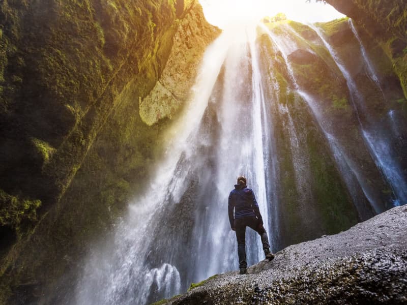
Gljúfrabúi
The waterfall Gljúfrabúi tumbles down from the Gljúfurá River. Its source is north of Tröllagil (Troll Gorge) Canyon in the heath Hamragarðaheiði. It is a spring-fed river and less voluminous than its neighbor Seljalandsá River. The river runs from Tröllagilsmýri (Troll Gorge Marsh), a picturesque fertile marsh in the heath. When the river emerges out of the marsh, it runs into the northern edge of a lava field formed in the volcanic eruptions in Eyjafjallajökull at the beginning of the Holocene. There are several little waterfalls to be found in the river in the area.
Gljúfrabúi, which is 40 m tall, is on the land of the uninhabited farmstead Hamragarðar which the Rangá Foresty Society received as a gift in 1962 and is now owned by the municipality of Rangárþing eystra. There is a certain mystique over the waterfall because it falls into a deep chasm, while in front of it, there is much palagonite rock that blocks the waterfall so that only the very top of it is visible. The boulder that blocks the waterfall is called Franskanef. Previously, people believed that it and the surrounding cliffs were the residences of huldufólk or hidden people. It is possible to take off your shoes and wade the river down in the canyon. It’s a fantastic experience. Caution must be taken when traveling in the canyon because there is a risk of falling rocks. There is an old bath basin below Franskanef, and at the inner end of the basin, there is a little cave called Ömpuhellir, named after a hermit woman who lived there. Gljúfrabúi is a protected natural monument.
A little south of Gljúfrabúi, there is a small canyon in the cliff face from which it is possible to ascend onto the heath above, where there is a spectacular view of the neighboring area. People referred to it as going up Stígurinn (the path); thus, the river in that canyon is named Stígslækur (Path Brook). The path is still relatively clear, with some stairs where it is steepest. Right above the edge, there are ruins of old sheepcotes from Hamragarðar.
View
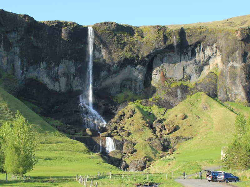
Foss á Síðu
Foss á Síðu is the name of an old farm, approximately 10 km east of Kirkjubæjarklaustur. A beautiful waterfall cascades over the cliffs above the farm, which flows from Lake Þórutjörn. This magnificent spectacle catches the eye of everyone that passes by. An easy hiking trail leads up to Lake Þórutjörn where the view over Síða is amazing.
View
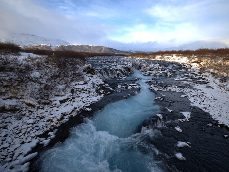
Brúarfoss
Brúarfoss is a beautiful waterfall in Bláskógabyggð in South Iceland. It is known for its unique clear blue color, which results from how light is reflected off the fine-grained sedimentary rock in the water. Brúarfoss is part of the Brúará River, which flows through a lush area and forms the waterfall where the river narrows through a gorge. The waterfall may not be the tallest or widest in Iceland, yet it is remarkably stunning and has captured the attention of travelers and photographers worldwide. This is primarily due to the unique way the water's colors interact with each other, evoking a sense of awe and wonder. Brúarfoss remains relatively untouched by tourists, making it an ideal destination for those seeking tranquility and natural beauty without large crowds.
The journey to Brúarfoss can be an adventure in itself. Although it is not far from Road 1, one must walk along paths that run through beautiful landscapes. The hike offers the opportunity to enjoy the tranquility of Icelandic nature and is well worth it for those who choose to visit.
The area features not only Brúarfoss but also several smaller waterfalls. Tourists can enjoy walking along the river and experiencing different perspectives of the waterfall. What makes Brúarfoss especially enchanting is how the river's pure and clear water mixes with the landscape's green moss and basalt columns. This natural beauty, along with relatively easy access, makes Brúarfoss a must-see destination for anyone visiting Iceland, whether they are local or foreign, wanting to experience the country's unique beauty without having to go far from the main tourist spots in the area.
View
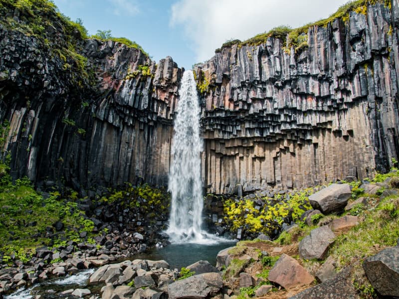
Svartifoss waterfall
Svartifoss is one of the unique waterfalls in South Iceland. It is situated in Skaftafell, which belongs to Vatnajökull National Park. Svartifoss is 20 meters (80ft) high. It is bordered on both sides by tall black basalt columns.
The hike to Svartifoss starts at the Visitor Centre in Skaftafell. You can also find all sorts of information and advice about the area. The hike is about 1.9 km or 45 minutes (one way).
Skaftafell Visitor Centre, Skaftafell
View
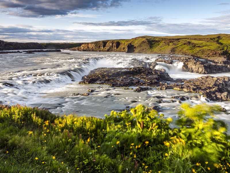
Urriðafoss waterfall
Urriðafoss is a waterfall in the Þjórsá River. Þjórsá is Iceland's longest river, 230 km, and Urriðafoss is the most voluminous waterfall in the country. This mighty river drops down (360 m3/sec) by the edge of the Þjórsárhraun lava field in beautiful and serene surroundings. Þjórsárhraun lava field is the result of the greatest lava flow on earth since the Ice Age. It is located right off highway 1.
View
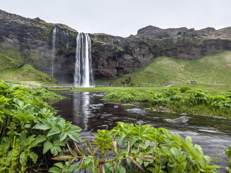
Seljalandsfoss waterfall
A unique waterfall in the river Seljalandsá, about 30 km west of Skógar: it is 60 meters high with a footpath behind it at the bottom of the cliff, but with a thin cascade. It is the only known waterfall of its kind where it is possible to walk behind it. The waterfall is very picturesque; therefore, its photo can be found in many books and calendars.
Access to the waterfall is from the farm of Seljaland along the Ring Road, Iceland's main highway. Several falls a little further to the west, including the interesting Gljúfrabúi, partially masked by its canyon. Access to it is from Hamragarðar farm along the road, east of Markarfljót.
These "do-not-miss" attractions lie very close to the main Ring Road at the base of the Eyjafjallajökull Glacier, on the road leading into Thorsmörk.
During winter, the area around Seljalandsfoss waterfall can be dangerous as paths can be slippery and large pieces of ice fall, making it extremely dangerous to venture too close to the cliffs and particularly dangerous to walk behind the waterfall. The fine mist from the waterfall freezes on the cliffs and the ceiling of the path behind the waterfall, but when the weather warms, and the ice begins to thaw, it can fall off in large chunks, which can be dangerous. People are advised to show caution and respect the closure of the paths. More information can be found on www.safetravel.is
View
Systrafoss Waterfall
Systrafoss is the name of the waterfall where the river Fossá falls from the lake Systravatn, over the mountain edge above Kirkjubæjarklaustur. Low down in the gorge, there's Fossasteinn, which fell from the mountain during a massive thunderstorm in 1830. A beautiful hiking trail leads to the top of the mountain and Systravatn. From the mountain edge, the view is breathtaking, and up there, you see the Golden Nugget, which aim is to recall the history of hydropower plants in Iceland. The Hiking trail, Ástarbrautin (Love Path), starts at Systrafoss. It is 5 km. And you can see Kirkjugólfið on the way.
The forest by Systrafoss is from 1945. Skógarstígurinn is a circular path in the forest where one stop is Sönghellir. The forest path is marked by the tallest tree in Iceland, a spruce almost 30 meters high.
View
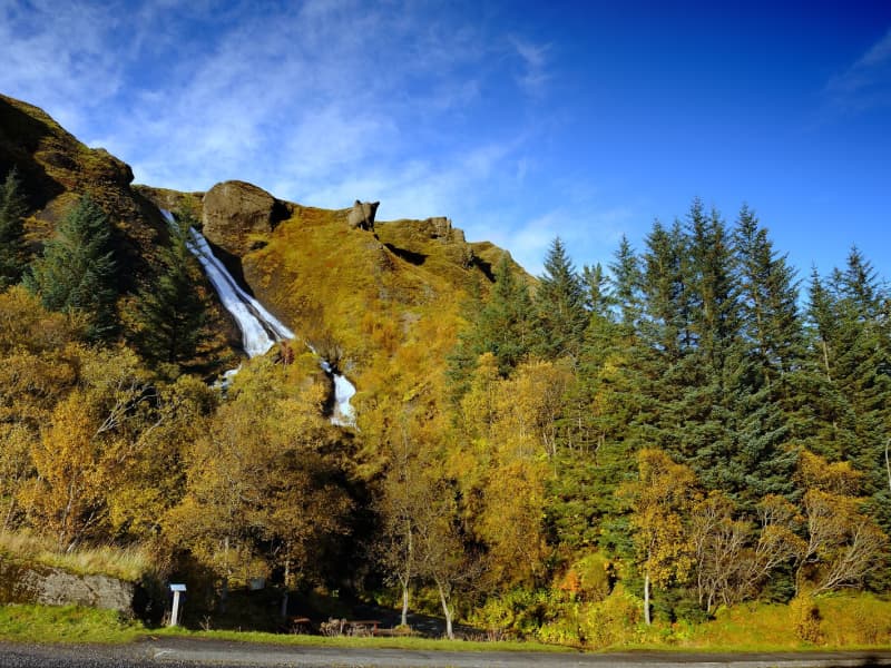
Reykjafoss
The Botanical garden in Hveragerði is in the center of the town. Since 1983 it has given people the chance to relax and enjoy nature amongst the trees and the wonderful river Varmá with the waterfall Reykjafoss right next to the garden.
Further along the river, a hiking trail goes past the ruins of an old wool factory and ruins of a hydroelectric powerplant surrounded by colorful hot-spring areas.
View
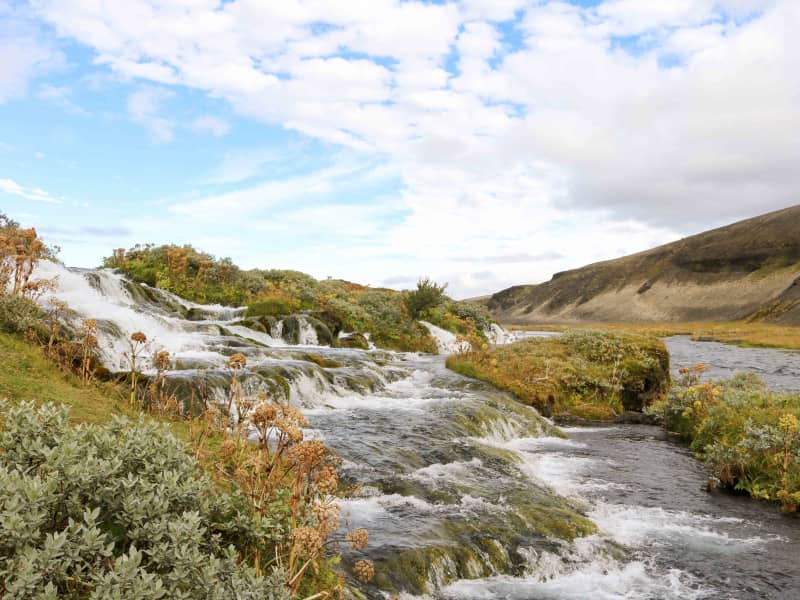
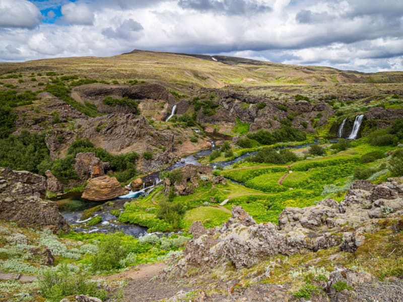
Fossabrekkur
The uppermost falls in the Ytri-Rangá river are called Fossabrekkur. The falls are just below the western source of the river just after entering the common land of the Landmannaafréttur.
Fossabrekkur is a fertile oasis in the barren pumice landscape. It is necessary to drive to the location to see this gem, as it is well hidden.
Fossabrekkur is a unique and beautiful location where the western arm of Ytri-Rangá falls off the rocks into the eastern cape and runs after that in a single channel almost to the sea.
View
Fagrifoss Waterfall
Fagrifoss is a scenic 80 m high waterfall in the Geirlandsá River. Basaltic pillows occur in the vicinity of the waterfall, which cascades from 140m thick hyaloclastite deposits.
Fagrifoss is situated on the F206 road to Laki craters, a rugged road with rivers that can be treacherous to cross if the water level rises due to rain and thaw. A 4x4 vehicle is needed, and the area is only accessible during summer.
View
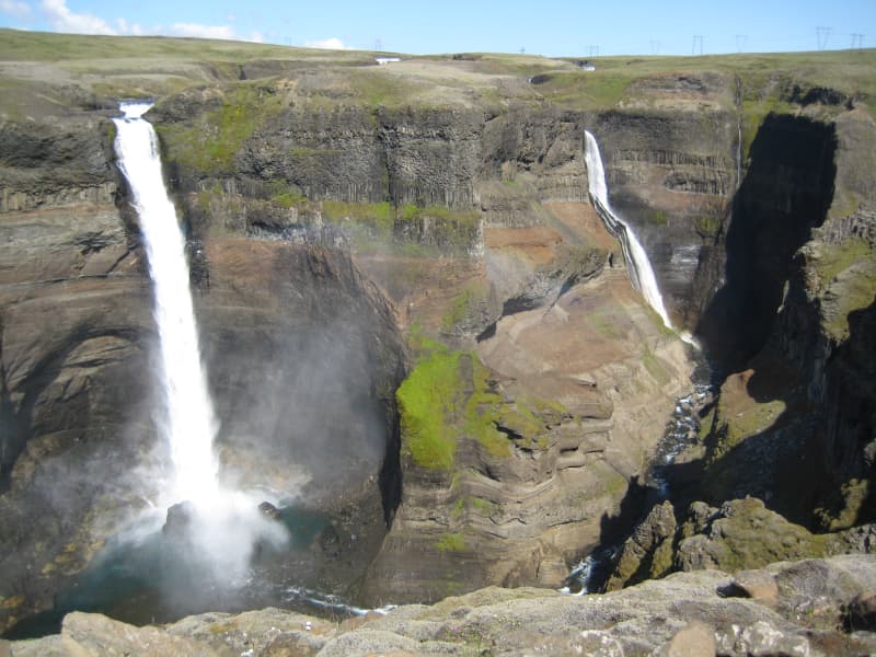
Háifoss Waterfall
The waterfall Háifoss is situated near the volcano Hekla in the south of Iceland. The river Fossá, a tributary of Þjórsá, drops here from a height of 122 m. This is the third-highest waterfall on the island. For a long time, the waterfall had no name, but in 1912 Dr. Helgi Pétursson, a geologist, came and named him.
From the historical farm Stöng, destroyed by a volcanic eruption of Hekla in the Middle Ages and reconstructed, it is possible to hike to the waterfall along the Fossá (6km each way). Above the waterfall, there is also a parking lot, so the hiking can also be done in the other direction.
View

Hjálparfoss Waterfall
Hjálparfoss is a beautiful, two-stepped waterfall near the confluence of Rivers Thjorsa and Fossa in the Thjorsa Valley. The surrounding area is called Hjalp (Help) because the travelers across the Sprengisandur Route found great help reaching a vegetated area to graze their horses after a long journey in the barren interior.
As elsewhere in the valley, the signs of the eruptions of Mt. Hekla are very prominent by the waterfall, with ashes everywhere.
View
Ófærufoss waterfall - Nyrðri Ófæra river
Ófærufoss is an extremely beautiful waterfall in the river Nyrðri-Ófæra and falls into Eldgjá in two cascades. There used to be a stone arch across the lower one up until the year 1993, when it fell into the river during spring thawing. From Northern Fjallabaksleið it is possible to drive into Eldgjá and walk from there to the Ófærufoss. A road lies up to the eastern edge of Eldgjá. To get there, one needs to cross the river Nyrðri-Ófæra at a wading place, which can be risky. It is safe to recommend a walk up the mountain Gjátindur, from where there is magnificent view of Eldgjá, mountains by Langisjór and Lakagígur and its surroundings.
Ófærufoss falls into Eldgjá in Skaftártunguafréttur. Eldgjá is an approx. 40 km long eruptive fissure, approx. 600 meters wide in many places, and up to 200 meters deep. When it was formed, probably around 934, there were likely eruptions along the whole extent of it. The fissure is believed to reach under Mýrdalsjökull glacier. From Eldgjá, extensive streams of lava have flowed through Landbrot and Meðalland, reaching sea at Alviðruhamrar in Álftaver. The lava-field is believed to cover 700 km², which makes it one of the vastest lava-fields on earth in historical times, that is, after the last ice age.
Eldgjá is believed to belong to the same crater system as Katla. Eldgjá is a unique natural phenomenon and is listed as natural remnants. Plans to make Eldgjá and its surrounding area a part of Vatnajökull National Park are in place.Theories have surfaced that suggest that the Eldgjá eruptions had even more effect in Europe then the Lakagígar eruptions. According to newly discovered evidence, crop failure, plagues and other disasters occurred in both Europe and the Middle East at that time. It has also been speculated that these eruptions caused more damage than the eruptions of Lakagígar.
View
Gjáin in Þjórsárdalur valley
This beautiful natural phenomenon and oasis at the edge of the central highlands should not be passed by if you are traveling in the Thjorsar Valley. The Red River (Rauda) cascades into and through this gorge, and the surroundings are amply vegetated. River Thjorsa ran through before a dike was built between the mountains Sandafell and Skeljafell to redirect it.
One of the younger Tungnaa-Lavas ran down the gorge, leaving a thin layer on its bottom and walls and a thicker layer on the edges. The lava formations are worth taking a closer look at. An easy 10 minutes walk takes you into this beautiful area from the archaeological excavations at Stong, and another approach is from the car track on edge.
Some find this place so beautiful they (secretly) have strewn their ashes in the river to be forever united with monumental nature in this "paradise on earth."
View
Þjófafoss waterfall
Þjófafoss is in the river Þjórsá, to the east of the Merkurhraun lava field. The waterfall's name translates as "thieves' waterfall," as thieves used to be executed by drowning in its pool. The waterfall is one of the three main waterfalls in Þjórsá. The Þjórsá river forms the boundary between Rangárvallasýsla and Árnessýsla and is the longest river in Iceland.
Þjófafoss is to the south of Búrfell mountain, not far from the Búrfell Power Plant and somewhat lower down from Tröllkonuhlaup in Þjórsá. The flow rate in Þjófafoss is relatively low during winter but greater during the summer. This is due to the power plants on the river, as a large proportion of the water is diverted past the falls. The river is dammed at Sultartangi, forming the Sultartangalón reservoir. The water is first channeled through Sultartangi Power Plant and then into the Bjarnarlón reservoir and through the Búrfell Power Plant. As a result, it is first and foremost when the Sultartangalón reservoir is full in late summer that the excess water can flow over Þjófafoss.
With the construction of the Búrfell Power Plant 2, water flow over Þjófafoss has decreased, even more during summer and winter.
View
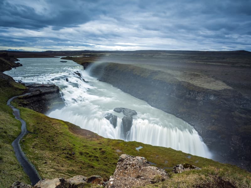
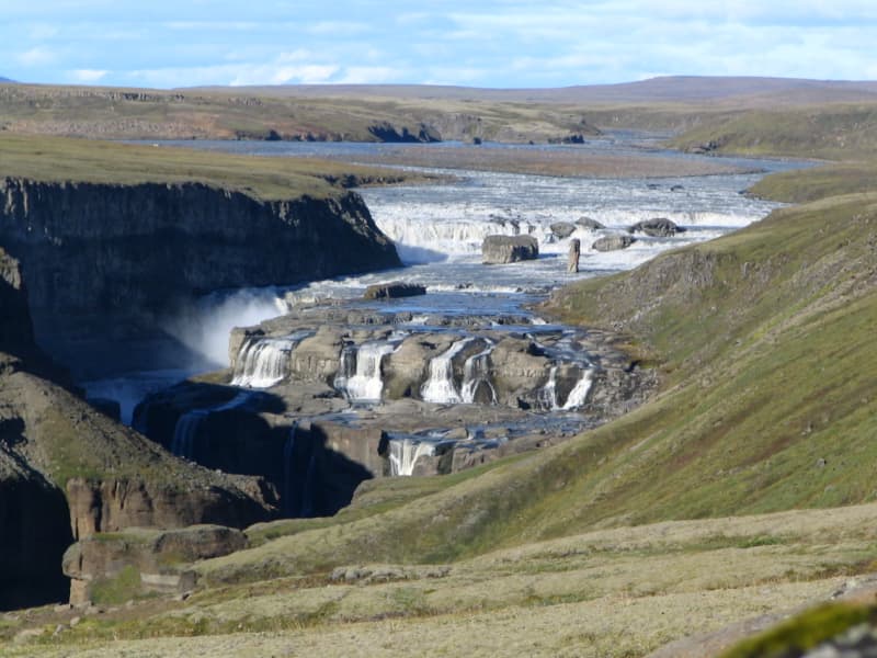
Gullfoss waterfall
Gullfoss is two separate waterfalls; the upper one has a drop of 11 meters and the lower one 21 meters. The rock of the river bed was formed during an interglacial period.
Water flows over Gullfoss at an average rate of 109 cubic meters per second. The heaviest floods have recorded a flow of 2000 cubic meters per second. During the summer, the flow is 130 cubic meters per second, which would take only 3 seconds to fill this building. People were eager to exploit the power potential of Gullfoss, and many plans for hydroelectric developments on the river Hvítá have been proposed.
The trails by Gullfoss can be closed, so it's good to check the conditions before going. To check whether it is open or closed to visitors, check out the website of Safetravel.is.
View