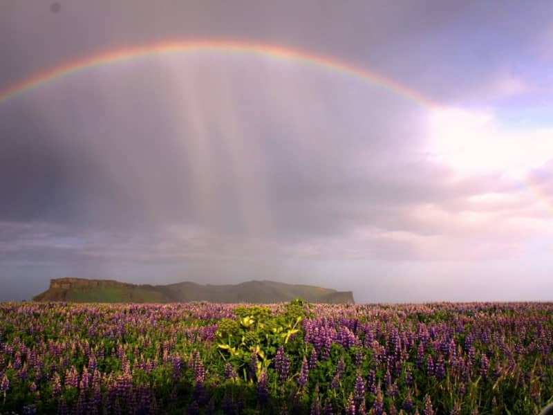
Distinctive peaks rising above coast and lowlands. Enjoy ever-changing views of glaciers, valleys, and sea cliffs from sculpted ridges and ancient volcanic forms.

Eldfell
Hiking to the top of the volcano Eldfell is one of the most popular trails on Heimaey. This volcano was created in the eruption in 1973 which lasted for about six months and during that time nearly one-third of all the homes and buildings on Heimaey had burned or been covered under the lava and ash. The volcanic museum, Eldheimar tells the story of the eruption and is very nice to visit prior to hiking up the volcano.
View
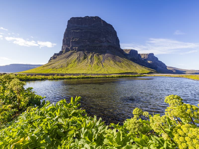
Hjörleifshöfði
Hjörleifshöfði is a 220-meter tuya cliff. Tuya is a distinctive, flat-topped, steep-sided volcano formed when lava erupts through thick glaciers or ice sheets. Hjörleifshöfði is on the southwest side of Mýrdalssandur. It's believed it formed during the last cold period of the ice age when the eruption took place under the glacier. It was probably an island in the sea in the past but has become landlocked during the settlement period with a fjord called Kerlingarfjörður. Today it's surrounded by black sands that have collected after repeated glacial runs from Katla volcano.
South of Hjörleifshöfði, a spit is named after Katla and is called Kötlutangi - the Katla spit. It was formed from a large eruption in 1918 where an enormous amount of sediment came with a sizeable glacial run from Katla. Kötlutangi - the Katla spit was the southernmost point of mainland Iceland; before the eruption, it was Dyrhólaey.
Hjörleifshöfði gets its name from the settler Hjörleifur Hróðmarsson, Ingólfur Arnarson's stepbrother. They sailed in two ships on their way to Iceland but parted ways as Ingólfur spent the winter at Ingólfshöfði and his stepbrother at Hjörleifshöfði. Hjörleifur did not live long, but he was killed along with his men by Irish slaves who followed them to the country. They fled to the Westman Islands with the women, where Ingólfur found them and killed them. On Hjörleifshöfði is a mound where it's considered that Hjörleifur is buried.
Hjörleifshöfði was inhabited till 1936, there was a farm located in the southern part of it, but it was moved there after the eruption in Katla in 1721, which destroyed the old town. The old town is located by Katla UNESCO Global Geopark's destination when you reach Hjörleifshöfði on the west side.
View
Bláhnúkur in Landmannalaugar
The very most popular mountain in the Landmannalaugar-region to walk on top on. It's a 945 m. above sea-level viewpoint, with a horizontal disc on the top.
View
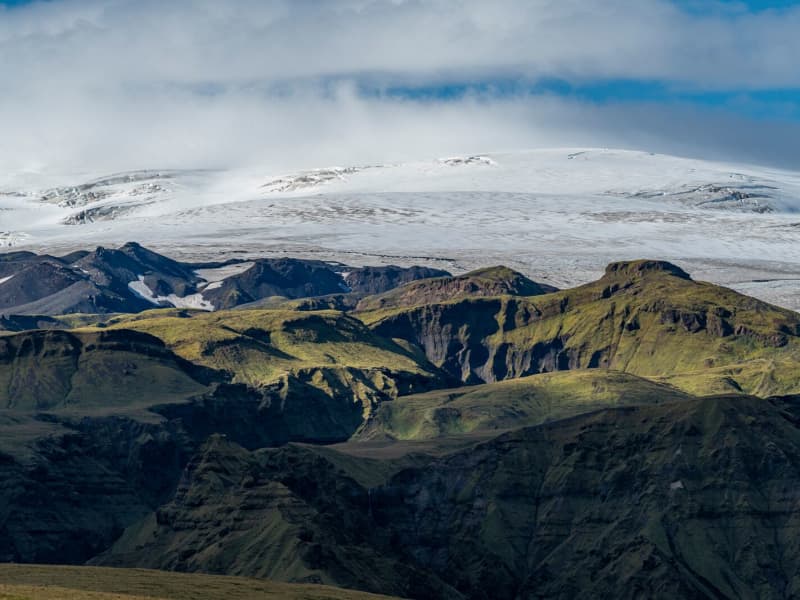
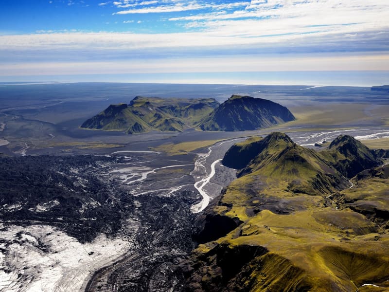
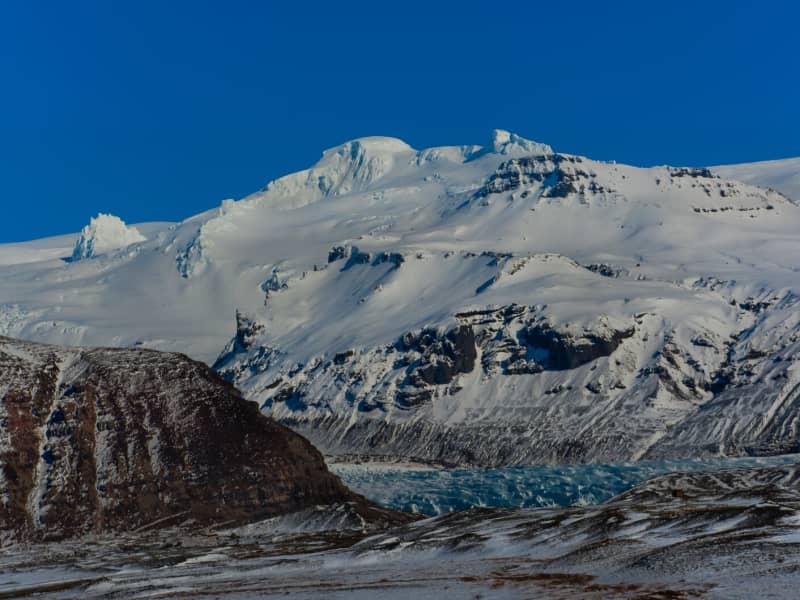
Mýrdalsjökull glacier and Katla
Mýrdalsjökull Glacier and Katla VolcanoMýrdalsjökull is a glacier located in the south of Iceland. It is situated to the north of Vík í Mýrdal and the east of the smaller glacier Eyjafjallajökull. Its peak reaches 1493 m in height, and in 1980, it covered an area of 595 km². The view on a clear day is one of the prettiest in the world.
Guided snow scooters, snowmobiles, Super Jeep, and ice-climbing tours are offered on the Myrdalsjökull glacier. Travelers on the glacier must be cautious about crevasses, and inexperienced travelers should not go alone. Weather conditions shift rapidly high winds, and snowstorms can appear in a flash all year round.
The volcano Katla in the Mýrdalsjökull glacier, the volcano Katla erupts on average every 40 - 60 years. Sixteen eruptions have been recorded since the settlement of Iceland, the last in 1918, but there have probably been more. Katla is one of the most famous volcanoes in the country, and its eruptions usually have very serious consequences. It can be regarded as one of the most powerful volcanoes in the world and probably the largest active volcano in the northern hemisphere.
During the eruption, the glacier above the volcanic vent melts, and the melted water collects under the ice cap until it makes its way out under the edge in a violent flood. These are called "jokulhlaup."The floodwater carries huge amounts of ice, rocks, silt, and sand. Most of the Mýrdalssandur sand plain has been formed by deposits in past floods.
Katla has been showing signs of unrest recently, and some geologists suspect it might erupt soon since it is way overdue to erupt.
Eruptions of Katla have taken place (since known and recognized human settlement): 1918, 1860, 1823, 1755-56, 1721, 1660-61, 1625, 1612, 1580, 1416, 1357, 1311, 1262, 1245, 1177, 950.
View
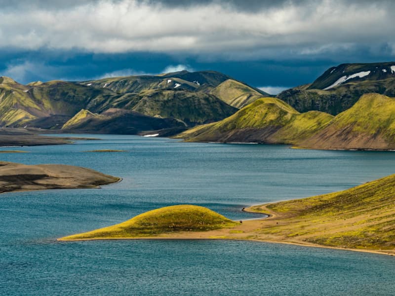
Langisjór Lake, Fögrufjöll, Grænifjallgarður
Langisjór is a lake within Vatnajökull National Park that's 20 km long and 2 km wide in some places. The lake is to the southwest of Vatnajökull, between the mountains Tungnárfjöll and Fögrufjöll, in a beautiful and picturesque landscape. Its square measure is 27 km², it reaches a depth of 75 m, and the water surface is 670 m above s
Langisjór is reached by the mountain road Fjallabaksleið nyrðri (F 208), west of Kirkjubæjarklaustur. All roads in the western part of the national park are mountain tracks, only navigable for vehicles with four-wheel-drive; some only for large jeeps. Some sections of the road are rocky and full of potholes, and loose gravel is common. It is sometimes necessary to ford (drive through) streams and rivers, which can suddenly become swollen, making them difficult or even impossible to cross. It is dependent on the weather when the roads are open. Usually, they are open from early June through to the autumn. Driving is only allowed on the roads marked on the accompanying map. All other roads or tracks are closed to the public. Here, as elsewhere in Iceland, driving off-road is banned by law.
View
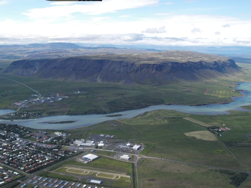
Ingólfsfjall mountain
Ingólfsfjall mountain in Ölfus is 551m. Ingólfsfjall is fenced with cliffs in three ways and is very steep. When the sea level was highest at the end of the ice age, it was a steep head that the waves broke down and created the steep slopes. It is connected to Grafningsfjöll with Grafningsháls. Ingólfsfjall is mainly made of palagonite with lava layers in between. Ingólfsfjall was formed in the middle of the ice age. To the south of the western corner of the mountain protrudes a gray cliff called Silfurberg, which is made of palagonite with light hole fillings, mainly rayon deposits. To the south is Kögunarhóll and the main road lies between. Ingólfsfjall is named after the settler Ingólf Arnarson. Up on the mountain is a gray stone hill called Inghóll, and it is said that Ingólfur is buried there. Below Ingólfsfjall on the south side is Fjallstún.The Settlement Book states that Ingólfur Arnarson spent his third winter in Iceland on his way to Reykjavík. Later, a large farm called Fjall was built and deserted in the 18th century. Remains of ancient structures can still be seen on the site and are now protected.On May 29, 2008, the source of the Suðurlandsskjálfi earthquake was 6.3 on the Richter scale below Ingólfsfjall.
View
Hafursey
Hafursey is an exceptionally beautiful palagonite mountain on the north side of Mýrdalssandur. It is divided by Klofgil Gorge- the west side, Skálafell, is 582m high, and Kistufell's east side is 513m high. There, the Fulmar has its nesting grounds, and the slopes are covered with scrub vegetation in an area once forested.
Hafursey was used by the farmers from Hjörleifshöfði for sheep grazing all year round and kept in a 'sel,’ a shelter used during summers until 1854. The Sel (a natural cave used for shelter) in Hafursey is one of the best-preserved remnants in the history of Iceland. In 1755, when Katla erupted, six men took shelter in the cave during the glacier burst. Their signatures, plus the date and year of their stay there, are written on the wall and are visible as you enter the cave.
View
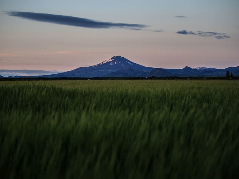
Hekla volcano
The volcano Mt. Hekla is Iceland’s most famous volcano and the one that has erupted most frequently in recent years. Mt. Hekla rises 1,491 m over sea level and can widely be seen in the south of Iceland. Hekla has been dubbed the Queen of Icelandic Volcanos and is well known internationally.
Considerable superstitions have been attached to the mountain, with the most famous legend being that it is the entrance to Hell and might even be Hell itself. The first documented expedition onto the mountain is from 1750 when the naturalists Eggert Ólaffson and Bjarni Pálsson scaled the mountain. The route to the top of Hekla is quite popular, although hikers must be aware of the danger that can occur if the mountain should erupt. The route taken normally starts from Skjólkvíar.
Hekla is located in an area where the South Iceland fracture zone meets the South Iceland volcanic zone, which probably accounts for its frequent eruptions. Hekla has erupted in the following years since Iceland was settled: 1104, 1158, 1206, 1222, 1300, 1341, 1389, 1501, 1597, 1636, 1693, 1766, 1845, 1947, 1970, 1980, 1981, 1991 and 2000. Geologists have repeatedly reiterated in recent years that Hekla is ready to erupt and can erupt at any time. However, the mountain does generally provide an hour’s warning.
View
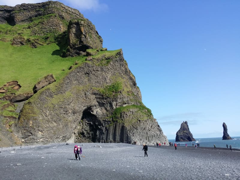
Reynisfjara, Reynisfjall og Reynisdrangar
Reynisfjall is a 340 m high tuff mountain arising out of a volcanic eruption from under a glacier in the penultimate Ice Age, near the village of Vik. Alternating in an irregular manner are layers of tuff, pillow lava and columnar basalt veins and loops.
Reynisdrangar stacks are a collection of 66 m high rock pillars that rise out of the sea and are of the same geological formation as Reynisfjall. On Reynisfjöru beach, very beautiful basalt formations in the south part of the mountain can be seen, and there you will find an exceedingly beautiful cave called Hálsanefshellir.
The waves here are deceiving and have caused the death of a number of visitors in recent years, even in the best of weather. Please take great care and keep a good distance from the sea.
View
Hrafntinnusker
Hrafntinnusker in Torfajökull glacier is a place you must visit. The English name of this 1128 m high mountain is The Obsidian Skerry. It is situated some distance east of the infamous volcano Hekla. It is accessible by 4wd vehicles from the north and south.
The view from Hrafntinnusker is outstanding. A sizeable geothermal area is around the mountain, especially to the west. There are fumaroles, multicolored clay hot springs, and hot water springs, some of which are evergreen and, in some places, under a glacier, ice caves from there, both big and small. The color of this area is diverse and beautiful. East of Hrafntinnusker is the mountain hut of Ferðafélag Íslands, on "Laugavegur," the hiking trail between Landmannalaugar and Þórsmerkur, built-in 1977. It seats about 20 people.
View
Lómagnúpur
Lómagnúpur is a 688 high palisade of cliffs that towers over Björninn Mountain, west of the Núpsvötn Lakes in Skeiðarársandur. The surroundings are renowned for their spectacular beauty, stretching from the black sand beaches of the south shore, all the way to Vatnajökul Glacier. Volcanoes, glaciers, and lakes have been woven together to form a varied landscape that can only be said to be extraordinary from a geological perspective. Lómagnúpur is part of the Núpsstaður Farmlands which is on the list of protected national heritage sites in Iceland.
View
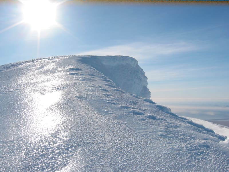
Öræfajökull glacier
Öræfajökull: Iceland’s highest mountainExtending south from the Vatnajökull icecap within Vatnajökull National Park and towering to around 2,110 m (6,922 feet), Öræfajökull is Iceland’s highest mountain. Its height actually varies with the season and the depth of snow and ice, since the peak itself, Hvannadalshnjúkur, is topped by ice which is thickest in spring and thinnest in autumn.
The mountain and surrounding areas offer good skiing in winter and are very popular with walkers and hikers throughout the year.
Vatnajökulsþjóðgarður
View
Eyjafjallajökull Glacier
The Eyjafjallajökull glacier is a 1651 m high glacier-capped stratovolcano. It is one of the smaller glaciers of Iceland. It is situated to the north of Skógar and to the south and west of the bigger glacier Mýrdalsjökull. The icecap of the glacier covers a volcano (1651m in height) that has erupted relatively frequently since the Ice Age. The crater of the volcano has a diameter of 3-4 km and the glacier covers an area of about 100 km². In June 1994 an earthquake swarm lasting for nearly a month occurred below the active volcano Eyjafjallajökull in South Iceland. It is otherwise a relatively quiet volcano – although it is not listed as being inactive. Eyjafjallajökull erupted in 1821-1823. The south end of the mountain was once part of the Atlantic coastline. As the sea has since retreated some 5 km, the former coastline has left behind sheer cliffs with a multitude of beautiful waterfalls, the best known of them being Skógafoss and Seljalandsfoss. In strong winds, the water of some of the smaller falls can even be blown up the mountain. It is one of the three glaciers that surround the Thorsmörk area - the other 2 being Myrdalsjökull and Tindfjallajökull. Specialized tours are arranged on the glacier for both skiing, super jeep tour, and hiking. One should never venture onto the glacier without guides and good knowledge of this kind of activity as this is a very dangerous area for inexperienced visitors.
Eyjafjallajökull featured prominently in world news in 2010 when ash from its eruption halted air traffic in Europe. An ice cap with several outlet glaciers covers the caldera of Eyjafjallajökull with a crater diameter 3-4 km wide. The outlet glaciers, Steinholtsjökull and Gígjökull, descend from the main glacier and can be visited by 4x4 trucks along the F-road to Þórsmörk. The area between the glaciers Eyjafjallajökull and Mýrdalsjökull with volcanic craters, Magni and Móði, created in the first stage of the Eyjafjallajökull eruption in April 2010.
View