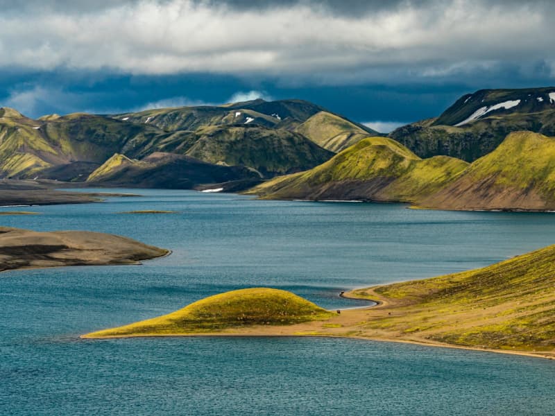
A vast interior of raw colors and big skies. Black sands, rhyolite ridges, and mossy lava fields create unforgettable contrasts and a sense of true wilderness.
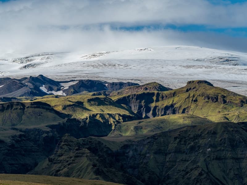
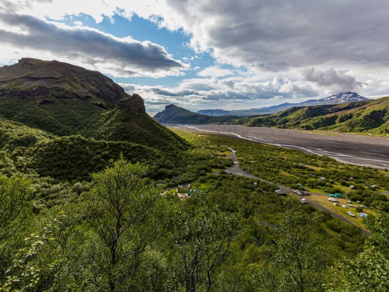
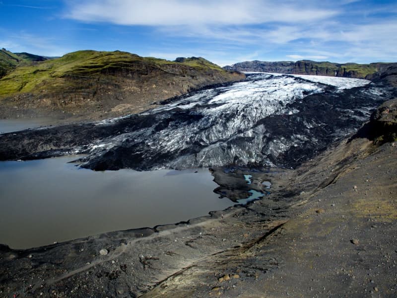
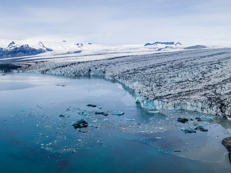
Mýrdalsjökull glacier and Katla
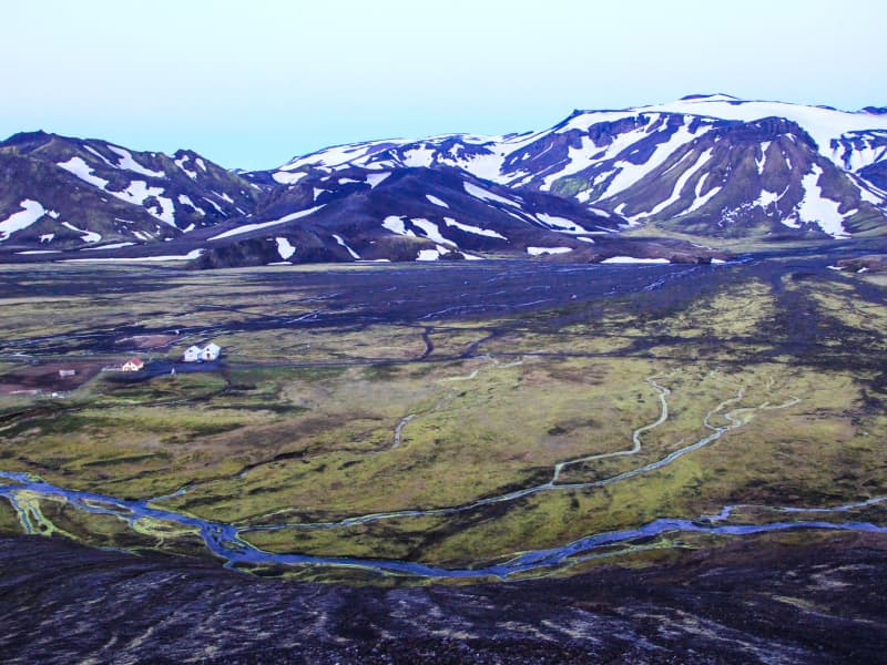
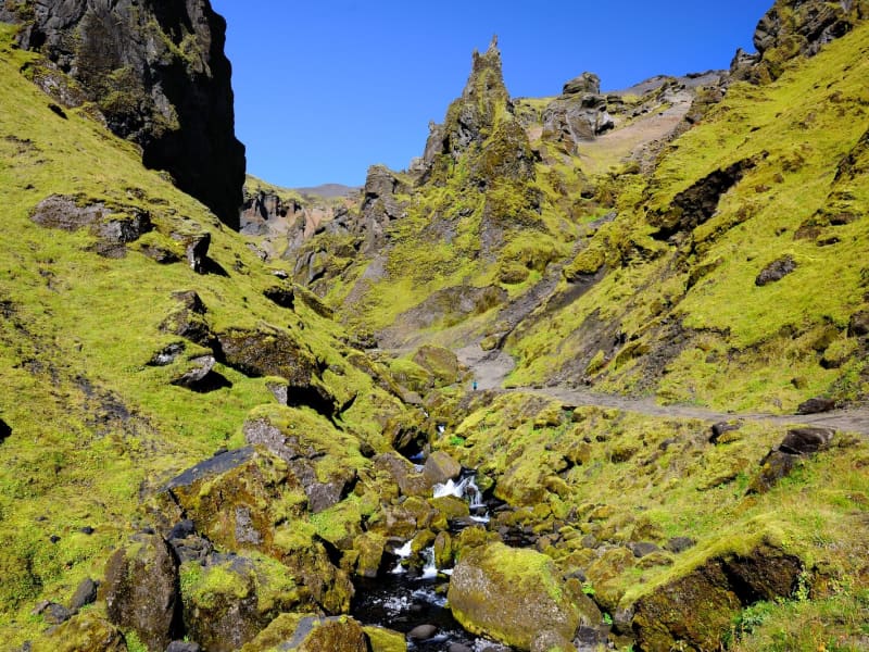
Mýrdalsjökull Glacier and Katla VolcanoMýrdalsjökull is a glacier located in the south of Iceland. It is situated to the north of Vík í Mýrdal and the east of the smaller glacier Eyjafjallajökull. Its peak reaches 1493 m in height, and in 1980, it covered an area of 595 km². The view on a clear day is one of the prettiest in the world.
Guided snow scooters, snowmobiles, Super Jeep, and ice-climbing tours are offered on the Myrdalsjökull glacier. Travelers on the glacier must be cautious about crevasses, and inexperienced travelers should not go alone. Weather conditions shift rapidly high winds, and snowstorms can appear in a flash all year round.
The volcano Katla in the Mýrdalsjökull glacier, the volcano Katla erupts on average every 40 - 60 years. Sixteen eruptions have been recorded since the settlement of Iceland, the last in 1918, but there have probably been more. Katla is one of the most famous volcanoes in the country, and its eruptions usually have very serious consequences. It can be regarded as one of the most powerful volcanoes in the world and probably the largest active volcano in the northern hemisphere.
During the eruption, the glacier above the volcanic vent melts, and the melted water collects under the ice cap until it makes its way out under the edge in a violent flood. These are called "jokulhlaup."The floodwater carries huge amounts of ice, rocks, silt, and sand. Most of the Mýrdalssandur sand plain has been formed by deposits in past floods.
Katla has been showing signs of unrest recently, and some geologists suspect it might erupt soon since it is way overdue to erupt.
Eruptions of Katla have taken place (since known and recognized human settlement): 1918, 1860, 1823, 1755-56, 1721, 1660-61, 1625, 1612, 1580, 1416, 1357, 1311, 1262, 1245, 1177, 950.
View
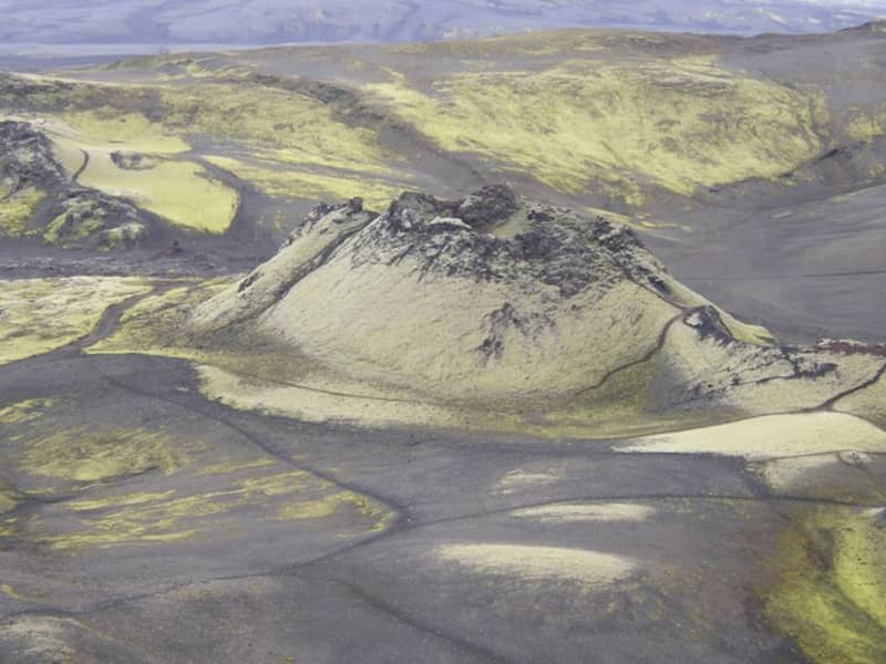
Lakagígar and Laki
Lakagígar is a row of craters formed in one of the world's largest mixed eruptions in recorded history. This continuous series of eruptions emitted a vast quantity of lava and substantial amounts of volcanic ash from a fissure stretching 25 km across the area west of the ice cap. The craters are regarded as a globally unique phenomenon and are, as such, protected within Vatnajökull National Park.
In 1783, a huge lava flow streamed from Lakagígar in what became known as the "Skaftá Fires." This is believed to have been one of the greatest lava flows in a single eruption in the history of the world: the molten lava filled the gorges through which the Skaftá and Hverfisfljót rivers flowed and swept down in two branches into inhabited areas, to spread over the lowlands where it laid waste many farms. The eruption produced large quantities of volcanic ash. For residents of the region and Iceland as a whole, the results of the eruption were catastrophic: this time is known as "Móðuharðindin" (the Haze Famine).
All roads in the western part of the national park are mountain tracks, only navigable for vehicles with four-wheel-drive; some only for large jeeps. Some sections of the road are rocky and full of potholes, and loose gravel is common. It is sometimes necessary to ford (drive through) streams and rivers which can become suddenly swollen, making them difficult, or even impossible, to cross. It is dependent on the weather when the roads are opened. Usually, they are open from early June through to autumn. Driving is only allowed on the roads marked on the accompanying map. All other roads or tracks are closed to the public. Here, as elsewhere in Iceland, driving off-road is banned by law.
View
Lónsöræfi
In Lón District, the most eastern area of the Vatnajökull Region, lie the Stafafellsfjöll mountains, also called Lónsöræfi. They dominate the skyline east of the Vatnajökull glacier and have long comprised one of Iceland’s most extensive protected areas. Besides the deep, rugged canyons, the landscape displays a wide range of colors owing to the presence of rhyolite and other colorful rocks. In contrast, there are also lushly vegetated and sheltered valleys offering a very good chance of spotting reindeer. The numerous hiking trails make this area perfect for hiking. Keep in mind that getting there can be very difficult and one should seek advice from a visitor- or information center before attempting to go there.
View
Ófærufoss waterfall - Nyrðri Ófæra river
Ófærufoss is an extremely beautiful waterfall in the river Nyrðri-Ófæra and falls into Eldgjá in two cascades. There used to be a stone arch across the lower one up until the year 1993, when it fell into the river during spring thawing. From Northern Fjallabaksleið it is possible to drive into Eldgjá and walk from there to the Ófærufoss. A road lies up to the eastern edge of Eldgjá. To get there, one needs to cross the river Nyrðri-Ófæra at a wading place, which can be risky. It is safe to recommend a walk up the mountain Gjátindur, from where there is magnificent view of Eldgjá, mountains by Langisjór and Lakagígur and its surroundings.
Ófærufoss falls into Eldgjá in Skaftártunguafréttur. Eldgjá is an approx. 40 km long eruptive fissure, approx. 600 meters wide in many places, and up to 200 meters deep. When it was formed, probably around 934, there were likely eruptions along the whole extent of it. The fissure is believed to reach under Mýrdalsjökull glacier. From Eldgjá, extensive streams of lava have flowed through Landbrot and Meðalland, reaching sea at Alviðruhamrar in Álftaver. The lava-field is believed to cover 700 km², which makes it one of the vastest lava-fields on earth in historical times, that is, after the last ice age.
Eldgjá is believed to belong to the same crater system as Katla. Eldgjá is a unique natural phenomenon and is listed as natural remnants. Plans to make Eldgjá and its surrounding area a part of Vatnajökull National Park are in place.Theories have surfaced that suggest that the Eldgjá eruptions had even more effect in Europe then the Lakagígar eruptions. According to newly discovered evidence, crop failure, plagues and other disasters occurred in both Europe and the Middle East at that time. It has also been speculated that these eruptions caused more damage than the eruptions of Lakagígar.
View
Hungurfit in Rangárvallaafréttur
There have been lodge facilities in Hungurfit since 1963, when a mountain lodge, housing 20 people, was built there. This was a great improvement for mountain shepherds, who previously had to sleep in tents. In 2013, a new mountain lodge was opened in Hungurfit, housing 50 people. It is one of the most modern mountain lodges in Iceland, with running water, a flushable toilet and electricity.
Hungurfit has unique natural beauty, and the area is suitable for hiking, jeeping and horse riding. There are excellent horse riding trails leading from the area, both to Rangárbotnar, Sultarfit, Faxi and onto Hvanngil and down to Fljótshlíðarafrétt. It is a day’s journey by horse from Hungurfit to Foss at Rangárvellir. The river Hvítmaga has its source at Hungurfit, and it is highly enjoyable to travel by horse or foot along the river.
Above the mountain lodges, the Skyggnishlíðar ridge leads up to the mountain Skyggnir. Skyggnishlíðar is a popular hiking destination, as the view from there is spectacular on a clear day. It is also highly enjoyable to walk or ride to Sultuarfit and towards Gimbragil and Hrútagil or into Jökulskarð.
View
Fimmvörðuháls
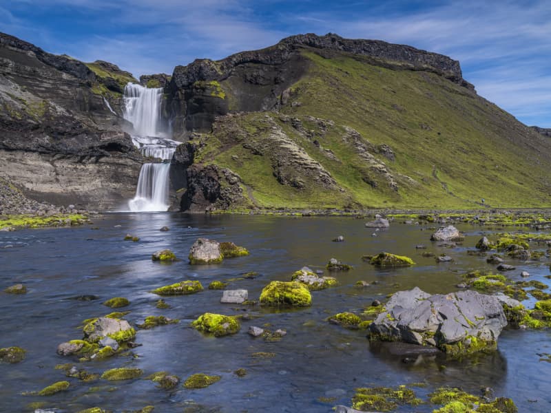
Fimmvörðuháls is situated in between two glaciers, Eyjafjallajökull and Mýrdalsjökull.The hiking trail over Fimmvörðuháls is one of the most popular one in Iceland and even more so now when hikers can explore the eruption sites up there. The trail starts at Skógar and takes us from the beatiful Skógafoss waterfall along the Skógá river. The distance is about 20 km. with estimated hiking time between 8 - 12 hours. Elevation increases and decrease is 1.000 meters. The route is especially beautiful if you walk from south to north, as there are unusually many streams in Skógá and a beautiful view down to Þórsmörk when you cross the ridge. Be prepared for sudden changes in weather since the trail leads us between two glaciers.
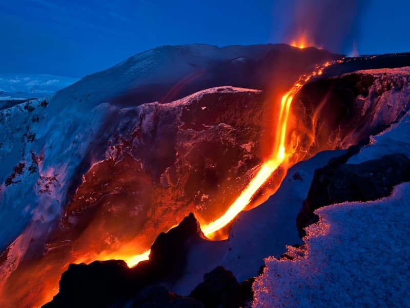
The eruption at Fimmvörðuháls began on the eve of March 21, 2010. Then there were reports of an eruption with associated ash fall in or near Eyjafjallajökull and the information came from the Police in Hvolsvöllur. The eruption was north of Fimmvörðuháls, just east of Eyjafjallajökull. This eruption is classified as a lava eruption. The lava flow from the eruption fissure formed the highest lava waterfall in the world that flows down into a gorge near the eruption fissure. The lava waterfall was about 200 meters high.
View
Hrafntinnusker
Hrafntinnusker in Torfajökull glacier is a place you must visit. The English name of this 1128 m high mountain is The Obsidian Skerry. It is situated some distance east of the infamous volcano Hekla. It is accessible by 4wd vehicles from the north and south.
The view from Hrafntinnusker is outstanding. A sizeable geothermal area is around the mountain, especially to the west. There are fumaroles, multicolored clay hot springs, and hot water springs, some of which are evergreen and, in some places, under a glacier, ice caves from there, both big and small. The color of this area is diverse and beautiful. East of Hrafntinnusker is the mountain hut of Ferðafélag Íslands, on "Laugavegur," the hiking trail between Landmannalaugar and Þórsmerkur, built-in 1977. It seats about 20 people.
View
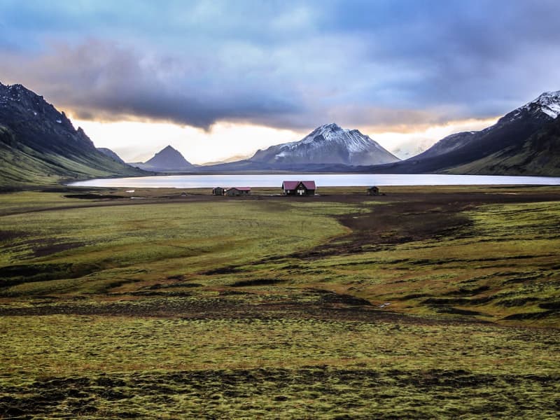
Álftavatn in Rangárvallaafréttur
There are lodges at Álftavatn, and Arctic char can be caught in the lake. Álftavatn is close to places of great natural beauty such as Grashagi, Torfafit, Ljósártungur, Jökultungur, Ófæruhöfði, Útigönguhöfði, Hvanngilshnausar, Torfatindur, Sáta, Brattháls and Hvanngil.
The Álftavatn lodge area is part of Laugavegur, one of Iceland's most popular hiking trails, from Landmannalaugar to Þórsmörk.
View
Frostastaðavatn
Lake Frostastaðavatn rests in breathtaking nature and is surrounded by black lava fields and colorful rhyolite mountains. It covers around 2,5km2 and lies at 573 meters above sea level. Access to the lake is excellent; roads are on its north and east sides.
Like other lakes in this area, it is rich in trout and therefore popular with fishermen and hikers who want fresh catch of the day on their dish at dinner time.
View
Höfðabrekkuheiði, Þakgil
A breathtaking 14 km drive from ring road no. 1 to Þakgil campsite and hiking area. Surrounded by black sand and glacial rivers, a gravel road crosses the heath of Höfðabrekka, a tuff ridge between rivers Múlakvísl and Kerlingadalsá formed during the last Ice Age when volcanic material forced its way from beneath the glacier following a sub-glacial eruption. The road is closed during the winter. The vegetation in this area is highly vulnerable to trampling; please always keep to trails.
View
Kerlingarfjöll Mountains
The mountain massif Kerlingarfjöll (The Giantess Mountains; 800 - 1500 m) is the main ornament in the chain of mountains and glaciers framing the Kjölur area. It covers about 150 km² area southeast of The Temple Glacier (Hofsjökull) It derives its name from a single, 25 m high and dark hyaloclastite pillar protruding from the light-colored, rhyolite scree of the peak Kerlingartindur. The aforementioned types of rock represent the main structure of the mountain massif and this yellowish tint is the dominant color in the area.The area is full of small steaming hot springs, mud pools, and water fountains. It is truly a hiker's paradise. It is one of the largest geothermal areas in all of Europe and there are future plans to construct a large geothermal steam plant here for electricity to harness the massive amounts of energy stored here. The area is very unique, sensitive, and beautiful - why such a decision may be controversial if proper conservational steps are not taken when doing so.It is recommended to use 4wd vehicles because of the various and changing condition of the tracks and unbridged rivers, which have to be forded with the greatest of care. It is also recommended that people read the special brochure on driving in the interior before heading up there and remember, that off-road driving is strictly forbidden. Many of those who have visited the interior catch the bug and the only remedy is to come back again and again. It is like an incurable disease. Traveling across the interior was common during the Saga period, but after that up to the middle of the 18th century, superstition kept people away. Nowadays - more and more people enjoy this part of the country the whole year-round.
The small glacier patches up there have been retreating fast and now the summer skiing school, which was operated for decades, exists no more. Its complex of houses is now being used to accommodate travelers in the area during the summer months.
View

Landmannalaugar - Nature Reserve
Landmannalaugar derives its name from a hot pool that rises under the Laugahraun lava field. Landmannalaugar has been a stopping point for people for centuries, and the mountain shepherds on Landmannaafréttur have stayed there while herding sheep off the mountain for as long as there have been reports of such travel.
Many beautiful mountains can be seen from Landmannalaugar: Barmur, Bláhnúkur, Brennisteinsalda, Suðurnám, and Norðurnám. The area has considerable deposits of rhyolite, obsidian, and rhyolite lava, and the Landmannalaugar landscape is famous for its colorfulness and unique environs.
The start of one of the most popular hiking trails in Iceland, Laugavegurinn, is at Landmannalaugar. The trail proceeds along Hrafntinnusker, Álftavatn, Hvanngil, and Emstrur and ends in Þórsmörk.
Ferðafélag Íslands (the Iceland Touring Association) provides facilities, such as showers and accommodation, for travelers at Landmannalaugar. In addition, there is a horse rental and a small café operated during the summer.
Fees:The Environmental Agency will implement a booking system for parking in Landmannalaugar for the summer of 2024. It will be necessary to book parking spaces in advance and pay a service fee.
The system will be used from June 20th to September 15th, every day of the week. During this period, all visitors planning to come to Landmannalaugar on their own in a private or rental car between 8 am and 3 pm will need to book a parking space in advance. More information here:
View
Fishing in Landmannaafréttur
Many other lakes, apart from Veiðivötn, are located south of Tungnaá, and fishing permits for twelve of them can be bought from the wardens at Landmannahellir.
These are the lakes Blautuver, Dómadalsvatn, Eskihlíðarvatn, Frostastaðavatn, Herbjarnarfellsvatn, Hnausapollur (Bláhylur), Hrafnabjargavatn, Kílingavötn, Lifrafjallavatn, Ljótipollur, Löðmundarvatn and Sauðleysuvatn. Ljótipollur and Hnausapollur are the youngest of these lakes, with the former dating from 1477 and the latter from 871.
Most of these are closed lakes, although Helliskvísl flows out from Löðmundarvatn, and Blautuver and Klingavötn are connected to Tungnaá. Only trout is caught in Ljótapollur, Herbjarnarfellsvatn, Lifrarfjallavatn and Dómadalsvatn. Trout and Arctic char is caught in Blautuver, Frostastaðavatn and Kílingavötn, but only Arctic char in other lakes.
View
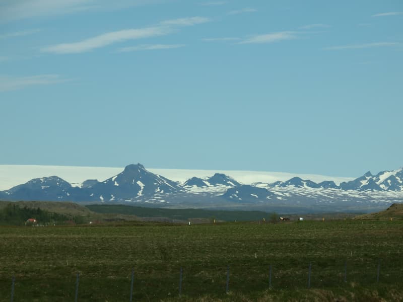
Eyjafjallajökull Glacier
The Eyjafjallajökull glacier is a 1651 m high glacier-capped stratovolcano. It is one of the smaller glaciers of Iceland. It is situated to the north of Skógar and to the south and west of the bigger glacier Mýrdalsjökull. The icecap of the glacier covers a volcano (1651m in height) that has erupted relatively frequently since the Ice Age. The crater of the volcano has a diameter of 3-4 km and the glacier covers an area of about 100 km². In June 1994 an earthquake swarm lasting for nearly a month occurred below the active volcano Eyjafjallajökull in South Iceland. It is otherwise a relatively quiet volcano – although it is not listed as being inactive. Eyjafjallajökull erupted in 1821-1823. The south end of the mountain was once part of the Atlantic coastline. As the sea has since retreated some 5 km, the former coastline has left behind sheer cliffs with a multitude of beautiful waterfalls, the best known of them being Skógafoss and Seljalandsfoss. In strong winds, the water of some of the smaller falls can even be blown up the mountain. It is one of the three glaciers that surround the Thorsmörk area - the other 2 being Myrdalsjökull and Tindfjallajökull. Specialized tours are arranged on the glacier for both skiing, super jeep tour, and hiking. One should never venture onto the glacier without guides and good knowledge of this kind of activity as this is a very dangerous area for inexperienced visitors.
Eyjafjallajökull featured prominently in world news in 2010 when ash from its eruption halted air traffic in Europe. An ice cap with several outlet glaciers covers the caldera of Eyjafjallajökull with a crater diameter 3-4 km wide. The outlet glaciers, Steinholtsjökull and Gígjökull, descend from the main glacier and can be visited by 4x4 trucks along the F-road to Þórsmörk. The area between the glaciers Eyjafjallajökull and Mýrdalsjökull with volcanic craters, Magni and Móði, created in the first stage of the Eyjafjallajökull eruption in April 2010.
View
Þórsmörk
Þórsmörk (Thórsmörk) is a natural gem that sits between Mýrdalsjökull to the east, the river Krossá in the south, with Markárfljót and Þröngá Rivers to the north. Its diverse landscape is characterized by impressive gorges, ravines, scrubby slopes, and a wide variety of unique vegetation. In times past, the farmers of Fljótshlíð and the area under Eyjafjall pastured their sheep all year round due to the mild climate found within þórsmörk.
Since the 1918 eruption of Katla, Þórsmörk was designated as a Natural Mountain Reserve. There are many curious natural rock formations in the area, such as Snorraríki, Sóttarhellar Cave, Álfakirkja (The Church of the Elves), Stakkholtsgjá Gorge, and the stone arch in Stóra Enda. Only large jeeps and buses can navigate the road into Þórsmörk due to the ever-changing volume of water, which can turn small and easily passable tributaries into tumultuous rivers in a matter of hours.
View
Langjökull Glacier
Langjökull is the country's second-largest glacier. Its accessibility is as good as it gets; however, no one should attempt driving up a glacier on their own. Many agencies offer tours that take you up the glacier in specially equipped vehicles with experienced glacier guides. You can choose from jeep excursions, glacier hiking, and snowmobiling.
View
Eldgjá canyon
Eldgjá is an old tectonic graben reactivated in a massive eruption in 934-940. The Eldgjá vents form a discontinuous 75 km long volcanic fissure extending from the Katla volcano in the west to Vatnajökull in the east. The eruption in 934-940 takes its name from a spectacular 150 m deep and 8 km long chasm called Eldgjá (fire fissure) that occupies the central part of the vent system. Part of the fissure is under the protection of the Vatnajökull National Park. There you can take a walk along the bottom of the fissure and witness the sheer scale of it. An easy hike takes you from the car park (with WC facilities) along the bottom of the fissure to Ófærufoss waterfall. Getting there: you need a 4x4, and the area is only accessible in the summer. Eldgjá is a site of international geological significance. Ófærufoss is a distinctive two-tiered waterfall cascading into the fissure Eldgjá.
Eldgjá is reached by the mountain road Fjallabaksleið nyrðri (F 208), west of Kirkjubæjarklaustur. All roads in the western part of the national park are mountain tracks, only navigable for vehicles with four-wheel-drive; some only for large jeeps. Some sections of the road are rocky and full of potholes, and loose gravel is common. It is sometimes necessary to ford (drive-through) streams and rivers, which can suddenly become swollen, making them difficult or even impossible to cross. It is dependent on the weather when the roads are opened. Usually, they are open from early June through to autumn. Driving is only allowed on the roads marked on the accompanying map. All other roads or tracks are closed to the public. Here, as elsewhere in Iceland, driving off-road is banned by law.
View
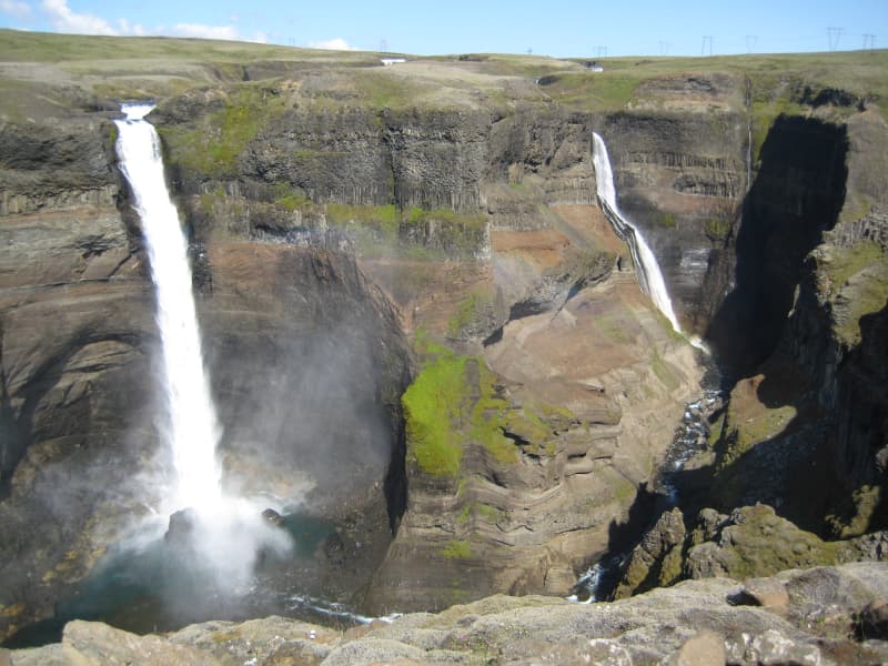
Háifoss Waterfall
The waterfall Háifoss is situated near the volcano Hekla in the south of Iceland. The river Fossá, a tributary of Þjórsá, drops here from a height of 122 m. This is the third-highest waterfall on the island. For a long time, the waterfall had no name, but in 1912 Dr. Helgi Pétursson, a geologist, came and named him.
From the historical farm Stöng, destroyed by a volcanic eruption of Hekla in the Middle Ages and reconstructed, it is possible to hike to the waterfall along the Fossá (6km each way). Above the waterfall, there is also a parking lot, so the hiking can also be done in the other direction.
View
Sólheimajökull
Sólheimajökull is an outlet glacier that descends from the southwest corner of Mýrdalsjökull. It is a so-called "climate glacier" responding quickly to climate change. Access to the glacier tongue is good because it reaches down to the lowlands, and possible to go hiking on the glaciers with tour operators from the parking lot.
Large and rapid changes have taken place on the glacier in recent years, and one clear example of this is the increased distance required to approach the glacier trail.
Sólheimajökull has long been a research topic for glaciologists. Still, glacier research can tell us much about climate and climate change over the centuries. Still, the glacial history of Sólheimajökull is in many ways unusual compared to other Icelandic glaciers.
Over a hundred years ago, the glacial footprints of the Sólheimajökull glacier lay considerably in front of the current car park.
View
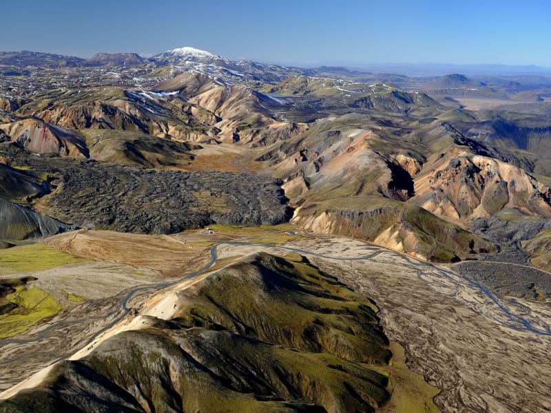
Fjallabak Nature Reserve
Fjallabak Nature Reserve was protected in 1979. The protection aims to preserve unique areas so that future generations have the opportunity to enjoy them in the same way as we do. For this to happen, there are specific rules of conduct to prevent damage to the environment or disruption of the landscape. A diverse landscape, a unique but fragile ecosystem, desert wilderness, and peacefulness are the main characteristics of the Friðland Nature Reserve, and thousands of people visit every year to enjoy the natural resources. Visitors to the area are asked to respect the nature reserve's rules of conduct and thus contribute so that the aim of the protection can be achieved and that everyone, as well as our descendants, can fully enjoy the nature reserve's nature.
The nature reserve is 44,633.4 ha in size and all more than 500 m above sea level. The area is mountainous and shaped by volcanic activity and geothermal heat. The color palette is broad, mostly due to rhyolite and obsidian in the mountains. Lava fields, rivers, and lakes are also prominent in the landscape.
Management and Protection PlanWork on preparing a management and protection plan for the nature reserve is ongoing, and all information about that work can be accessed here in Icelandic.
AccessThe northern Fjallabaksleið route (F208) lies between Land and Skaftártunga, through the Fjallabak Nature Reserve. The Landmannaleið route (F225) lies from road 26 towards Landsmannahellir through Dómadalur and connects to road 208 by Frostastaðavatn. The Sígölduleið route (208) lies from Sprengisandsvegur (F26) to Landmannalaugar.
The land here is especially sensitive to damage from traffic, and as a result, drivers are asked to familiarise themselves with road conditions before embarking on a journey through the nature reserve and not drive outside those roads shown on the map.
Weather ConditionsThe average annual temperature in Fjallabak is probably 0–1°C. July is the warmest month of the year, with an average temperature of 7–8°C. The average temperature of the coldest months, January and February, is around -6°C. Remember that each month's average temperature varies greatly from year to year. Winter conditions and frost can occur at any time of the year. The annual precipitation at Torfajökull glacier, in the southeast corner of the nature reserve, is probably around 2–3 thousand mm but decreases rapidly to the north and northwest and is perhaps down to approx. one thousand mm in the northernmost part of the nature reserve.
Further information about The Fjallabak Nature reserve
View
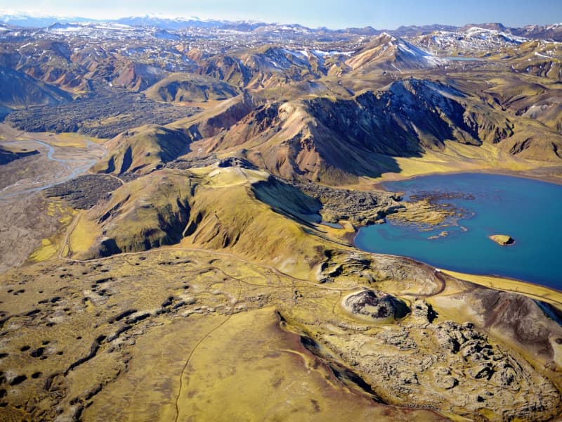
Veiðivötn Lakes
Veidivötn Lakes are a magnificent highland oasis. They are a friend in the desert, which no one should miss. Here, the crater formations are of a true extraterrestrial character and environment, something truly unique. The contrast between black sand and gin-clear waters is unique, and many travelers find this to be the highlight of their visit.
This part of the country is among the central highlands' youngest (1477) and wildest pearls. It comprises about 50 lakes of different sizes, which are so-called crater lakes. The area is about 20 km long and 5 km wide and has a southwest-northeast direction. The craters and the lakes lie in two rows. You must ford the small river between the two Fossvotn lakes to get into the area. Most lakes are fed and discharged underground because the lava fields and the scoria are very absorbent.
Some of the best brown trout & arctic char fishing in Iceland (or anywhere) are found here. The lakes are rich in natural trout that are believed to be from one of the oldest stocks in Europe. They vary in size, 3-6 pounders being common, but they can occasionally reach up to incredible 25 lbs in size. They are known for their excellent taste, which many say is naturally spiced. Inquire about fishing here in advance, as the area is usually heavily booked.
The road from Veidivötn continues north to Jökulheimar on the west of Tungnaarjökull, one of the valley glaciers that "flows" from Vatnajökull. This destination is still somewhat of a well-kept secret and undiscovered by foreign travelers. Usually, the road here is open from 15 June to the middle of October - only accessible by 4WD vehicles. It is an excellent place to "get away from it all" - the silence is often total, unbroken even by bird calls.
View
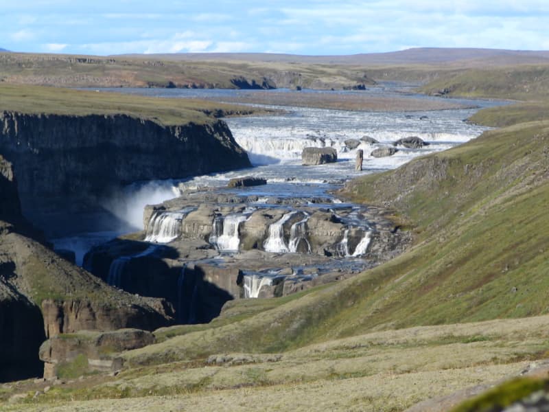
Dynkur in Þjórsá river
Dynkur is a majestic waterfall, about 38 m. High in Þjórsá. The river falls from many pedestals in small waterfalls, forming a single waterfall system. There are beautiful shapes, but these tiny waterfalls also create many beautiful rainbows when the sun shines. Dynkur can be reached from both sides of the river, but it is more accessible to reach it from the east at Búðarháls.
The road is signed but only suitable for jeeps and off-road vehicles. It is also an excellent trip to drive down to the waterfall Fagrifoss in the Kaldakvísl canyon on the way. There are also many other waterfalls to visit in the waterfilled flowing region.
View
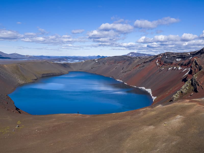
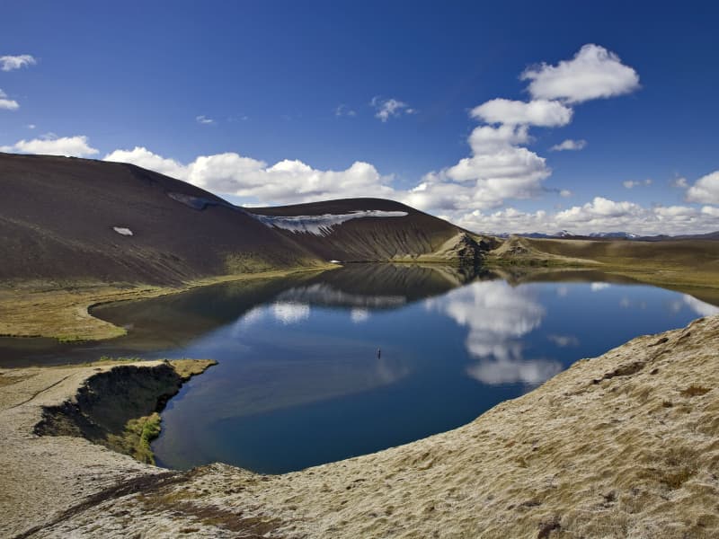
Ljótipollur
Ljótipollur is an explosion crater in the Nature Reserve of Fjallabak and is part of the Veiðivötn volcanic fissure system. It was formed in historical times. Inside the crater, there is a 0,42 km2 and 14 m deep lake. There is trout in the lake but there is no inlet or outlet to the lake, so it is not clear how the fish got there. The naming of the crater translates to "Ugly Puddle" despite the fact it is an incredibly beautiful site.
View
Fagrifoss Waterfall
Fagrifoss is a scenic 80 m high waterfall in the Geirlandsá River. Basaltic pillows occur in the vicinity of the waterfall, which cascades from 140m thick hyaloclastite deposits.
Fagrifoss is situated on the F206 road to Laki craters, a rugged road with rivers that can be treacherous to cross if the water level rises due to rain and thaw. A 4x4 vehicle is needed, and the area is only accessible during summer.
View
Bláhnúkur in Landmannalaugar
The very most popular mountain in the Landmannalaugar-region to walk on top on. It's a 945 m. above sea-level viewpoint, with a horizontal disc on the top.
View
Landmannahellir
Landmannahellir in Landmannaafréttur has long been a destination point for travellers passing through the area. The name of the place is drawn from a cave there which was used for centuries to shelter both men and horses.
At present, the location is a popular stopping point for both hikers and riders who stay there during the summer. There is, moreover, a campsite at the location. The operation of the area is in the hands of Hellismenn ehf. The company owns a number of huts at the location, as do Veiðifélag Landmannaafréttar and private entities.
A well-known hiking trail, Hellismannaleið, lies through the area and has now been signposted from Rjúpnavellir through Áfangagil to Landmannahellir and from there to Landmannalaugar. In order to reach Landmannahellir cave, one needs to use the Dómadalsleið (road F225). The road is approximately 80 km long from Landvegamót to Landmannahellir.
View
Vatnajökull Glacier
Vatnajökull is the largest glacier in Iceland and the largest glacier by volume in Europe. It covers approx 8 percent of Iceland, measuring an area of 7,700 km² (2021), with an average thickness of 400 m, and the highest point, Hvannadalshnjúkur, measures 2,110 m (6,921 ft.). Vatnajökull has around 30 outlet glaciers flowing from the ice cap, all of which bear a name; glaciers and outlet glaciers all have names that end in "jökull" in Icelandic.
Vatnajökull belongs to the Vatnajökulþjóðgarður (Vatnajökull National Park) and covers a large area surrounding the glacier, including the glacier itself. In 2019, Vatnajökull National Park was inscribed on the UNESCO World Heritage List. The National Park offers numerous exciting sites and is a must for all interested in Geology and beautiful, natural vistas.
View
Langisjór Lake, Fögrufjöll, Grænifjallgarður
Langisjór is a lake within Vatnajökull National Park that's 20 km long and 2 km wide in some places. The lake is to the southwest of Vatnajökull, between the mountains Tungnárfjöll and Fögrufjöll, in a beautiful and picturesque landscape. Its square measure is 27 km², it reaches a depth of 75 m, and the water surface is 670 m above s
Langisjór is reached by the mountain road Fjallabaksleið nyrðri (F 208), west of Kirkjubæjarklaustur. All roads in the western part of the national park are mountain tracks, only navigable for vehicles with four-wheel-drive; some only for large jeeps. Some sections of the road are rocky and full of potholes, and loose gravel is common. It is sometimes necessary to ford (drive through) streams and rivers, which can suddenly become swollen, making them difficult or even impossible to cross. It is dependent on the weather when the roads are open. Usually, they are open from early June through to the autumn. Driving is only allowed on the roads marked on the accompanying map. All other roads or tracks are closed to the public. Here, as elsewhere in Iceland, driving off-road is banned by law.
View