Author: Egill Bjarnason, 2025
Ready to make that turn?
When travelers hit the road from Keflavík Airport, they are faced with a choice at the first highway crossroads: Continue to Reykjavík city or turn right into the newest part of Iceland for the road less traveled: The Volcanic Way.
The Volcanic Way is a curated travel route of 1200 kilometers (750 Miles) connecting some of Iceland's most iconic landscapes through the volcanoes that shaped them. No worries, you won’t be climbing all those volcanoes. Instead, you can see them as guiding waypoints as you explore their surrounding regions.
Ready to make that turn? Here is how the next eight days could unfold.
Day 1: Your guide for today is Fagradalsfjall volcano
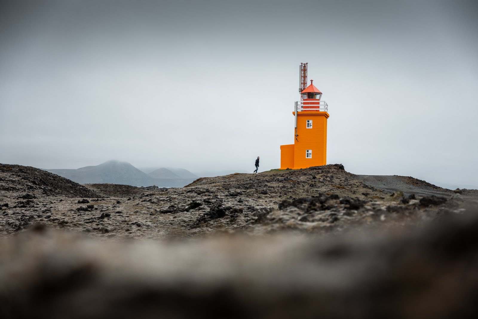
A lighthouse in Reykjanes. Photo by Þráinn Kolbeinsson.
The Reykjanes Peninsula had been dormant for 800 years when, in 2021, the mountain ridge known as Fagradalsfjall flared to life. Since then, eruptions have become routine on the peninsula and at times menaced the fishing town of Grindavík.
Make sure to travel the shoe-shaped Reykjanes Peninsula via its ‘heel’; the lower corner is packed with the hot spring Gunnuhver, coastal crater Brimketill, and the famous Reykjanes Lighthouse. The scenery - especially around the Bridge Between Continents - resembles that of the Highland interior, a rare feature in coastal Iceland. Stay the night in Reykjanesbær or any of the small towns on the peninsula.
Safety
Travel restrictions near the eruption sites can apply during phases of volcanic and seismic activity. Do not attempt to walk on the lava, even if it looks cold on the outside. As a rule of thumb, lava that has no vegetation is unsafe.
The drive
Paved. Continue Rte 427 and reconnect with Rte 1 at Selfoss.
Day 2: Your guide for today is Hekla volcano

A small waterfall in Gjáin, Þjórsárdalur valley. Photo by Þráinn Kolbeinsson.
South Iceland has the Golden Circle, touring some of the biggest attractions in the country. Fewer know that right next to it a less traveled route twists into the enchanting Þjórsárdalur valley.
Looming over Þjórsárdalur is Mt. Hekla, a volcano that has erupted 23 times for the past 1000 years and shaped the region each time. Visit The Commonwealth Farm, a recreation of a Viking long-house that archaeologists discovered as an abandoned settlement following the 1104 Hekla eruption. (Another interesting look into Viking whereabouts are the Caves of Hella.)
Hekla was during the Middle Ages believed to be the gateway to hell. But you won’t be thinking of the underworld as you enter Gjáin, a green oasis on the edge of the Highland interior, with pure springs and small waterfalls.
It is possible to cross the River Þjórsá from Þjórsárdalur via a one-lane bridge on Rte 32, near the hydropower station Sultartangavirkjun. From there, check out the cascades of Fossabrekkur or Þjófafoss. Alternatively, make your way back to Hella via Rte
The drive:
Paved but expect to drive on some rough gravel after crossing Þjórsá River to the eastern banks, and leading up to some attractions.
Day 3: Your guide for today is Eldfell on Heimaey Island
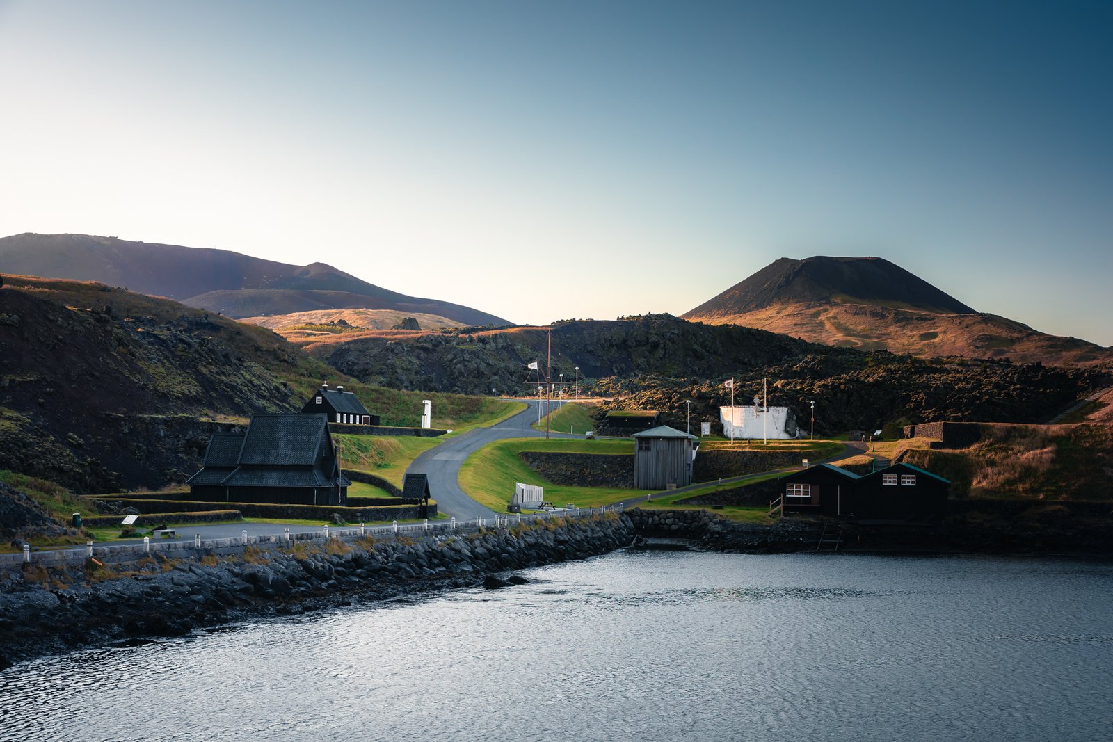
Skansinn historical site in Vestmannaeyjar. Photo by Þráinn Kolbeinsson.
Heimaey in the Vestmannaeyjar islands archipelago is the largest island community in Iceland. It is home to about 5,000 people and countless puffins during the summer. However, its population temporarily dropped to zero in 1973 when a volcanic eruption at Eldfell forced residents to move out of their homes. Many returned once the eruption was over, and the town has grown ever since.
A visit to the Eldheimar museum, followed by a hike up the newly formed Eldfell volcano, will help put the town’s remarkable history in perspective.
For hours or days, the island is a place to stroll, full of curiosities, including the Beluga Whales & Puffin sanctuary.
The drive:
Take the ferry from Landeyjarhöfn harbour (30 minutes); you won’t need a car on the island. To make the most of your stay, book a guided tour of the main island or join a boat tour to explore the surroundings further.
Day 4: Your guide for today is Lakagígar Craters
A trail by Dverghamrar. Waterfall Foss á Síðu in back. Photo by Þráinn Kolbeinsson.
On the Ring Road between Vík and Kirkjubæjarklaustur, the boundaries of Laki territory are easy to spot. The road plows through a field of lava, covered by thick moss, over one hundred kilometers away from the fissure that cracked open in 1783.
The Laki eruption is the Iceland eruption you can read about in foreign Encyclopedias. Ash blanketed the ground and clouded the sun, causing temperatures to drop across the Northern Hemisphere.
The settlement at Kirkjubækjarklaustur survived the eruption and is today home to almost 200 people. Skaftárstofa Visitor Center is a good place to start, with information on local trails and Vatnajökull National Park. Make time to check out Fjaðrárgljúfur Canyon before entering town, or take a moment to walk among the Dverghamrar basalt columns which, according to legend, are home to elves and dwarfs. It’s easy to spend days enjoying the surroundings of Kirkjubæjarklaustur with its curious geological features and historical sites.
The drive:
Rental cars are not equipped to drive the mountain road to the craters of Laki. Tours are available. Skaftárstofa Visitor Center has information.
Day 5: Your guide for today is Öræfajökull glacier

Hoffellsjökull and Hoffelsslón. Photo by Þráinn Kolbeinsson.
This day covers a lot of ground, from Kirkjubæjarklaustur to Höfn, and at least one new term: subglacial volcano. Underneath the mighty Vatnajökull Glacier are eight active volcanoes, including Öræfajökull.
The landscape near Öræfajökull is an incredible contrast. Black basalt rocks and birch trees at Skaftafell; volcanic beaches at Breiðamerkursandur and floating icebergs at Jökulsárlón Lagoon. Photographers love this area, including the motifs at Vestrahorn and Hvalsnes.
Skaftafell is also an accessible part of Vatnajökull National Park, with trails to sustain days. Svartifoss (5km, round trip) is a classic.
Eat in Höfn, a fishing town known for its cuisine, be it from local agriculture or fresh from the sea.
The drive:
Entirely on Rte 1 (Ring Road). Less traffic beyond Jökulsárlón.
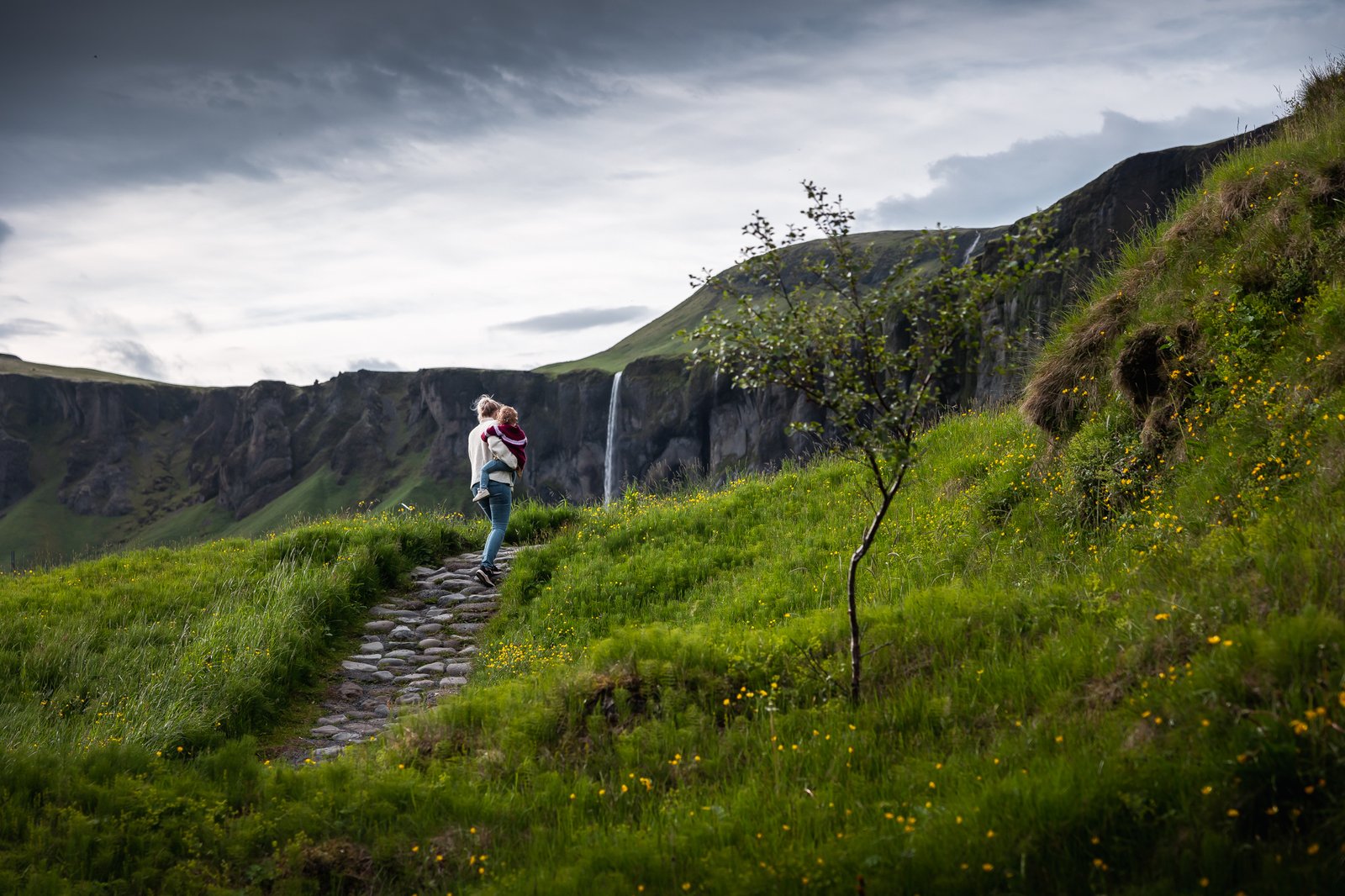
Day 6: Your guide for today is Katla volcano

Dyrhólaeyjarviti lighthouse. Photo by Þráinn Kolbeinsson.
The drive towards Katla marks the reroute back to Reykjavík or the southwestern part of Iceland. Katla is another subglacial volcano that has erupted periodically throughout Iceland’s history, most recently in 1918.
It is no wonder the beach around Katla is charcoal black, as Katla's eruptions have been known to spew sand and ash over the region. Reynisfjara beach is among Iceland’s top tourist attractions, with crashing waves and basalt columns. For a quieter option, check out Víkurfjara beach, within the town of Vík. Reynisdrangar basalt sea stacks can be seen from either of those beaches.
Small-town Vík is a default stop for travelers, with its scenic views, thriving food scene, and wide range of activity options. Most locals make a living from tourism, and many successful tourism enterprises have taken off from there, including the Lava Show and zip-lining.
The drive:
The Ring Road. Despite being a popular region for tourists, the area also holds a great diversity of quiet spots and accessible hikes.
Day 7: Your guide for today is Eyjafjallajökull glacier

Þórsmörk valley. Photo by VolcanoTrails.
Eyjafjallajökull last erupted in 2010 with a cloud of ash that brought aviation traffic in Europe to a standstill for several days. The volcano itself is underneath an ice cap but many of the iconic pictures of the 2010 eruption are recognizable on the drive along Eyjafjöll mountains.
Stop at Skógafoss, a waterfall flowing off the edge of the Eyjafjöll mountains. However, instead of following the daily crowd, you might want to hike to the less-visited Kvernufoss waterfall. Skógar, along with nearby Seljalandsfoss waterfall, is a major tourist attraction. Want some real peace and quiet? Head to Fljótshlíð and check out Gluggafoss waterfall. You could also join a thrilling Super Jeep ride to Þórsmörk nature reserve. Over the summer, daily buses also depart between Hvolsvöllur and Þórsmörk (as regular cars can’t drive there).
Hvolsvöllur, a small town located on the Ring Road, features the Lava Center, an interactive exhibition about volcanoes and geology, exciting for all ages.
The drive: Continue the Ring Road, with the option of a few detours.
Day 8: Your guide for today is Hengill volcano
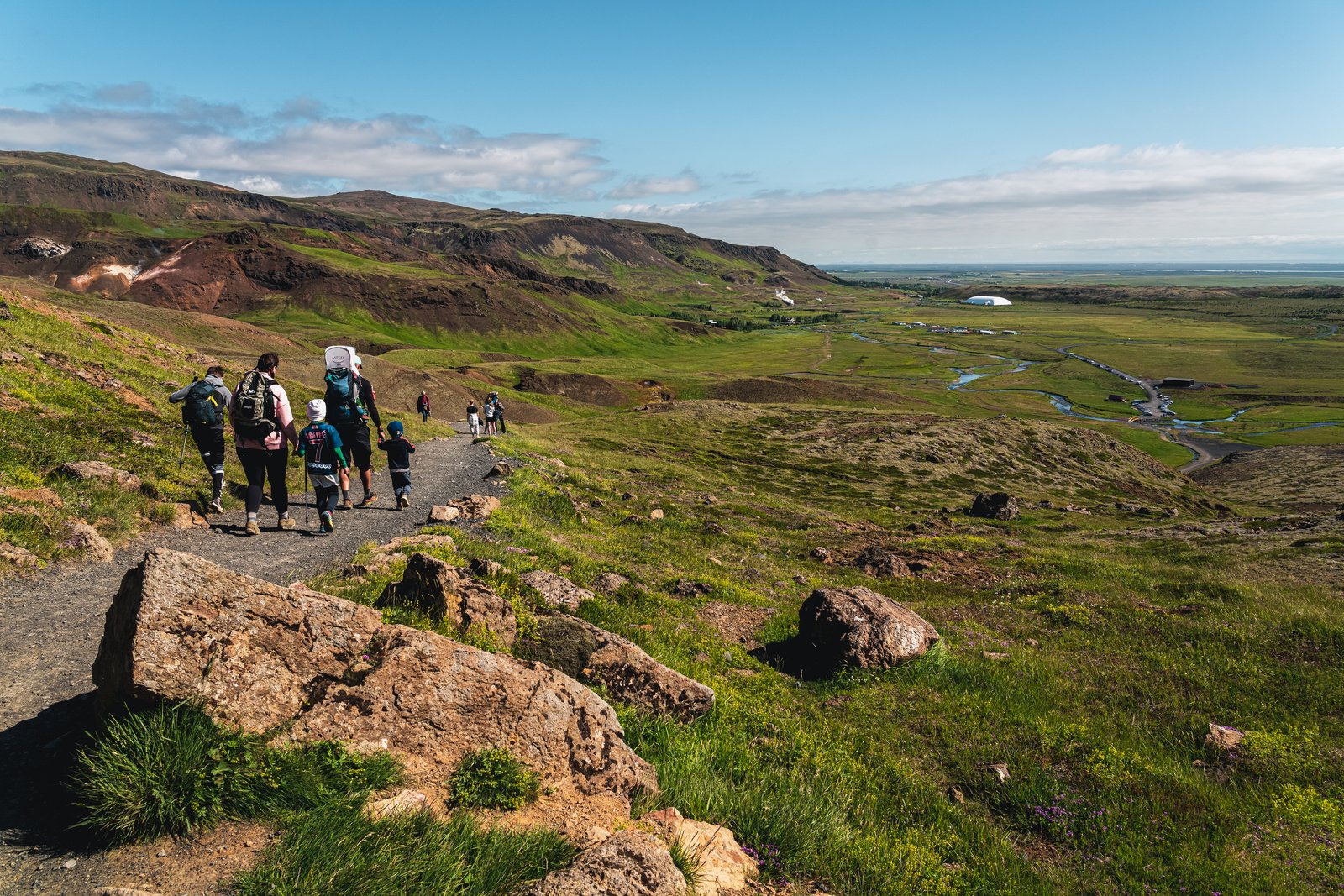
Hiking in Reykjadalur valley. Photo by Páll Jökull.
At Selfoss, it is time to get off the Ring Road again, to the coastline between the twin villages of Stokkseyri and Eyrarbakki. A path connecting the two settlements overlooks the Atlantic Ocean and the vast Þjórsárhraun lava field, which dates back 8,000 years. In the flat landscape, random lighthouses appear like skyscrapers. Follow the South Coast Lighthouse Trail for more.
The best thing about Iceland’s volcanic activity is no doubt the abundant geothermal water. Hot water just spills from the ground along the volcanic rift zone. In Reykjadalur, hikers can take a bath in a river where the cold stream mixes with hot springs.
The area is part of Hengill, with geothermal spots dotting the way from Hveragerði to Nesjavellir via Iceland’s largest geothermal power plant at Hellisheiði. In Hveragerði, exotic flowers grow inside greenhouses and, no wonder, the town has one of the country’s oldest public sundlaug pools at Laugarskarð. Everything is heated the volcanic way.
The drive: Mostly on the Ring Road. In winter, the mountain pass between Hveragerði and Reykjavík may be closed for a few hours during adverse weather conditions.
And finally, some fun volcano facts …
... Þjórsárhraun lava field is the result of the greatest lava flow on earth since the last Ice Age. It is well visible at the beach in Stokkseyri and Eyrarbakki
… Hekla was in the Middle Ages rumored to be the gateway to hell.
… Hot lava was used to heat houses on the island of Heimaey for about 15 years after the eruption ended, the only lava heating source known to the modern world.
… the 2010 Eyjafjallajökull eruption caused the biggest disruption to aviation the world has ever seen.
… the Reykjanes Peninsula has erupted eleven times since 2021. The second-most active volcanic system in Iceland is currently the sub-glacial Grímsvötn and Bárðarbunga, nestled under Vatnajökull glacier.

Þjórsárhraun lava field meets the Atlantic Ocean by Stokkseyri village. Photo by Þráinn Kolbeinsson.