Historic places in South Iceland bring the region’s story to life. From settlement-era sites to landmarks tied to local heritage, they offer insight into the people, events, and traditions that shaped the area. Here you’ll find a selection of historic places in South Iceland.
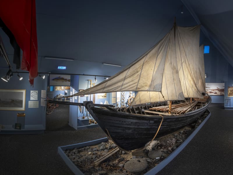
Eyrarbakki Maritime Museum
The museum takes the visitor back to old times in a small Icelandic fishing village. On display is a fine collection of artifacts connected with fisheries, crafts, social and cultural life of the common people durning the last 100 years.
View
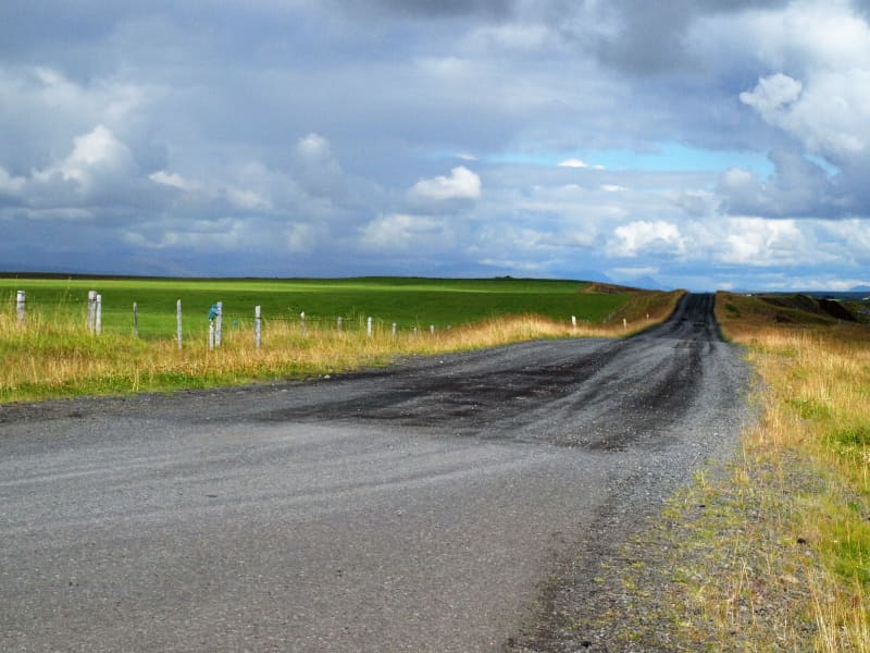
Ásavegur - trail
The trail Ásavegur used to be an important highway through the South of Iceland. This centuries-old man-made route would be used by people from different directions to go fishing, for example, or to collect their sheep and cattle from the mountains.
Between Orrustudal and Hnaus is a marked hiking trail along the old Ásavegur trail, about a 6 km walk. On this trail is the highest point of Flóahreppur, with breathtaking views in all directions. Information signs on Orrustudalur (The Valley of Battles), Skotmannshóll (Archer's Hill), and Mannabeinsmelur (The Human Bone Field) are located at different points during the hike.
These locations are a great part of Icelandic history. Here is the stage of Flóamanna-Saga; two big battles were fought in Orrustudalur valley, and from Skotmannshóll or Archer's Hill came one of the greatest bowshots in the saga.
View
Baugsstaðir creamery
The creamery was established by local farmers in 1905 and operated until 1952. Its products were butter and cheese. The Baugsstaðir creamery was powered by a water wheel and is the only one of Iceland’s creameries that still retains its original equipment. A little to the west are the ruins of the creamery’s storage, which was an icehouse and used to store products before they were transported to market. The creamery’s main markets were in England as well as in Iceland.
View
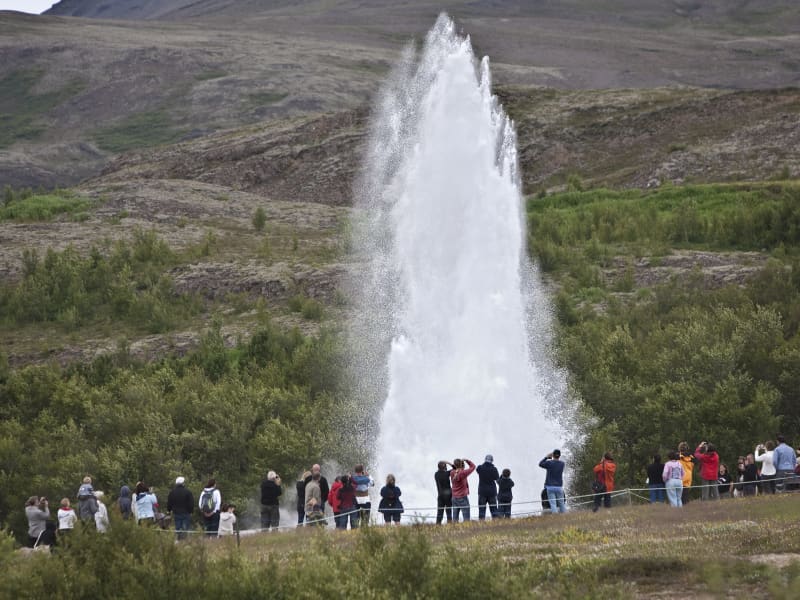
Geysir Geothermal area
One of the greatest natural attractions of Iceland and part of the famous "Golden Circle Tour," The Great Geysir, or Stori-Geysir, has been dormant since 1916 when it suddenly ceased to spout. It came to life only once in 1935 and quickly went back to sleep. Since then, its repose has sporadically been disturbed by the dumping of tons of carbolic soap powder into its seething orifice to tickle it to spout.
It is not exactly known when Geysir was created. It is believed that it came into existence around the end of the 13th century when a series of strong earthquakes, accompanied by a devastating eruption of Mt. Hekla, hit Haukadalur. In this geothermal valley, Geysir is located. What is known is that it regularly spouted every third hour or so up to the beginning of the 19th century and, after that, progressively at much longer intervals until it completely stopped in 1916. Whether its silence is eternal or temporary, no one knows.
When it was alive and shooting, it could thunderously blast a spectacular jet of superheated water and steam into the air as high as 60 to 80 meters, according to different sources. Its opening is 18 meters wide and its chamber 20 meters deep. One reason for cessation is believed to be the accumulated rocks and foreign objects thrown into it by thousands of tourists throughout the years. Though definitely damaging, this could not be the only reason for its dormancy.
The Great Geysir was among the most notable geysers in the world, such as those in Yellowstone Park, New Zealand, and North Iceland. The English word "geyser" is derived from the Icelandic word "geysir," which means gusher. Though the Great Geysir itself is now more or less inactive, the area surrounding it is geothermically very active with many smaller hot springs.
The attraction of the area is now Strokkur (The Churn), another geyser 100 meters south of the Great Geysir, which erupts at regular intervals every 10 minutes or so, and its white column of boiling water can reach as high as 30 meters. The whole area is a geothermal park sitting on top of a vast boiling cauldron. Belching sulfurous mud pots of unusual colors, hissing steam vents, hot and cold springs, warm streams, and primitive plants can all be found here.
A short distance away to the west stands the small Laugarfjall Mountain with a panoramic view overlooking the Geysir area. King Christian IX of Denmark visited the area in 1874 and by the foot of the mountain are the rocks where he leaned while his hosts tried to impress and amuse him by boiling eggs in the hot springs. The rocks are now called Konungssteinar ("The King's Stones").
View
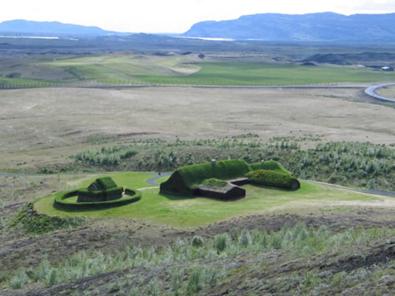
The commonwealth farm
The commonwealth farm is situated under the mountain Sámstaðamúli, and it is an attempt to rebuild in the most credible way, a large farm since about 1100. The Commonwealth farm is based on the ruins of the former manor farm, Stöng in Þjórsárdalur, which is considered to have been abandoned after its destruction in the Hekla eruption of 1104, along with about 20 other farms in the area. When building the Commonwealth farm, every effort was made to replicate as precisely as possible the ruins of the farm at Stöng and thus to try to give as credible a picture as possible of a dwelling of an Icelandic chieftain from the Age of Settlement. The farm building itself is a museum piece illustrating ancient handwork, and where this was not possible, imagination took over, as is the case in historical novels. The Commonwealth farm is a living witness to the fact that the dwellings of the Icelanders of yore were well built and majestic constructions.
To celebrate the 1100 anniversary of the Settlement of Iceland in 1974, it was decided to reconstruct a manor farm from the Age of Settlement. The well-preserved ruins at Stöng were very suitable on which to base a replica manor farm. Building work on the Commonwealth farm commenced in 1974, and it was completed three years later. The building was formally opened on 24 June 1977.
The newest addition to buildings at the Commonwealth farm is the stave church built-in 1999-2000 and established before the summer of 2000. It is built from Norwegian electoral wood. It is a gift from The Norwegians on the occasion of 1000 years of Christianity in the country and the finding of North America.
Information about opening hours and admission fees can be found on its website: thjodveldisbaer.is
View
Ingólfshöfði
At the edge of the Atlantic Ocean, Ingólfshöfði is a headland isolated by black sands and perilous rivers from the rest of the mainland.
This historical cape is named after the first settler of Iceland, Ingólfur Arnarson, who spent his first winter there with his family after moving to Iceland, 874-875 A.D.
However, it´s home to thousands of nesting seabirds and gulls, especially puffins and the great skua. Ingólfshöfði is only accessible by organized tours.
View
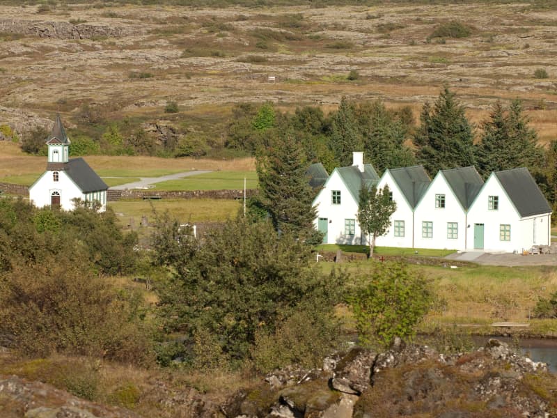
Þingvellir National Park
Þingvellir National Park is a designated UNESCO World Heritage site. It is one of the most important places in Icelandic history, as well as being famous for its unique geological features. It is among the three key locations on The Golden Circle.
The parliament plainsThe site has historical importance spanning over 1000 years. In 930, the Alþingi, one of the oldest parliamentary institutions in the world, was founded. In fact, Þingvellir literally translates to "parliament plains". The Alþingi met annually, and the Lawspeaker recited the law to all the gathered people and resolved disputes as well. This is where Christianity was made the official religion of Iceland around the year 1000. On June 17th, 1944, the independence of The Republic of Iceland was proclaimed in Þingvellir.Where Eurasia meets North AmericaÞingvellir has been a national park since 1928 because of its special tectonic and volcanic environment. The effect of the continental drift can be clearly seen in the cracks and faults traversing the region, the most famous one, Almannagjá, being a veritable canyon.
By Iceland's largest lakeÞingvellir is situated on the northern shore of Þingvallavatn, the biggest lake in Iceland. The river Öxará traverses the national park and forms a waterfall at the Almannagjá called Öxaráfoss. Together with Gullfoss waterfall and the Geysir hot spring area, Þingvellir is part of the famous Golden Circle travel route.
What to seeThe national park contains several points of interest, including Almannagjá Gorge, which showcases the effects of continental drift; Lögberg cliff, where the assembly of Alþing met; Öxarárfoss waterfall; and Peningagjá, a deep fissure with crystal clear water where visitors like to throw a coin and make a wish. A quaint wooden church stands in a picturesque location, and the national park offers a network of walking paths.
Activities and servicesGuests may opt to enter the park's visitor center and exhibition to learn more about Þingvellir's unique history and nature. Along with varied hiking options, visitors may enjoy bird-watching or angling. Fishing permits can be bought on location. Another popular activity at Þingvellir is snorkeling or diving with experienced local tour operators.
CampingÞingvellir is ideal for camping. There are several camping grounds at the national park, some of which offer showers and electricity.
View
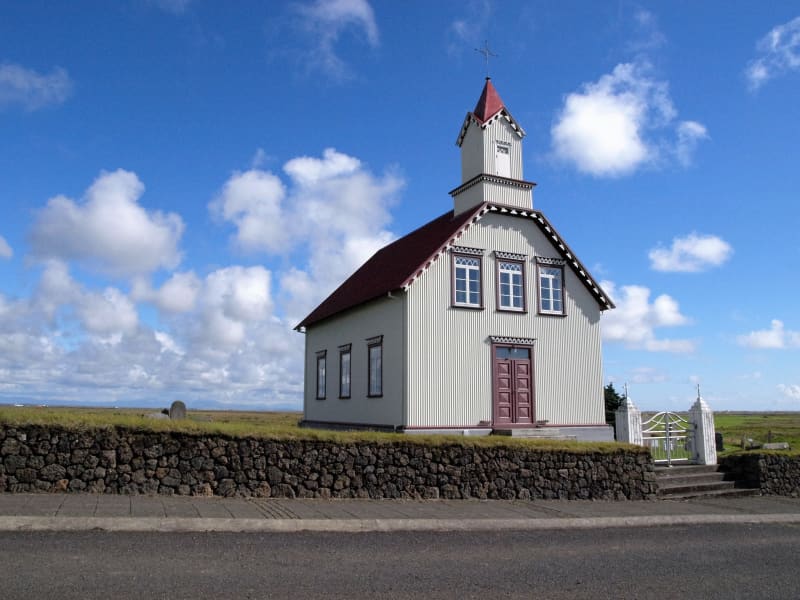
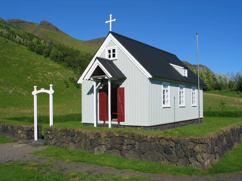
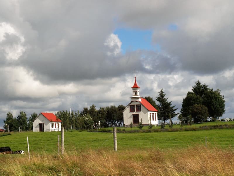
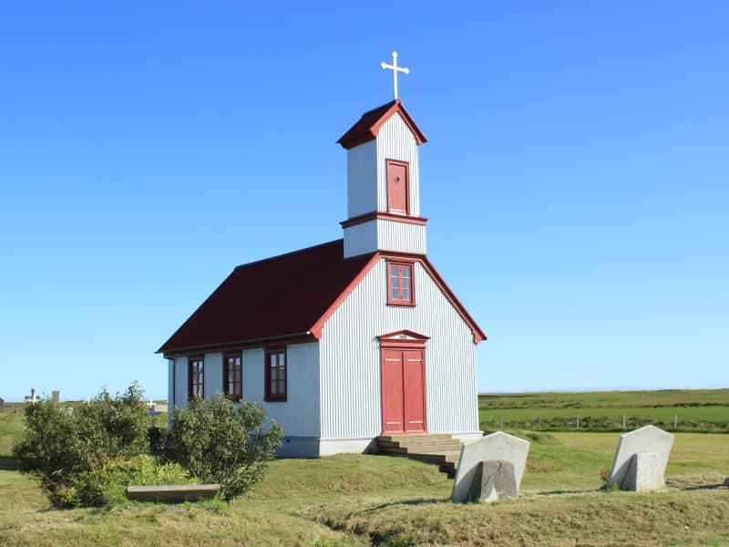
Gaulverjabær church
Gaulverjabær has been a church site and manor since early settlement. Loftur Gamli from Norway was Gaulverjabær's first settler and named the place after people from Gaular in Norway, a province of Sogn and Fjordane. In 1930 a significant collection of 360 silver coins from the first century of Icelandic settlement was discovered at this site. The current church was built in 1909 and has now been preserved.
View
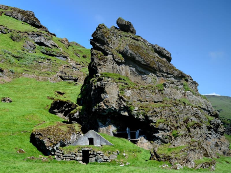
Rútshellir
Rútshellir in mount Hrútafell is a protected cave with a newly renovated sheep pen attached in front of it. Said to be the largest man-made cave in Iceland, Rútshellir has two parts. The upper half contains an adjoining cave, which is so high that at one time, a 2nd floor was installed, making this a double-story cave. Further in, there is a ledge that was undoubtedly used for sleeping. In the ceiling, you will notice a carving of a cross that tells us that the cave dates from the time of Irish monks, before the Norse settlement. Many legends are connected to this cave. One involves a man called Rútur, who lived in the cave, but his slaves intended to kill him. They carved a hole under the ledge where Rútur slept, so they could kill him with spears while he was asleep. One night, arriving home and preparing to sleep, Rútur discovered their plot. He chased the enslaved people into the mountains and killed them all.
View
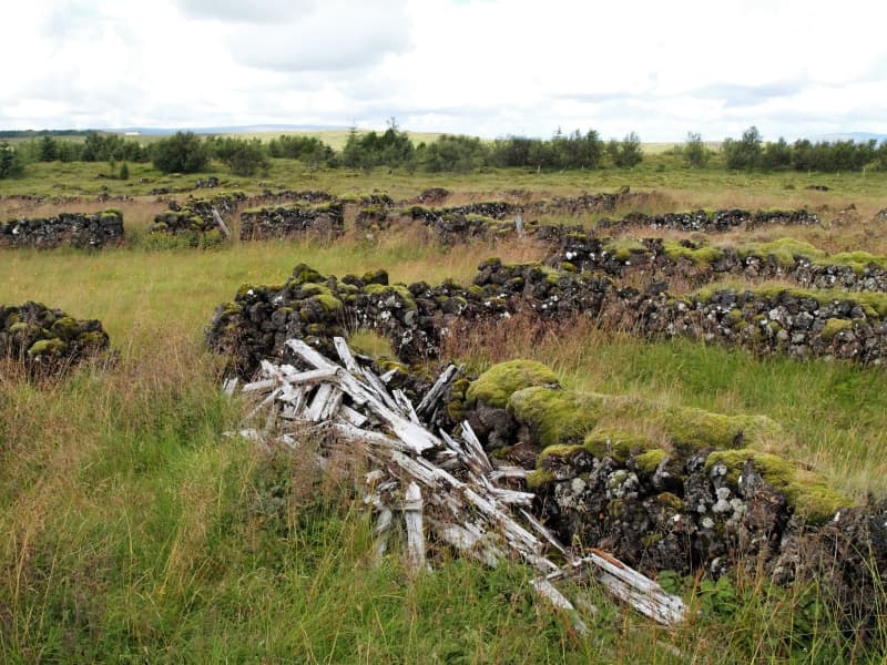
Dælarétt
Dælarétt is a centuries-old sheep pen surrounded by beautiful landscape, built from rocks of the great Þjórsárhraun lava field. Dælarétt is considered to be the oldest sheep pen in the country and has now been preserved. Close by are earthquake fissure; use caution around the fissures.
View
Skógakirkja church
Skógar was a church site from shortly after the adoption of Christianity in Iceland around 1000 AD; the first church was built in about 1100 and dedicated to St. Nicholas. In the early centuries, Skógar Church was wealthy, but after the Reformation of 1550, it declined. The last church at Skógar was a modest wooden church built in the mid-19th century and demolished in 1890.
The present Skógar Church at the museum site was designed by architect Hjörleifur Stefánsson and consecrated in 1998. The exterior structure is new, while most interior fittings are from Kálfholt Church, built in 1879. The windows, which date from 1898, are from Gröf Church. One of the bells, which dates from about 1600, is from Höfðabrekka, the other from Ásar, Skaftártunga, from 1742. All the ecclesiastical goods date from the 17th and 18th centuries. The altarpiece is from Ásólfsskáli Church (1768), the candelabra from Steinar Church and Eyvindarhólar Church (16th century). Various religious ceremonies take place each year in Skógar Church. The church is non-denominational and welcomes all Christian ceremonies.
The present Skógar Church at the museum site was designed by architect Hjörleifur Stefánsson and consecrated in 1998. The exterior structure is new, while most interior fittings are from Kálfholt Church, built in 1879. The windows, which date from 1898, are from Gröf Church. One of the bells, which dates from about 1600, is from Höfðabrekka, the other from Ásar, Skaftártunga, from 1742. All the ecclesiastical goods date from the 17th and 18th centuries. The altarpiece is from Ásólfsskáli Church (1768), the candelabra from Steinar Church and Eyvindarhólar Church (16th century). Various religious ceremonies take place each year in Skógar Church. The church is non-denominational and welcomes all Christian ceremonies.
View
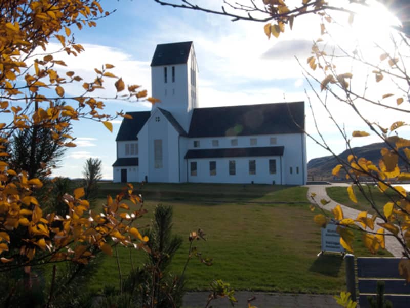
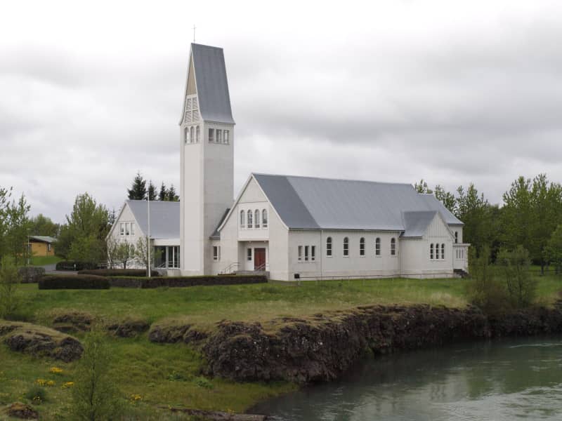
Laugardælir
Laugardælir is a small hamlet near the town of Selfoss. Laugardælir was one of Iceland’s busiest ferry sites until a bridge was built across Ölfusá in Selfoss in 1891. The church at Laugardælir was built in 1965 using mainly concrete and it is 300 m2 in total. In the church cemetery is the burial site of former World Chess Champion Bobby Fischer (1943-2008).
View
Skálholt Church
Situated in the lower part of the Biskupstungur valley between the rivers Hvítá and Brúará, Skálholt is one of Iceland's places of special historical interest. For seven centuries it was the scene of the most dramatic events which shaped the political, spiritual and cultural life in Iceland. Its early history is traced back to the 11th century when religious disputes were at their sharpest in Iceland. Within two centuries of the settlement of Iceland, the first bishopric was founded at Skálholt in 1056 for South Iceland, and soon a second at Hólar in 1109 for North Iceland.
The man who chose Skálholt as the site of the first Episcopal see in Iceland was Ísleifur (1006 - 1080), son of Gissur the White. Skálholt had earlier been his patrimonial estate and his grandfather, Teitur Ketilbjarnarson, was the first settler there. According to an old account, Skálholt was at that time "the largest town in Iceland". Ísleifur's father, who was a wealthy aristocrat and a redoubtable political figure as well, played a decisive role in the Christianization of Iceland and the future status of the church. He built the first church in Iceland at Skálholt around the year 1000.
In the 12th century bishop Klængur Þorsteinsson built a great cathedral at Skálholt. It was a sumptuous edifice made of timber shipped from Norway. For centuries Skálholt was the centre of learning and culture in Iceland, a status which lasted up to the Reformation in 1550.
In 1954, a team of archaeologists, while digging up the foundations of the old cathedral, came upon a sarcophagus which was believed to contain the skeleton of Páll Jónsson, one of the most powerful bishops of Skálholt. His sarcophagus, together with a few relics found at the scene, is now on display in an underground vault beneath the new memorial church built during 1956-1963 on the site of the old cathedral. All churches in Scandinavia contributed financially to its construction.
The last Catholic bishop of Iceland, Jón Arason, was executed at Skálholt in 1550, along with his two sons. He had opposed the Reformation imposed upon Iceland by King Christian III of Denmark. Today, a memorial stands at the site of the execution. Arason's Episcopal robes are on display at the National Museum of Iceland in Reykjavík.
Today, Skálholt is visited for the new cathedral, the tomb of bishops, the museum, and the collection of ancient books in the tower.
View
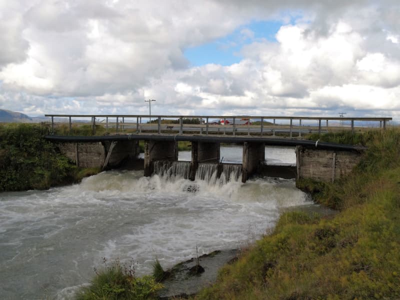
Flóaáveita - canals
Flóaáveitan are canals that run through the entire Flói region, from Ölfusá in the west to Þjórsá River in the east. This monumental construction consisted of 300 km long canals and 900 km of embankments. The Flói irrigation system reached over 12 thousand hectares of land and became a major transition in farming and production in the area at the time. The construction of Flói irrigation system began in 1922 and irrigation began its activities in 1927. When the irrigation was inaugurated in 1927 it was one of the greatest structures in Europe and to this day it plays an important role in transferring water between farms. Beside the sluice gate you will find an information board with more details about the Flói irrigation system. To the east of the sluice gate is a marked hiking trail along Hvítá (about 4,4 km, one way).
View
Kambur
A notorious robbery, called Kambsrán, was committed at this spot in 1827. Four men broke into the farm at night, tied up the farmer Hjörtur Jónsson as well as the members of his household and ransacked the house in search of money. They ended up stealing about 1000 state dollars. The thieves left behind some evidence and it was the famous sea captain Þuríður Einarsdóttir who finally solved the case.
View
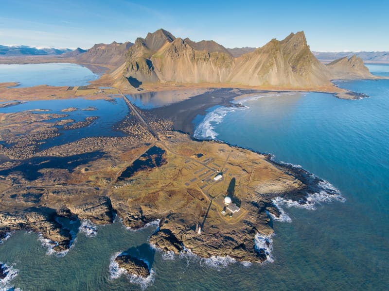
Vestrahorn
Vestrahorn is a 454-metre mountain on the Stokksnes peninsula, about a ten-minute drive from Höfn. The area is known for its dark sand beaches, rocky shoreline, and views of the mountain rising above the coast.
Vestrahorn is also a notable geological site, made mainly of gabbro with some granophyre. East of the mountain is Brunnhorn, a distinctive outcrop that extends towards the sea.
The area has historical connections to one of Iceland’s early settlement farms, Horn. During the Second World War, it was used as a British army base, and a NATO radar station was later built at Stokksnes. Visitors may also see seals on the sand, but sightings are not guaranteed.
View
Loftsstaðir
Loftstaðir is a medieval fishing station. A great sorcerer called Galdra-Ögmundur lived there around 1600. On a hill nearby, called Loftstaðahóll, is a huge and age-old stone cairn.
View
Villingaholt church
A church and farm site and home to the great 17th century saga writer Jón Erlendsson; thanks to his work many of the Icelandic Sagas were preserved that would otherwise have been lost. Later the home of Jón Gestsson (1863-1945) craftsman and farmer who designed and constructed the current church in 1910-1911. The church has a tower, choir loft and seats for 100 people. A little further to the south is a hill next to the school which used to be where the church and farm were located. Due to frequent sandstorms and heavy damage from earthquakes in 1784 they were moved to the current location.
View
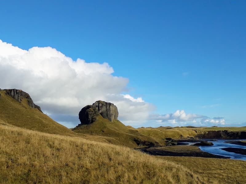
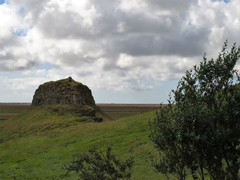
Systrastapi
In 1186 a nun monastery was established in Kirkjubær á Síðu. It was later called Kirkjubæjarklaustur, and the topographical names Systrastapi and Systrafoss are connected to this time. Systrastapi is a steep rocky hill west of Klaustur.
Folklore says that two nuns of the monastery were buried after being burned at the stake for violating codes of ethics. One is supposed to have sold herself to the Devil, carried consecrated Communion bread past the door of the privy, and had carnal knowledge with men. The other spoke blasphemously of the Pope. After the Reformation, the latter nun was regarded as innocent and beautiful flowers grew on her grave, while the other one's grave remained barren.
The rocky hill can be climbed, and from the top, the view of glaciers, among other things, is fantastic.
View
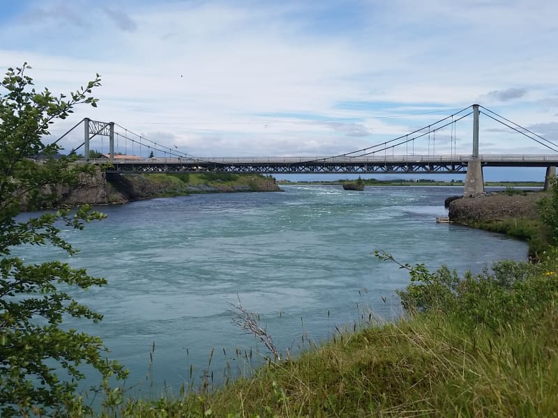
Ölfusárbrú - suspension bridge
Ölfusárbrú is a suspension bridge over the Ölfusá River that was first built in 1891 and became the largest bridge in Iceland at the time. In September 1944, when the bridge had been in use for 53 years, the eastern bearing cables broke due to the weight of two trucks. A new suspension bridge was built in 1945, which only took five and a half months, but while it was being constructed, the old bridge had been fixed for temporary use. The bridge is 84 meters long and is in the town of Selfoss.
View
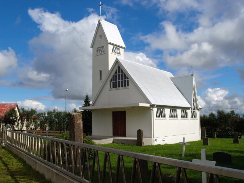
Selfosskirkja - church
Selfoss Church was built from 1952 to 1956 and consecrated on Palm Sunday, 25 March 1956. It was designed by the headmaster of the Technical College in Selfoss, Bjarni Pálsson (1912-1987). The building was expanded between 1978 and 1984; a tower, porch, and congregation hall with a kitchen and facilities, which now serve the purpose of a convention center, was added to the structure.
View
Oddi church
Oddi at Rangárvellir is a historic church site, farm and vicarage. In earlier times, Oddi was one of the most important seats of chieftains and education, with Snorri Sturluson being one notable figure who grew up there.
Oddi stands quite far down in the Rangárvellir region, just between Ytri- and Eystri-Rangá, with the river Þverá flowing just below Oddatorfa. Oddi was a major farm for a number of centuries and was blessed with rich pastures. The farm controlled numerous smallholdings and had enormous influence.
One of the more famous pastors who served at Oddi was poet Matthías Jochumsson, author of Iceland’s National Anthem, whose poetry includes glowing descriptions of the surrounding landscape.
It is believed that a church has stood at Oddi since Icelanders first adopted the Christian faith. The current church is a timber church from 1924 and seats around 100. The church was designed by Guðjón Samúelsson, the State Architect of Iceland. The church was renovated, painted and decorated in 1953 by Gréta and Jón Björnsson and re-consecrated the same year.
Among the most important items owned by the church are a silver chalice believed to be from around 1300, an altarpiece from 1895 showing Christ in the garden of Gethsemane and a baptismal font carved and painted by carpenter Ámundi Jónsson.
During the Commonwealth Era, Oddi was the ancestral home of the Oddverjar clan, one of the most powerful family clans of the period. The most famous member of the family was Sæmundur the Learned Sigfússon. Sæmundur the Learned studied at the Black School (the Sorbonne) in Paris. He was probably one of the first Icelandic historians to write a history of the Kings of Norway, although the manuscript is now lost. The grandson of Sæmundur the Learned was Jón Loftsson, who was one of the most powerful chieftains in Iceland and was, moreover, one of the most respected of them all, the most peaceful and beloved. Jón fostered Snorri Sturluson and educated him.
Six pastors serving in Oddi have become the Bishop of Iceland: Ólafur Rögnvaldsson, Björn Þorleifsson, Ólafur Gíslason, Árni Þórarinsson, Steingrímur Jónsson and Helgi G. Thordarsen.
The Oddi Association (Oddafélagið) was established in 1990. One of the main objectives of the Association is to re-establish the seat of learning at Oddi in Rangárvellir. Members currently number 200, and the patron of the Association is Vigdís Finnbogadóttir, the former President of Iceland. The Association holds the Oddastefna (Oddi conference) each year, where numerous lectures are given on the importance and history of Oddi.
The current pastor of Oddi is Elína Hrund Kristjánsdóttir.
View
Hraungerði church
Hraungerði is a church manor and former assembly site. The land once belonged to Hróðgerður the Wise, one of the first settlers and progenitor of the clan Oddverjar. The first mention of a church in Hraungerði is in Bishop Páll’s records from around 1200 AD and since then there have been numerous churches built in Hraungerði. The current church, established in 1902, was designed by architect Eiríkur Gíslason from Bitra and is now preserved.
View
Þykkvabæjarklaustur
Þykkvabæjarklaustur is a present and historic church site snuggled in the Álftaver pseudo crater area. In medieval times this was the location of a catholic monastery, which was founded in 1168 and remained active until the reformation in the mid-16th century. Recent archaeological findings (2015) show that there was an extremely large building of about 1800m2 of ground floor. It was a rich convent of monks with a large farm and a school.
View
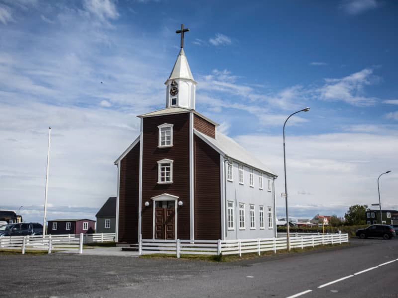
Eyrarbakkakirkja - church
The church in Eyrarbakki was inaugurated in December of 1890. Before that, the people of Eyrarbakki attended services in the neighboring village of Stokkseyri, but as the population of Eyarbakki grew, reaching 702 in 1890, it was time for Eyrarbakki to have its church. The church seats 230-240 people.
The church of Eyrarbakki's main proponent was the Reverend Jón Björnsson, who was a pastor of the church from its opening until 1892. The church was designed by Jóhann Fr. Jónssyni, the chief carpenter in Eyrarbakki from 1880 to 1890, but he died before the church's completion.
One of the main points of interest is the church's altarpiece, which is a painted picture of Jesus talking with the Samaritan woman at Jacob's well (John 4, 13-14). "Whoever drinks of the water that I shall give him, he will never be thirsty." The Reverend Jón Björnsson sailed to Denmark to obtain building materials for the church, and while there, he was given an audience with King Christian IX and Queen Louise. They liked him so well that the queen gave him the church altar she had painted. The altarpiece bears her name and the year 1891.
Other items of interest are the candlesticks from Kaldaðarneskirkja, the church in Kaldaðarnes, which was closed in 1902. The candlesticks, inscribed with the year 1780 and the letters E.S.S. Stjakarnir, are Icelandic craftsmanship and all hand-made. The chandelier also comes from Kaldaðarneskirkja. In 1918, a bell was added to the tower, which rang twice an hour. It was a gift from the Danish merchant James A. Lefolii in memory of the many decades of the Lefolii family in Eyrarbakki.
Extensive renovations to the church were carried out from 1977 to 1979. A new 11-pipe organ by Björgvin Tómasson was put into service on Christmas day, 1995.
View
Self guided walk in Hella
The archaeology app takes you on a self-guided tour of the village of Hella.
Hella does not have a very long history, but there has been a farm, Gaddstaðir, at Hella for a few decades. The first inhabitant to move to Hella who didn't have the goal of being a farmer was Þorsteinn Björnsson. He moved in in 1927 and opened a store named Hella. From that moment, that village started to develop, and the name Hella grew to the village.
The app will take you for an approximately 1 1/2 hour walk around the village, where you will get to know much more. To download the "wapp " app search in the app store or google play; it's free.
View
Reverend Jón Steingrímsson chapel
The chapel at Kirkjubæjarklaustur was consecrated in 1974. It was built in the memory of reverend Jón Steingrímsson, fire cleric (1728-1791). He said the famous Eldmessa (Fire Mass) on July 20, 1783, in the church in Klaustur. Many believe that the Eldmessa stopped the stream of the lava that threatened habitation at the time. The place where the stream of lava stopped is now called Eldmessutangi and is to the west of Systrastapi, but the chapel is situated a little to the east of the old church site. According to the Icelandic church, there aren't many stories that are as powerful, clear, and reliable narratives of the value and power of religion and prayer like the ones associated with reverend Jón Steingrímsson and the church in Kirkjubæjarklaustur. The old cemetery in Kirkjubæjarklaustur was fenced in with a concrete wall. There are a few gravestones in the cemetery, among them one at the grave of Reverend Jón Steingrímsson and his wife Þórunn.
View
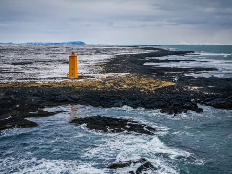
Knarrarósviti Lighthouse
Built-in 1938-1939, the lighthouse was the first one in Iceland to be built out of reinforced concrete. For a long time, the lighthouse was the tallest building in South Iceland, 26,2 meters (86 feet) high. It was designed by the engineer Axel Sveinsson as a blend of functionalism and art nouveau (jugendstil). In summertime (mid of June to start August) the lighthouse is open every day.
Knarrarósviti lighthouse is part of the beautiful South Coast Lighthouse trail that you can find more information about here.
View
Selvogsviti Lighthouse
Selvogsviti was built in 1919 and rebuilt in 1931. The light height is 20 meters above sea level. In 1919, a 15-meter high iron frame was built on Selvogstangi. It was fitted with a 3.3 meter high light and a 200 ° dioptric 1000 mm lens and gaslight fixture.
The lighthouse was the same type as the Stokksnes lighthouse, built-in 1922. After only ten years, the lighthouse had become so rusty that it became necessary to build a new lighthouse, and in 1930 a 15.8 m high lighthouse was made of concrete. A year later, the lighthouse, lens, and gaslight fixtures of the iron frame lighthouse were installed on it, and the new Selvog lighthouse was taken into use. In 1987, the walls of the lighthouse were renovated. The lighthouse was electrified a year later, and a radar detector was installed on it. The light is now lit on the lighthouse for safety reasons, but the radio transmitters on top of it are the most important thing now.
The lighthouse is still in operation and is fully automated today.
Selvogsviti lighthouse is part of the beautiful South Coast Lighthouse trail that you can find more information about here.
View
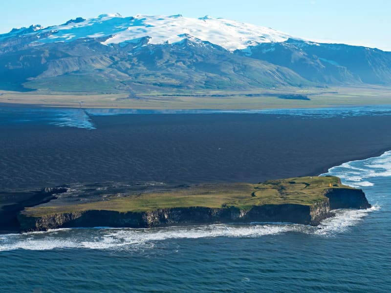
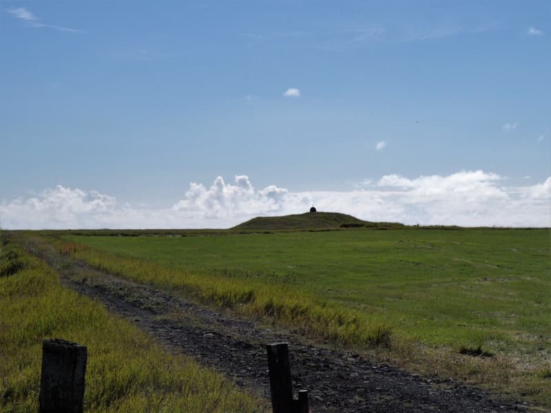
Hjörleifshöfði
Hjörleifshöfði is a 220-meter tuya cliff. Tuya is a distinctive, flat-topped, steep-sided volcano formed when lava erupts through thick glaciers or ice sheets. Hjörleifshöfði is on the southwest side of Mýrdalssandur. It's believed it formed during the last cold period of the ice age when the eruption took place under the glacier. It was probably an island in the sea in the past but has become landlocked during the settlement period with a fjord called Kerlingarfjörður. Today it's surrounded by black sands that have collected after repeated glacial runs from Katla volcano.
South of Hjörleifshöfði, a spit is named after Katla and is called Kötlutangi - the Katla spit. It was formed from a large eruption in 1918 where an enormous amount of sediment came with a sizeable glacial run from Katla. Kötlutangi - the Katla spit was the southernmost point of mainland Iceland; before the eruption, it was Dyrhólaey.
Hjörleifshöfði gets its name from the settler Hjörleifur Hróðmarsson, Ingólfur Arnarson's stepbrother. They sailed in two ships on their way to Iceland but parted ways as Ingólfur spent the winter at Ingólfshöfði and his stepbrother at Hjörleifshöfði. Hjörleifur did not live long, but he was killed along with his men by Irish slaves who followed them to the country. They fled to the Westman Islands with the women, where Ingólfur found them and killed them. On Hjörleifshöfði is a mound where it's considered that Hjörleifur is buried.
Hjörleifshöfði was inhabited till 1936, there was a farm located in the southern part of it, but it was moved there after the eruption in Katla in 1721, which destroyed the old town. The old town is located by Katla UNESCO Global Geopark's destination when you reach Hjörleifshöfði on the west side.
View