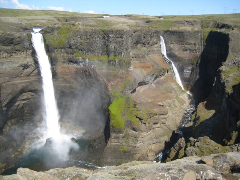
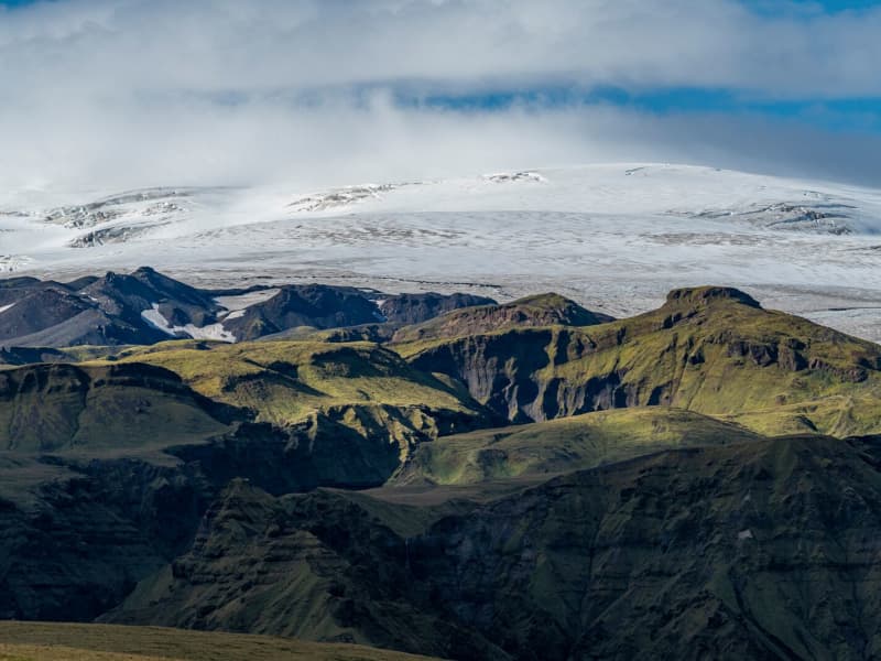
Panoramic viewpoints and standout nature spots across South Iceland. Take in wide horizons, shifting light, and striking contrasts of coast, lava, highlands, and farmland.
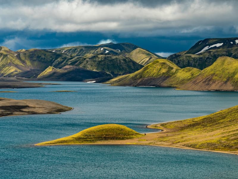
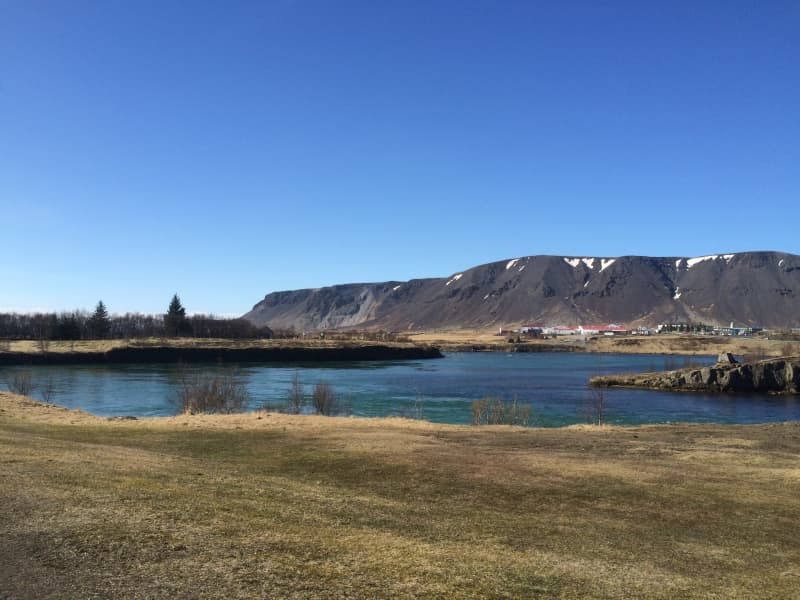
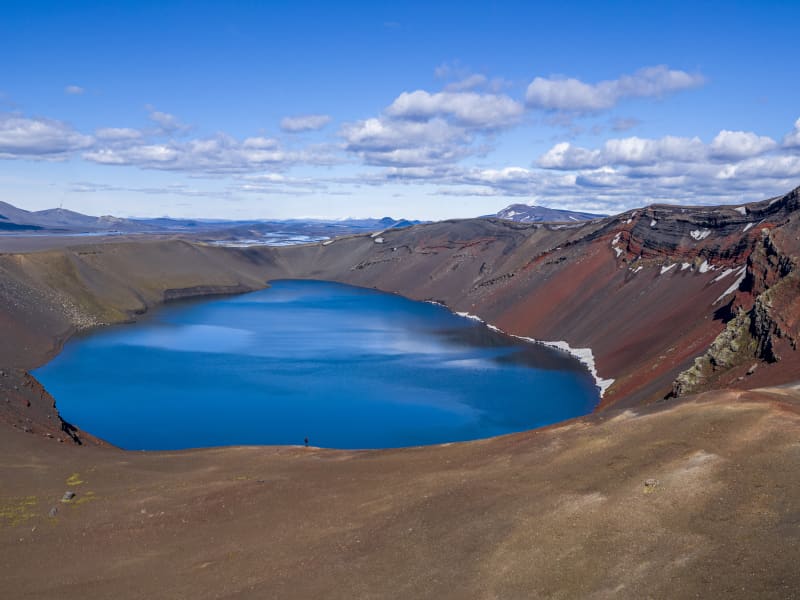
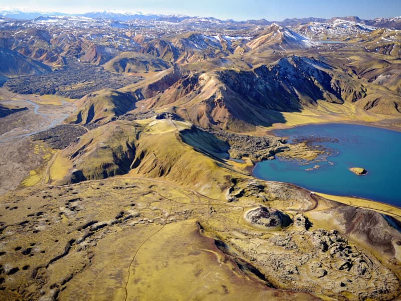
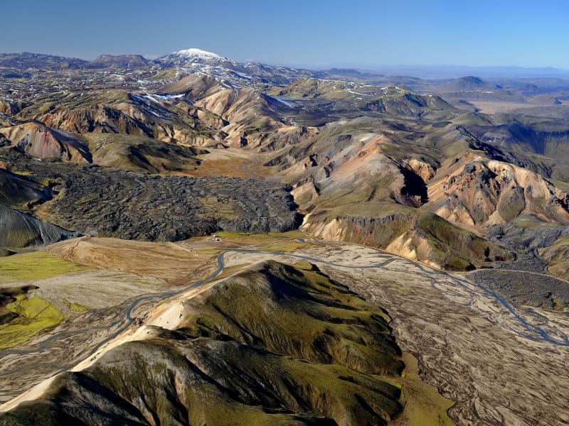
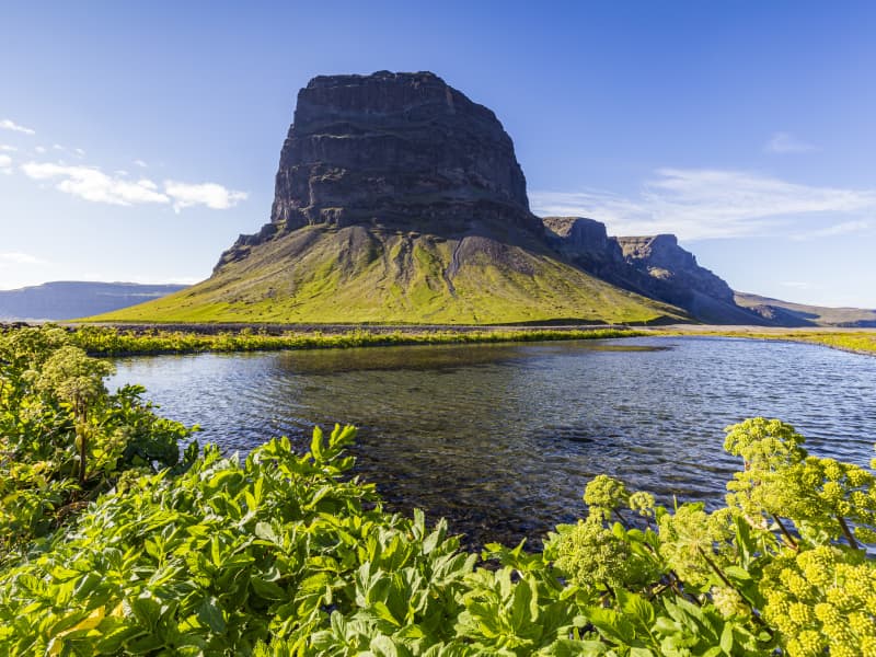
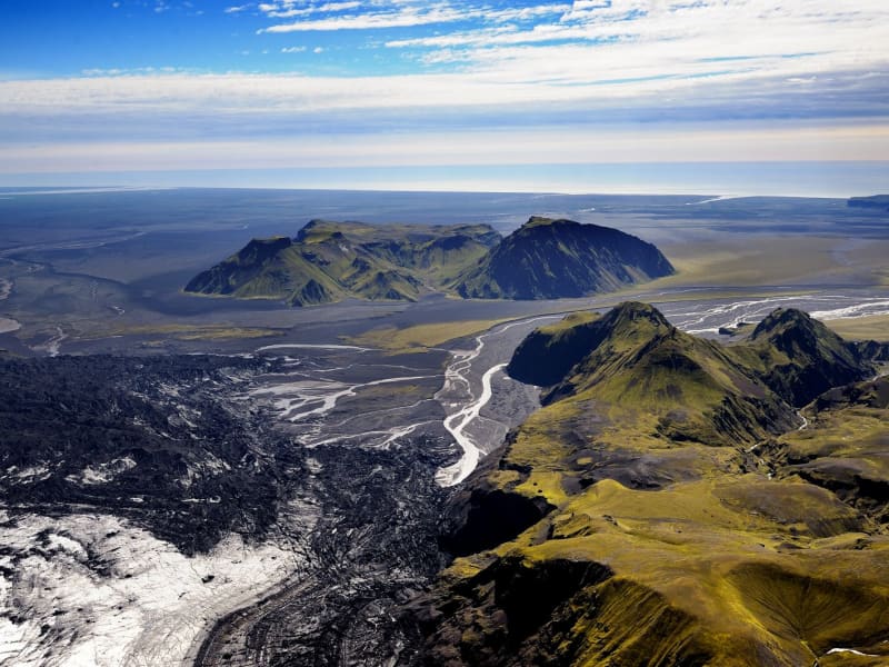
Langisjór Lake, Fögrufjöll, Grænifjallgarður
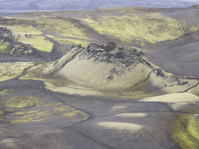
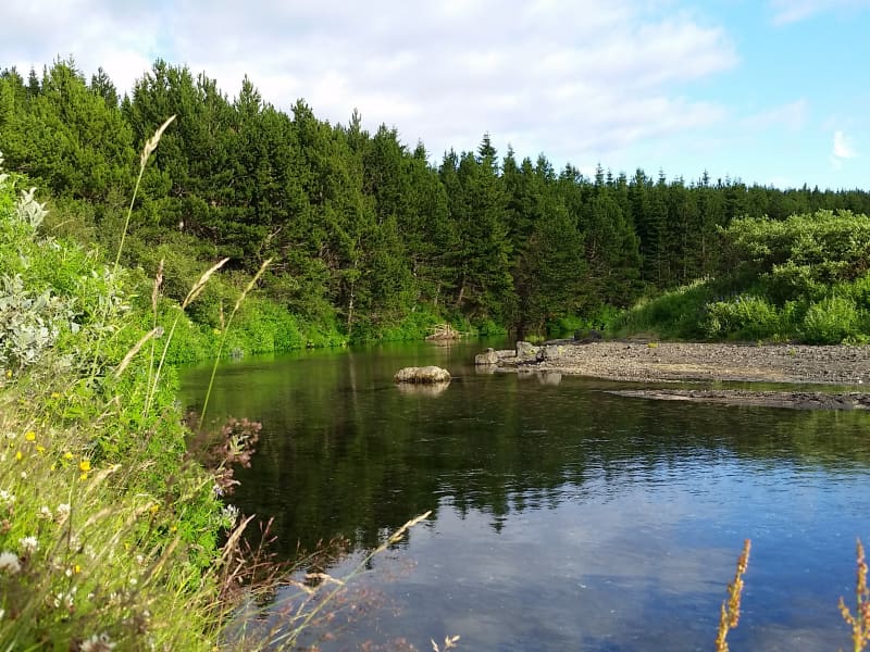
Langisjór is a lake within Vatnajökull National Park that's 20 km long and 2 km wide in some places. The lake is to the southwest of Vatnajökull, between the mountains Tungnárfjöll and Fögrufjöll, in a beautiful and picturesque landscape. Its square measure is 27 km², it reaches a depth of 75 m, and the water surface is 670 m above s
Langisjór is reached by the mountain road Fjallabaksleið nyrðri (F 208), west of Kirkjubæjarklaustur. All roads in the western part of the national park are mountain tracks, only navigable for vehicles with four-wheel-drive; some only for large jeeps. Some sections of the road are rocky and full of potholes, and loose gravel is common. It is sometimes necessary to ford (drive through) streams and rivers, which can suddenly become swollen, making them difficult or even impossible to cross. It is dependent on the weather when the roads are open. Usually, they are open from early June through to the autumn. Driving is only allowed on the roads marked on the accompanying map. All other roads or tracks are closed to the public. Here, as elsewhere in Iceland, driving off-road is banned by law.
View
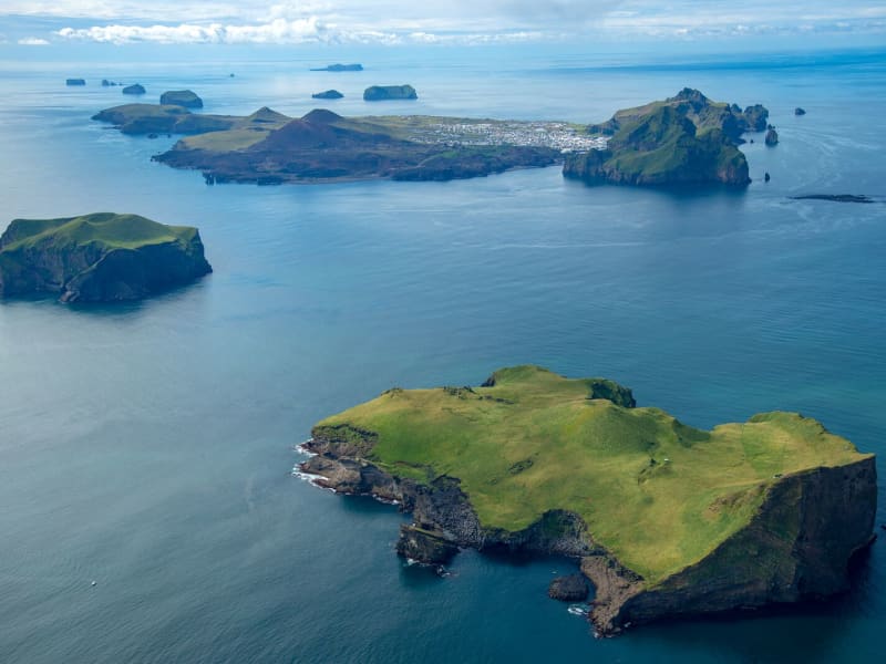
Surtsey Island
Surtsey, on the UNESCO World Heritage list, from July 7, 2008
Surtsey, Iceland’s youngest volcanic island, has been added to the prestigious UNESCO World Heritage list following the World Heritage Committee held in Quebec City on July 7, 2008."Surtur comes from the South... the hot stars down from Heaven are whirled. Fierce grows the steam and the life-feeding flame, until fire leaps high about Heaven itself."- From the Icelandic poem Völuspá, ca. 950 A.D.Surtsey is not only one of the world's newest islands, but the most filmed and researched and one of the most restricted. Ever since the eruption in 1963 which heaved it up out of the waters 18km (11 miles) southwest of Heimaey, its progress has been monitored. This has been giving scientists a fascinating insight into how a new island evolves, how flora and fauna develop, and so on. Because of this very few people are now allowed to visit the island, and special permits are only granted for scientific research.On the 14th of November, 1963 Icelandic seamen, that were fishing about 20 km southwest of Heimaey ( Vestmannaeyjar ) observed the beginnings of an undersea eruption that originated at a 130 meters depth. When the eruption first occurred, columns of ash were sent almost 9,146m (30,000 ft) into the sky and could be seen on clear days as far away as Reykjavík. An island eventually rose to a height of 169 meters above sea level that had an area of 2,5km².This island was named Surtsey for Surtur, the fire possessing giant of Norse mythology who would set fire to the earth at the Last Judgment. Because of pounding seas, there was a considerable amount of early erosion, but the island core quickly solidified as rock and is now holding its own while scientists watch everything.For three and a half years Surtsey rumbled and lava flowed. Long before the eruption stopped the island was proclaimed a nature preserve and all travel there was restricted to scientists that used this unique opportunity to study the gradual development of life on a sterile landmass. The first living found in the ash deposits close to shore. In May of the same year, a fly was found on the island. Seagulls visited the tidewaters furthest from the crater. The first vascular plant to flower along the shore was the sea rocket, observed in 1965. By 1987, twenty-five species of higher plants (including tomatoes!!) had been observed, transported there by seed in the sea currents, some from a nearby island, others from the southern Icelandic coast 40 kilometers off. Other species of plants have been carried there by the winds or birds from Europe.Surtsey is a favorite resting place for migratory birds during seasonal flights to and from Iceland and Europe. They visit there yearly by the thousands. Seals also visit the island and relax on its beaches. Today five species of birds nest on Surtsey: the Herring Gull, the Black-Backed Gull, the Black Guillemot, The Kittiwake, and Fulmar which was the first species to nest there and hatch its young on the warm lava in 1970. BBC and David Attenborough have produced acclaimed television programs from this amazing little island.
View
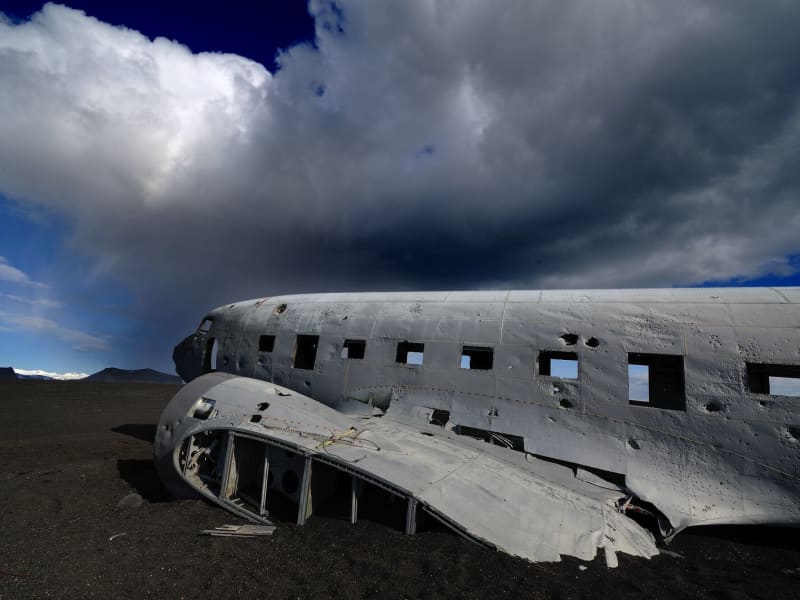
Sólheimasandur
Sólheimasandur is a sand desert formed by jökulhlaup, or glacial outburst floods, from the Katla volcano system that lies underneath the Mýrdalsjökull glacier.
In 1973 a DC-3 US Navy plane ran out of fuel and landed on the beach of Sólheimasandur. Everyone survived the landing; the plane wreck is still there and has become a popular site. Driving to the plane wreck is forbidden, but by the main road #1, there is a good parking place, and possible to walk from there to the site. Each way takes a little less than an hour to walk.
Note: In wintertime, there is a lack of daylight, and the weather can change quickly. It is easy to get lost in the area, so people are advised to know the weather forecast and have enough daylight for the walk.
View
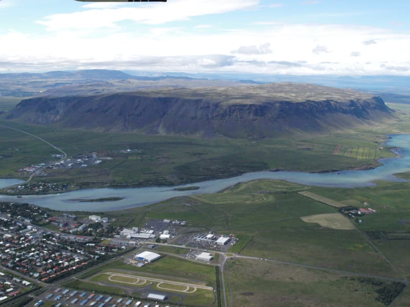
Ingólfsfjall mountain
Ingólfsfjall mountain in Ölfus is 551m. Ingólfsfjall is fenced with cliffs in three ways and is very steep. When the sea level was highest at the end of the ice age, it was a steep head that the waves broke down and created the steep slopes. It is connected to Grafningsfjöll with Grafningsháls. Ingólfsfjall is mainly made of palagonite with lava layers in between. Ingólfsfjall was formed in the middle of the ice age. To the south of the western corner of the mountain protrudes a gray cliff called Silfurberg, which is made of palagonite with light hole fillings, mainly rayon deposits. To the south is Kögunarhóll and the main road lies between. Ingólfsfjall is named after the settler Ingólf Arnarson. Up on the mountain is a gray stone hill called Inghóll, and it is said that Ingólfur is buried there. Below Ingólfsfjall on the south side is Fjallstún.The Settlement Book states that Ingólfur Arnarson spent his third winter in Iceland on his way to Reykjavík. Later, a large farm called Fjall was built and deserted in the 18th century. Remains of ancient structures can still be seen on the site and are now protected.On May 29, 2008, the source of the Suðurlandsskjálfi earthquake was 6.3 on the Richter scale below Ingólfsfjall.
View
Ölfusá river
Ölfusá river is the most voluminous in Iceland, with an average flow of 423 m³/sec.
Three large floods occurred in the 20th century, and beside the restaurant, Tryggvaskáli, are lines showing each flood's height. All the floods happened during the wintertime due to heavy rains and high temperatures, which caused the snow to melt unusually fast.
Ölfusá River is relatively short, about 25 km (14 miles) long. About 6 km (4 mi) north of Selfoss are two rivers, Sogið and Hvítá, and combined form Ölfusá.
View
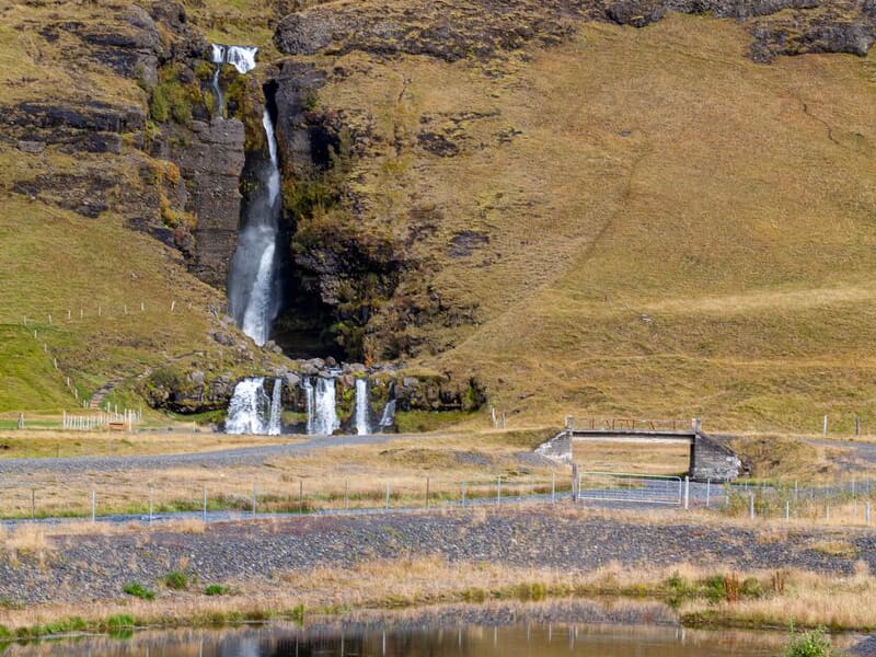
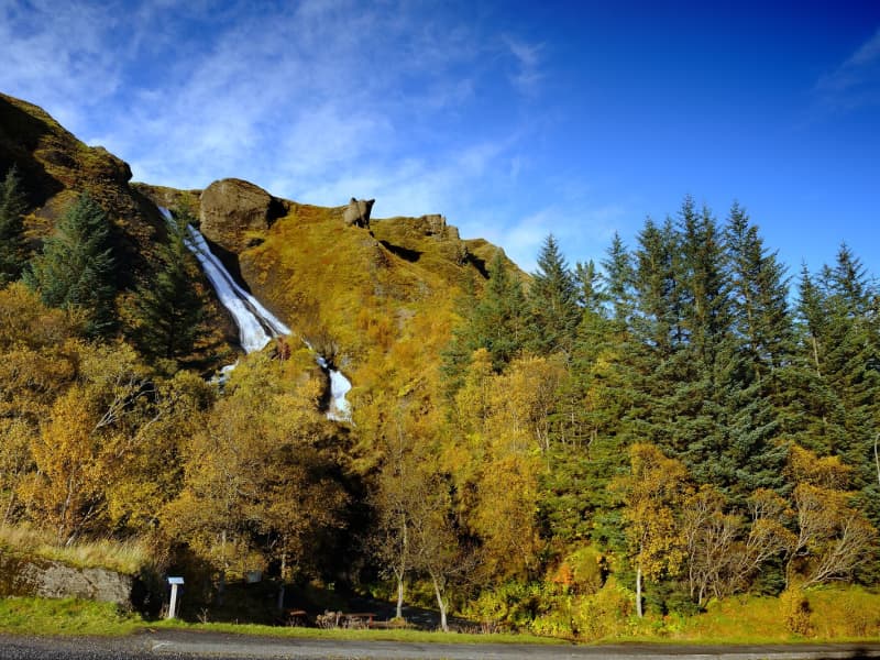
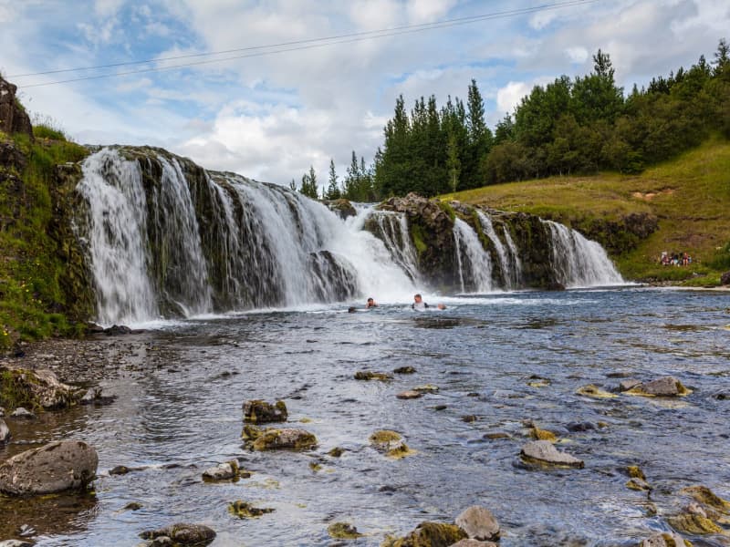
Gluggafoss waterfall
The Merkjá River has several beautiful waterfalls, but the most outstanding is Gluggafoss or Window Falls(also known as Merkjárfoss). The upper half of the cliff is palagonite or tuff rock, and the lower ledge is basalt. The river has formed tunnels and grooves through the soft rock and a series of ‘windows’ in the tunnels, thereby earning the name ‘Gluggafoss.’
The river passes under a stone arch at the very top of the falls. As the rock is relatively soft, the waterfall has changed over time. Around 1947 the upper half of the waterfall could hardly be seen as the water flowed into a vertical tunnel behind the cliff. It was only visible through three different openings or ‘windows’ one above the other. The water came out through the bottom ‘window’, forming a beautiful arch, except when the water rose in the river, forcing it through all three windows.
Further changes occurred when Hekla erupted in 1947, causing a 20 cm thick layer of volcanic ash to be carried downstream by the river. The vertical tunnel formation nearly disappeared as it filled with ash. It has taken almost 50 years for the falls to return to their former glory.
More geosites in the neighborhood: www.katlageopark.com
View
Bláhnúkur in Landmannalaugar
The very most popular mountain in the Landmannalaugar-region to walk on top on. It's a 945 m. above sea-level viewpoint, with a horizontal disc on the top.
View
Dynkur in Þjórsá river
Dynkur is a majestic waterfall, about 38 m. High in Þjórsá. The river falls from many pedestals in small waterfalls, forming a single waterfall system. There are beautiful shapes, but these tiny waterfalls also create many beautiful rainbows when the sun shines. Dynkur can be reached from both sides of the river, but it is more accessible to reach it from the east at Búðarháls.
The road is signed but only suitable for jeeps and off-road vehicles. It is also an excellent trip to drive down to the waterfall Fagrifoss in the Kaldakvísl canyon on the way. There are also many other waterfalls to visit in the waterfilled flowing region.
View
Ósland
Ósland is a conservation area by the harbour in Höfn, connected to the mainland by a man-made land bridge. The area is well suited for a short walk, with trails around Óslandstjörn pond and along the shoreline.
Ósland has rich birdlife, especially during the nesting season when Arctic terns are common. Visitors can also see Óslandshæð, a hill with a memorial to fishermen and an information board about the local nature.
A nature trail in the area presents the solar system at a reduced scale, showing the planets in proportion to their size and distance. Basalt rock in Ósland also contains visible impressions of ancient trees that were covered by lava.
View
The coastline between Stokkseyri and Eyrarbakki
The coastline between the rivers Þjórsá and Ölfusá (25 km/15 mi) forms the outskirt of the great Þjórsárhraun lava field. Eyrarbakki and Stokkseyri provide easy access to the coastline as well as a path between the two villages where you can see the Atlantic Ocean and marvel at the fact the South Pole is directly to the south. This spot has a great view of both the ocean and mountains. Information signs can be found in both villages as well as an observation platform in Stokkseyri.
View
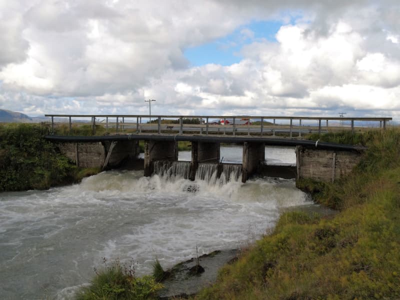
Flóaáveita - canals
Flóaáveitan are canals that run through the entire Flói region, from Ölfusá in the west to Þjórsá River in the east. This monumental construction consisted of 300 km long canals and 900 km of embankments. The Flói irrigation system reached over 12 thousand hectares of land and became a major transition in farming and production in the area at the time. The construction of Flói irrigation system began in 1922 and irrigation began its activities in 1927. When the irrigation was inaugurated in 1927 it was one of the greatest structures in Europe and to this day it plays an important role in transferring water between farms. Beside the sluice gate you will find an information board with more details about the Flói irrigation system. To the east of the sluice gate is a marked hiking trail along Hvítá (about 4,4 km, one way).
View
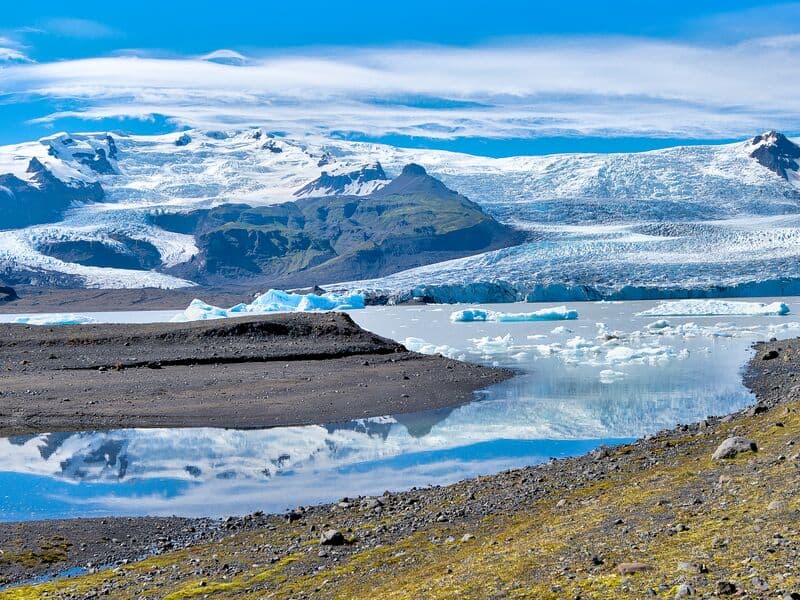
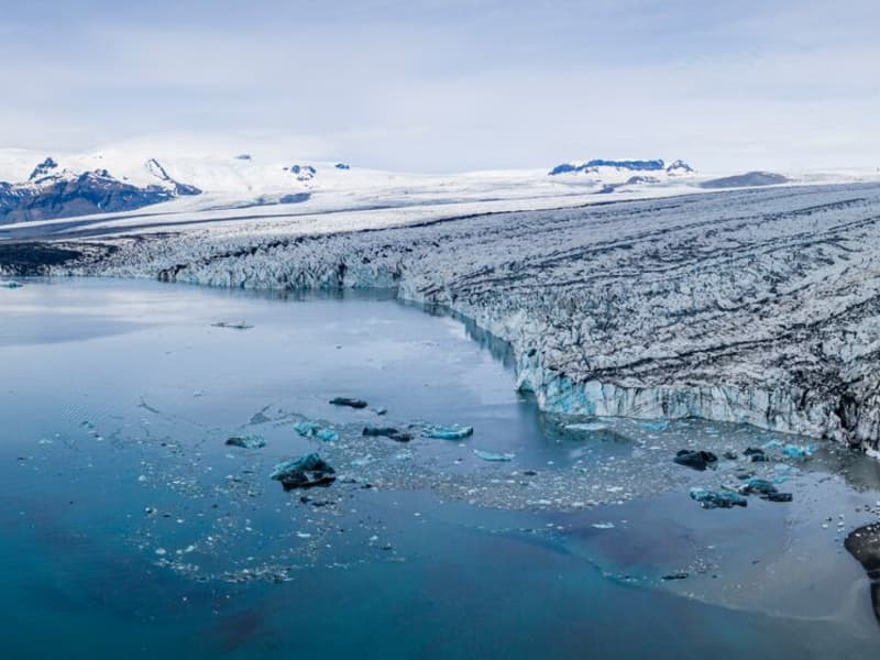
Fjallsárlón glacial lagoon
Fjallsárlón is a glacial lagoon at the southern edge of Vatnajökull glacier, about 10 km west of Jökulsárlón Glacier Lagoon. The lagoon lies within Vatnajökull National Park and is reached from Road 1.
The lagoon sits below Fjallsjökull, a steep glacier tongue that descends from Vatnajökull into the water. Visitors can stop for views of the glacier, floating ice, and the surrounding moraine landscape. Fjallsárlón is often a quieter alternative to nearby Jökulsárlón, although conditions and visitor numbers vary by season.
Boat tours are available on the lagoon, and there is a bistro on site. As with all glacier areas, visitors should stay on marked paths, keep away from unstable ice, and check local conditions before traveling in winter.
View
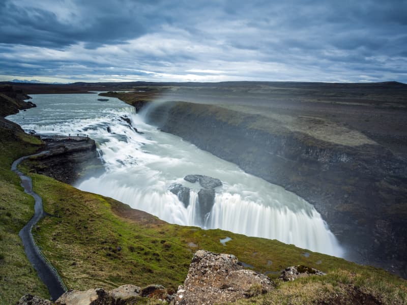
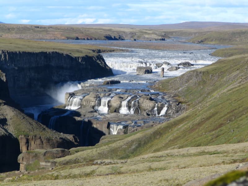
Gullfoss waterfall
Gullfoss is two separate waterfalls; the upper one has a drop of 11 meters and the lower one 21 meters. The rock of the river bed was formed during an interglacial period.
Water flows over Gullfoss at an average rate of 109 cubic meters per second. The heaviest floods have recorded a flow of 2000 cubic meters per second. During the summer, the flow is 130 cubic meters per second, which would take only 3 seconds to fill this building. People were eager to exploit the power potential of Gullfoss, and many plans for hydroelectric developments on the river Hvítá have been proposed.
The trails by Gullfoss can be closed, so it's good to check the conditions before going. To check whether it is open or closed to visitors, check out the website of Safetravel.is.
View
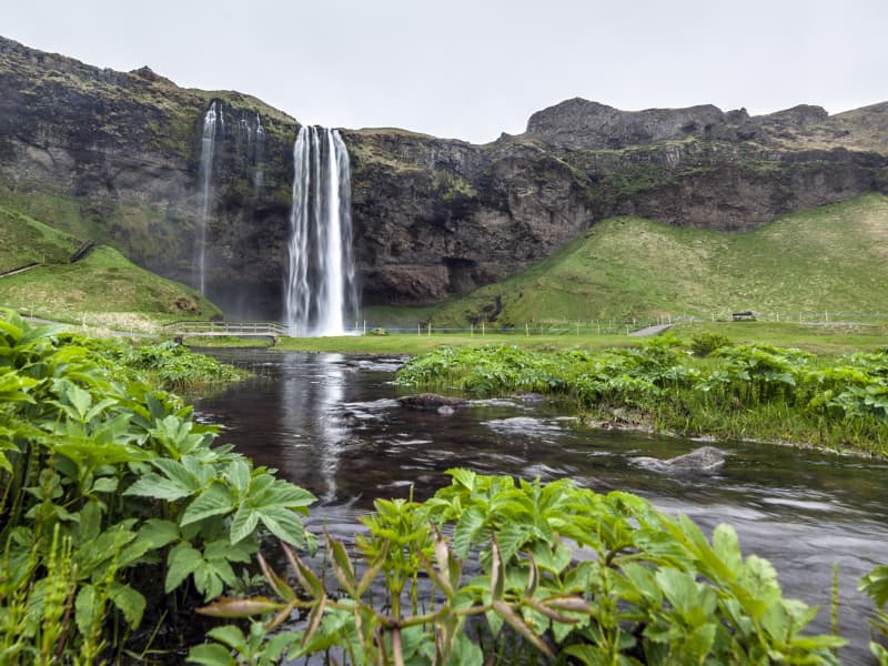
Seljalandsfoss waterfall
A unique waterfall in the river Seljalandsá, about 30 km west of Skógar: it is 60 meters high with a footpath behind it at the bottom of the cliff, but with a thin cascade. It is the only known waterfall of its kind where it is possible to walk behind it. The waterfall is very picturesque; therefore, its photo can be found in many books and calendars.
Access to the waterfall is from the farm of Seljaland along the Ring Road, Iceland's main highway. Several falls a little further to the west, including the interesting Gljúfrabúi, partially masked by its canyon. Access to it is from Hamragarðar farm along the road, east of Markarfljót.
These "do-not-miss" attractions lie very close to the main Ring Road at the base of the Eyjafjallajökull Glacier, on the road leading into Thorsmörk.
During winter, the area around Seljalandsfoss waterfall can be dangerous as paths can be slippery and large pieces of ice fall, making it extremely dangerous to venture too close to the cliffs and particularly dangerous to walk behind the waterfall. The fine mist from the waterfall freezes on the cliffs and the ceiling of the path behind the waterfall, but when the weather warms, and the ice begins to thaw, it can fall off in large chunks, which can be dangerous. People are advised to show caution and respect the closure of the paths. More information can be found on www.safetravel.is
View
Landbrotshólar
In Landbrot, right next to Kirkjubæjarklaustur, are Landbrotshólar, many clusters of pseudocraters, formed in the Eldgjá eruption in 934 to 940 when lava flowed over wetlands. Pseudocraters are formed when hot magma comes into direct contact with water-soaked substrates and causes the water to instantly boil. Magma flows through lava tubes, but where the magma bursts from the lava tubes, lava nuggets are formed.
These lava nuggets bulge out due to magma flowing into them, but gradually the flow is limited to fixed lava pipes inside the semi-solidified lava. When the lava nuggets bulge out, their weight increases and the lava sinks into the substrate until the bottom crust breaks beneath the lava channel. This causes magma to flow directly into the water-soaked substrate, causing steam explosions that form pseudocraters on the surface. The explosive activity prevents further lava flows along the lava channel below the steam explosions, leading to a shift in the lava flow and the formation of new lava channels and new pseudocraters. This chain reaction goes on until the lava has worked its way over the wetland and built up a cluster of pseudocraters.
Very interesting, but easy, 9 km hiking trail is around Landbrotshólar and starts at the bridge over Skaftá. The route leads to Hæðargarðsvatn and from there to an old road between the pseudocraters.
View
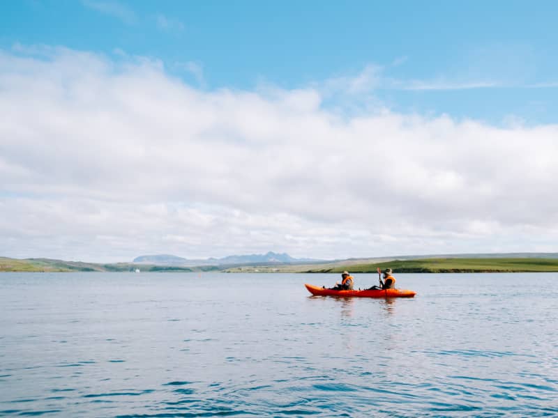
Úlfljótsvatn
Úlfljótsvatn is a family campsite run by the Icelandic Scout Association that has served as their home since 1941. At Úlfljótsvatn, campers can camp by the side of a beautiful lake and venture into some activities like Climbing, Kayaking, Archery, or Hiking.
Úlfljótsvatn sits in a privileged position just a few minute’s driving from Þingvallavatn. This means you can enjoy Icelandic gems like Þingvellir, Geysir, and Gullfoss within an hour of driving. Kérið, the volcanic crater lake, is also situated 15 min drive from our location.
Great first stop on the south coast, nature at its best, and Icelandic wonders on very easy reach.
View
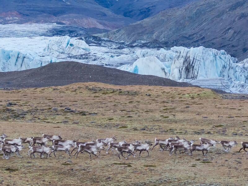
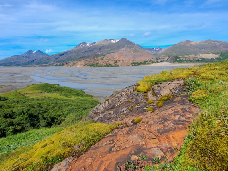
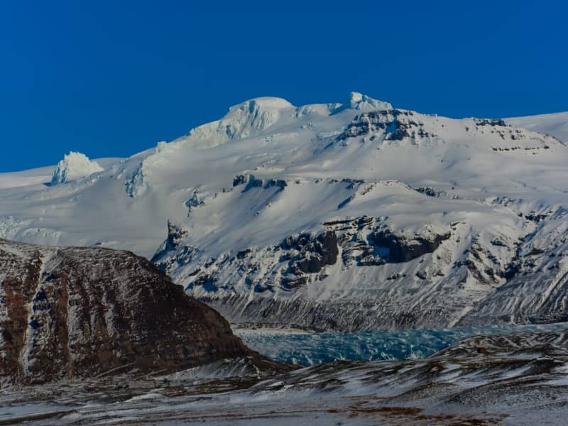
Vatnajökull Glacier
Vatnajökull is the largest glacier in Iceland and the largest glacier by volume in Europe. It covers approx 8 percent of Iceland, measuring an area of 7,700 km² (2021), with an average thickness of 400 m, and the highest point, Hvannadalshnjúkur, measures 2,110 m (6,921 ft.). Vatnajökull has around 30 outlet glaciers flowing from the ice cap, all of which bear a name; glaciers and outlet glaciers all have names that end in "jökull" in Icelandic.
Vatnajökull belongs to the Vatnajökulþjóðgarður (Vatnajökull National Park) and covers a large area surrounding the glacier, including the glacier itself. In 2019, Vatnajökull National Park was inscribed on the UNESCO World Heritage List. The National Park offers numerous exciting sites and is a must for all interested in Geology and beautiful, natural vistas.
View
Systrafoss Waterfall
Systrafoss is the name of the waterfall where the river Fossá falls from the lake Systravatn, over the mountain edge above Kirkjubæjarklaustur. Low down in the gorge, there's Fossasteinn, which fell from the mountain during a massive thunderstorm in 1830. A beautiful hiking trail leads to the top of the mountain and Systravatn. From the mountain edge, the view is breathtaking, and up there, you see the Golden Nugget, which aim is to recall the history of hydropower plants in Iceland. The Hiking trail, Ástarbrautin (Love Path), starts at Systrafoss. It is 5 km. And you can see Kirkjugólfið on the way.
The forest by Systrafoss is from 1945. Skógarstígurinn is a circular path in the forest where one stop is Sönghellir. The forest path is marked by the tallest tree in Iceland, a spruce almost 30 meters high.
View
Hoffell
Hoffell is a farmland and glacier area about 20 km from Höfn in southeast Iceland, and partially within Vatnajökull national park. The area is known for Hoffellsjökull, an outlet glacier of Vatnajökull, as well as gabbro rock, geothermal water, rivers, outwash plains, and mountain views.
Visitors can explore several hiking routes around Hoffellsjökull and Geitafellsbjörg, with views of the glacier and its lagoon. From Road 1, a 3 km paved road leads to Hoffell Guesthouse and Hoffell geothermal Baths.
To reach the Hoffellsjökull car park, visitors continue along a 4 km gravel road. The road is rough and can be difficult for ordinary cars, so a four-wheel-drive vehicle is recommended. Overnight stays are not allowed at the Hoffellsjökull car park, and hikers should check trail, road, and weather conditions before setting out.
View
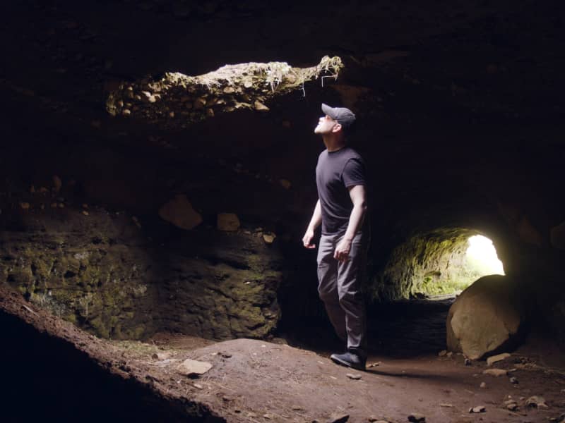
Efra-Hvolshellar caves
The caves in Efra-Hvol (Upper Hvol) have histarically been referred to as „the Irish Caves“ which are set into the so-called, „Irish Heath“. It was originally thought that many of these man-made or artificial caves were madein the 19th century, but in fact, their histofical names appear to confirm they originated even beforr the settlement period.
More geosites in the neighbourhood: www.katlageopark.com
View
Hjörleifshöfði
Hjörleifshöfði is a 220-meter tuya cliff. Tuya is a distinctive, flat-topped, steep-sided volcano formed when lava erupts through thick glaciers or ice sheets. Hjörleifshöfði is on the southwest side of Mýrdalssandur. It's believed it formed during the last cold period of the ice age when the eruption took place under the glacier. It was probably an island in the sea in the past but has become landlocked during the settlement period with a fjord called Kerlingarfjörður. Today it's surrounded by black sands that have collected after repeated glacial runs from Katla volcano.
South of Hjörleifshöfði, a spit is named after Katla and is called Kötlutangi - the Katla spit. It was formed from a large eruption in 1918 where an enormous amount of sediment came with a sizeable glacial run from Katla. Kötlutangi - the Katla spit was the southernmost point of mainland Iceland; before the eruption, it was Dyrhólaey.
Hjörleifshöfði gets its name from the settler Hjörleifur Hróðmarsson, Ingólfur Arnarson's stepbrother. They sailed in two ships on their way to Iceland but parted ways as Ingólfur spent the winter at Ingólfshöfði and his stepbrother at Hjörleifshöfði. Hjörleifur did not live long, but he was killed along with his men by Irish slaves who followed them to the country. They fled to the Westman Islands with the women, where Ingólfur found them and killed them. On Hjörleifshöfði is a mound where it's considered that Hjörleifur is buried.
Hjörleifshöfði was inhabited till 1936, there was a farm located in the southern part of it, but it was moved there after the eruption in Katla in 1721, which destroyed the old town. The old town is located by Katla UNESCO Global Geopark's destination when you reach Hjörleifshöfði on the west side.
View
Kvernufoss waterfall
Is in a small canyon 1.5 km to the east of Skógafoss. A hiking path leads up to it from the car park of the museum at Skógar. We recommend checking out the museum along the way, where you can learn about the history of the area and how people traversed the glacial rivers before they were bridged.
Find information about more geosites in Katla UNESCO Global Geopark at www.katlageopark.com
View
Þórsmörk
Þórsmörk (Thórsmörk) is a natural gem that sits between Mýrdalsjökull to the east, the river Krossá in the south, with Markárfljót and Þröngá Rivers to the north. Its diverse landscape is characterized by impressive gorges, ravines, scrubby slopes, and a wide variety of unique vegetation. In times past, the farmers of Fljótshlíð and the area under Eyjafjall pastured their sheep all year round due to the mild climate found within þórsmörk.
Since the 1918 eruption of Katla, Þórsmörk was designated as a Natural Mountain Reserve. There are many curious natural rock formations in the area, such as Snorraríki, Sóttarhellar Cave, Álfakirkja (The Church of the Elves), Stakkholtsgjá Gorge, and the stone arch in Stóra Enda. Only large jeeps and buses can navigate the road into Þórsmörk due to the ever-changing volume of water, which can turn small and easily passable tributaries into tumultuous rivers in a matter of hours.
View
Brúarhlöð
Brúarhlöð is a narrow gorge in the Hvitá River about three kilometers south of the Golden Waterfalls (Gullfoss). The river has formed the rocks into beautiful pillars and formations through the centuries. The name of the rocks is Breccias (Hyaloclastite).
Just above Brúarhlöð is a bridge over the river, built in 1959 after the first two bridges washed away, the first one in 1929 and the second in 1930. When driving over the bridge, we can only imagine the forces needed to wash away a bridge of that size.
Hvita River is a popular place for river rafting, and rafting through Brúarhlöð is an adventure that is difficult to describe with words. Travelers should make a note to stop at Brúarhlöð and view the magnificent nature and the rock formations.
View
Urriðafoss waterfall
Urriðafoss is a waterfall in the Þjórsá River. Þjórsá is Iceland's longest river, 230 km, and Urriðafoss is the most voluminous waterfall in the country. This mighty river drops down (360 m3/sec) by the edge of the Þjórsárhraun lava field in beautiful and serene surroundings. Þjórsárhraun lava field is the result of the greatest lava flow on earth since the Ice Age. It is located right off highway 1.
View
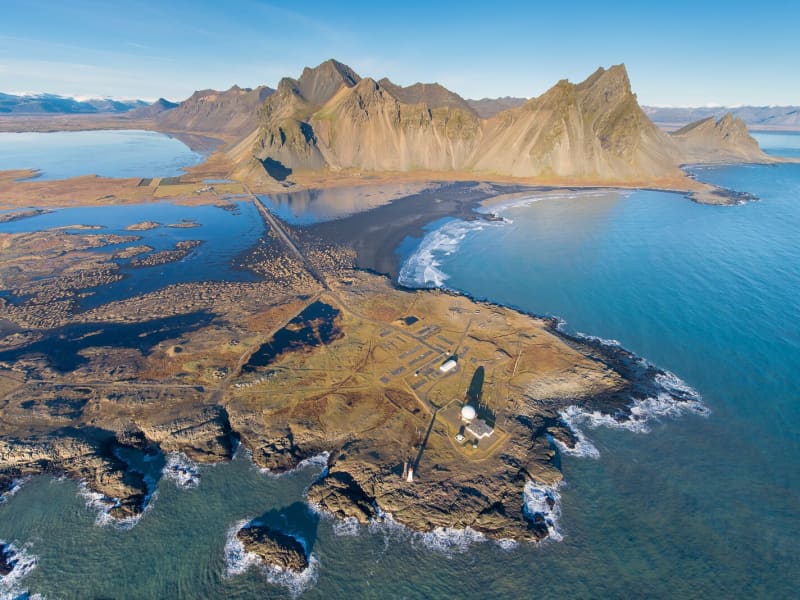
Vestrahorn
Vestrahorn is a 454-metre mountain on the Stokksnes peninsula, about a ten-minute drive from Höfn. The area is known for its dark sand beaches, rocky shoreline, and views of the mountain rising above the coast.
Vestrahorn is also a notable geological site, made mainly of gabbro with some granophyre. East of the mountain is Brunnhorn, a distinctive outcrop that extends towards the sea.
The area has historical connections to one of Iceland’s early settlement farms, Horn. During the Second World War, it was used as a British army base, and a NATO radar station was later built at Stokksnes. Visitors may also see seals on the sand, but sightings are not guaranteed.
View
Langjökull Glacier
Langjökull is the country's second-largest glacier. Its accessibility is as good as it gets; however, no one should attempt driving up a glacier on their own. Many agencies offer tours that take you up the glacier in specially equipped vehicles with experienced glacier guides. You can choose from jeep excursions, glacier hiking, and snowmobiling.
View
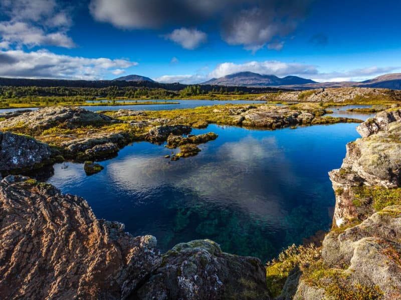
Þingvallavatn Lake
Lake Þingvallavatn lies in a rift valley that extends south from the Langjokull glacier to mount Hengill and from Botnssulur mountains in the west to Lyngdalsheidi heath in the east. The lake is the largest natural lake in Iceland, about 84 square kilometers, at an altitude of approximately 100 meters above sea level. The deepest part of the lake measures 114 meters, which means it reaches below sea level. The catchment area of Lake Thingvallavatn, about 1300 square kilometers, lies in the same direction as the fissure in the area, and its existence is closely connected with its geological history. The water in the lake is very cold and therefore very pure, so snorkeling and diving are popular. Silfra, one of the fissures in the northern part of the lake, is one of the most popular diving spots in Iceland.
View
Hellisskógur forest
Hellisskógur is a small forest just outside of the town of Selfoss. In Hellisskógur are roads, walking paths around the area, and benches so visitors can relax and enjoy the site.
The cave in Hellisskógur forest was formed during a latter glacial period by sea erosion. Sea levels have been higher than now several times, and signs of sea erosion can be seen on more cliffs in the area, made of around 0, 7 – 3, 1 million-year-old basalt. The cave was previously used to store hay in the back and as a sheepcote in the front.
It was once believed that the cave was haunted by a ghost wearing a blue scarf. The story tells of a young man who was broken hearted and hung himself in the cave using a long blue scarf.
Here is a map of Hellisskógur
View
Þjórsárhraun
Þjórsárhraun is the result of the greatest lava flow on earth since the end of the last Ice Age. The lava came from an enormous eruption around 6700 B.C., possibly in Heljargjá canyon in the Veiðivötn region, in Iceland's highlands. The lava's extreme temperature and fluidity contributed to its flow being at least 140 kilometers (87 mi) until it was stopped by the waves of the North Atlantic Ocean. The lava is well visible by Stokkseyri and Eyrarbakki's coastline. The great Þjórsárhraun lava is approx. 975 square km (376 sq. miles), and its volume is 25 cubic km (6 cubic miles).
View
Laufskálavarða
Laufskálavarða is a lava ridge surrounded by stone cairns between the Hólmsá and Skálmá rivers, close to the road north of Álftaver. For the first time, all travelers crossing the desert of Mýrdalssandur for the first time were supposed to pile stones up to make a cairn, which would bring them good fortune on the journey.
At Laufskálavarða, you find a viewing platform to see Mýrdalsjökull, where Katla, the famous volcano, is located.
View
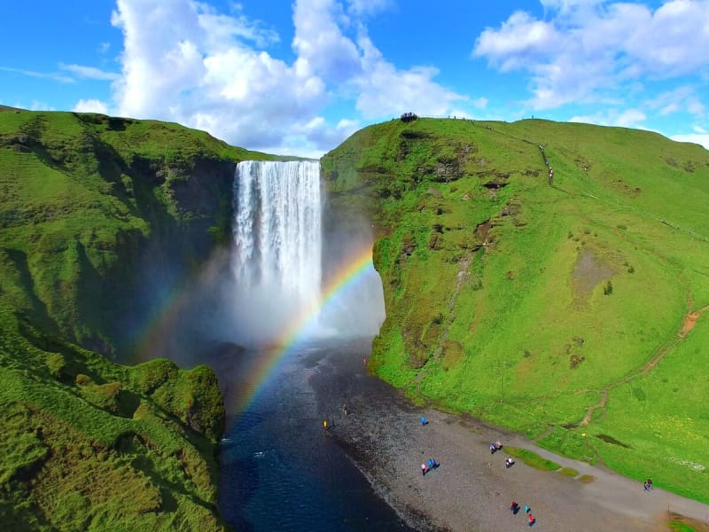
Skógafoss - Waterfall
Only a few kilometers away from the south shores of Iceland lies the village of Skógar along the Southern Ring Road. It is a popular summer resort center surrounded by unusual scenic beauty. The breathtaking view of Skogáfoss waterfall and picturesque surroundings and the snow-capped heights of two towering glaciers are Skógar's major summer attractions. There are two settlements by this name. One is Ytri-Skógar (outer or western Skógar) and the other Eystri-Skógar (eastern Skógar), located at a short distance from each other. Ytri-Skógar, commonly referred to as Skógar, is the main settlement. It is an old farm and has a church from 1890. It is located between the Skógá and Kverná rivers.
The greatest attraction of Skógar is, of course, the beautiful 60-meter high Skogáfoss waterfall in the river Skógá. Like the legends of buried treasures of Egill Skallagrímsson in Mosfell near Reykjavík and Ketilbjörn in Mosfell near Skálholt, there is a similar legend about the settler Þrasi who is believed to have buried his chest of gold under the Skogáfoss waterfall.
If the sun conditions are favorable - one can see a vivid rainbow in front of the waterfalls. The river below the falls holds a large salmon and char population, and fishermen are seen here fishing from July - October. The path leading to the top of the waterfalls continues following the river upstream - where numerous more dramatic waterfalls of sheer beauty are found. A great hike - to say the least!
One of the finest folk museums in Iceland is situated in extraordinarily beautiful natural surroundings. The fascinating local folk museum has a collection of over 6000 artifacts and examples of various types of dwellings in Iceland since the early times. The collection of tools and equipment used on land and sea is outstanding. The museum also has an old turf farmhouse, where guests can experience the standards of living in Iceland in past centuries.
From Skógar, the Ring Road runs eastwards along the foot of Mýrdalsjökull glacier, across the southern sandy plains and over glacial rivers, passes Seljavellir, and continues along with the soaring glaciated massive of Eyjafjöll and the two waterfalls Seljalandsfoss and Gljúfrabúi. From here runs a 10 km long trek along the river Skógá over the Fimmvörðuháls Pass between the Eyjafjallajökull and Mýrdalsjökull glaciers to the mountain oasis of Þórsmörk.
Skógar is a place to explore the natural diversity of the south or, if the weather is good, to spend a holiday amid beautiful and rugged landscapes. It is also very close to the ocean and the unique black beach.
View
Ljótipollur
Ljótipollur is an explosion crater in the Nature Reserve of Fjallabak and is part of the Veiðivötn volcanic fissure system. It was formed in historical times. Inside the crater, there is a 0,42 km2 and 14 m deep lake. There is trout in the lake but there is no inlet or outlet to the lake, so it is not clear how the fish got there. The naming of the crater translates to "Ugly Puddle" despite the fact it is an incredibly beautiful site.
View
Háifoss Waterfall
The waterfall Háifoss is situated near the volcano Hekla in the south of Iceland. The river Fossá, a tributary of Þjórsá, drops here from a height of 122 m. This is the third-highest waterfall on the island. For a long time, the waterfall had no name, but in 1912 Dr. Helgi Pétursson, a geologist, came and named him.
From the historical farm Stöng, destroyed by a volcanic eruption of Hekla in the Middle Ages and reconstructed, it is possible to hike to the waterfall along the Fossá (6km each way). Above the waterfall, there is also a parking lot, so the hiking can also be done in the other direction.
View
Eldgjá canyon
Eldgjá is an old tectonic graben reactivated in a massive eruption in 934-940. The Eldgjá vents form a discontinuous 75 km long volcanic fissure extending from the Katla volcano in the west to Vatnajökull in the east. The eruption in 934-940 takes its name from a spectacular 150 m deep and 8 km long chasm called Eldgjá (fire fissure) that occupies the central part of the vent system. Part of the fissure is under the protection of the Vatnajökull National Park. There you can take a walk along the bottom of the fissure and witness the sheer scale of it. An easy hike takes you from the car park (with WC facilities) along the bottom of the fissure to Ófærufoss waterfall. Getting there: you need a 4x4, and the area is only accessible in the summer. Eldgjá is a site of international geological significance. Ófærufoss is a distinctive two-tiered waterfall cascading into the fissure Eldgjá.
Eldgjá is reached by the mountain road Fjallabaksleið nyrðri (F 208), west of Kirkjubæjarklaustur. All roads in the western part of the national park are mountain tracks, only navigable for vehicles with four-wheel-drive; some only for large jeeps. Some sections of the road are rocky and full of potholes, and loose gravel is common. It is sometimes necessary to ford (drive-through) streams and rivers, which can suddenly become swollen, making them difficult or even impossible to cross. It is dependent on the weather when the roads are opened. Usually, they are open from early June through to autumn. Driving is only allowed on the roads marked on the accompanying map. All other roads or tracks are closed to the public. Here, as elsewhere in Iceland, driving off-road is banned by law.
View
Ytri Rangá river
Ytri-Rangá flows past Hella. Its source is to the north of Mount Hekla, in Rangárbotnar at Landmannafréttur, where it surfaces in several places from under the lava fields. The river is 55 km in length and is one of Iceland's richest salmon fishing rivers. The river is fed by run-off and springs.
There are several waterfalls along the river, Fossabrekkur, Gutlfoss, Árbæjarfoss, and Ægissíðufoss. Approximately 10 km below Hella, Þverá joins the river and is called Hólmsá until it runs into the sea.
There has been considerable fish farming in the river for many years, which means that the river is more often than not at the top of the list of Icelandic salmon fishing rivers and is extremely popular. The farming operations in the river are in the hands of the Ytri-Rangá Fishing Association.
View
Lakagígar and Laki
Lakagígar is a row of craters formed in one of the world's largest mixed eruptions in recorded history. This continuous series of eruptions emitted a vast quantity of lava and substantial amounts of volcanic ash from a fissure stretching 25 km across the area west of the ice cap. The craters are regarded as a globally unique phenomenon and are, as such, protected within Vatnajökull National Park.
In 1783, a huge lava flow streamed from Lakagígar in what became known as the "Skaftá Fires." This is believed to have been one of the greatest lava flows in a single eruption in the history of the world: the molten lava filled the gorges through which the Skaftá and Hverfisfljót rivers flowed and swept down in two branches into inhabited areas, to spread over the lowlands where it laid waste many farms. The eruption produced large quantities of volcanic ash. For residents of the region and Iceland as a whole, the results of the eruption were catastrophic: this time is known as "Móðuharðindin" (the Haze Famine).
All roads in the western part of the national park are mountain tracks, only navigable for vehicles with four-wheel-drive; some only for large jeeps. Some sections of the road are rocky and full of potholes, and loose gravel is common. It is sometimes necessary to ford (drive through) streams and rivers which can become suddenly swollen, making them difficult, or even impossible, to cross. It is dependent on the weather when the roads are opened. Usually, they are open from early June through to autumn. Driving is only allowed on the roads marked on the accompanying map. All other roads or tracks are closed to the public. Here, as elsewhere in Iceland, driving off-road is banned by law.
View
Brúarfoss
Brúarfoss is a beautiful waterfall in Bláskógabyggð in South Iceland. It is known for its unique clear blue color, which results from how light is reflected off the fine-grained sedimentary rock in the water. Brúarfoss is part of the Brúará River, which flows through a lush area and forms the waterfall where the river narrows through a gorge. The waterfall may not be the tallest or widest in Iceland, yet it is remarkably stunning and has captured the attention of travelers and photographers worldwide. This is primarily due to the unique way the water's colors interact with each other, evoking a sense of awe and wonder. Brúarfoss remains relatively untouched by tourists, making it an ideal destination for those seeking tranquility and natural beauty without large crowds.
The journey to Brúarfoss can be an adventure in itself. Although it is not far from Road 1, one must walk along paths that run through beautiful landscapes. The hike offers the opportunity to enjoy the tranquility of Icelandic nature and is well worth it for those who choose to visit.
The area features not only Brúarfoss but also several smaller waterfalls. Tourists can enjoy walking along the river and experiencing different perspectives of the waterfall. What makes Brúarfoss especially enchanting is how the river's pure and clear water mixes with the landscape's green moss and basalt columns. This natural beauty, along with relatively easy access, makes Brúarfoss a must-see destination for anyone visiting Iceland, whether they are local or foreign, wanting to experience the country's unique beauty without having to go far from the main tourist spots in the area.
View
Selvogsviti Lighthouse
Selvogsviti was built in 1919 and rebuilt in 1931. The light height is 20 meters above sea level. In 1919, a 15-meter high iron frame was built on Selvogstangi. It was fitted with a 3.3 meter high light and a 200 ° dioptric 1000 mm lens and gaslight fixture.
The lighthouse was the same type as the Stokksnes lighthouse, built-in 1922. After only ten years, the lighthouse had become so rusty that it became necessary to build a new lighthouse, and in 1930 a 15.8 m high lighthouse was made of concrete. A year later, the lighthouse, lens, and gaslight fixtures of the iron frame lighthouse were installed on it, and the new Selvog lighthouse was taken into use. In 1987, the walls of the lighthouse were renovated. The lighthouse was electrified a year later, and a radar detector was installed on it. The light is now lit on the lighthouse for safety reasons, but the radio transmitters on top of it are the most important thing now.
The lighthouse is still in operation and is fully automated today.
Selvogsviti lighthouse is part of the beautiful South Coast Lighthouse trail that you can find more information about here.
View
Skagaás grove
Skagaás grove is a small forest area in Flóahreppur, surrounded by young woodland and open countryside. The area has walking paths through birch, spruce, and pine trees, making it suitable for a short walk, a picnic, or a quiet stop while traveling in the area.
The grove is open to visitors and is easily accessible. Please help keep the area clean by taking all litter with you. Barbecuing is only allowed in the designated area because of fire risk.
View
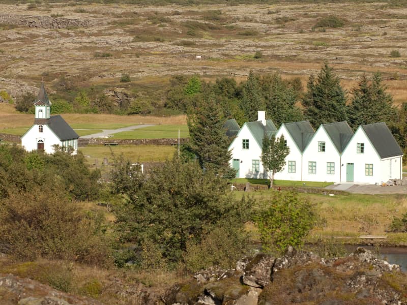
Þingvellir National Park
Þingvellir National Park is a designated UNESCO World Heritage site. It is one of the most important places in Icelandic history, as well as being famous for its unique geological features. It is among the three key locations on The Golden Circle.
The parliament plainsThe site has historical importance spanning over 1000 years. In 930, the Alþingi, one of the oldest parliamentary institutions in the world, was founded. In fact, Þingvellir literally translates to "parliament plains". The Alþingi met annually, and the Lawspeaker recited the law to all the gathered people and resolved disputes as well. This is where Christianity was made the official religion of Iceland around the year 1000. On June 17th, 1944, the independence of The Republic of Iceland was proclaimed in Þingvellir.Where Eurasia meets North AmericaÞingvellir has been a national park since 1928 because of its special tectonic and volcanic environment. The effect of the continental drift can be clearly seen in the cracks and faults traversing the region, the most famous one, Almannagjá, being a veritable canyon.
By Iceland's largest lakeÞingvellir is situated on the northern shore of Þingvallavatn, the biggest lake in Iceland. The river Öxará traverses the national park and forms a waterfall at the Almannagjá called Öxaráfoss. Together with Gullfoss waterfall and the Geysir hot spring area, Þingvellir is part of the famous Golden Circle travel route.
What to seeThe national park contains several points of interest, including Almannagjá Gorge, which showcases the effects of continental drift; Lögberg cliff, where the assembly of Alþing met; Öxarárfoss waterfall; and Peningagjá, a deep fissure with crystal clear water where visitors like to throw a coin and make a wish. A quaint wooden church stands in a picturesque location, and the national park offers a network of walking paths.
Activities and servicesGuests may opt to enter the park's visitor center and exhibition to learn more about Þingvellir's unique history and nature. Along with varied hiking options, visitors may enjoy bird-watching or angling. Fishing permits can be bought on location. Another popular activity at Þingvellir is snorkeling or diving with experienced local tour operators.
CampingÞingvellir is ideal for camping. There are several camping grounds at the national park, some of which offer showers and electricity.
View
Stóri Dímon
Stóri Dímon is located near Eyjafjallajökull. Stóri Dímon has a sister mountain called Litla Dímon. The name is thought to come from Latin, meaning twin mountains or two alike. It has also been said that the word means haystack, which is certainly reminiscent of a haystack surrounded by golden fields.
The Saga Center of Hvolsvöllur has erected a sign near the mountain, which tells of battles fought in the area during Iceland's settlement in the most famous Icelandic saga, Njálssaga. The mountain is only 178 meters high and is a fun hike for adults and children.
View
Þrastaskógur forest
Thrastaskogur is a beautiful and historic forest area located in Grímsnes- og Grafningshreppur in South Iceland, close to Úlfljótsvatn and Thingvallavatn. It is one of the oldest and most notable forestry and land reclamation sites in the country and has long been a popular destination for outdoor activities and environmental education.
Forestry in Thrastaskogur began around 1905, making it one of Iceland’s earliest reforestation projects. The land is owned by the Icelandic Forestry Association and has served as a research and educational area for more than a century. Visitors can see a wide variety of trees, including native species such as birch and willow, as well as imported species like spruce, pine, and larch.
The forest offers marked walking trails, small ponds, and diverse birdlife, making it a favourite spot for families, school groups, and nature enthusiasts. There are picnic tables, benches, and educational signs throughout the area, providing information about tree species and local ecosystems.
Thrastaskogur has also played an important role in environmental education and outdoor learning. Schools and organisations often use the forest for nature studies, and the Icelandic Forestry Association regularly arranges guided tours and educational events there.
Located about 60 to 70 kilometres from Reykjavík along Road 360 (Þingvallavegur), the forest lies near Úlfljótsvatn and the Ljósafoss power station, both of which are interesting places to visit in connection with a trip to Thrastaskogur.
View
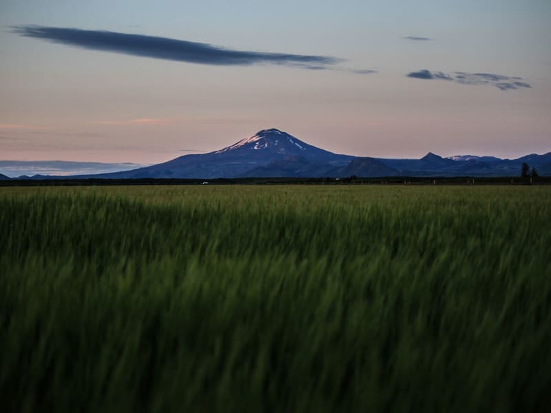
Hekla volcano
The volcano Mt. Hekla is Iceland’s most famous volcano and the one that has erupted most frequently in recent years. Mt. Hekla rises 1,491 m over sea level and can widely be seen in the south of Iceland. Hekla has been dubbed the Queen of Icelandic Volcanos and is well known internationally.
Considerable superstitions have been attached to the mountain, with the most famous legend being that it is the entrance to Hell and might even be Hell itself. The first documented expedition onto the mountain is from 1750 when the naturalists Eggert Ólaffson and Bjarni Pálsson scaled the mountain. The route to the top of Hekla is quite popular, although hikers must be aware of the danger that can occur if the mountain should erupt. The route taken normally starts from Skjólkvíar.
Hekla is located in an area where the South Iceland fracture zone meets the South Iceland volcanic zone, which probably accounts for its frequent eruptions. Hekla has erupted in the following years since Iceland was settled: 1104, 1158, 1206, 1222, 1300, 1341, 1389, 1501, 1597, 1636, 1693, 1766, 1845, 1947, 1970, 1980, 1981, 1991 and 2000. Geologists have repeatedly reiterated in recent years that Hekla is ready to erupt and can erupt at any time. However, the mountain does generally provide an hour’s warning.
View
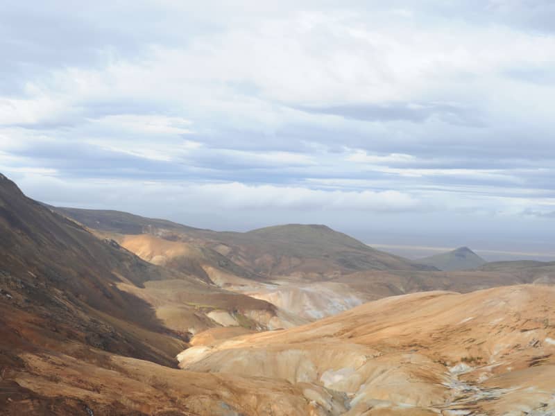
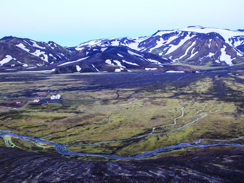
Kerlingarfjöll Mountains
The mountain massif Kerlingarfjöll (The Giantess Mountains; 800 - 1500 m) is the main ornament in the chain of mountains and glaciers framing the Kjölur area. It covers about 150 km² area southeast of The Temple Glacier (Hofsjökull) It derives its name from a single, 25 m high and dark hyaloclastite pillar protruding from the light-colored, rhyolite scree of the peak Kerlingartindur. The aforementioned types of rock represent the main structure of the mountain massif and this yellowish tint is the dominant color in the area.The area is full of small steaming hot springs, mud pools, and water fountains. It is truly a hiker's paradise. It is one of the largest geothermal areas in all of Europe and there are future plans to construct a large geothermal steam plant here for electricity to harness the massive amounts of energy stored here. The area is very unique, sensitive, and beautiful - why such a decision may be controversial if proper conservational steps are not taken when doing so.It is recommended to use 4wd vehicles because of the various and changing condition of the tracks and unbridged rivers, which have to be forded with the greatest of care. It is also recommended that people read the special brochure on driving in the interior before heading up there and remember, that off-road driving is strictly forbidden. Many of those who have visited the interior catch the bug and the only remedy is to come back again and again. It is like an incurable disease. Traveling across the interior was common during the Saga period, but after that up to the middle of the 18th century, superstition kept people away. Nowadays - more and more people enjoy this part of the country the whole year-round.
The small glacier patches up there have been retreating fast and now the summer skiing school, which was operated for decades, exists no more. Its complex of houses is now being used to accommodate travelers in the area during the summer months.
View
Frostastaðavatn
Lake Frostastaðavatn rests in breathtaking nature and is surrounded by black lava fields and colorful rhyolite mountains. It covers around 2,5km2 and lies at 573 meters above sea level. Access to the lake is excellent; roads are on its north and east sides.
Like other lakes in this area, it is rich in trout and therefore popular with fishermen and hikers who want fresh catch of the day on their dish at dinner time.
View
Fossabrekkur
The uppermost falls in the Ytri-Rangá river are called Fossabrekkur. The falls are just below the western source of the river just after entering the common land of the Landmannaafréttur.
Fossabrekkur is a fertile oasis in the barren pumice landscape. It is necessary to drive to the location to see this gem, as it is well hidden.
Fossabrekkur is a unique and beautiful location where the western arm of Ytri-Rangá falls off the rocks into the eastern cape and runs after that in a single channel almost to the sea.
View
Timburhóll - Grove
Timburhóll is a beautiful grove where you can relax and enjoy the surroundings. You could even barbecue using the barbecue facilities provided but use caution with the fire and make sure not to leave any litter. This is also a memorial site of the great Icelandic artist and painter Ásgrímur Jónsson as well as the farmers Guðfinna Guðmundsdóttir and Stefán Jasonarson.
View
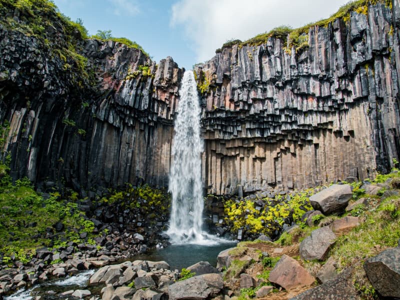
Svartifoss waterfall
Svartifoss is one of the unique waterfalls in South Iceland. It is situated in Skaftafell, which belongs to Vatnajökull National Park. Svartifoss is 20 meters (80ft) high. It is bordered on both sides by tall black basalt columns.
The hike to Svartifoss starts at the Visitor Centre in Skaftafell. You can also find all sorts of information and advice about the area. The hike is about 1.9 km or 45 minutes (one way).
Skaftafell Visitor Centre, Skaftafell
View

Landmannalaugar - Nature Reserve
Landmannalaugar derives its name from a hot pool that rises under the Laugahraun lava field. Landmannalaugar has been a stopping point for people for centuries, and the mountain shepherds on Landmannaafréttur have stayed there while herding sheep off the mountain for as long as there have been reports of such travel.
Many beautiful mountains can be seen from Landmannalaugar: Barmur, Bláhnúkur, Brennisteinsalda, Suðurnám, and Norðurnám. The area has considerable deposits of rhyolite, obsidian, and rhyolite lava, and the Landmannalaugar landscape is famous for its colorfulness and unique environs.
The start of one of the most popular hiking trails in Iceland, Laugavegurinn, is at Landmannalaugar. The trail proceeds along Hrafntinnusker, Álftavatn, Hvanngil, and Emstrur and ends in Þórsmörk.
Ferðafélag Íslands (the Iceland Touring Association) provides facilities, such as showers and accommodation, for travelers at Landmannalaugar. In addition, there is a horse rental and a small café operated during the summer.
Fees:The Environmental Agency will implement a booking system for parking in Landmannalaugar for the summer of 2024. It will be necessary to book parking spaces in advance and pay a service fee.
The system will be used from June 20th to September 15th, every day of the week. During this period, all visitors planning to come to Landmannalaugar on their own in a private or rental car between 8 am and 3 pm will need to book a parking space in advance. More information here:
View
Þjórsárdalsskógur Forest
The natural setting of the forest follows a varied landscape of intense contrasts, from flowering forests to unripe ash hake from Hekla. The forest is mostly birch and spruce, pine, and larch mixed forests. An ideal place for outdoor activities, as there are many marked and unmarked paths and forest roads in the woods.
Þjórsárdalsskógur lies west of Highway 32, where it goes east towards Búrfellsvirkjun. You can get into the forest from Ásólfsstaðir and also via a bridge over Sanda, a short way into the valley. The campsite in Þjórsárdalur is in between and is well marked.
In Þjórsárdalur, the forest stretches far up the slopes, the landscape is beautiful and varied, and it has a true fairytale atmosphere. There are numerous marked and unmarked paths and trails in the forest for travelers and hikers, rivers to swim in, and lava to explore. In the area, there are paths for wheelchairs, good camping, and a swimming pool in Árnes, about 15 kilometers down in the countryside.
Source: skoraekt.is
View

Jökulsárlón glacial lagoon
Jökulsárlón is a glacial lagoon beside the Ring Road, within Vatnajökull National Park. It is fed by Breiðamerkurjökull, an outlet glacier of Vatnajökull, and is known for the icebergs that drift across the lagoon before floating towards the Atlantic Ocean.
The area is one of the most popular stops in South Iceland, with views of blue-tinted ice, the glacier edge, and the nearby black sand beach where ice is often washed ashore. Seals can sometimes be seen in the lagoon or resting on the ice, but sightings vary by season and conditions.
Jökulsárlón is accessible year-round from Road 1, and there is a café by the lagoon. Visitors can also follow a marked hiking trail between Jökulsárlón and Fjallsárlón. Never step onto floating ice in the lagoon, as it can roll over or break apart without warning.
Vatnajökulsþjóðgarður
View
Lónsöræfi
In Lón District, the most eastern area of the Vatnajökull Region, lie the Stafafellsfjöll mountains, also called Lónsöræfi. They dominate the skyline east of the Vatnajökull glacier and have long comprised one of Iceland’s most extensive protected areas. Besides the deep, rugged canyons, the landscape displays a wide range of colors owing to the presence of rhyolite and other colorful rocks. In contrast, there are also lushly vegetated and sheltered valleys offering a very good chance of spotting reindeer. The numerous hiking trails make this area perfect for hiking. Keep in mind that getting there can be very difficult and one should seek advice from a visitor- or information center before attempting to go there.
View
Hungurfit in Rangárvallaafréttur
There have been lodge facilities in Hungurfit since 1963, when a mountain lodge, housing 20 people, was built there. This was a great improvement for mountain shepherds, who previously had to sleep in tents. In 2013, a new mountain lodge was opened in Hungurfit, housing 50 people. It is one of the most modern mountain lodges in Iceland, with running water, a flushable toilet and electricity.
Hungurfit has unique natural beauty, and the area is suitable for hiking, jeeping and horse riding. There are excellent horse riding trails leading from the area, both to Rangárbotnar, Sultarfit, Faxi and onto Hvanngil and down to Fljótshlíðarafrétt. It is a day’s journey by horse from Hungurfit to Foss at Rangárvellir. The river Hvítmaga has its source at Hungurfit, and it is highly enjoyable to travel by horse or foot along the river.
Above the mountain lodges, the Skyggnishlíðar ridge leads up to the mountain Skyggnir. Skyggnishlíðar is a popular hiking destination, as the view from there is spectacular on a clear day. It is also highly enjoyable to walk or ride to Sultuarfit and towards Gimbragil and Hrútagil or into Jökulskarð.
View
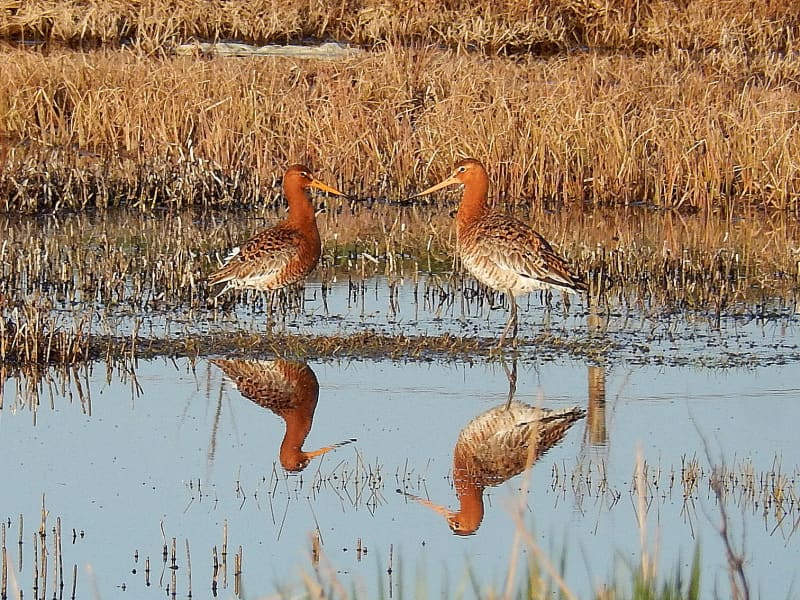
The Flói Bird Reserve
Northwest to the town of Eyrarbakki is a wetland area, rich in birdlife. The reserve has walking paths and a bird hide, an ideal spot for bird watching. The Flói Bird Reserve is listed in the Bird Life international Association. The Reserve is characterized by its flood meadows and numerous small ponds. Approximately 70 species of birds have been recorded in the Reserve. During spring and autumn migration Greylag Geese and White-fronted Geese can be found as well as Wigeon and Tufted Duck and various waders such as Snipe and passerines like Wheatear. During winter, birds, chiefly gulls and sometimes Long-tailed Duck and Common Eider, are concentrated in the estuary of the river Ölfusá. Whooper Swan, Teal, Mallard and Goosander are attracted to open water in winter.
View
Reykjadalur valley
Reykjadalur valley is the most popular and arguably the most beautiful hiking area in Ölfus. Hot springs and colorful areas full of geothermal activity entertain along a hiking trail that leads to a hot river. For some of the river's length, the temperature is perfect for bathing, and that's a wonderful natural experience.
The trail by Reykjadalur can be closed, so it's good to check the conditions before going. To check whether the valley is open or closed to visitors, check out the website of Safetravel.is. Those who plan on visiting the valley need to respect the rules and stay on the paths. Please help us to protect the fragile vegetation around the area!
View

Skaftafell
Scenic nature, favorable weather conditions, and a network of hiking trails make Skaftafell in Vatnajökull National Park an ideal destination to enjoy outdoor activities in Icelandic nature. Short and easy trails lead to the waterfall Svartifoss and Skaftafellsjökull glacier. Still, those who want to reach further out Morsárdalur valley and Kristínartindar mountain peaks are perfect in terms of distance and labor. Skaftafell is also the ideal base camp for those who seek to climb Iceland‘s highest mountain peak, Hvannadalshnúkur.
During the summer months, the national park offers interpretive tours with rangers. Ask for information at the desk or check the park´s website.
Private travel companies operate in Skaftafell and offer guided hikes on the nearby glaciers and mountains. Also on offer are sightseeing flights over the Vatnajökull glacier and other renowned attractions.
Vatnajökulsþjóðgarður
View
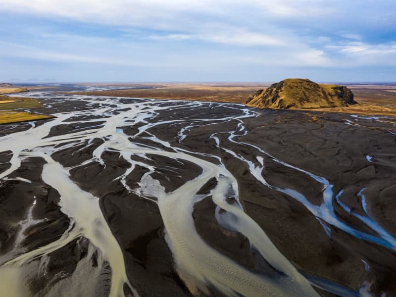
Mýrdalssandur
Mýrdalssandur, the vast desert east of the glacier, is the outwash plain where glacial outburst flooding has continued to pummel the landscape. It is believed to have once been a fertile farming community destroyed by repeated glacial flooding through the centuries.
In each glacial outburst, more and more sediment gathers in the area. Given the eruption average of around 50-60 years, the sand has ample opportunity to grow. Many believe that Katla is long overdue to erupt, giving the Mýrdalssandur plain a (possible) chance to grow even further in the near future.
View
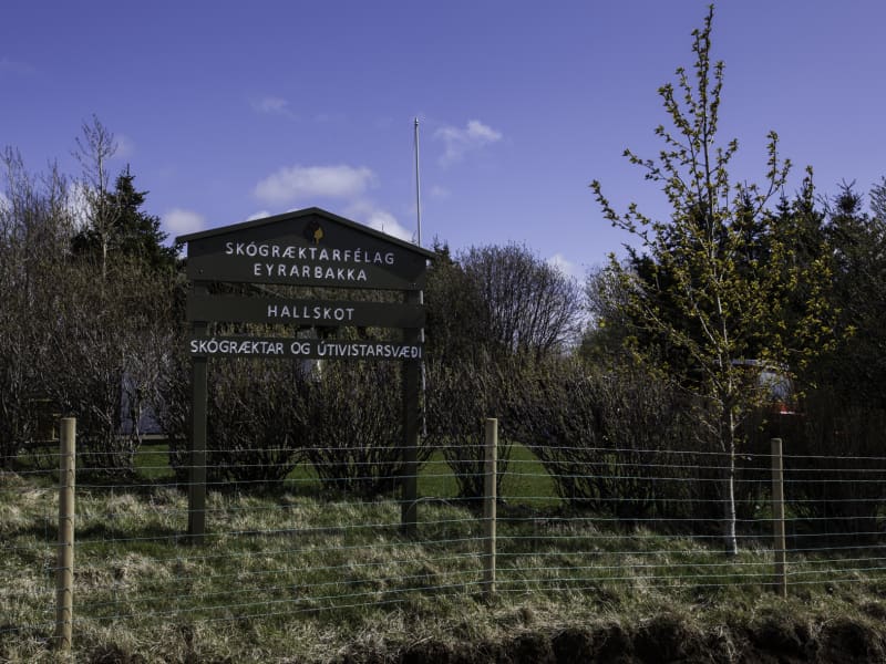
Hallskot - Recreation Forest
A recreation area north of Eyrarbakki in supervision of the forestry community of Eyrarbakki, Skógræktarfélag Eyrarbakka. In Hallskot is a perfect picnic area with benches and tables where one can always find a windless spot in the groves.
ADDRESS: 820 EYRARBAKKI / TEL: (+354) 660 6130, (+354) 847 5028 SKOGRAEKTARFELAGEYRARBAKKA@GMAIL.COM / GPS: 63°53'57.0"N 21°10'19.1"W
View
Haukadalsskógur Forest
Haukadalsskógur is a lush and expansive forest in Haukadalur valley, just a short drive from the famous Geysir geothermal area. Known for its tranquil atmosphere and diverse plant life, the forest offers a unique contrast to the dramatic geothermal landscapes nearby, making it a perfect stop for those seeking peace and natural beauty.
One of the largest national forests in South Iceland, Haukadalsskógur is also the most extensively planted of all Iceland’s national forests. It stands as a remarkable example of long-term reforestation, with planting efforts dating back to the early 20th century. Today, the forest features a rich mix of native birch and imported conifer species, creating a varied and shaded environment ideal for walking, picnicking, and nature observation.
The forest's outdoor facilities are well-developed and thoughtfully maintained. Among its standout features is a specially designed wheelchair-accessible trail, created in close cooperation with Sjálfsbjörg, the local association for people with disabilities in Iceland. This makes Haukadalsskógur an inclusive destination where everyone can enjoy the beauty of the outdoors.
View
Fjallabak Nature Reserve
Fjallabak Nature Reserve was protected in 1979. The protection aims to preserve unique areas so that future generations have the opportunity to enjoy them in the same way as we do. For this to happen, there are specific rules of conduct to prevent damage to the environment or disruption of the landscape. A diverse landscape, a unique but fragile ecosystem, desert wilderness, and peacefulness are the main characteristics of the Friðland Nature Reserve, and thousands of people visit every year to enjoy the natural resources. Visitors to the area are asked to respect the nature reserve's rules of conduct and thus contribute so that the aim of the protection can be achieved and that everyone, as well as our descendants, can fully enjoy the nature reserve's nature.
The nature reserve is 44,633.4 ha in size and all more than 500 m above sea level. The area is mountainous and shaped by volcanic activity and geothermal heat. The color palette is broad, mostly due to rhyolite and obsidian in the mountains. Lava fields, rivers, and lakes are also prominent in the landscape.
Management and Protection PlanWork on preparing a management and protection plan for the nature reserve is ongoing, and all information about that work can be accessed here in Icelandic.
AccessThe northern Fjallabaksleið route (F208) lies between Land and Skaftártunga, through the Fjallabak Nature Reserve. The Landmannaleið route (F225) lies from road 26 towards Landsmannahellir through Dómadalur and connects to road 208 by Frostastaðavatn. The Sígölduleið route (208) lies from Sprengisandsvegur (F26) to Landmannalaugar.
The land here is especially sensitive to damage from traffic, and as a result, drivers are asked to familiarise themselves with road conditions before embarking on a journey through the nature reserve and not drive outside those roads shown on the map.
Weather ConditionsThe average annual temperature in Fjallabak is probably 0–1°C. July is the warmest month of the year, with an average temperature of 7–8°C. The average temperature of the coldest months, January and February, is around -6°C. Remember that each month's average temperature varies greatly from year to year. Winter conditions and frost can occur at any time of the year. The annual precipitation at Torfajökull glacier, in the southeast corner of the nature reserve, is probably around 2–3 thousand mm but decreases rapidly to the north and northwest and is perhaps down to approx. one thousand mm in the northernmost part of the nature reserve.
Further information about The Fjallabak Nature reserve
View
Eyjafjallajökull Glacier
The Eyjafjallajökull glacier is a 1651 m high glacier-capped stratovolcano. It is one of the smaller glaciers of Iceland. It is situated to the north of Skógar and to the south and west of the bigger glacier Mýrdalsjökull. The icecap of the glacier covers a volcano (1651m in height) that has erupted relatively frequently since the Ice Age. The crater of the volcano has a diameter of 3-4 km and the glacier covers an area of about 100 km². In June 1994 an earthquake swarm lasting for nearly a month occurred below the active volcano Eyjafjallajökull in South Iceland. It is otherwise a relatively quiet volcano – although it is not listed as being inactive. Eyjafjallajökull erupted in 1821-1823. The south end of the mountain was once part of the Atlantic coastline. As the sea has since retreated some 5 km, the former coastline has left behind sheer cliffs with a multitude of beautiful waterfalls, the best known of them being Skógafoss and Seljalandsfoss. In strong winds, the water of some of the smaller falls can even be blown up the mountain. It is one of the three glaciers that surround the Thorsmörk area - the other 2 being Myrdalsjökull and Tindfjallajökull. Specialized tours are arranged on the glacier for both skiing, super jeep tour, and hiking. One should never venture onto the glacier without guides and good knowledge of this kind of activity as this is a very dangerous area for inexperienced visitors.
Eyjafjallajökull featured prominently in world news in 2010 when ash from its eruption halted air traffic in Europe. An ice cap with several outlet glaciers covers the caldera of Eyjafjallajökull with a crater diameter 3-4 km wide. The outlet glaciers, Steinholtsjökull and Gígjökull, descend from the main glacier and can be visited by 4x4 trucks along the F-road to Þórsmörk. The area between the glaciers Eyjafjallajökull and Mýrdalsjökull with volcanic craters, Magni and Móði, created in the first stage of the Eyjafjallajökull eruption in April 2010.
View
Þjófafoss waterfall
Þjófafoss is in the river Þjórsá, to the east of the Merkurhraun lava field. The waterfall's name translates as "thieves' waterfall," as thieves used to be executed by drowning in its pool. The waterfall is one of the three main waterfalls in Þjórsá. The Þjórsá river forms the boundary between Rangárvallasýsla and Árnessýsla and is the longest river in Iceland.
Þjófafoss is to the south of Búrfell mountain, not far from the Búrfell Power Plant and somewhat lower down from Tröllkonuhlaup in Þjórsá. The flow rate in Þjófafoss is relatively low during winter but greater during the summer. This is due to the power plants on the river, as a large proportion of the water is diverted past the falls. The river is dammed at Sultartangi, forming the Sultartangalón reservoir. The water is first channeled through Sultartangi Power Plant and then into the Bjarnarlón reservoir and through the Búrfell Power Plant. As a result, it is first and foremost when the Sultartangalón reservoir is full in late summer that the excess water can flow over Þjófafoss.
With the construction of the Búrfell Power Plant 2, water flow over Þjófafoss has decreased, even more during summer and winter.
View
Sólheimajökull
Sólheimajökull is an outlet glacier that descends from the southwest corner of Mýrdalsjökull. It is a so-called "climate glacier" responding quickly to climate change. Access to the glacier tongue is good because it reaches down to the lowlands, and possible to go hiking on the glaciers with tour operators from the parking lot.
Large and rapid changes have taken place on the glacier in recent years, and one clear example of this is the increased distance required to approach the glacier trail.
Sólheimajökull has long been a research topic for glaciologists. Still, glacier research can tell us much about climate and climate change over the centuries. Still, the glacial history of Sólheimajökull is in many ways unusual compared to other Icelandic glaciers.
Over a hundred years ago, the glacial footprints of the Sólheimajökull glacier lay considerably in front of the current car park.
View
Lómagnúpur
Lómagnúpur is a 688 high palisade of cliffs that towers over Björninn Mountain, west of the Núpsvötn Lakes in Skeiðarársandur. The surroundings are renowned for their spectacular beauty, stretching from the black sand beaches of the south shore, all the way to Vatnajökul Glacier. Volcanoes, glaciers, and lakes have been woven together to form a varied landscape that can only be said to be extraordinary from a geological perspective. Lómagnúpur is part of the Núpsstaður Farmlands which is on the list of protected national heritage sites in Iceland.
View
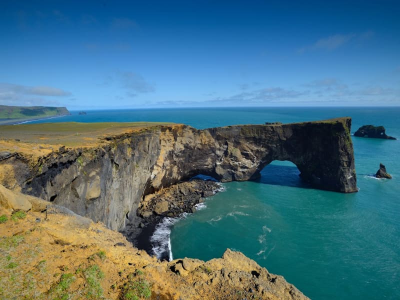
Dyrhólaey
Dyrhólaey is a nature reserve. The protected areas are necessary to ensure protection while ensuring public rights. Some areas are closed for part of the year to preserve wildlife, others are closed all year round due to sensitive natural monuments, traffic is also limited in some areas to people, and others are open all year round.
More information about DyrhólaeyDyrhólaey is a 120-meter high promontory not far from Vík. The place got its name from the massive arch that the sea has eroded from the headland. When the sea is calm, big boats can sail through it. A maniacal daredevil pilot has even flown through the arch with a small-craft airplane!
From the top of Dyrhólaey, there is a great view. The headland is thought to have been made in an underwater volcanic eruption late in the glacial period, not unlike the eruption of Surtsey. Several outcrops are in the sea; the highest one, called Háidrangur ("High column"), is 56 m. high. Dyrhólaey has been a natural reserve since 1978.
The promontory is widely known among sailors as "Portland" and English trawler fishermen beach where one can climb (at your own risk). According to legend, the Reynisdrangar needles were formed when two trolls tried dragging a three-masted ship to land. When daylight broke, they turned to stone. The Needles can be seen clearly from the village of Vík and are 66 meters above sea level at their highest.
In one of the many caves here – there is a local legend about a monster having lived here for many centuries. The monster seems to have disappeared after a landslide over 100 years ago…used to call it a "Blow hole." There are also unique rock formations all along the Birdlife here is abundant, with puffins and eider ducks being the most common species in the area. On top of the cliff, the lighthouse stands impressive and stoic in this often very windy area. Be careful not to go too close to the ledge of this dramatic cliff.
View
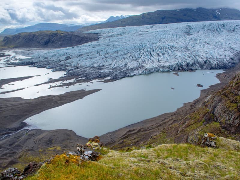
Fláajökull Glacier
Fláajökull is an outlet glacier of Vatnajökull in the southern part of Vatnajökull National Park, about 40 km west of Höfn. The area can be reached from Road 1 via a side road between Hólmur and Lambleiksstaðir, then a 6 km gravel road to the car park.
The glacier and surrounding landscape clearly show how ice has shaped the lowlands over time. Fláajökull reached its greatest known extent in 1894, after centuries of glacier advance during the colder period known as the Little Ice Age. Today, visitors can explore marked routes and information panels about the area’s history and geology.
There is also access from Haukafell forestry , with a footpath leading towards Fláajökull. Overnight stays are not allowed at the Fláajökull car park, and visitors should check road, trail, and weather conditions before traveling.
View
Fimmvörðuháls
Fimmvörðuháls is situated in between two glaciers, Eyjafjallajökull and Mýrdalsjökull.The hiking trail over Fimmvörðuháls is one of the most popular one in Iceland and even more so now when hikers can explore the eruption sites up there. The trail starts at Skógar and takes us from the beatiful Skógafoss waterfall along the Skógá river. The distance is about 20 km. with estimated hiking time between 8 - 12 hours. Elevation increases and decrease is 1.000 meters. The route is especially beautiful if you walk from south to north, as there are unusually many streams in Skógá and a beautiful view down to Þórsmörk when you cross the ridge. Be prepared for sudden changes in weather since the trail leads us between two glaciers.
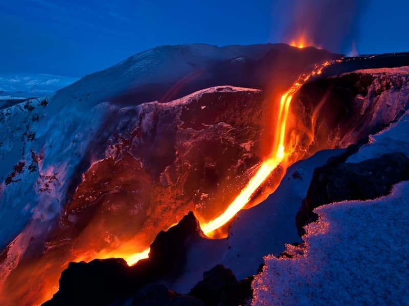
The eruption at Fimmvörðuháls began on the eve of March 21, 2010. Then there were reports of an eruption with associated ash fall in or near Eyjafjallajökull and the information came from the Police in Hvolsvöllur. The eruption was north of Fimmvörðuháls, just east of Eyjafjallajökull. This eruption is classified as a lava eruption. The lava flow from the eruption fissure formed the highest lava waterfall in the world that flows down into a gorge near the eruption fissure. The lava waterfall was about 200 meters high.
View
Mýrdalsjökull glacier and Katla
Mýrdalsjökull Glacier and Katla VolcanoMýrdalsjökull is a glacier located in the south of Iceland. It is situated to the north of Vík í Mýrdal and the east of the smaller glacier Eyjafjallajökull. Its peak reaches 1493 m in height, and in 1980, it covered an area of 595 km². The view on a clear day is one of the prettiest in the world.
Guided snow scooters, snowmobiles, Super Jeep, and ice-climbing tours are offered on the Myrdalsjökull glacier. Travelers on the glacier must be cautious about crevasses, and inexperienced travelers should not go alone. Weather conditions shift rapidly high winds, and snowstorms can appear in a flash all year round.
The volcano Katla in the Mýrdalsjökull glacier, the volcano Katla erupts on average every 40 - 60 years. Sixteen eruptions have been recorded since the settlement of Iceland, the last in 1918, but there have probably been more. Katla is one of the most famous volcanoes in the country, and its eruptions usually have very serious consequences. It can be regarded as one of the most powerful volcanoes in the world and probably the largest active volcano in the northern hemisphere.
During the eruption, the glacier above the volcanic vent melts, and the melted water collects under the ice cap until it makes its way out under the edge in a violent flood. These are called "jokulhlaup."The floodwater carries huge amounts of ice, rocks, silt, and sand. Most of the Mýrdalssandur sand plain has been formed by deposits in past floods.
Katla has been showing signs of unrest recently, and some geologists suspect it might erupt soon since it is way overdue to erupt.
Eruptions of Katla have taken place (since known and recognized human settlement): 1918, 1860, 1823, 1755-56, 1721, 1660-61, 1625, 1612, 1580, 1416, 1357, 1311, 1262, 1245, 1177, 950.
View
Þjórsá river
Þjórsá is the longest river in Iceland, 230 km, with a catchment area of 8000 km². Þjórsá is a glacier river, and its source is the Hofsjökull glacier. On its way to the sea, it falls off some cliffs in many places, forming beautiful waterfalls. Some of these waterfalls are well-known, but others are unknown pearls to discover, especially those in the highlands. The waterfall Þjófafoss in Þjórsá, south of the hill Búrfell, is well known and easy to reach.
In winter, the river can gather vast quantities of ice that has settled at its bottom. In spring, when the ice melts in Þjórsá canyons below Urriðafoss waterfall, the river breaks through the ice, which is a magnificent sight to behold.
View
Höfðabrekkuheiði, Þakgil
A breathtaking 14 km drive from ring road no. 1 to Þakgil campsite and hiking area. Surrounded by black sand and glacial rivers, a gravel road crosses the heath of Höfðabrekka, a tuff ridge between rivers Múlakvísl and Kerlingadalsá formed during the last Ice Age when volcanic material forced its way from beneath the glacier following a sub-glacial eruption. The road is closed during the winter. The vegetation in this area is highly vulnerable to trampling; please always keep to trails.
View
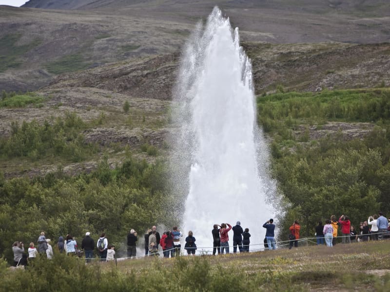
Geysir Geothermal area
One of the greatest natural attractions of Iceland and part of the famous "Golden Circle Tour," The Great Geysir, or Stori-Geysir, has been dormant since 1916 when it suddenly ceased to spout. It came to life only once in 1935 and quickly went back to sleep. Since then, its repose has sporadically been disturbed by the dumping of tons of carbolic soap powder into its seething orifice to tickle it to spout.
It is not exactly known when Geysir was created. It is believed that it came into existence around the end of the 13th century when a series of strong earthquakes, accompanied by a devastating eruption of Mt. Hekla, hit Haukadalur. In this geothermal valley, Geysir is located. What is known is that it regularly spouted every third hour or so up to the beginning of the 19th century and, after that, progressively at much longer intervals until it completely stopped in 1916. Whether its silence is eternal or temporary, no one knows.
When it was alive and shooting, it could thunderously blast a spectacular jet of superheated water and steam into the air as high as 60 to 80 meters, according to different sources. Its opening is 18 meters wide and its chamber 20 meters deep. One reason for cessation is believed to be the accumulated rocks and foreign objects thrown into it by thousands of tourists throughout the years. Though definitely damaging, this could not be the only reason for its dormancy.
The Great Geysir was among the most notable geysers in the world, such as those in Yellowstone Park, New Zealand, and North Iceland. The English word "geyser" is derived from the Icelandic word "geysir," which means gusher. Though the Great Geysir itself is now more or less inactive, the area surrounding it is geothermically very active with many smaller hot springs.
The attraction of the area is now Strokkur (The Churn), another geyser 100 meters south of the Great Geysir, which erupts at regular intervals every 10 minutes or so, and its white column of boiling water can reach as high as 30 meters. The whole area is a geothermal park sitting on top of a vast boiling cauldron. Belching sulfurous mud pots of unusual colors, hissing steam vents, hot and cold springs, warm streams, and primitive plants can all be found here.
A short distance away to the west stands the small Laugarfjall Mountain with a panoramic view overlooking the Geysir area. King Christian IX of Denmark visited the area in 1874 and by the foot of the mountain are the rocks where he leaned while his hosts tried to impress and amuse him by boiling eggs in the hot springs. The rocks are now called Konungssteinar ("The King's Stones").
View
Hafursey
Hafursey is an exceptionally beautiful palagonite mountain on the north side of Mýrdalssandur. It is divided by Klofgil Gorge- the west side, Skálafell, is 582m high, and Kistufell's east side is 513m high. There, the Fulmar has its nesting grounds, and the slopes are covered with scrub vegetation in an area once forested.
Hafursey was used by the farmers from Hjörleifshöfði for sheep grazing all year round and kept in a 'sel,’ a shelter used during summers until 1854. The Sel (a natural cave used for shelter) in Hafursey is one of the best-preserved remnants in the history of Iceland. In 1755, when Katla erupted, six men took shelter in the cave during the glacier burst. Their signatures, plus the date and year of their stay there, are written on the wall and are visible as you enter the cave.
View
Reykjafoss
The Botanical garden in Hveragerði is in the center of the town. Since 1983 it has given people the chance to relax and enjoy nature amongst the trees and the wonderful river Varmá with the waterfall Reykjafoss right next to the garden.
Further along the river, a hiking trail goes past the ruins of an old wool factory and ruins of a hydroelectric powerplant surrounded by colorful hot-spring areas.
View
Öræfajökull glacier
Öræfajökull: Iceland’s highest mountainExtending south from the Vatnajökull icecap within Vatnajökull National Park and towering to around 2,110 m (6,922 feet), Öræfajökull is Iceland’s highest mountain. Its height actually varies with the season and the depth of snow and ice, since the peak itself, Hvannadalshnjúkur, is topped by ice which is thickest in spring and thinnest in autumn.
The mountain and surrounding areas offer good skiing in winter and are very popular with walkers and hikers throughout the year.
Vatnajökulsþjóðgarður
View
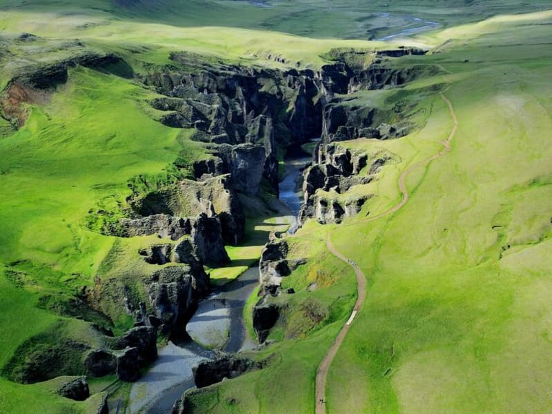
Fjaðrárgljúfur canyon
Fjaðrárgljúfur is 6 kilometers from Road 1; take road F206. People can travel by small cars to Fjaðrárgljúfur all year round. Fjaðrárgljúfur is a magnificent and massive canyon, about 100 meters deep and about two kilometers long. The canyon has sheer walls and is somewhat serpentine and narrow. The bedrock in Fjaðrárgljúfur is mostly palagonite from cold periods of the Ice Age and is thought to be about two million years old. The river Fjaðrá has its source in the mountain Geirlandshraun and falls off the heath edge in this stunning canyon until it makes it down into the Skaftá river. Fjaðrá has changed a lot over time.
Formation of the Fjaðrárgljúfur canyonIt is believed that Fjaðrárgljúfur was formed at the end of the last Ice Age, about nine thousand years ago. When the glacier retreated, a lake formed in the valley behind a hard, resistant rock. The run-off from the lake flowed to where Fjaðrárgljúfur is today. Glacial rivers from the glacier’s edge carried a lot of sediment into the lake, and the river which ran from it dug itself down into the rock and down onto the palagonite in front of it. Because the cascade was so large, it was powerful in digging out the canyon. Eventually, the lake filled with sediments, and the river’s strength dwindled. When the lake filled up completely, the river began to dig into the sediment layers it had previously left in the valley. Fluvial terraces on both sides of the valley indicate the original height and location of the lake while a deep channel in the palagonite serves as a silent reminder of the power of nature.
More geosites in the neighborhood: www.katlageopark.com
View
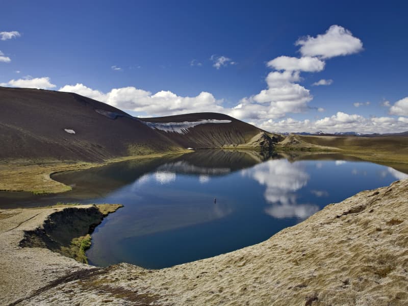
Veiðivötn Lakes
Veidivötn Lakes are a magnificent highland oasis. They are a friend in the desert, which no one should miss. Here, the crater formations are of a true extraterrestrial character and environment, something truly unique. The contrast between black sand and gin-clear waters is unique, and many travelers find this to be the highlight of their visit.
This part of the country is among the central highlands' youngest (1477) and wildest pearls. It comprises about 50 lakes of different sizes, which are so-called crater lakes. The area is about 20 km long and 5 km wide and has a southwest-northeast direction. The craters and the lakes lie in two rows. You must ford the small river between the two Fossvotn lakes to get into the area. Most lakes are fed and discharged underground because the lava fields and the scoria are very absorbent.
Some of the best brown trout & arctic char fishing in Iceland (or anywhere) are found here. The lakes are rich in natural trout that are believed to be from one of the oldest stocks in Europe. They vary in size, 3-6 pounders being common, but they can occasionally reach up to incredible 25 lbs in size. They are known for their excellent taste, which many say is naturally spiced. Inquire about fishing here in advance, as the area is usually heavily booked.
The road from Veidivötn continues north to Jökulheimar on the west of Tungnaarjökull, one of the valley glaciers that "flows" from Vatnajökull. This destination is still somewhat of a well-kept secret and undiscovered by foreign travelers. Usually, the road here is open from 15 June to the middle of October - only accessible by 4WD vehicles. It is an excellent place to "get away from it all" - the silence is often total, unbroken even by bird calls.
View
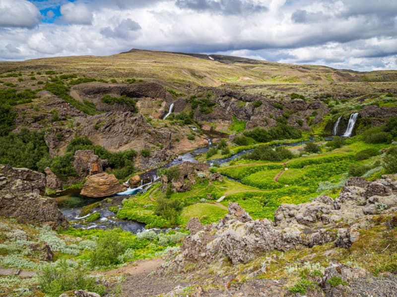
Gjáin in Þjórsárdalur valley
This beautiful natural phenomenon and oasis at the edge of the central highlands should not be passed by if you are traveling in the Thjorsar Valley. The Red River (Rauda) cascades into and through this gorge, and the surroundings are amply vegetated. River Thjorsa ran through before a dike was built between the mountains Sandafell and Skeljafell to redirect it.
One of the younger Tungnaa-Lavas ran down the gorge, leaving a thin layer on its bottom and walls and a thicker layer on the edges. The lava formations are worth taking a closer look at. An easy 10 minutes walk takes you into this beautiful area from the archaeological excavations at Stong, and another approach is from the car track on edge.
Some find this place so beautiful they (secretly) have strewn their ashes in the river to be forever united with monumental nature in this "paradise on earth."
View
Kirkjugólf
Kirkjugólf, or ‘the church floor,’ is an 80 square meter expanse of columnar basalt stone slabs that slowly eroded when the sea covered the area. The hexagonal ‘tiles’ look like man-made flooring, but there has never been a church or any other building on the site.
The protected natural monument is located just a few hundred meters east of the village of Kirkjubæjarklaustur.
View
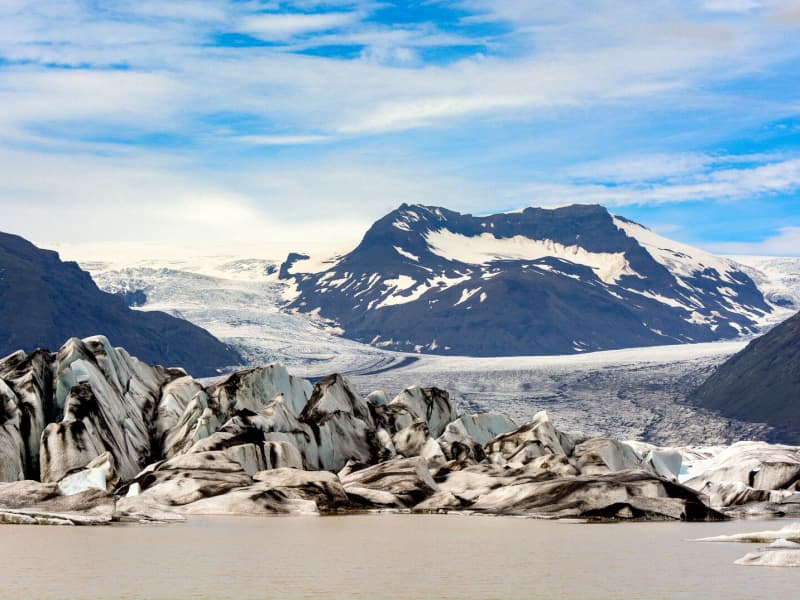
Heinaberg
Heinaberg is a beautiful area that consists of Heinabergsjökull glacier, the glacial lagoon Heinabergslón, where you can go kayaking among the icebergs during summer, and stunning landscape. The Heinaberg area is part of Vatnajökull National Park.
The gorgeous glacial lagoon of Heinaberg, Heinabergslón, is accessible by car and is often studded with large chunks of glacier that break off the Heinabergsjökull glacier. The area offers excellent conditions for hikers, as it has several interesting hiking trails, along which one can see waterfalls, ravines, volcanic intrusions, and even, on a lucky day, a reindeer.
The gravel road from road no 1 to the glacial lake is not in service during the winter months. Therefore, one needs to be aware of changes in road conditions and accessibility.
Vatnajökulsþjóðgarður
View
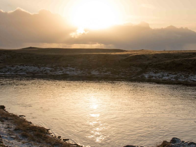
Self guided walk in Hella
The archaeology app takes you on a self-guided tour of the village of Hella.
Hella does not have a very long history, but there has been a farm, Gaddstaðir, at Hella for a few decades. The first inhabitant to move to Hella who didn't have the goal of being a farmer was Þorsteinn Björnsson. He moved in in 1927 and opened a store named Hella. From that moment, that village started to develop, and the name Hella grew to the village.
The app will take you for an approximately 1 1/2 hour walk around the village, where you will get to know much more. To download the "wapp " app search in the app store or google play; it's free.
View

Núpsstaðarskógar forest
The forest Núpsstaðarskógar is on the land of Núpsstaðir, but Núpsstaðir is the easternmost farm in Skaftárhreppur and is situated by Lómagnúpur. At Núpsstaður there are remarkable old turf buildings that are believed to be typical for farms in Iceland in past centuries. The most noteworthy of these is the chapel, one of few remaining turf churches in the country. The beauty of the environment surrounding Núpsstaður is well known. The area reaches from the ocean and black sands and all the way to Vatnajökull. Volcanic eruptions, glaciers and lakes have shaped the environment there, in addition to shaping diverse formations.The forest Núpsstaðarskógar is a beautiful copsewood that grows in the hills of Eystrafjall, west of Skeiðarárjökull and south of Grænalón. Diverse vegetation grows there and it's an area that's enjoyable to walk around. A rough track to the forest passes Lómagnúpur and Núpsvötn. There is lots to see there and the landscape is grand, sure to embed itself in the mind of anyone who goes there. Wild sheep were there in the 19th century.
The forest Núpsstaðarskógar is a beautiful copsewood that grows in the hills of Eystrafjall, west of Skeiðarárjökull and south of Grænalón. Diverse vegetation grows there and it's an area that's enjoyable to walk around. A rough track to the forest passes Lómagnúpur and Núpsvötn. There is lots to see there and the landscape is grand, sure to embed itself in the mind of anyone who goes there. Wild sheep were there in the 19th century.
View
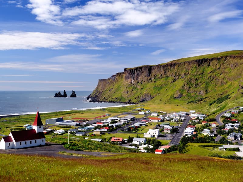
Katla UNESCO Global Geopark
Katla Geopark includes geological features of global significance. Over 150 volcanic eruptions have been recorded in the area since the 9th century. The eruptions created the landscape and influenced where people settled. Through the centuries, man and nature have affected the region's history. The area is constantly changing due to volcanic activity.
A geopark is defined as a territory that includes a particular geological heritage and a sustainable territorial development strategy to promote development. It must have clearly defined boundaries and sufficient surface area for true territorial economic development.
The Geopark covers about 9% of Iceland, 9542 km2, and follows the borders of three municipalities, Skaftárhreppur, Mýrdalshreppur, and Rangárþing eystra. About 2700 people live within the Geopark.GeologyIceland lies astride the Mid-Atlantic Ridge, where tectonic plates move apart, causing a rift zone. A mantle plume exists below the country, centered beneath the Vatnajökull ice cap. In South Iceland, the interaction of the rift zone and the mantle plume results in complex and diverse volcanic activity. Volcanic activity and its widespread effect on the area's nature and landscape make Katla Geopark special.
The Geopark is in Iceland's most volcanically active area, and the volcanic systems at Eyjafjallajökull, Katla, and Grímsvötn are particularly active. The region is characterized by central volcanoes, eruptive craters and fissures, rootless cones, lava fields, table mountains (tuyas), and hyaloclastite ridges that trend SW-NE, like the rift zone.
Ice caps are prominent in the landscape, topping the highest volcanoes. Outlet glaciers and glacial rivers flow from them, and glacial landforms, e.g., moraines and ice-dammed lakes, occur in the area. Large floods, usually glacier outbursts associated with subglacial eruptions, have formed outwash plains in the lowlands. The oldest bedrock in the area is about 2.5 million years old and can be found at the base of Lómagnúpur, an old sea cliff (671 m). Other interesting features in the Geopark are fossil-bearing xenoliths and tephra layers which are useful for dating (tephrochronology).
Further information about the area is on www.katlageopark.com.
View
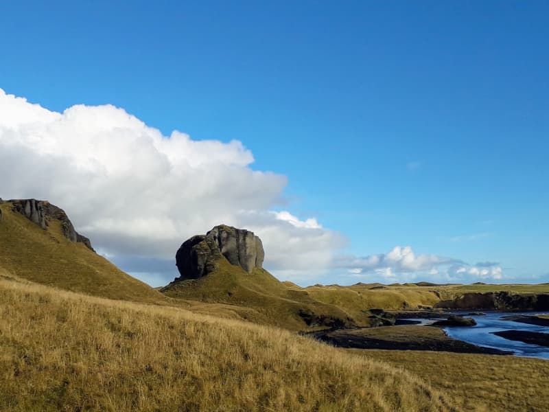
Systrastapi
In 1186 a nun monastery was established in Kirkjubær á Síðu. It was later called Kirkjubæjarklaustur, and the topographical names Systrastapi and Systrafoss are connected to this time. Systrastapi is a steep rocky hill west of Klaustur.
Folklore says that two nuns of the monastery were buried after being burned at the stake for violating codes of ethics. One is supposed to have sold herself to the Devil, carried consecrated Communion bread past the door of the privy, and had carnal knowledge with men. The other spoke blasphemously of the Pope. After the Reformation, the latter nun was regarded as innocent and beautiful flowers grew on her grave, while the other one's grave remained barren.
The rocky hill can be climbed, and from the top, the view of glaciers, among other things, is fantastic.
View
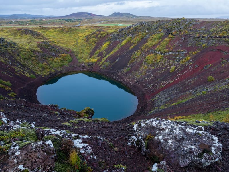
Kerið Crater
Kerið is a 55 m deep volcanic crater, about 3000 years old. It is a part of a group of volcanic hills called Tjarnarhólar and is now filled with water, creating a lake whose steep circular slopes resemble an ancient amphitheater.
View
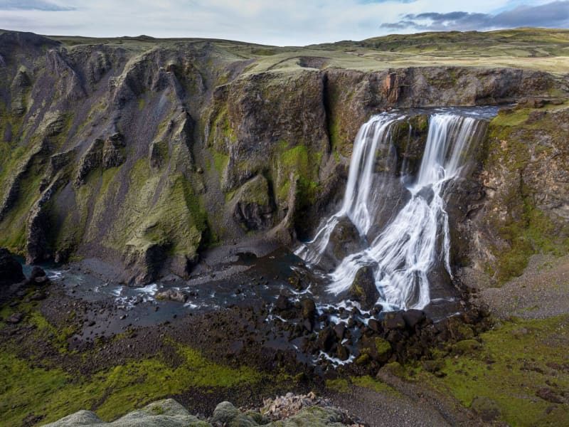
Fagrifoss Waterfall
Fagrifoss is a scenic 80 m high waterfall in the Geirlandsá River. Basaltic pillows occur in the vicinity of the waterfall, which cascades from 140m thick hyaloclastite deposits.
Fagrifoss is situated on the F206 road to Laki craters, a rugged road with rivers that can be treacherous to cross if the water level rises due to rain and thaw. A 4x4 vehicle is needed, and the area is only accessible during summer.
View
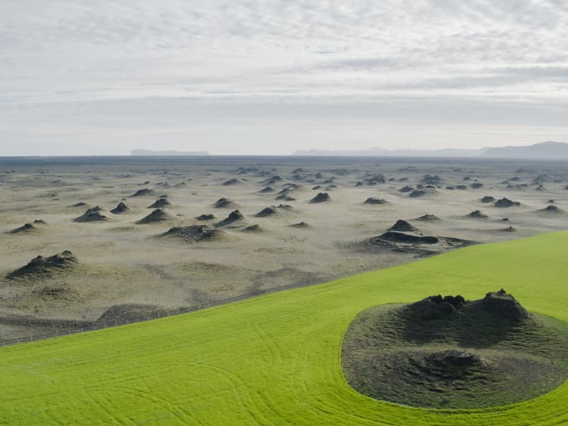
Álftaversgígar
Álftaversgígar is a protected natural phenomenon of international geological significance. An area of rootless cones (pseudocraters) formed by the Eldgjá lava flowing over wetlands in 934-940. A side road south of ring road no.1 takes you to a panoramic spot with information panels.
There is an easy hike along the signed sand track to Dýralækjasker geosite, a former shelter for travelers crossing the sands of Mýrdalssandur on foot or horseback before the time of automobiles. Another excellent place to experience these cones is in a farmed area at Þykkvabæjarklaustur.
View
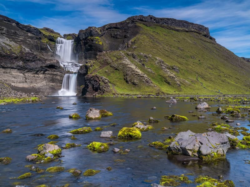
Ófærufoss waterfall - Nyrðri Ófæra river
Ófærufoss is an extremely beautiful waterfall in the river Nyrðri-Ófæra and falls into Eldgjá in two cascades. There used to be a stone arch across the lower one up until the year 1993, when it fell into the river during spring thawing. From Northern Fjallabaksleið it is possible to drive into Eldgjá and walk from there to the Ófærufoss. A road lies up to the eastern edge of Eldgjá. To get there, one needs to cross the river Nyrðri-Ófæra at a wading place, which can be risky. It is safe to recommend a walk up the mountain Gjátindur, from where there is magnificent view of Eldgjá, mountains by Langisjór and Lakagígur and its surroundings.
Ófærufoss falls into Eldgjá in Skaftártunguafréttur. Eldgjá is an approx. 40 km long eruptive fissure, approx. 600 meters wide in many places, and up to 200 meters deep. When it was formed, probably around 934, there were likely eruptions along the whole extent of it. The fissure is believed to reach under Mýrdalsjökull glacier. From Eldgjá, extensive streams of lava have flowed through Landbrot and Meðalland, reaching sea at Alviðruhamrar in Álftaver. The lava-field is believed to cover 700 km², which makes it one of the vastest lava-fields on earth in historical times, that is, after the last ice age.
Eldgjá is believed to belong to the same crater system as Katla. Eldgjá is a unique natural phenomenon and is listed as natural remnants. Plans to make Eldgjá and its surrounding area a part of Vatnajökull National Park are in place.Theories have surfaced that suggest that the Eldgjá eruptions had even more effect in Europe then the Lakagígar eruptions. According to newly discovered evidence, crop failure, plagues and other disasters occurred in both Europe and the Middle East at that time. It has also been speculated that these eruptions caused more damage than the eruptions of Lakagígar.
View
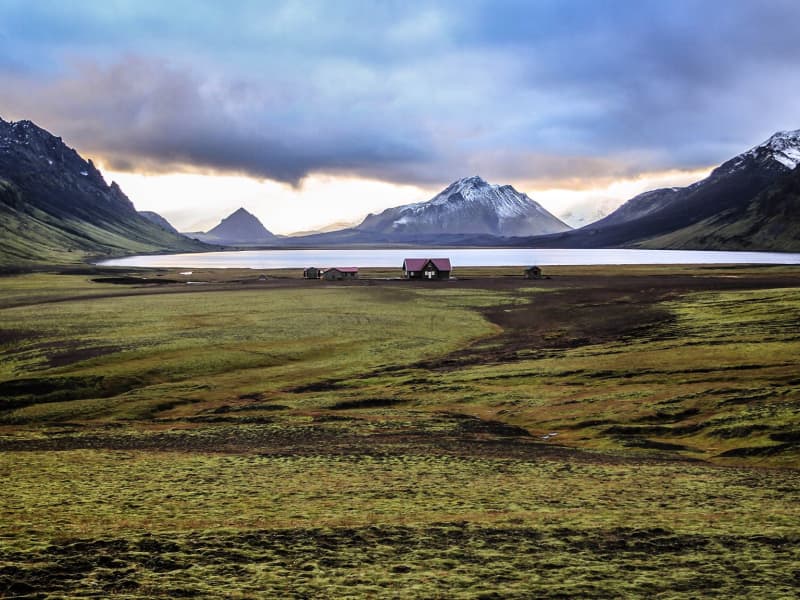
Álftavatn in Rangárvallaafréttur
There are lodges at Álftavatn, and Arctic char can be caught in the lake. Álftavatn is close to places of great natural beauty such as Grashagi, Torfafit, Ljósártungur, Jökultungur, Ófæruhöfði, Útigönguhöfði, Hvanngilshnausar, Torfatindur, Sáta, Brattháls and Hvanngil.
The Álftavatn lodge area is part of Laugavegur, one of Iceland's most popular hiking trails, from Landmannalaugar to Þórsmörk.
View
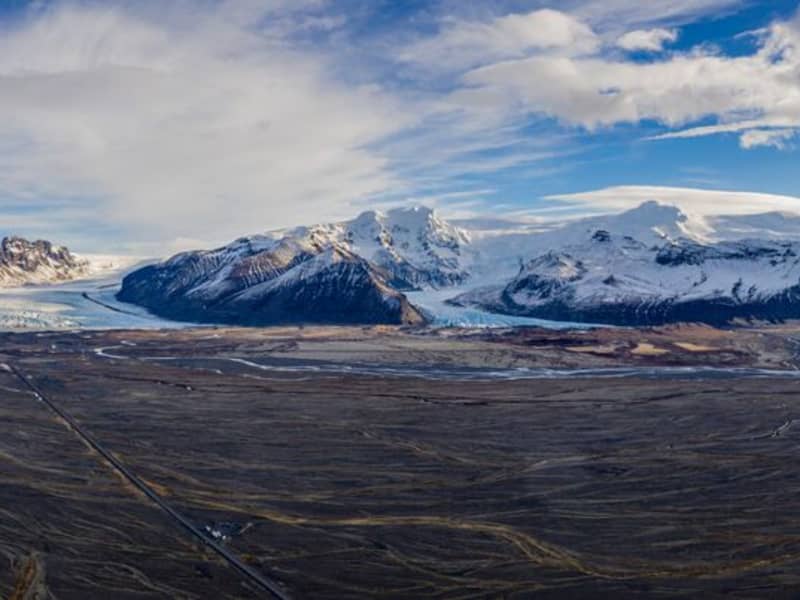
Skeiðarársandur
Skeiðarársandur is a large area of black sands, reaching from Skeiðarárjökull (a part of Vatnajökull) and to the sea. It covers an area of 1300 km² and was formed as the glacial rivers in the area washed material towards the sea. The rivers bring forth material that surfaced during sub-glacial volcanic eruptions in Vatnajökull. Near the glacier, the ground is gravelly and even rocky; as it reaches the sea, it has turned into sand and clay. There used to be little vegetation found on Skeiðarársandur, but in the past decade, a self-sprouted forest of birch trees has been growing lushly in the middle of the area. Skeiðarársandur is a large nesting area for the great skua.
Skeiðarárbrú Skeiðarárbrú is the name of the bridge that crosses the Skeiðará river on Skeiðarársandur, and its opening in 1974 marked the opening of the ring road in Iceland. Skeiðarárbrú is a one-lane bridge made of specifically engineered steel trusses. In 1996 there was a volcanic eruption in Grímsvötn in Skeiðarárjökull, which created massive floods and glacier melting. The hefty amount of floodwaters and house-sized icebergs severely damaged the bridge. All that remains of the original bridge today are two twisted girders by the side of the new road. They form a unique monument to Iceland's natural landscape's lovely but powerful beauty. The bridge has been replaced with a new one due to changes in the water flow underneath the glacier. The river flowing under the new bridge is called Morsá.
View
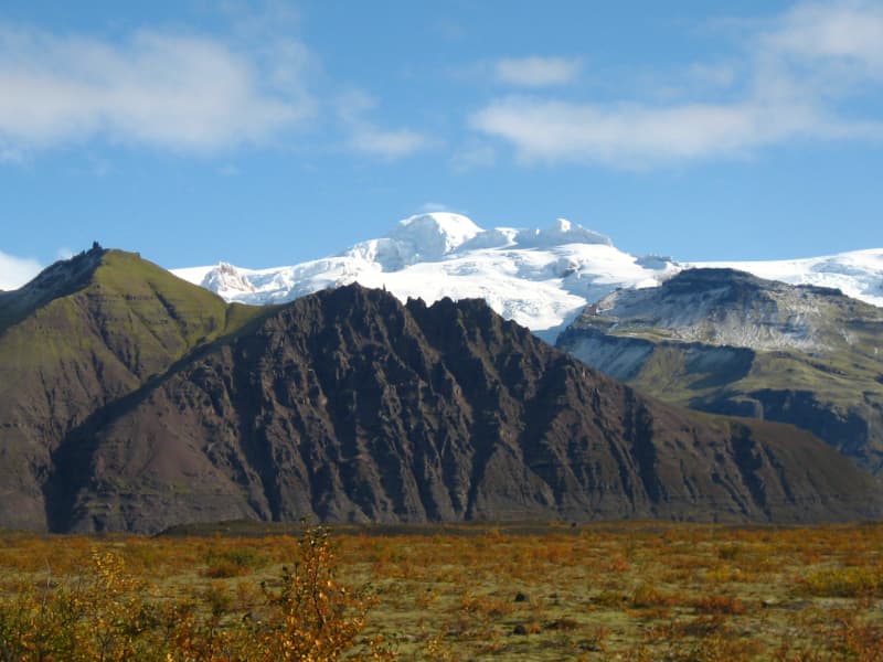
Vatnajökull National Park
Vatnajökull National Park was established in 2008. It includes the national parks in Skaftafell (est. 1967) and Jökulsárgljúfur (est. 1973) along with the Vatnajökull ice cap itself and extensive areas around it. Today Vatnajökull National Park area covers 15% of Iceland.
A map showing the park’s boundaries (last updated September 21st, 2021): https://www.vatnajokulsthjodgardur.is/static/files/_blob/fuk31dewng5iwwugi4tnkb.jpg
Vatnajökull National Park is characterized by diversity on all fronts, be it landscape, biosphere, cultural remains, or service levels. For simplification, however, it may be placed into two categories: uninhabited highland areas with limited services and lowland areas with higher service levels.
The park‘s visitor centers are all located in lowland areas. Each of them has an exhibition about the park‘s nature and cultural heritage. Each also has a souvenir shop with a special emphasis on local handicrafts and products.
In 2019, Vatnajökull National Park was inscribed upon the UNESCO World Heritage List.
Visitor centres and other tourist information offices working with the parkVisitor centres and other tourist information offices working with the park provide information and services for the park and its immediate environs. The following offices operate along the south coast of Iceland:
• Skaftárstofa Visitor Centre | Kirkjubæjarklaustur | open all year
• Skaftafellsstofa Visitor Centre | Skaftafell | open all year
• Skálafell farm | Suðursveit | varying hours - all year
• Hoffell farm | Nes | varying hours - all year
Vatnajökulsþjóðgarður
View
Dælarétt
Dælarétt is a centuries-old sheep pen surrounded by beautiful landscape, built from rocks of the great Þjórsárhraun lava field. Dælarétt is considered to be the oldest sheep pen in the country and has now been preserved. Close by are earthquake fissure; use caution around the fissures.
View
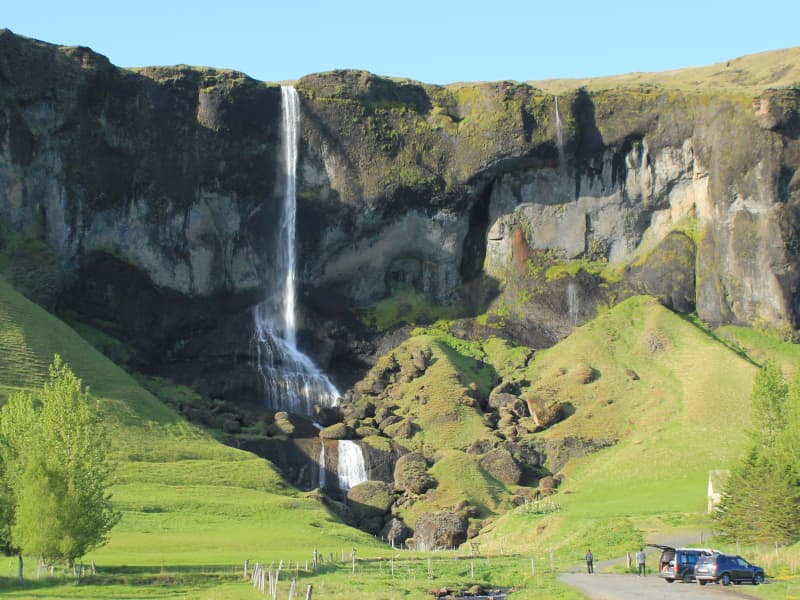
Foss á Síðu
Foss á Síðu is the name of an old farm, approximately 10 km east of Kirkjubæjarklaustur. A beautiful waterfall cascades over the cliffs above the farm, which flows from Lake Þórutjörn. This magnificent spectacle catches the eye of everyone that passes by. An easy hiking trail leads up to Lake Þórutjörn where the view over Síða is amazing.
View
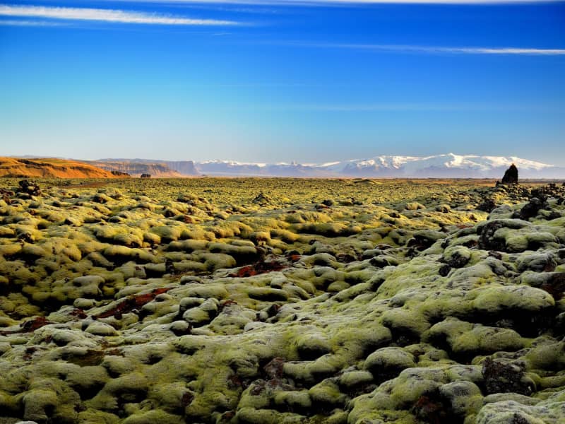
Skaftáreldahraun lava field
In 1783, a huge lava flow streamed from Lakagígar in what became known as the “Skaftá Fires.” This is believed to have been one of the greatest lava flows in a single eruption in the history of the world. The molten lava filled the gorges through which the Skaftá and Hverfisfljót rivers flowed, and swept down in two branches into inhabited areas, to spread over the lowlands where it laid waste many farms. Its cubic measure is estimated um 16km3 and the square measure of the lava is approximately 580km2.
In Skaftáreldahraun you find a good place to stop the car and take a look over the lava field shortly (4 km) before you arrive in Kirkjubæjarklaustur. There you find a car park and an information board.
View
Landmannahellir
Landmannahellir in Landmannaafréttur has long been a destination point for travellers passing through the area. The name of the place is drawn from a cave there which was used for centuries to shelter both men and horses.
At present, the location is a popular stopping point for both hikers and riders who stay there during the summer. There is, moreover, a campsite at the location. The operation of the area is in the hands of Hellismenn ehf. The company owns a number of huts at the location, as do Veiðifélag Landmannaafréttar and private entities.
A well-known hiking trail, Hellismannaleið, lies through the area and has now been signposted from Rjúpnavellir through Áfangagil to Landmannahellir and from there to Landmannalaugar. In order to reach Landmannahellir cave, one needs to use the Dómadalsleið (road F225). The road is approximately 80 km long from Landvegamót to Landmannahellir.
View
Hvalnes
Hvalnes is a small peninsula with a black pebble beach stretching for a few kilometers. Sitting on its tip is a picturesque old, yellow lighthouse and an old turf farm with the same name as Hvalnes.
The beach stretches for a few kilometers and would make a nice walk, or you can hang out on the beach and enjoy the view. It is an excellent location for bird watching and photography.
View
Ægissíðufoss waterfall
The Ægissíðufoss waterfall in Ytri-Rangá is a few kilometers further down the river from Hella. The waterfall is a well-known fishing location on the river and has a salmon ladder. The waterfall is magnificent all year round, as the flow is quite steady throughout the year given that Ytri-Rangá is a spring-fed river. Any changes to its flow rate can for the most part be attributed to spring thaws.
When thoughts turned to bridge the Ytri-Rangá river, Jón Þorláksson, the then Chief Civil Engineer and later Prime Minister, examined the option of building a bridge just above Ægissíðufoss. This construction did not materialize, and the bridge was ultimately built where the village of Hella stands today.
A popular hiking trail lies from Hella down to Ægissíðufoss along the Ytri-Rangá river and is much used by both locals and visitors.
View
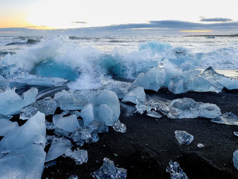
Breiðamerkursandur - Fellsfjara
Fellsfjara is a black-sand beach next to Jökulsárlón Glacier Lagoon, within Vatnajökull National Park. Ice from the glacial lagoon is carried by the river towards the sea, then washed back onto the beach by the tides.
The scattered ice pieces across the black sand make the area a popular spot for photography, especially when the light reflects through the ice. Conditions change with the tide, weather, and season, so the amount and position of ice on the beach vary.
The name Breiðamerkursandur refers to the large glacial outwash plain south of the glacier Breiðamerkurjökull. Fellsfjara refers to the coastline itself. The place has been nicknamed The Diamond Beach by international visitors.
Visitors should take care near the shoreline. Never climb onto the ice, stay away from ice close to the sea, and always keep watch for waves, which can come in unexpectedly.
View

Eldfell
Hiking to the top of the volcano Eldfell is one of the most popular trails on Heimaey. This volcano was created in the eruption in 1973 which lasted for about six months and during that time nearly one-third of all the homes and buildings on Heimaey had burned or been covered under the lava and ash. The volcanic museum, Eldheimar tells the story of the eruption and is very nice to visit prior to hiking up the volcano.
View
Drangurinn í Drangshlíð
Drangurinn í Drangshlíð is a characteristic tuff rock formation that stands alone on the grazing land of Drangshlíð farm, at the foothills of Eyjafjöll.
A folktale tells of a strong man named Grettir Ásmundsson who was showing off and ripped the giant boulder right out of the Hrútafell cliff, leaving a chasm that is now above Skarðshlíð. There are caves and passages in these rocks to which additional buildings were added throughout the centuries, some of which are still standing. The site has been used to film Icelandic movies and in various documentaries.
Drangurinn, and its immediate surroundings, are a protected natural site and are on private land.
View
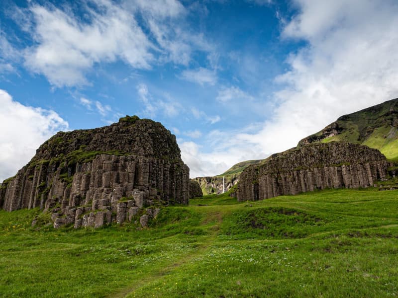
Dverghamrar
Dverghamrar (Dwarf Rocks), just east of Foss, is a peculiar and beautiful columnar basalt formation. On top of the columns, there is cube-jointed basalt.
The landscape is thought to have been molded at the end of the Ice Age. The sea level was higher at that time, and it is believed that the waves caused the peculiar look of the rocks. Dverghamrar is a protected natural monument.
Columnar basalt is formed when lava flow gets cooled, and contraction forces build up. Cracks then form horizontally, and the extensive fracture network that develops results in the six-sided formation of the columns.
View
Haukafell
Haukafell is a forestry and outdoor recreation area east of Fláajökull glacier in southeast Iceland. The forestry project began in 1985 and now provides shelter for low-growing vegetation, including berry bushes that are usually ripe in August.
The area is used by locals and visitors for hiking and nature enjoyment. Several trails lead through the sheltered landscape, and a marked hiking route connects Haukafell with Fláajökull, crossing the Kolgrafardalsá river on a footbridge.
Haukafell is close to Road 1 and has a campsite in a scenic setting. Visitors planning to hike towards Fláajökull should check the weather and trail conditions before setting out, as conditions can change quickly near glacier areas.
View
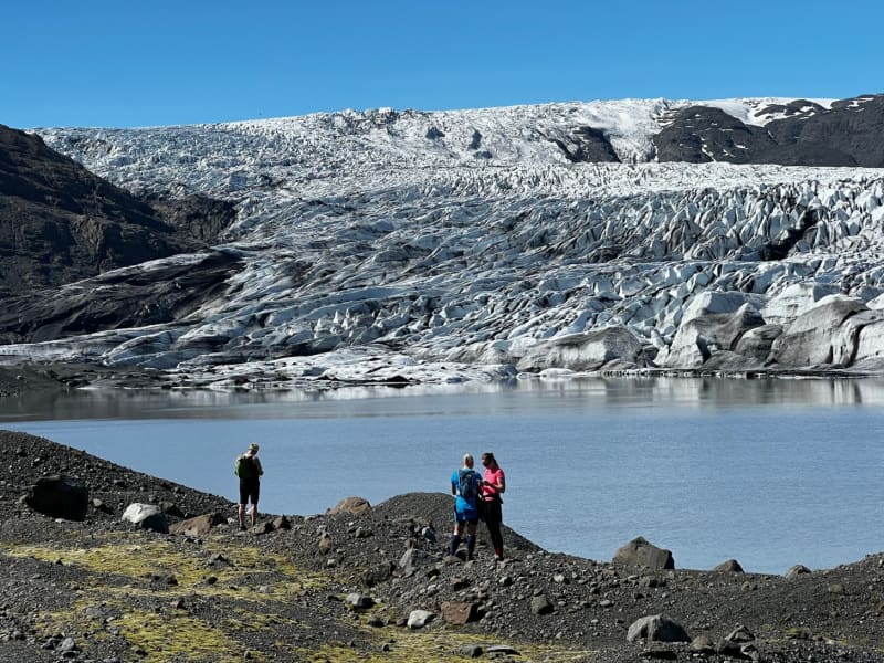
Skálafell – Hjallanes
Skálafell–Hjallanes is a hiking area between Jökulsárlón Glacier Lagoon and Höfn in Hornafjörður, within Vatnajökull National Park. The area gives visitors access to marked walking paths and glacier views in a quieter part of southeast Iceland.
One of the main routes is an 8 km circular hike through the Hjallanes area, leading towards the edge of Vatnajökull glacier. A walking bridge over the river Kolgríma also connects Skálafell with the Heinaberg hiking area, opening up more routes for visitors who want to explore the glacial landscape on foot.
Skálafell is close to Road 1 and can be a good stop for travellers driving between Jökulsárlón and Höfn. Check trail and weather conditions before setting out, and allow around 3–4 hours for the circular hike.
More trail information: Vatnajökull National Park
View
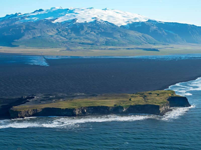
Ingólfshöfði
At the edge of the Atlantic Ocean, Ingólfshöfði is a headland isolated by black sands and perilous rivers from the rest of the mainland.
This historical cape is named after the first settler of Iceland, Ingólfur Arnarson, who spent his first winter there with his family after moving to Iceland, 874-875 A.D.
However, it´s home to thousands of nesting seabirds and gulls, especially puffins and the great skua. Ingólfshöfði is only accessible by organized tours.
View

Hjálparfoss Waterfall
Hjálparfoss is a beautiful, two-stepped waterfall near the confluence of Rivers Thjorsa and Fossa in the Thjorsa Valley. The surrounding area is called Hjalp (Help) because the travelers across the Sprengisandur Route found great help reaching a vegetated area to graze their horses after a long journey in the barren interior.
As elsewhere in the valley, the signs of the eruptions of Mt. Hekla are very prominent by the waterfall, with ashes everywhere.
View
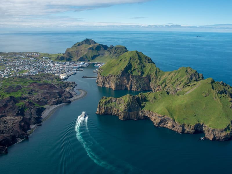
Vestmannaeyjar
The largest island of Vestmannaeyjar is called Heimaey and is the only one of the islands that is inhabited. The island was first settled in 930 A.D., although some sources (with evidence supporting) claim that fishing village had been established there 300 years earlier and that, by that time, Irish monks had already been to Heimaey, too.
The islands are also the only part of Iceland to have endured violent foreign invasion. In the 15th century, the English came to Iceland to trade and occasionally to raid. They kidnapped one governor of Iceland and killed another, and bought local children, which gave rise to the contemporary legend that Icelanders gave away their children but sold their dogs dearly. Their headquarters were on Heimaey, where they built the fortress Skansinn which still remains. But after a war with the Danes and the Hanseatic League in 1468-73, the English withdrew.
A more violent invasion was the “The Turkish Raid” in 1627. Actually, this was launched by Algerians, Moroccan-converted Europeans and commanded by a Dutchman. But as the captives were taken to Algeria, then a suzerainty of the Ottoman Sultan in Constantinople, the raid was blamed on the Turks. It was not until the 1970s that a contemporary law stating that any Turk found in Iceland should be killed on sight was withdrawn. Thankfully, this was never enforced.
The Turks killed and captured some 400 people, most of these from Heimaey, and burned down the church and the warehouse. Ten years later, 27 of the captives were ransomed back to Iceland. The place where the Turks came ashore is still called “Ræningjatangi”, or robber’s peninsula.
Heimaey has a population of about 4800 residents. Its economy is primarily based on commercial fishing. Over 50 fishing vessels work out from Vestmannaeyjar employing over 500 people. Two large fishing plants and several smaller ones employ another 400 residents.The island has a hospital, retirement home and apartments for the elderly, several nursery schools, two elementary schools and one secondary school. A scientific research institute operates in cooperation with the University of Iceland and the town of Vestmannaeyjar.
An eruption on Heimaey in 1973 destroyed 417 houses and the island needed to be evacuated during the night. Over 5000 town residents left in a hurry on sea or air and the eruption added a total of 250 million cubic meters of new volcanic material to the island. To save the port people used sea to stop and re-direct the lava flow and today the Vestmannaeyjar port is good, one of the best in the world in fact.
The Vestmannaeyjar´s natural majesty is rich sea and bird life and the island is also home to a burgeoning ecotourism industry. Visitors can tour the island both on land and sea and a visit to the aquarium devoted to local wildlife is an experience one should not miss. The Vestmannaeyjar archipelago is group of 15 islands first formed by volcanic eruptions some 10.000 years ago. The latest island, Surtsey, formed in 1963 in an eruption from the bottom of the ocean.
The puffin colony in Vestmannaeyjar is the largest in the world. Millions of Atlantic puffins return to Vestmannaeyjar each spring and summer and provide base for a traditional, seasonal industry. Residents collect puffin eggs and hunt birds using nets, according to an elaborate and age-old set of rules and ethics. Annual catches do not exceed 1% of the total puffin population.
The island is well known for cliff-hanging, a sport centuries old and involves climbing and descending the island’s most dramatic rock formations using ropes suspended from the cliff tops. Children and teenagers still practice this sport for its own sake as well as a puffin-hunting technique. Island’s children also save young puffins that have lost their way and direct them to the ocean. They also compete which puffin flies the farthest.
Two overlooks with interpretive signage give breathtaking views of Klettsvik Bay and the town of Vestmannaeyjar. East of Eldfell is a monument to Guðlaugur Fridþórsson, who swam for six hours to reach shore in 1984, when his boat sank five kilometers east of Heimaey.
At Hamarinn, on western Heimaey, there is a monument to Jón Vigfússon, who in 1928, scaled what is considered an unclimbable vertical cliff after his boat stranded, thereby saving the lives of his comrades as well as his own. A small sanctuary or oasis in the middle of the lava field called Eldfellshraun is cultivated by Erlendur Stefánsson and Guðfinna Ólafsdóttir. It throws into high relief the great contrasts in Vestmannaeyjar landscape.
One of the best 18-hole golf courses in Iceland can be found on the island. It is situated in an old volcanic crater under steep cliffs. In spring there is a deep-sea fishing contest and a jazz festival. In summer the islanders host the national soccer tournaments for children and the annual islands festival is in August. Cliff scaling on ropes, can be observed, horses can be rented and many marked hiking trails up volcanoes, over lava fields and through puffin colonies interest visitors. Bird watching is great on the island and the island has a good swimming pool with sauna and hot tubs. A movie about the eruption and rebuilding of the town can be seen and the Folk and Art Museum should not be missed
View
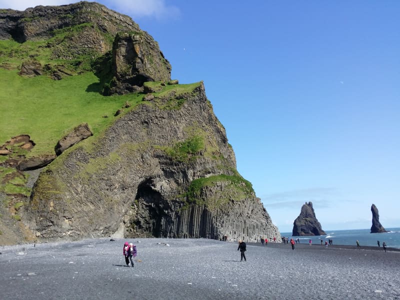
Reynisfjara, Reynisfjall og Reynisdrangar
Reynisfjall is a 340 m high tuff mountain arising out of a volcanic eruption from under a glacier in the penultimate Ice Age, near the village of Vik. Alternating in an irregular manner are layers of tuff, pillow lava and columnar basalt veins and loops.
Reynisdrangar stacks are a collection of 66 m high rock pillars that rise out of the sea and are of the same geological formation as Reynisfjall. On Reynisfjöru beach, very beautiful basalt formations in the south part of the mountain can be seen, and there you will find an exceedingly beautiful cave called Hálsanefshellir.
The waves here are deceiving and have caused the death of a number of visitors in recent years, even in the best of weather. Please take great care and keep a good distance from the sea.
View
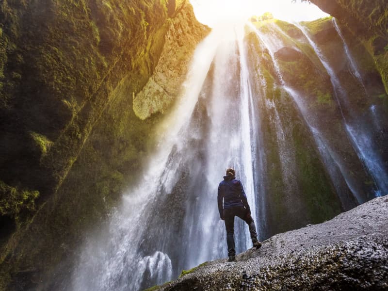
Gljúfrabúi
The waterfall Gljúfrabúi tumbles down from the Gljúfurá River. Its source is north of Tröllagil (Troll Gorge) Canyon in the heath Hamragarðaheiði. It is a spring-fed river and less voluminous than its neighbor Seljalandsá River. The river runs from Tröllagilsmýri (Troll Gorge Marsh), a picturesque fertile marsh in the heath. When the river emerges out of the marsh, it runs into the northern edge of a lava field formed in the volcanic eruptions in Eyjafjallajökull at the beginning of the Holocene. There are several little waterfalls to be found in the river in the area.
Gljúfrabúi, which is 40 m tall, is on the land of the uninhabited farmstead Hamragarðar which the Rangá Foresty Society received as a gift in 1962 and is now owned by the municipality of Rangárþing eystra. There is a certain mystique over the waterfall because it falls into a deep chasm, while in front of it, there is much palagonite rock that blocks the waterfall so that only the very top of it is visible. The boulder that blocks the waterfall is called Franskanef. Previously, people believed that it and the surrounding cliffs were the residences of huldufólk or hidden people. It is possible to take off your shoes and wade the river down in the canyon. It’s a fantastic experience. Caution must be taken when traveling in the canyon because there is a risk of falling rocks. There is an old bath basin below Franskanef, and at the inner end of the basin, there is a little cave called Ömpuhellir, named after a hermit woman who lived there. Gljúfrabúi is a protected natural monument.
A little south of Gljúfrabúi, there is a small canyon in the cliff face from which it is possible to ascend onto the heath above, where there is a spectacular view of the neighboring area. People referred to it as going up Stígurinn (the path); thus, the river in that canyon is named Stígslækur (Path Brook). The path is still relatively clear, with some stairs where it is steepest. Right above the edge, there are ruins of old sheepcotes from Hamragarðar.
View