Find a list of activities to do when your traveling with children.
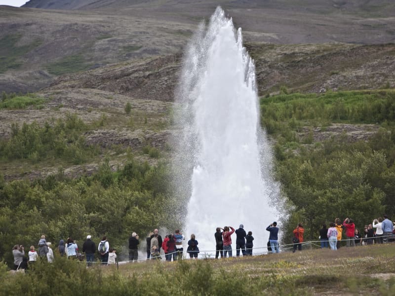
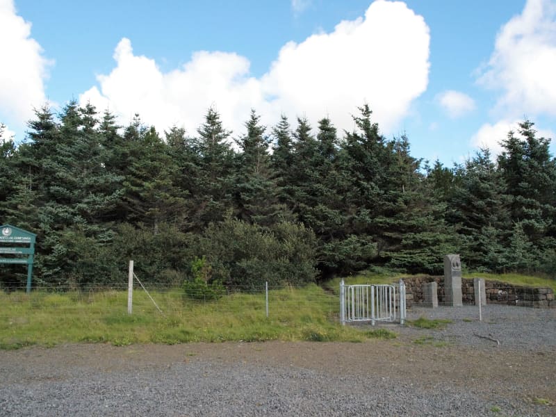
Geysir Geothermal area
One of the greatest natural attractions of Iceland and part of the famous "Golden Circle Tour," The Great Geysir, or Stori-Geysir, has been dormant since 1916 when it suddenly ceased to spout. It came to life only once in 1935 and quickly went back to sleep. Since then, its repose has sporadically been disturbed by the dumping of tons of carbolic soap powder into its seething orifice to tickle it to spout.
It is not exactly known when Geysir was created. It is believed that it came into existence around the end of the 13th century when a series of strong earthquakes, accompanied by a devastating eruption of Mt. Hekla, hit Haukadalur. In this geothermal valley, Geysir is located. What is known is that it regularly spouted every third hour or so up to the beginning of the 19th century and, after that, progressively at much longer intervals until it completely stopped in 1916. Whether its silence is eternal or temporary, no one knows.
When it was alive and shooting, it could thunderously blast a spectacular jet of superheated water and steam into the air as high as 60 to 80 meters, according to different sources. Its opening is 18 meters wide and its chamber 20 meters deep. One reason for cessation is believed to be the accumulated rocks and foreign objects thrown into it by thousands of tourists throughout the years. Though definitely damaging, this could not be the only reason for its dormancy.
The Great Geysir was among the most notable geysers in the world, such as those in Yellowstone Park, New Zealand, and North Iceland. The English word "geyser" is derived from the Icelandic word "geysir," which means gusher. Though the Great Geysir itself is now more or less inactive, the area surrounding it is geothermically very active with many smaller hot springs.
The attraction of the area is now Strokkur (The Churn), another geyser 100 meters south of the Great Geysir, which erupts at regular intervals every 10 minutes or so, and its white column of boiling water can reach as high as 30 meters. The whole area is a geothermal park sitting on top of a vast boiling cauldron. Belching sulfurous mud pots of unusual colors, hissing steam vents, hot and cold springs, warm streams, and primitive plants can all be found here.
A short distance away to the west stands the small Laugarfjall Mountain with a panoramic view overlooking the Geysir area. King Christian IX of Denmark visited the area in 1874 and by the foot of the mountain are the rocks where he leaned while his hosts tried to impress and amuse him by boiling eggs in the hot springs. The rocks are now called Konungssteinar ("The King's Stones").
View
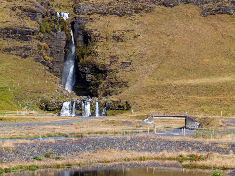
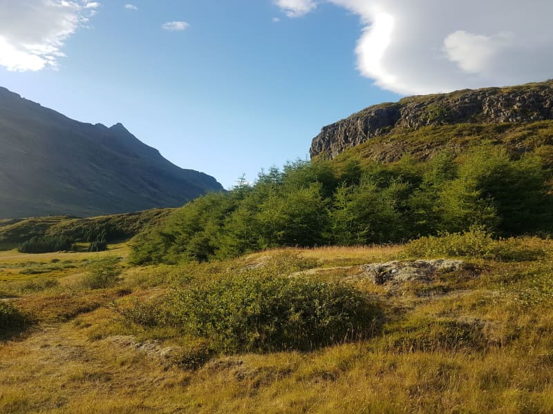
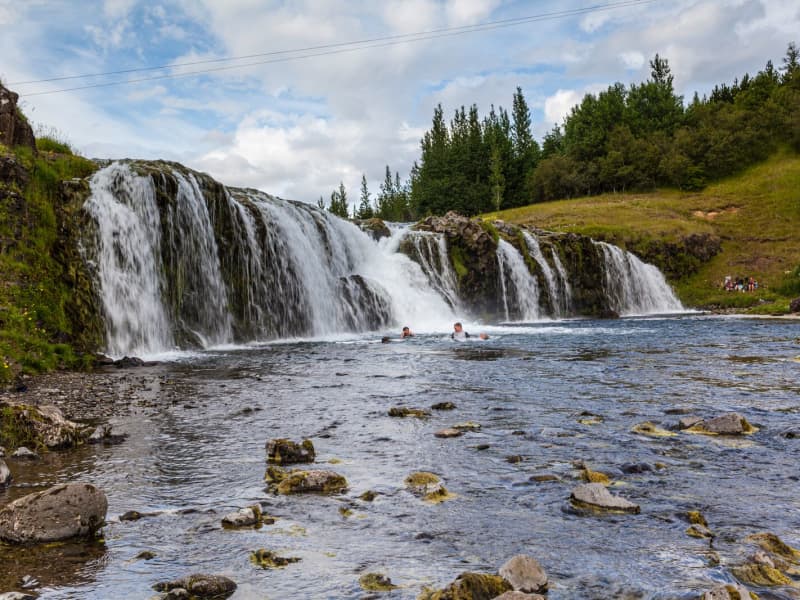
Gluggafoss waterfall
The Merkjá River has several beautiful waterfalls, but the most outstanding is Gluggafoss or Window Falls(also known as Merkjárfoss). The upper half of the cliff is palagonite or tuff rock, and the lower ledge is basalt. The river has formed tunnels and grooves through the soft rock and a series of ‘windows’ in the tunnels, thereby earning the name ‘Gluggafoss.’
The river passes under a stone arch at the very top of the falls. As the rock is relatively soft, the waterfall has changed over time. Around 1947 the upper half of the waterfall could hardly be seen as the water flowed into a vertical tunnel behind the cliff. It was only visible through three different openings or ‘windows’ one above the other. The water came out through the bottom ‘window’, forming a beautiful arch, except when the water rose in the river, forcing it through all three windows.
Further changes occurred when Hekla erupted in 1947, causing a 20 cm thick layer of volcanic ash to be carried downstream by the river. The vertical tunnel formation nearly disappeared as it filled with ash. It has taken almost 50 years for the falls to return to their former glory.
More geosites in the neighborhood: www.katlageopark.com
View
Skaftafell
Scenic nature, favorable weather conditions, and a network of hiking trails make Skaftafell in Vatnajökull National Park an ideal destination to enjoy outdoor activities in Icelandic nature. Short and easy trails lead to the waterfall Svartifoss and Skaftafellsjökull glacier. Still, those who want to reach further out Morsárdalur valley and Kristínartindar mountain peaks are perfect in terms of distance and labor. Skaftafell is also the ideal base camp for those who seek to climb Iceland‘s highest mountain peak, Hvannadalshnúkur.
During the summer months, the national park offers interpretive tours with rangers. Ask for information at the desk or check the park´s website.
Private travel companies operate in Skaftafell and offer guided hikes on the nearby glaciers and mountains. Also on offer are sightseeing flights over the Vatnajökull glacier and other renowned attractions.
Vatnajökulsþjóðgarður
View
Reykjadalur valley
Reykjadalur valley is the most popular and arguably the most beautiful hiking area in Ölfus. Hot springs and colorful areas full of geothermal activity entertain along a hiking trail that leads to a hot river. For some of the river's length, the temperature is perfect for bathing, and that's a wonderful natural experience.
The trail by Reykjadalur can be closed, so it's good to check the conditions before going. To check whether the valley is open or closed to visitors, check out the website of Safetravel.is. Those who plan on visiting the valley need to respect the rules and stay on the paths. Please help us to protect the fragile vegetation around the area!
View
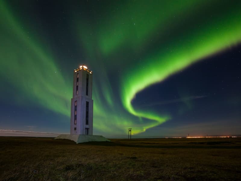
Knarrarósviti Lighthouse
Built-in 1938-1939, the lighthouse was the first one in Iceland to be built out of reinforced concrete. For a long time, the lighthouse was the tallest building in South Iceland, 26,2 meters (86 feet) high. It was designed by the engineer Axel Sveinsson as a blend of functionalism and art nouveau (jugendstil). In summertime (mid of June to start August) the lighthouse is open every day.
Knarrarósviti lighthouse is part of the beautiful South Coast Lighthouse trail that you can find more information about here.
View

Lækjargarður
Lækjargarður is a delightful outdoor recreation area situated in the village of Flúðir in South Iceland. Nestled beside a gentle stream and surrounded by lush greenery, the park offers a peaceful, family-friendly environment where nature and community converge.
The park boasts a variety of amenities catering to visitors of all ages. Children can enjoy the large jumping pillow and a thrilling zipline, providing endless fun and excitement. For sports enthusiasts, there's a beach volleyball court and a frisbee golf course, perfect for friendly competitions and outdoor exercise. Picnic areas and grassy lawns invite relaxation and social gatherings, while the stream adds a tranquil ambiance to the setting.
Adding an element of adventure, Lækjargarður features the Spot the Owl trail, a playful activity where visitors can search for owl figures hidden along the walking paths. This activity engages both children and adults in a fun exploration of the park.
View
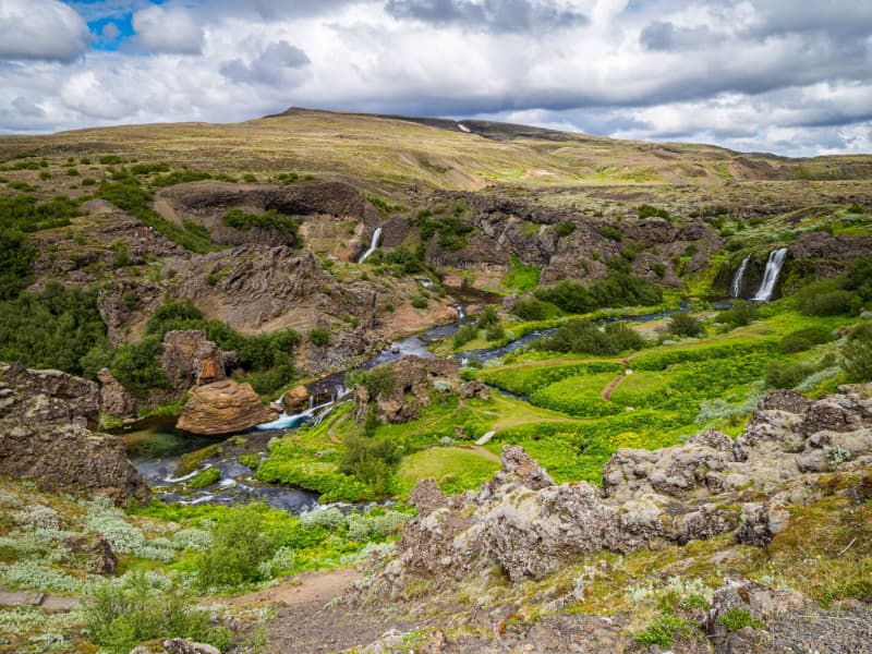
Gjáin in Þjórsárdalur valley
This beautiful natural phenomenon and oasis at the edge of the central highlands should not be passed by if you are traveling in the Thjorsar Valley. The Red River (Rauda) cascades into and through this gorge, and the surroundings are amply vegetated. River Thjorsa ran through before a dike was built between the mountains Sandafell and Skeljafell to redirect it.
One of the younger Tungnaa-Lavas ran down the gorge, leaving a thin layer on its bottom and walls and a thicker layer on the edges. The lava formations are worth taking a closer look at. An easy 10 minutes walk takes you into this beautiful area from the archaeological excavations at Stong, and another approach is from the car track on edge.
Some find this place so beautiful they (secretly) have strewn their ashes in the river to be forever united with monumental nature in this "paradise on earth."
View
Einbúi, Oddgeirshólar
A beautiful sports and outdoor recreational area on the banks of Hvítá River. The area is owned by the Youth Association Baldur.
View
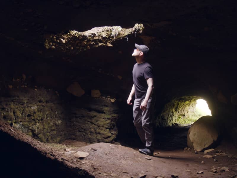
Efra-Hvolshellar caves
The caves in Efra-Hvol (Upper Hvol) have histarically been referred to as „the Irish Caves“ which are set into the so-called, „Irish Heath“. It was originally thought that many of these man-made or artificial caves were madein the 19th century, but in fact, their histofical names appear to confirm they originated even beforr the settlement period.
More geosites in the neighbourhood: www.katlageopark.com
View

Hjálparfoss Waterfall
Hjálparfoss is a beautiful, two-stepped waterfall near the confluence of Rivers Thjorsa and Fossa in the Thjorsa Valley. The surrounding area is called Hjalp (Help) because the travelers across the Sprengisandur Route found great help reaching a vegetated area to graze their horses after a long journey in the barren interior.
As elsewhere in the valley, the signs of the eruptions of Mt. Hekla are very prominent by the waterfall, with ashes everywhere.
View

Haukafell
Haukafell is a forestry and outdoor recreation area east of Fláajökull glacier in southeast Iceland. The forestry project began in 1985 and now provides shelter for low-growing vegetation, including berry bushes that are usually ripe in August.
The area is used by locals and visitors for hiking and nature enjoyment. Several trails lead through the sheltered landscape, and a marked hiking route connects Haukafell with Fláajökull, crossing the Kolgrafardalsá river on a footbridge.
Haukafell is close to Road 1 and has a campsite in a scenic setting. Visitors planning to hike towards Fláajökull should check the weather and trail conditions before setting out, as conditions can change quickly near glacier areas.
View
Reykjafoss
The Botanical garden in Hveragerði is in the center of the town. Since 1983 it has given people the chance to relax and enjoy nature amongst the trees and the wonderful river Varmá with the waterfall Reykjafoss right next to the garden.
Further along the river, a hiking trail goes past the ruins of an old wool factory and ruins of a hydroelectric powerplant surrounded by colorful hot-spring areas.
View
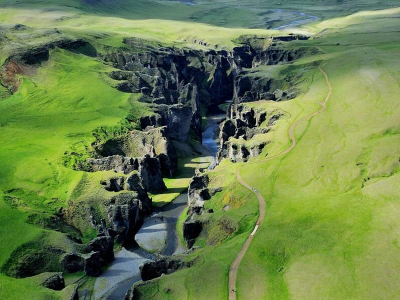
Fjaðrárgljúfur canyon
Fjaðrárgljúfur is 6 kilometers from Road 1; take road F206. People can travel by small cars to Fjaðrárgljúfur all year round. Fjaðrárgljúfur is a magnificent and massive canyon, about 100 meters deep and about two kilometers long. The canyon has sheer walls and is somewhat serpentine and narrow. The bedrock in Fjaðrárgljúfur is mostly palagonite from cold periods of the Ice Age and is thought to be about two million years old. The river Fjaðrá has its source in the mountain Geirlandshraun and falls off the heath edge in this stunning canyon until it makes it down into the Skaftá river. Fjaðrá has changed a lot over time.
Formation of the Fjaðrárgljúfur canyonIt is believed that Fjaðrárgljúfur was formed at the end of the last Ice Age, about nine thousand years ago. When the glacier retreated, a lake formed in the valley behind a hard, resistant rock. The run-off from the lake flowed to where Fjaðrárgljúfur is today. Glacial rivers from the glacier’s edge carried a lot of sediment into the lake, and the river which ran from it dug itself down into the rock and down onto the palagonite in front of it. Because the cascade was so large, it was powerful in digging out the canyon. Eventually, the lake filled with sediments, and the river’s strength dwindled. When the lake filled up completely, the river began to dig into the sediment layers it had previously left in the valley. Fluvial terraces on both sides of the valley indicate the original height and location of the lake while a deep channel in the palagonite serves as a silent reminder of the power of nature.
More geosites in the neighborhood: www.katlageopark.com
View
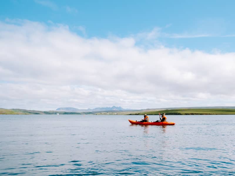
Úlfljótsvatn
Úlfljótsvatn is a family campsite run by the Icelandic Scout Association that has served as their home since 1941. At Úlfljótsvatn, campers can camp by the side of a beautiful lake and venture into some activities like Climbing, Kayaking, Archery, or Hiking.
Úlfljótsvatn sits in a privileged position just a few minute’s driving from Þingvallavatn. This means you can enjoy Icelandic gems like Þingvellir, Geysir, and Gullfoss within an hour of driving. Kérið, the volcanic crater lake, is also situated 15 min drive from our location.
Great first stop on the south coast, nature at its best, and Icelandic wonders on very easy reach.
View
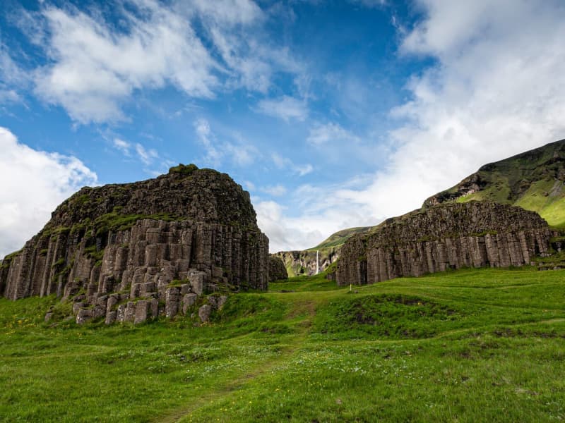
Dverghamrar
Dverghamrar (Dwarf Rocks), just east of Foss, is a peculiar and beautiful columnar basalt formation. On top of the columns, there is cube-jointed basalt.
The landscape is thought to have been molded at the end of the Ice Age. The sea level was higher at that time, and it is believed that the waves caused the peculiar look of the rocks. Dverghamrar is a protected natural monument.
Columnar basalt is formed when lava flow gets cooled, and contraction forces build up. Cracks then form horizontally, and the extensive fracture network that develops results in the six-sided formation of the columns.
View
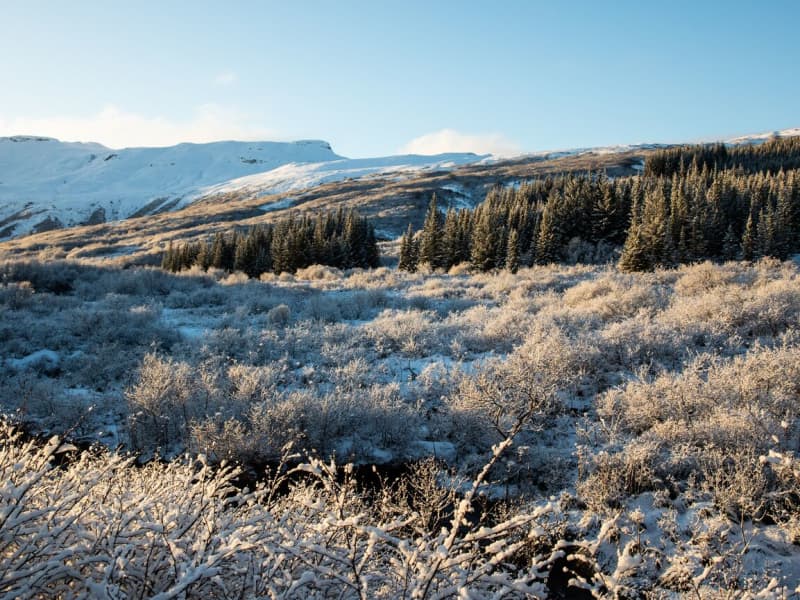
Þjórsárdalsskógur Forest
The natural setting of the forest follows a varied landscape of intense contrasts, from flowering forests to unripe ash hake from Hekla. The forest is mostly birch and spruce, pine, and larch mixed forests. An ideal place for outdoor activities, as there are many marked and unmarked paths and forest roads in the woods.
Þjórsárdalsskógur lies west of Highway 32, where it goes east towards Búrfellsvirkjun. You can get into the forest from Ásólfsstaðir and also via a bridge over Sanda, a short way into the valley. The campsite in Þjórsárdalur is in between and is well marked.
In Þjórsárdalur, the forest stretches far up the slopes, the landscape is beautiful and varied, and it has a true fairytale atmosphere. There are numerous marked and unmarked paths and trails in the forest for travelers and hikers, rivers to swim in, and lava to explore. In the area, there are paths for wheelchairs, good camping, and a swimming pool in Árnes, about 15 kilometers down in the countryside.
Source: skoraekt.is
View
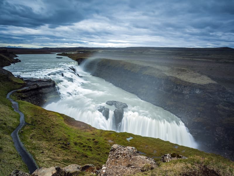
Gullfoss waterfall
Gullfoss is two separate waterfalls; the upper one has a drop of 11 meters and the lower one 21 meters. The rock of the river bed was formed during an interglacial period.
Water flows over Gullfoss at an average rate of 109 cubic meters per second. The heaviest floods have recorded a flow of 2000 cubic meters per second. During the summer, the flow is 130 cubic meters per second, which would take only 3 seconds to fill this building. People were eager to exploit the power potential of Gullfoss, and many plans for hydroelectric developments on the river Hvítá have been proposed.
The trails by Gullfoss can be closed, so it's good to check the conditions before going. To check whether it is open or closed to visitors, check out the website of Safetravel.is.
View
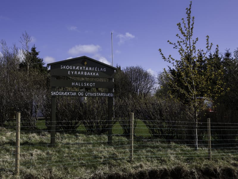
Hallskot - Recreation Forest
A recreation area north of Eyrarbakki in supervision of the forestry community of Eyrarbakki, Skógræktarfélag Eyrarbakka. In Hallskot is a perfect picnic area with benches and tables where one can always find a windless spot in the groves.
ADDRESS: 820 EYRARBAKKI / TEL: (+354) 660 6130, (+354) 847 5028 SKOGRAEKTARFELAGEYRARBAKKA@GMAIL.COM / GPS: 63°53'57.0"N 21°10'19.1"W
View
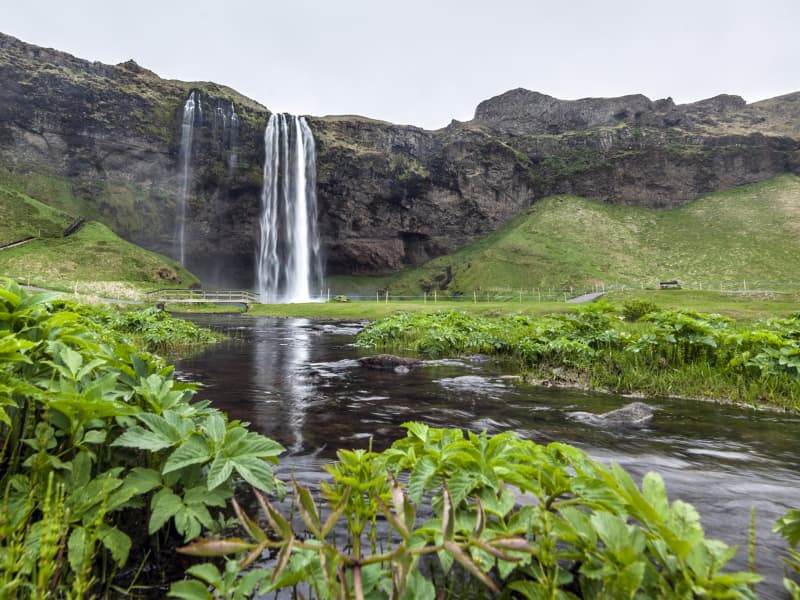
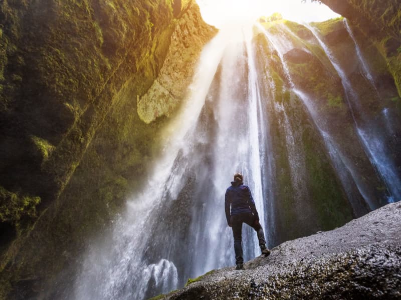
Seljalandsfoss waterfall
A unique waterfall in the river Seljalandsá, about 30 km west of Skógar: it is 60 meters high with a footpath behind it at the bottom of the cliff, but with a thin cascade. It is the only known waterfall of its kind where it is possible to walk behind it. The waterfall is very picturesque; therefore, its photo can be found in many books and calendars.
Access to the waterfall is from the farm of Seljaland along the Ring Road, Iceland's main highway. Several falls a little further to the west, including the interesting Gljúfrabúi, partially masked by its canyon. Access to it is from Hamragarðar farm along the road, east of Markarfljót.
These "do-not-miss" attractions lie very close to the main Ring Road at the base of the Eyjafjallajökull Glacier, on the road leading into Thorsmörk.
During winter, the area around Seljalandsfoss waterfall can be dangerous as paths can be slippery and large pieces of ice fall, making it extremely dangerous to venture too close to the cliffs and particularly dangerous to walk behind the waterfall. The fine mist from the waterfall freezes on the cliffs and the ceiling of the path behind the waterfall, but when the weather warms, and the ice begins to thaw, it can fall off in large chunks, which can be dangerous. People are advised to show caution and respect the closure of the paths. More information can be found on www.safetravel.is
View
Þórsmörk
Þórsmörk (Thórsmörk) is a natural gem that sits between Mýrdalsjökull to the east, the river Krossá in the south, with Markárfljót and Þröngá Rivers to the north. Its diverse landscape is characterized by impressive gorges, ravines, scrubby slopes, and a wide variety of unique vegetation. In times past, the farmers of Fljótshlíð and the area under Eyjafjall pastured their sheep all year round due to the mild climate found within þórsmörk.
Since the 1918 eruption of Katla, Þórsmörk was designated as a Natural Mountain Reserve. There are many curious natural rock formations in the area, such as Snorraríki, Sóttarhellar Cave, Álfakirkja (The Church of the Elves), Stakkholtsgjá Gorge, and the stone arch in Stóra Enda. Only large jeeps and buses can navigate the road into Þórsmörk due to the ever-changing volume of water, which can turn small and easily passable tributaries into tumultuous rivers in a matter of hours.
View
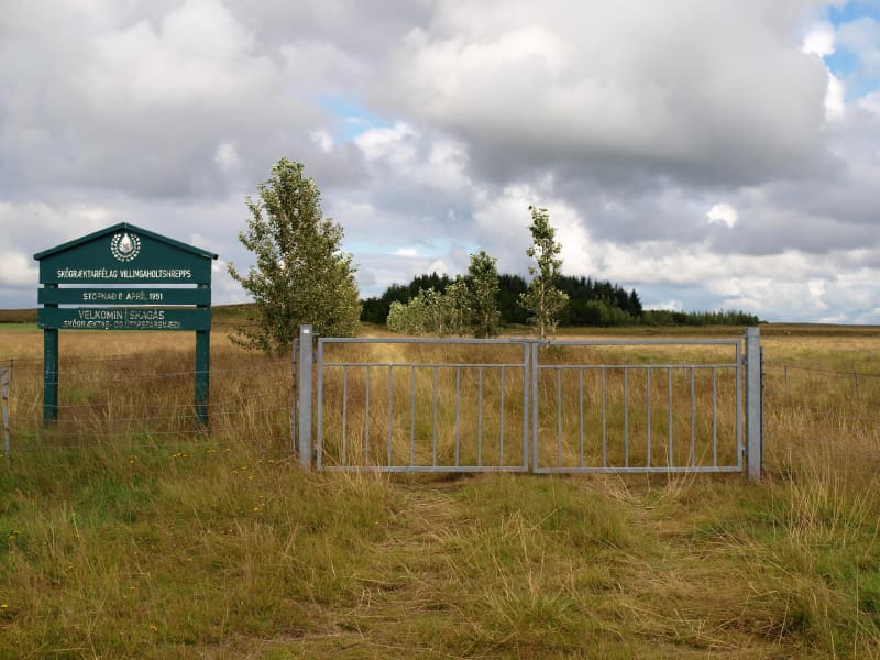
Skagaás grove
Skagaás grove is a small forest area in Flóahreppur, surrounded by young woodland and open countryside. The area has walking paths through birch, spruce, and pine trees, making it suitable for a short walk, a picnic, or a quiet stop while traveling in the area.
The grove is open to visitors and is easily accessible. Please help keep the area clean by taking all litter with you. Barbecuing is only allowed in the designated area because of fire risk.
View
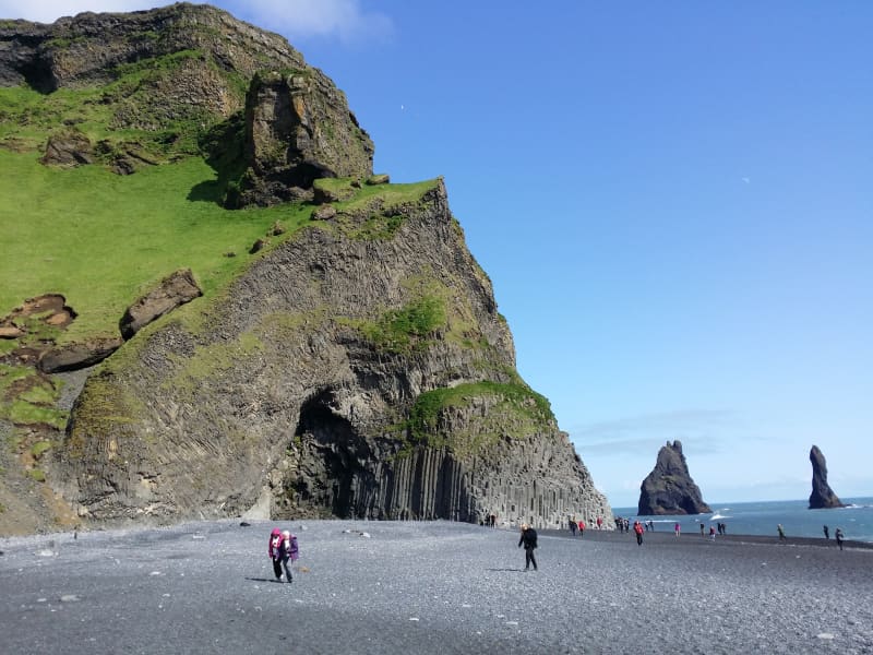
Reynisfjara, Reynisfjall og Reynisdrangar
Reynisfjall is a 340 m high tuff mountain arising out of a volcanic eruption from under a glacier in the penultimate Ice Age, near the village of Vik. Alternating in an irregular manner are layers of tuff, pillow lava and columnar basalt veins and loops.
Reynisdrangar stacks are a collection of 66 m high rock pillars that rise out of the sea and are of the same geological formation as Reynisfjall. On Reynisfjöru beach, very beautiful basalt formations in the south part of the mountain can be seen, and there you will find an exceedingly beautiful cave called Hálsanefshellir.
The waves here are deceiving and have caused the death of a number of visitors in recent years, even in the best of weather. Please take great care and keep a good distance from the sea.
View
Timburhóll - Grove
Timburhóll is a beautiful grove where you can relax and enjoy the surroundings. You could even barbecue using the barbecue facilities provided but use caution with the fire and make sure not to leave any litter. This is also a memorial site of the great Icelandic artist and painter Ásgrímur Jónsson as well as the farmers Guðfinna Guðmundsdóttir and Stefán Jasonarson.
View
Haukadalsskógur Forest
Haukadalsskógur is a lush and expansive forest in Haukadalur valley, just a short drive from the famous Geysir geothermal area. Known for its tranquil atmosphere and diverse plant life, the forest offers a unique contrast to the dramatic geothermal landscapes nearby, making it a perfect stop for those seeking peace and natural beauty.
One of the largest national forests in South Iceland, Haukadalsskógur is also the most extensively planted of all Iceland’s national forests. It stands as a remarkable example of long-term reforestation, with planting efforts dating back to the early 20th century. Today, the forest features a rich mix of native birch and imported conifer species, creating a varied and shaded environment ideal for walking, picnicking, and nature observation.
The forest's outdoor facilities are well-developed and thoughtfully maintained. Among its standout features is a specially designed wheelchair-accessible trail, created in close cooperation with Sjálfsbjörg, the local association for people with disabilities in Iceland. This makes Haukadalsskógur an inclusive destination where everyone can enjoy the beauty of the outdoors.
View
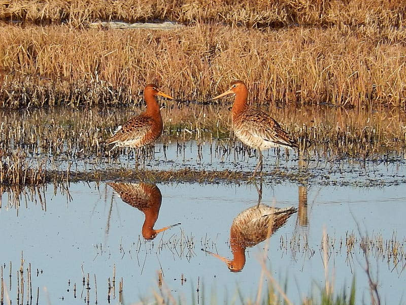
The Flói Bird Reserve
Northwest to the town of Eyrarbakki is a wetland area, rich in birdlife. The reserve has walking paths and a bird hide, an ideal spot for bird watching. The Flói Bird Reserve is listed in the Bird Life international Association. The Reserve is characterized by its flood meadows and numerous small ponds. Approximately 70 species of birds have been recorded in the Reserve. During spring and autumn migration Greylag Geese and White-fronted Geese can be found as well as Wigeon and Tufted Duck and various waders such as Snipe and passerines like Wheatear. During winter, birds, chiefly gulls and sometimes Long-tailed Duck and Common Eider, are concentrated in the estuary of the river Ölfusá. Whooper Swan, Teal, Mallard and Goosander are attracted to open water in winter.
View
Fishing in Landmannaafréttur
Many other lakes, apart from Veiðivötn, are located south of Tungnaá, and fishing permits for twelve of them can be bought from the wardens at Landmannahellir.
These are the lakes Blautuver, Dómadalsvatn, Eskihlíðarvatn, Frostastaðavatn, Herbjarnarfellsvatn, Hnausapollur (Bláhylur), Hrafnabjargavatn, Kílingavötn, Lifrafjallavatn, Ljótipollur, Löðmundarvatn and Sauðleysuvatn. Ljótipollur and Hnausapollur are the youngest of these lakes, with the former dating from 1477 and the latter from 871.
Most of these are closed lakes, although Helliskvísl flows out from Löðmundarvatn, and Blautuver and Klingavötn are connected to Tungnaá. Only trout is caught in Ljótapollur, Herbjarnarfellsvatn, Lifrarfjallavatn and Dómadalsvatn. Trout and Arctic char is caught in Blautuver, Frostastaðavatn and Kílingavötn, but only Arctic char in other lakes.
View
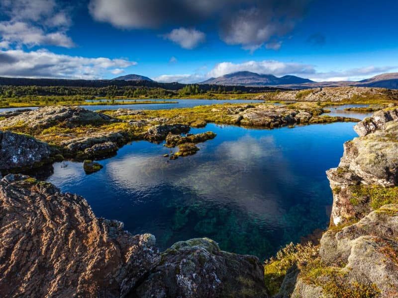
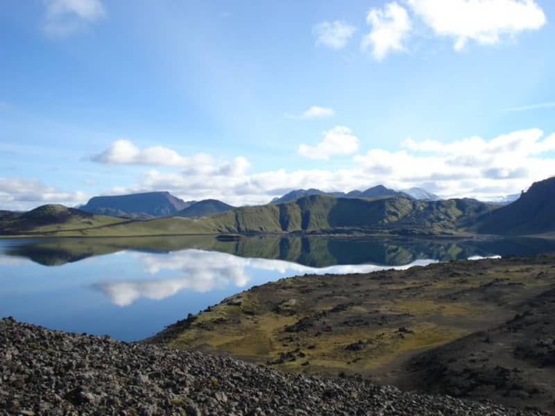
Þingvallavatn Lake
Lake Þingvallavatn lies in a rift valley that extends south from the Langjokull glacier to mount Hengill and from Botnssulur mountains in the west to Lyngdalsheidi heath in the east. The lake is the largest natural lake in Iceland, about 84 square kilometers, at an altitude of approximately 100 meters above sea level. The deepest part of the lake measures 114 meters, which means it reaches below sea level. The catchment area of Lake Thingvallavatn, about 1300 square kilometers, lies in the same direction as the fissure in the area, and its existence is closely connected with its geological history. The water in the lake is very cold and therefore very pure, so snorkeling and diving are popular. Silfra, one of the fissures in the northern part of the lake, is one of the most popular diving spots in Iceland.
View
Hellisskógur forest
Hellisskógur is a small forest just outside of the town of Selfoss. In Hellisskógur are roads, walking paths around the area, and benches so visitors can relax and enjoy the site.
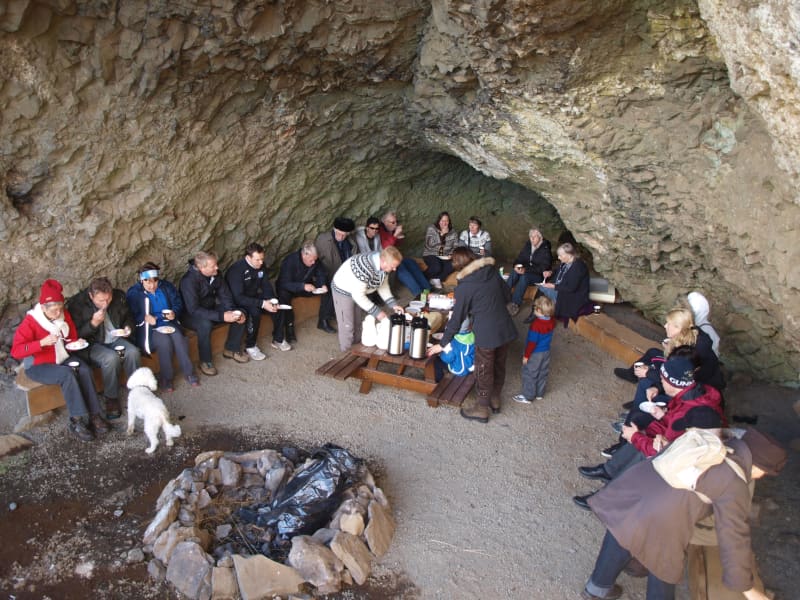
The cave in Hellisskógur forest was formed during a latter glacial period by sea erosion. Sea levels have been higher than now several times, and signs of sea erosion can be seen on more cliffs in the area, made of around 0, 7 – 3, 1 million-year-old basalt. The cave was previously used to store hay in the back and as a sheepcote in the front.
It was once believed that the cave was haunted by a ghost wearing a blue scarf. The story tells of a young man who was broken hearted and hung himself in the cave using a long blue scarf.
Here is a map of Hellisskógur
View
Gljúfrabúi
The waterfall Gljúfrabúi tumbles down from the Gljúfurá River. Its source is north of Tröllagil (Troll Gorge) Canyon in the heath Hamragarðaheiði. It is a spring-fed river and less voluminous than its neighbor Seljalandsá River. The river runs from Tröllagilsmýri (Troll Gorge Marsh), a picturesque fertile marsh in the heath. When the river emerges out of the marsh, it runs into the northern edge of a lava field formed in the volcanic eruptions in Eyjafjallajökull at the beginning of the Holocene. There are several little waterfalls to be found in the river in the area.
Gljúfrabúi, which is 40 m tall, is on the land of the uninhabited farmstead Hamragarðar which the Rangá Foresty Society received as a gift in 1962 and is now owned by the municipality of Rangárþing eystra. There is a certain mystique over the waterfall because it falls into a deep chasm, while in front of it, there is much palagonite rock that blocks the waterfall so that only the very top of it is visible. The boulder that blocks the waterfall is called Franskanef. Previously, people believed that it and the surrounding cliffs were the residences of huldufólk or hidden people. It is possible to take off your shoes and wade the river down in the canyon. It’s a fantastic experience. Caution must be taken when traveling in the canyon because there is a risk of falling rocks. There is an old bath basin below Franskanef, and at the inner end of the basin, there is a little cave called Ömpuhellir, named after a hermit woman who lived there. Gljúfrabúi is a protected natural monument.
A little south of Gljúfrabúi, there is a small canyon in the cliff face from which it is possible to ascend onto the heath above, where there is a spectacular view of the neighboring area. People referred to it as going up Stígurinn (the path); thus, the river in that canyon is named Stígslækur (Path Brook). The path is still relatively clear, with some stairs where it is steepest. Right above the edge, there are ruins of old sheepcotes from Hamragarðar.
View
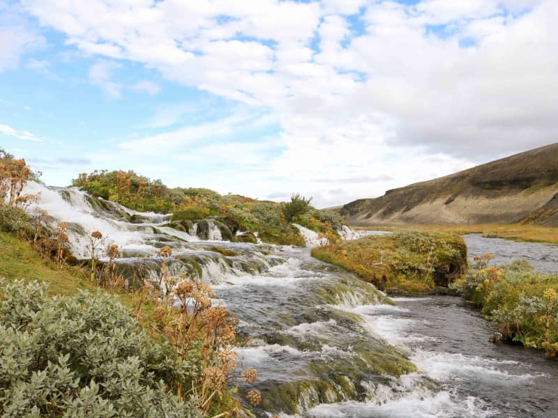
Fossabrekkur
The uppermost falls in the Ytri-Rangá river are called Fossabrekkur. The falls are just below the western source of the river just after entering the common land of the Landmannaafréttur.
Fossabrekkur is a fertile oasis in the barren pumice landscape. It is necessary to drive to the location to see this gem, as it is well hidden.
Fossabrekkur is a unique and beautiful location where the western arm of Ytri-Rangá falls off the rocks into the eastern cape and runs after that in a single channel almost to the sea.
View