Skip to content

Or try searching by Category and/or Location

Places Away From the Crowd

Þjórsárdalsskógur Forest
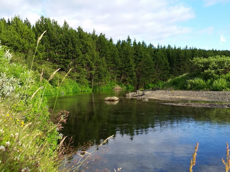
The natural setting of the forest follows a varied landscape of intense contrasts, from flowering forests to unripe ash hake from Hekla. The forest is mostly birch and spruce, pine, and larch mixed forests. An ideal place for outdoor activities, as there are many marked and unmarked paths and forest roads in the woods.  
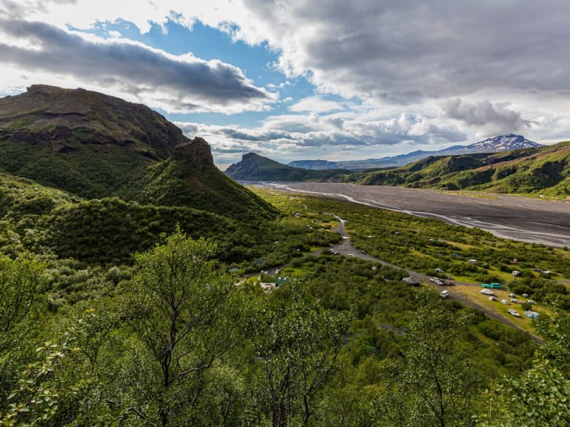
Þjórsárdalsskógur lies west of Highway 32, where it goes east towards Búrfellsvirkjun. You can get into the forest from Ásólfsstaðir and also via a bridge over Sanda, a short way into the valley. The campsite in Þjórsárdalur is in between and is well marked. In Þjórsárdalur, the forest stretches far up the slopes, the landscape is beautiful and varied, and it has a true fairytale atmosphere. There are numerous marked and unmarked paths and trails in the forest for travelers and hikers, rivers to swim in, and lava to explore. In the area, there are paths for wheelchairs, good camping, and a swimming pool in Árnes, about 15 kilometers down in the countryside. Source: skoraekt.is  
Kerlingarfjöll Mountains
The mountain massif Kerlingarfjöll (The Giantess Mountains; 800 - 1500 m) is the main ornament in the chain of mountains and glaciers framing the Kjölur area. It covers about 150 km² area southeast of The Temple Glacier (Hofsjökull)  It derives its name from a single, 25 m high and dark hyaloclastite pillar protruding from the light-colored, rhyolite scree of the peak Kerlingartindur. The aforementioned types of rock represent the main structure of the mountain massif and this yellowish tint is the dominant color in the area.The area is full of small steaming hot springs, mud pools, and water fountains. It is truly a hiker's paradise. It is one of the largest geothermal areas in all of Europe and there are future plans to construct a large geothermal steam plant here for electricity to harness the massive amounts of energy stored here. The area is very unique, sensitive, and beautiful - why such a decision may be controversial if proper conservational steps are not taken when doing so.It is recommended to use 4wd vehicles because of the various and changing condition of the tracks and unbridged rivers, which have to be forded with the greatest of care. It is also recommended that people read the special brochure on driving in the interior before heading up there and remember, that off-road driving is strictly forbidden. Many of those who have visited the interior catch the bug and the only remedy is to come back again and again. It is like an incurable disease. Traveling across the interior was common during the Saga period, but after that up to the middle of the 18th century, superstition kept people away. Nowadays - more and more people enjoy this part of the country the whole year-round. The small glacier patches up there have been retreating fast and now the summer skiing school, which was operated for decades, exists no more. Its complex of houses is now being used to accommodate travelers in the area during the summer months.
Gluggafoss waterfall
The Merkjá River has several beautiful waterfalls, but the most outstanding is Gluggafoss or Window Falls(also known as Merkjárfoss). The upper half of the cliff is palagonite or tuff rock, and the lower ledge is basalt. The river has formed tunnels and grooves through the soft rock and a series of ‘windows’ in the tunnels, thereby earning the name ‘Gluggafoss.’  The river passes under a stone arch at the very top of the falls. As the rock is relatively soft, the waterfall has changed over time. Around 1947 the upper half of the waterfall could hardly be seen as the water flowed into a vertical tunnel behind the cliff. It was only visible through three different openings or ‘windows’ one above the other. The water came out through the bottom ‘window’, forming a beautiful arch, except when the water rose in the river, forcing it through all three windows.  Further changes occurred when Hekla erupted in 1947, causing a 20 cm thick layer of volcanic ash to be carried downstream by the river. The vertical tunnel formation nearly disappeared as it filled with ash. It has taken almost 50 years for the falls to return to their former glory. More geosites in the neighborhood: www.katlageopark.com
Þórsmörk
Þórsmörk (Thórsmörk) is a natural gem that sits between Mýrdalsjökull to the east, the river Krossá in the south, with Markárfljót and Þröngá Rivers to the north. Its diverse landscape is characterized by impressive gorges, ravines, scrubby slopes, and a wide variety of unique vegetation. In times past, the farmers of Fljótshlíð and the area under Eyjafjall pastured their sheep all year round due to the mild climate found within þórsmörk.  Since the 1918 eruption of Katla, Þórsmörk was designated as a Natural Mountain Reserve. There are many curious natural rock formations in the area, such as Snorraríki, Sóttarhellar Cave, Álfakirkja (The Church of the Elves), Stakkholtsgjá Gorge, and the stone arch in Stóra Enda. Only large jeeps and buses can navigate the road into Þórsmörk due to the ever-changing volume of water, which can turn small and easily passable tributaries into tumultuous rivers in a matter of hours. 
Knarrarósviti Lighthouse
Built-in 1938-1939, the lighthouse was the first one in Iceland to be built out of reinforced concrete. For a long time, the lighthouse was the tallest building in South Iceland, 26,2 meters (86 feet) high. It was designed by the engineer Axel Sveinsson as a blend of functionalism and art nouveau (jugendstil).  In summertime (mid of June to start August) the lighthouse is open every day. Knarrarósviti lighthouse is part of the beautiful South Coast Lighthouse trail that you can find more information about here. 
Selvogsviti Lighthouse
Selvogsviti was built in 1919 and rebuilt in 1931. The light height is 20 meters above sea level. In 1919, a 15-meter high iron frame was built on Selvogstangi. It was fitted with a 3.3 meter high light and a 200 ° dioptric 1000 mm lens and gaslight fixture. The lighthouse was the same type as the Stokksnes lighthouse, built-in 1922. After only ten years, the lighthouse had become so rusty that it became necessary to build a new lighthouse, and in 1930 a 15.8 m high lighthouse was made of concrete. A year later, the lighthouse, lens, and gaslight fixtures of the iron frame lighthouse were installed on it, and the new Selvog lighthouse was taken into use. In 1987, the walls of the lighthouse were renovated. The lighthouse was electrified a year later, and a radar detector was installed on it. The light is now lit on the lighthouse for safety reasons, but the radio transmitters on top of it are the most important thing now. The lighthouse is still in operation and is fully automated today.   Selvogsviti lighthouse is part of the beautiful South Coast Lighthouse trail that you can find more information about here.  
Heinaberg
Heinaberg is a beautiful area that consists of Heinabergsjökull glacier, the glacial lagoon Heinabergslón, where you can go kayaking among the icebergs during summer, and stunning landscape. The Heinaberg area is part of Vatnajökull National Park.  The gorgeous glacial lagoon of Heinaberg, Heinabergslón, is accessible by car and is often studded with large chunks of glacier that break off the Heinabergsjökull glacier. The area offers excellent conditions for hikers, as it has several interesting hiking trails, along which one can see waterfalls, ravines, volcanic intrusions, and even, on a lucky day, a reindeer.   The gravel road from road no 1 to the glacial lake is not in service during the winter months. Therefore, one needs to be aware of changes in road conditions and accessibility. Vatnajökulsþjóðgarður  
Hoffell
Hoffell is a farmland area characterized by a large outlet glacier named Hoffellsjökull and gabbro rock. Gabbro rock originated deep in the earth but is visible in the area due to the uplift of the area and glacial erosion, which gives the environment a greenish hue in the otherwise dark rocks. The Hoffell area is 15 kilometers from the town of Höfn. Driving or hiking north from Hoffell along the sands of Hoffellssandur, you will enjoy the spectacular scenery of mountain slopes carved out by earlier glaciers. Along the sands of Hoffellssandur, you will enjoy the stunning scenery of mountain slopes carved out by earlier glaciers. Along the way, a borehole is also constructed to extract geothermal water. Finally, you reach the ice of the glacier tongue, Hoffellsjökull, skirted by the numerous hiking trails of the Geitafell mountain. The area is partly within Vatnajökull National Park, preserved for outdoor recreation and is rich in vegetation, wildlife, and geological variety. The area’s many hiking trails offer a stunning view of the diverse, beautiful wonders it has to offer.  
Svartifoss waterfall
Svartifoss is one of the unique waterfalls in South Iceland. It is situated in Skaftafell, which belongs to Vatnajökull National Park. Svartifoss is 20 meters (80ft) high. It is bordered on both sides by tall black basalt columns.  The hike to Svartifoss starts at the Visitor Centre in Skaftafell. You can also find all sorts of information and advice about the area. The hike is about 1.9 km or 45 minutes (one way).   Skaftafell Visitor Centre, Skaftafell