Skip to content

Or try searching by Category and/or Location

Top Destinations

Vestrahorn
In Iceland, one of the first settlement farms was Horn, built by Hrollaugur, son of Rögnvaldur Earl of Møre in Norway. The Hornafjörður Municipality and several natural sites are named after the settlement farm. Horn means the same thing in Icelandic and English.  The area is approximately a ten-minute drive away from Höfn. The Horn area is below Vestra-Horn, a 454-meter-high mountain, and it is an interesting geological site composed of un-stratified plutonic rock, mostly gabbro but with some granophyre. East of the mountain is a strange-shaped outcrop called Brunnhorn that stretches out to sea. Seals also tend to hang out on the stretch of sand, so if you’re lucky, you can also catch a picture of a lazing seal.  During the Second World War, the Horn area became a base for the British army, and later a NATO radar station was set up at Stokksnes, south of Horn. At Stokksnes, you can feel the power of the Atlantic Ocean as the waves hit the rocky shore with massive force.  
Eyjafjallajökull Glacier
The Eyjafjallajökull glacier is a 1651 m high glacier-capped stratovolcano. It is one of the smaller glaciers of Iceland. It is situated to the north of Skógar and to the south and west of the bigger glacier Mýrdalsjökull. The icecap of the glacier covers a volcano (1651m in height) that has erupted relatively frequently since the Ice Age. The crater of the volcano has a diameter of 3-4 km and the glacier covers an area of about 100 km². In June 1994 an earthquake swarm lasting for nearly a month occurred below the active volcano Eyjafjallajökull in South Iceland. It is otherwise a relatively quiet volcano – although it is not listed as being inactive. Eyjafjallajökull erupted in 1821-1823. The south end of the mountain was once part of the Atlantic coastline. As the sea has since retreated some 5 km, the former coastline has left behind sheer cliffs with a multitude of beautiful waterfalls, the best known of them being Skógafoss and Seljalandsfoss. In strong winds, the water of some of the smaller falls can even be blown up the mountain. It is one of the three glaciers that surround the Thorsmörk area - the other 2 being Myrdalsjökull and Tindfjallajökull. Specialized tours are arranged on the glacier for both skiing, super jeep tour, and hiking. One should never venture onto the glacier without guides and good knowledge of this kind of activity as this is a very dangerous area for inexperienced visitors. Eyjafjallajökull featured prominently in world news in 2010 when ash from its eruption halted air traffic in Europe. An ice cap with several outlet glaciers covers the caldera of Eyjafjallajökull with a crater diameter 3-4 km wide. The outlet glaciers, Steinholtsjökull and Gígjökull, descend from the main glacier and can be visited by 4x4 trucks along the F-road to Þórsmörk. The area between the glaciers Eyjafjallajökull and Mýrdalsjökull with volcanic craters, Magni and Móði, created in the first stage of the Eyjafjallajökull eruption in April 2010.   
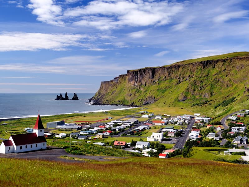
Landmannalaugar - Nature Reserve
Landmannalaugar derives its name from a hot pool that rises under the Laugahraun lava field. Landmannalaugar has been a stopping point for people for centuries, and the mountain shepherds on Landmannaafréttur have stayed there while herding sheep off the mountain for as long as there have been reports of such travel. 
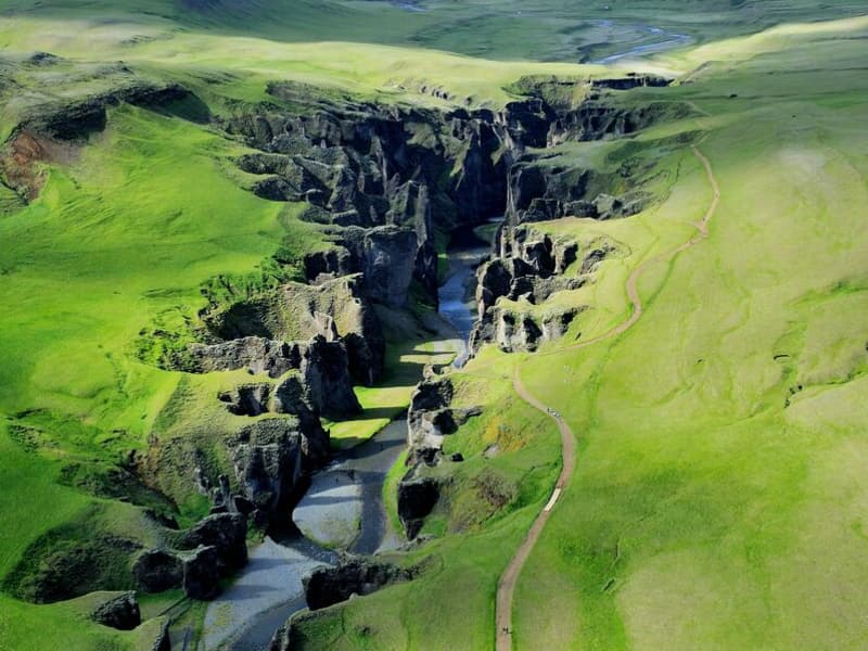
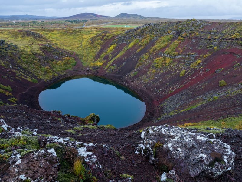
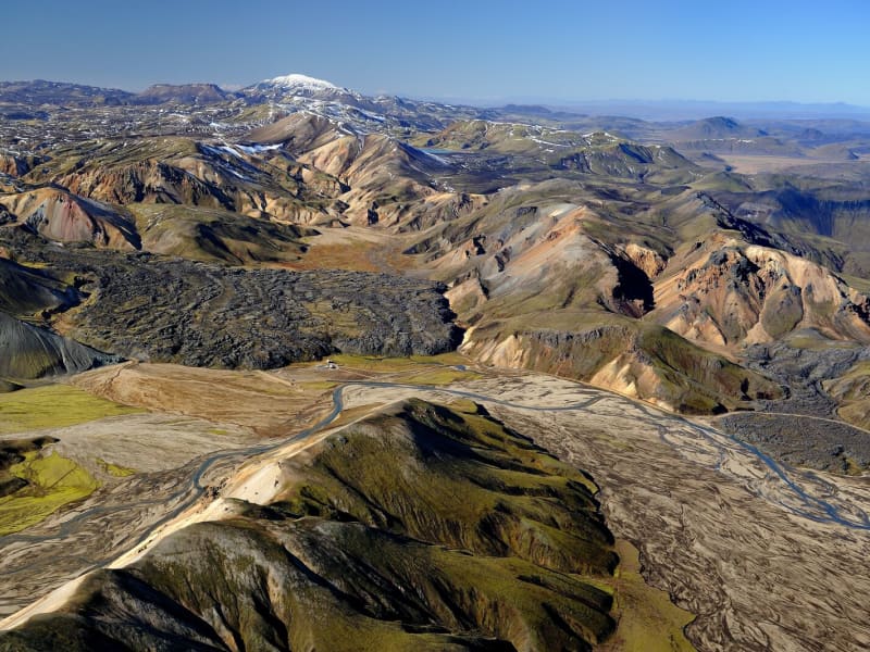
Many beautiful mountains can be seen from Landmannalaugar: Barmur, Bláhnúkur, Brennisteinsalda, Suðurnám, and Norðurnám. The area has considerable deposits of rhyolite, obsidian, and rhyolite lava, and the Landmannalaugar landscape is famous for its colorfulness and unique environs. The start of one of the most popular hiking trails in Iceland, Laugavegurinn, is at Landmannalaugar. The trail proceeds along Hrafntinnusker, Álftavatn, Hvanngil, and Emstrur and ends in Þórsmörk. Ferðafélag Íslands (the Iceland Touring Association) provides facilities, such as showers and accommodation, for travelers at Landmannalaugar. In addition, there is a horse rental and a small café operated during the summer. Fees:The Environmental Agency will implement a booking system for parking in Landmannalaugar for the summer of 2024. It will be necessary to book parking spaces in advance and pay a service fee. The system will be used from June 20th to September 15th, every day of the week. During this period, all visitors planning to come to Landmannalaugar on their own in a private or rental car between 8 am and 3 pm will need to book a parking space in advance. More information here: 
Geysir Geothermal area
One of the greatest natural attractions of Iceland and part of the famous "Golden Circle Tour," The Great Geysir, or Stori-Geysir, has been dormant since 1916 when it suddenly ceased to spout. It came to life only once in 1935 and quickly went back to sleep. Since then, its repose has sporadically been disturbed by the dumping of tons of carbolic soap powder into its seething orifice to tickle it to spout.  It is not exactly known when Geysir was created. It is believed that it came into existence around the end of the 13th century when a series of strong earthquakes, accompanied by a devastating eruption of Mt. Hekla, hit Haukadalur. In this geothermal valley, Geysir is located. What is known is that it regularly spouted every third hour or so up to the beginning of the 19th century and, after that, progressively at much longer intervals until it completely stopped in 1916. Whether its silence is eternal or temporary, no one knows.  When it was alive and shooting, it could thunderously blast a spectacular jet of superheated water and steam into the air as high as 60 to 80 meters, according to different sources. Its opening is 18 meters wide and its chamber 20 meters deep. One reason for cessation is believed to be the accumulated rocks and foreign objects thrown into it by thousands of tourists throughout the years. Though definitely damaging, this could not be the only reason for its dormancy.  The Great Geysir was among the most notable geysers in the world, such as those in Yellowstone Park, New Zealand, and North Iceland. The English word "geyser" is derived from the Icelandic word "geysir," which means gusher. Though the Great Geysir itself is now more or less inactive, the area surrounding it is geothermically very active with many smaller hot springs.  The attraction of the area is now Strokkur (The Churn), another geyser 100 meters south of the Great Geysir, which erupts at regular intervals every 10 minutes or so, and its white column of boiling water can reach as high as 30 meters. The whole area is a geothermal park sitting on top of a vast boiling cauldron. Belching sulfurous mud pots of unusual colors, hissing steam vents, hot and cold springs, warm streams, and primitive plants can all be found here.  A short distance away to the west stands the small Laugarfjall Mountain with a panoramic view overlooking the Geysir area. King Christian IX of Denmark visited the area in 1874 and by the foot of the mountain are the rocks where he leaned while his hosts tried to impress and amuse him by boiling eggs in the hot springs. The rocks are now called Konungssteinar ("The King's Stones").
Seljalandsfoss waterfall
A unique waterfall in the river Seljalandsá, about 30 km west of Skógar: it is 60 meters high with a footpath behind it at the bottom of the cliff, but with a thin cascade. It is the only known waterfall of its kind where it is possible to walk behind it. The waterfall is very picturesque; therefore, its photo can be found in many books and calendars. Access to the waterfall is from the farm of Seljaland along the Ring Road, Iceland's main highway. Several falls a little further to the west, including the interesting Gljúfrabúi, partially masked by its canyon. Access to it is from Hamragarðar farm along the road, east of Markarfljót. These "do-not-miss" attractions lie very close to the main Ring Road at the base of the Eyjafjallajökull Glacier, on the road leading into Thorsmörk. During winter, the area around Seljalandsfoss waterfall can be dangerous as paths can be slippery and large pieces of ice fall, making it extremely dangerous to venture too close to the cliffs and particularly dangerous to walk behind the waterfall. The fine mist from the waterfall freezes on the cliffs and the ceiling of the path behind the waterfall, but when the weather warms, and the ice begins to thaw, it can fall off in large chunks, which can be dangerous. People are advised to show caution and respect the closure of the paths. More information can be found on www.safetravel.is  
Vatnajökull National Park
Vatnajökull National Park was established in 2008. It includes the national parks in Skaftafell (est. 1967) and Jökulsárgljúfur (est. 1973) along with the Vatnajökull ice cap itself and extensive areas around it. Today Vatnajökull National Park area covers 15% of Iceland. A map showing the park’s boundaries (last updated September 21st, 2021): https://www.vatnajokulsthjodgardur.is/static/files/_blob/fuk31dewng5iwwugi4tnkb.jpg  Vatnajökull National Park is characterized by diversity on all fronts, be it landscape, biosphere, cultural remains, or service levels. For simplification, however, it may be placed into two categories: uninhabited highland areas with limited services and lowland areas with higher service levels. The park‘s visitor centers are all located in lowland areas. Each of them has an exhibition about the park‘s nature and cultural heritage. Each also has a souvenir shop with a special emphasis on local handicrafts and products. In 2019, Vatnajökull National Park was inscribed upon the UNESCO World Heritage List.  Visitor centres and other tourist information offices working with the parkVisitor centres and other tourist information offices working with the park provide information and services for the park and its immediate environs. The following offices operate along the south coast of Iceland: • Skaftárstofa Visitor Centre | Kirkjubæjarklaustur | open all year  • Skaftafellsstofa Visitor Centre | Skaftafell | open all year  • Skálafell farm | Suðursveit | varying hours - all year • Hoffell farm | Nes | varying hours - all year Vatnajökulsþjóðgarður
Jökulsárlón Glacier lagoon
Jökulsárlón is a glacial lagoon by the ring road and was recently designated as a part of Vatnajökull National Park. It's still blue waters are a sight not to be missed, as it is dotted with icebergs from the edge of Breiðamerkurjökull, a part of the Vatnajökull glacier. The lagoon flows through a narrow gateway into the Atlantic Ocean, leaving the spectacular sight of the large chunks of ice on the black sandy beach. In wintertime, the fish-filled lagoon hosts a number of seals, which visit the lagoon for an easy meal. Year-round curious seals can be seen basking on the blue-tinted icebergs. The lagoon is accessible from the beach all year round, and so is the café on the banks of Jökulsárlón. For hikers, a marked hiking trail between Jökulsárlón and Fjallsárlón is recommended as a scenic trip through unforgettable surroundings. During the summer, the national park offers interpretive tours with a ranger. Check for information on the park homepage or social media. A word of warning - don't jump onto the ice floating in the lagoon. Some tourists think it’s okay to do it, but it is dangerous to play, and the ice can capsize, leaving you stuck beneath it in the ice-cold water. So let's be very careful here. Please heed the advice of the locals and never step on the ice in the lagoon!   Vatnajökulsþjóðgarður 
Systrastapi
In 1186 a nun monastery was established in Kirkjubær á Síðu. It was later called Kirkjubæjarklaustur, and the topographical names Systrastapi and Systrafoss are connected to this time. Systrastapi is a steep rocky hill west of Klaustur.  Folklore says that two nuns of the monastery were buried after being burned at the stake for violating codes of ethics. One is supposed to have sold herself to the Devil, carried consecrated Communion bread past the door of the privy, and had carnal knowledge with men. The other spoke blasphemously of the Pope. After the Reformation, the latter nun was regarded as innocent and beautiful flowers grew on her grave, while the other one's grave remained barren.  The rocky hill can be climbed, and from the top, the view of glaciers, among other things, is fantastic. 
Vatnajökull Glacier
Vatnajökull is the largest glacier in Iceland and the largest glacier by volume in Europe. It covers approx 8 percent of Iceland, measuring an area of 7,700 km² (2021), with an average thickness of 400 m, and the highest point, Hvannadalshnjúkur, measures 2,110 m (6,921 ft.). Vatnajökull has around 30 outlet glaciers flowing from the ice cap, all of which bear a name; glaciers and outlet glaciers all have names that end in "jökull" in Icelandic.  Vatnajökull belongs to the Vatnajökulþjóðgarður (Vatnajökull National Park) and covers a large area surrounding the glacier, including the glacier itself. In 2019, Vatnajökull National Park was inscribed on the UNESCO World Heritage List. The National Park offers numerous exciting sites and is a must for all interested in Geology and beautiful, natural vistas.  
Skaftafell
Scenic nature, favorable weather conditions, and a network of hiking trails make Skaftafell in Vatnajökull National Park an ideal destination to enjoy outdoor activities in Icelandic nature. Short and easy trails lead to the waterfall Svartifoss and Skaftafellsjökull glacier. Still, those who want to reach further out Morsárdalur valley and Kristínartindar mountain peaks are perfect in terms of distance and labor. Skaftafell is also the ideal base camp for those who seek to climb Iceland‘s highest mountain peak, Hvannadalshnúkur. During the summer months, the national park offers interpretive tours with rangers. Ask for information at the desk or check the park´s website. Private travel companies operate in Skaftafell and offer guided hikes on the nearby glaciers and mountains. Also on offer are sightseeing flights over the Vatnajökull glacier and other renowned attractions. Vatnajökulsþjóðgarður 
Katla UNESCO Global Geopark
Katla Geopark includes geological features of global significance. Over 150 volcanic eruptions have been recorded in the area since the 9th century. The eruptions created the landscape and influenced where people settled. Through the centuries, man and nature have affected the region's history. The area is constantly changing due to volcanic activity. A geopark is defined as a territory that includes a particular geological heritage and a sustainable territorial development strategy to promote development. It must have clearly defined boundaries and sufficient surface area for true territorial economic development. The Geopark covers about 9% of Iceland, 9542 km2, and follows the borders of three municipalities, Skaftárhreppur, Mýrdalshreppur, and Rangárþing eystra. About 2700 people live within the Geopark.GeologyIceland lies astride the Mid-Atlantic Ridge, where tectonic plates move apart, causing a rift zone. A mantle plume exists below the country, centered beneath the Vatnajökull ice cap. In South Iceland, the interaction of the rift zone and the mantle plume results in complex and diverse volcanic activity. Volcanic activity and its widespread effect on the area's nature and landscape make Katla Geopark special. The Geopark is in Iceland's most volcanically active area, and the volcanic systems at Eyjafjallajökull, Katla, and Grímsvötn are particularly active. The region is characterized by central volcanoes, eruptive craters and fissures, rootless cones, lava fields, table mountains (tuyas), and hyaloclastite ridges that trend SW-NE, like the rift zone. Ice caps are prominent in the landscape, topping the highest volcanoes. Outlet glaciers and glacial rivers flow from them, and glacial landforms, e.g., moraines and ice-dammed lakes, occur in the area. Large floods, usually glacier outbursts associated with subglacial eruptions, have formed outwash plains in the lowlands. The oldest bedrock in the area is about 2.5 million years old and can be found at the base of Lómagnúpur, an old sea cliff (671 m). Other interesting features in the Geopark are fossil-bearing xenoliths and tephra layers which are useful for dating (tephrochronology).  Further information about the area is on www.katlageopark.com. 
Kerið Crater
Kerið is a 55 m deep volcanic crater, about 3000 years old. It is a part of a group of volcanic hills called Tjarnarhólar and is now filled with water, creating a lake whose steep circular slopes resemble an ancient amphitheater.
Hoffell
Hoffell is a farmland area characterized by a large outlet glacier named Hoffellsjökull and gabbro rock. Gabbro rock originated deep in the earth but is visible in the area due to the uplift of the area and glacial erosion, which gives the environment a greenish hue in the otherwise dark rocks. The Hoffell area is 15 kilometers from the town of Höfn. Driving or hiking north from Hoffell along the sands of Hoffellssandur, you will enjoy the spectacular scenery of mountain slopes carved out by earlier glaciers. Along the sands of Hoffellssandur, you will enjoy the stunning scenery of mountain slopes carved out by earlier glaciers. Along the way, a borehole is also constructed to extract geothermal water. Finally, you reach the ice of the glacier tongue, Hoffellsjökull, skirted by the numerous hiking trails of the Geitafell mountain. The area is partly within Vatnajökull National Park, preserved for outdoor recreation and is rich in vegetation, wildlife, and geological variety. The area’s many hiking trails offer a stunning view of the diverse, beautiful wonders it has to offer.  
Þingvellir National Park
Þingvellir (Icelandic "Þing": parliament, "vellir": plains) is a place in the southwest of Iceland near the peninsula of Reykjanes and the Hengill volcanic area.It is famous for two reasons:As one of the most important places in Icelandic history. In the year 930 the Alþingi, one of the oldest parliamentary institutions of the world, was founded. The Alþingi met yearly, where the Lawspeaker recited the law to all of the gathered people and decided disputes as well. In the year 999 or 1000, the Lawspeaker Þorgeir Ljósvetningagoði made Christianity the official religion of Iceland. After the conversion, it is said that, upon returning from the Alþingi, Þorgeir then threw his statues of the old Norse gods into the waterfall that is now named Goðafoss ("Waterfall of the Gods"). At this historical place, the independence of the Republic of Iceland was proclaimed on June 17, 1944.As a national park (since 1928) because of the special tectonic and volcanic environment. The continental drift can be clearly seen in the cracks or faults which are traversing the region, the biggest one, Almannagjá, being a veritable canyon. This causes also the often measurable earthquakes in the area. Þingvellir is situated on the northern shore of Þingvallavatn, the biggest lake of Iceland. The river Öxará traverses the national park and is forming a waterfall at the Almannagjá, called Öxaráfoss Together with the waterfall Gullfoss and the Geysir of Haukadalur, Þingvellir is part of the most famous sights of Iceland, the Golden Circle.Þingvellir is a designated UNESCO World Heritage SiteThingvellir, 50 km (31 miles) to the east of Reykjavík, is the national shrine of Iceland. Iceland's most historic site, and one of its most beautiful places, is also part of The Golden Circle tour. The oldest existing parliament in the world first met here in AD930. The Alþing met here every year to enact laws, including the law passed in AD1000 to introduce Christianity into the island. It has always been the focal point for the country, and whenever a major event is to be celebrated, thousands of people come here. At the celebration of the 1,100th anniversary of the first settlement in 1974, more than 60,000 people packed into Thingvellir.Nearby Lögberg is the cliff overlooking the place where the Alþing (assembly) met, and speakers stood to address the gatherings from this point. Nearby is Drekkingarhylur (The Drowning Pool), where mothers of illegitimate children were drowned. It is sited in the river Öxará in Almannagjá, a lava gorge, which with the Öxarárfoss waterfall, is an impressive sight.Peningagjá (The Money Chasm) is a deep fissure filled with crystal clear spring water; people throw coins into it from the bridge that lies across. The coins give off strange reflections as they drop through the water, it is said that if you can follow the coin all the way down until it comes to rest on the bottom, your wish will come true. Scubadiving and snorkeling in wet suits are becoming increasingly popular here.There is an old church at Thingvellir. Beside the church is the national burial ground.Thingvallavatn is the largest lake in Iceland, 83sq km (32sq miles) and over 100m (328ft) deep. The only outflow from lake Thingvallavatn is the river Sog, a famous salmon river with beautiful blue water. The lake's catchment area is 90% underground and the water from the thousands of cold springs has a constant temperature of 3-4°C the whole year-round.The anglers, who use boats for their fishing, have to be careful and watch out for changes in the weather. The lake becomes a boiling pot when the wind starts blowing. The catch in the lake has always been a necessary part of the survival of the farming families on the lake. They have netted the lake traditionally for centuries. Angling permits are sold in the little shop and visitors center in the camping area or at Hotel Valhöll. The catch consists of brown trout and lake char.It is said that these fish became isolated in the lake in the wake of the last ice age when the terrain rose at the south end of Þingvallavatn. These two species are a living testimony to how the evolution of species occurs in nature, as over a period of 10,000 years they have adapted themselves to various habitats in the lake. The constant, regular influx of groundwater into Lake Þingvallavatn, together with a very varied habitat, has created good conditions for fish and other life forms in the lake, to which they have adapted even more. This has resulted in the fact that both the brown trout and char in Thingvallavatn are amongst the largest to be found in the world. The trout are said to be as big as over 20 kg (max weight) and the char over 10 kg (max weight), which is at the max of both species size ranges.The lake is part of the Þingvellir National Park. The volcanic origin of the islands in the lake is clearly visible. The fissures around it - the famous Almannagjá is the biggest of them - indicate that here the tectonic plates of Europe and The Americas are in a conflict. In this lake, with the large quantity of sulfur and salt, the lake is extremely light and the water seems to be in less weight than other lakes.
Hekla volcano
The volcano Mt. Hekla is Iceland’s most famous volcano and the one that has erupted most frequently in recent years. Mt. Hekla rises 1,491 m over sea level and can widely be seen in the south of Iceland. Hekla has been dubbed the Queen of Icelandic Volcanos and is well known internationally. Considerable superstitions have been attached to the mountain, with the most famous legend being that it is the entrance to Hell and might even be Hell itself. The first documented expedition onto the mountain is from 1750 when the naturalists Eggert Ólaffson and Bjarni Pálsson scaled the mountain. The route to the top of Hekla is quite popular, although hikers must be aware of the danger that can occur if the mountain should erupt. The route taken normally starts from Skjólkvíar. Hekla is located in an area where the South Iceland fracture zone meets the South Iceland volcanic zone, which probably accounts for its frequent eruptions. Hekla has erupted in the following years since Iceland was settled: 1104, 1158, 1206, 1222, 1300, 1341, 1389, 1501, 1597, 1636, 1693, 1766, 1845, 1947, 1970, 1980, 1981, 1991 and 2000. Geologists have repeatedly reiterated in recent years that Hekla is ready to erupt and can erupt at any time. However, the mountain does generally provide an hour’s warning.
Skógafoss - Waterfall
Only a few kilometers away from the south shores of Iceland lies the village of Skógar along the Southern Ring Road. It is a popular summer resort center surrounded by unusual scenic beauty. The breathtaking view of Skogáfoss waterfall and picturesque surroundings and the snow-capped heights of two towering glaciers are Skógar's major summer attractions. There are two settlements by this name. One is Ytri-Skógar (outer or western Skógar) and the other Eystri-Skógar (eastern Skógar), located at a short distance from each other. Ytri-Skógar, commonly referred to as Skógar, is the main settlement. It is an old farm and has a church from 1890. It is located between the Skógá and Kverná rivers. The greatest attraction of Skógar is, of course, the beautiful 60-meter high Skogáfoss waterfall in the river Skógá. Like the legends of buried treasures of Egill Skallagrímsson in Mosfell near Reykjavík and Ketilbjörn in Mosfell near Skálholt, there is a similar legend about the settler Þrasi who is believed to have buried his chest of gold under the Skogáfoss waterfall. If the sun conditions are favorable - one can see a vivid rainbow in front of the waterfalls. The river below the falls holds a large salmon and char population, and fishermen are seen here fishing from July - October. The path leading to the top of the waterfalls continues following the river upstream - where numerous more dramatic waterfalls of sheer beauty are found. A great hike - to say the least! One of the finest folk museums in Iceland is situated in extraordinarily beautiful natural surroundings. The fascinating local folk museum has a collection of over 6000 artifacts and examples of various types of dwellings in Iceland since the early times. The collection of tools and equipment used on land and sea is outstanding. The museum also has an old turf farmhouse, where guests can experience the standards of living in Iceland in past centuries. From Skógar, the Ring Road runs eastwards along the foot of Mýrdalsjökull glacier, across the southern sandy plains and over glacial rivers, passes Seljavellir, and continues along with the soaring glaciated massive of Eyjafjöll and the two waterfalls Seljalandsfoss and Gljúfrabúi. From here runs a 10 km long trek along the river Skógá over the Fimmvörðuháls Pass between the Eyjafjallajökull and Mýrdalsjökull glaciers to the mountain oasis of Þórsmörk. Skógar is a place to explore the natural diversity of the south or, if the weather is good, to spend a holiday amid beautiful and rugged landscapes. It is also very close to the ocean and the unique black beach.
Dverghamrar
Dverghamrar (Dwarf Rocks), just east of Foss, is a peculiar and beautiful columnar basalt formation. On top of the columns, there is cube-jointed basalt.  The landscape is thought to have been molded at the end of the Ice Age. The sea level was higher at that time, and it is believed that the waves caused the peculiar look of the rocks. Dverghamrar is a protected natural monument.  Columnar basalt is formed when lava flow gets cooled, and contraction forces build up. Cracks then form horizontally, and the extensive fracture network that develops results in the six-sided formation of the columns.
Gullfoss waterfall
Gullfoss is two separate waterfalls; the upper one has a drop of 11 meters and the lower one 21 meters. The rock of the river bed was formed during an interglacial period. Water flows over Gullfoss at an average rate of 109 cubic meters per second. The heaviest floods have recorded a flow of 2000 cubic meters per second. During the summer, the flow is 130 cubic meters per second, which would take only 3 seconds to fill this building. People were eager to exploit the power potential of Gullfoss, and many plans for hydroelectric developments on the river Hvítá have been proposed. The trails by Gullfoss can be closed, so it's good to check the conditions before going. To check whether it is open or closed to visitors, check out the website of Safetravel.is.  
Fjaðrárgljúfur canyon
Fjaðrárgljúfur is 6 kilometers from Road 1; take road F206. People can travel by small cars to Fjaðrárgljúfur all year round. Fjaðrárgljúfur is a magnificent and massive canyon, about 100 meters deep and about two kilometers long. The canyon has sheer walls and is somewhat serpentine and narrow. The bedrock in Fjaðrárgljúfur is mostly palagonite from cold periods of the Ice Age and is thought to be about two million years old. The river Fjaðrá has its source in the mountain Geirlandshraun and falls off the heath edge in this stunning canyon until it makes it down into the Skaftá river. Fjaðrá has changed a lot over time.  Formation of the Fjaðrárgljúfur canyonIt is believed that Fjaðrárgljúfur was formed at the end of the last Ice Age, about nine thousand years ago. When the glacier retreated, a lake formed in the valley behind a hard, resistant rock. The run-off from the lake flowed to where Fjaðrárgljúfur is today. Glacial rivers from the glacier’s edge carried a lot of sediment into the lake, and the river which ran from it dug itself down into the rock and down onto the palagonite in front of it. Because the cascade was so large, it was powerful in digging out the canyon. Eventually, the lake filled with sediments, and the river’s strength dwindled. When the lake filled up completely, the river began to dig into the sediment layers it had previously left in the valley. Fluvial terraces on both sides of the valley indicate the original height and location of the lake while a deep channel in the palagonite serves as a silent reminder of the power of nature. More geosites in the neighborhood: www.katlageopark.com
Reynisfjara, Reynisfjall og Reynisdrangar
Reynisfjall is a 340 m high tuff mountain arising out of a volcanic eruption from under a glacier in the penultimate Ice Age, near the village of Vik.  Alternating in an irregular manner are layers of tuff, pillow lava and columnar basalt veins and loops.  Reynisdrangar stacks are a collection of 66 m high rock pillars that rise out of the sea and are of the same geological formation as Reynisfjall. On Reynisfjöru beach, very beautiful basalt formations in the south part of the mountain can be seen, and there you will find an exceedingly beautiful cave called Hálsanefshellir.  The waves here are deceiving and have caused the death of a number of visitors in recent years, even in the best of weather. Please take great care and keep a good distance from the sea.