
Glaciers
Glacial ice covers approximately 10% of Iceland’s surface area and the country’s glaciers contain the same amount of water as approximately 20 years’ precipitation across Iceland. One of the key features of glaciers is that they move. When a glacier advances, its surface cracks as the top 20-30 metres are fragile while deeper down the ice is more solid. This is why valley glaciers are often heavily crevassed, with crevasses being up to 30 metres deep. A changing climate has an effect on the distribution and movement of glaciers. Iceland’s glaciers cover numerous active volcanoes, and eruptions and geothermal heat melt ice and can cause glacial outbursts. Around one-third of the water flowing to the sea in Iceland is glacial in origin. Some Icelandic glaciers are fairly remote but most of the large ones can be visited easily enough.
Southern Iceland is home to Iceland’s largest glaciers
Glaciers cover approximately 10% of Iceland’s surface. The largest glaciers are located in central and southern Iceland, the largest being Vatnajökull covering 7,900 km2 and with a volume of 3,000 km3. This makes it Europe’s largest glacier by volume and second largest in terms of area. Other major glaciers are Langjökull (900 km2), Hofsjökull (890 km2) and Mýrdalsjökull (560 km2). Iceland’s fifth largest glacier is Drangajökull (142 km2) located in the eastern part of the West Fjords.
Valley glaciers
A valley glacier is an outlet glacier that flows out of an ice cap. Most valley glaciers only advance a few hundred metres a year. However, some unstable valley glaciers can surge forward several kilometres.
Ice caves
Most ice caves are located where rivers flow out of glaciers and are formed when the ice melts during the spring. Ice caves formed by geothermal heat can also be found at several locations within the Vatnajökull National Park. Ice caves are often stunningly beautiful and entering them can be a memorable experience and many tourists naturally want to visit them. However, ice caves are by their nature rather unstable and are constantly changing and can therefore be dangerous to inexperienced visitors. Ice caves should not be visited without an experienced local guide and the necessary equipment, such as crampons, a helmet and a headlight.
Glacial lagoons
Glacial lagoons form at the head of valley glaciers. Glacial tongues erode the land and the moraine is washed away by the water bursting out from beneath the snout of the glacier. The resulting depression often becomes a lake as the glacier retreats. With the melting of the glaciers over the past few decades, glacial lagoons have formed in several places at the heads of valley glaciers in Southern Iceland. The water in the lagoon comes from melted ice and such lagoons often contain icebergs that have broken off the edge of the glacier.
The oldest and most famous glacial lagoons at Vatnajökull are Jökulsárlón and Fjallsárlón, but in the last few years, lagoons have formed next to the valley glaciers Skeiðarárjökull, Skaftafellsjökull, Svínafellsjökull, Kvíarjökull, Fláajökull, Heinabergsjökull and Hoffellssjökull as they have melted and retreated. A lagoon at the head of Gígjökull, a valley glacier extending down from Eyjafjallajökull, disappeared in the volcanic eruption in 2010. In recent years a large lagoon has formed at the head of Sólheimajökull, a valley glacier flowing out of Mýrdalsjökull.
Jökulsárlón
Jökulsá is a powerful but very short glacial river at Breiðamerkursandur (average flow 250-300 m³/s, but only 500 metres long). It flows from Jökulsárlón, which is easily the largest and best known glacial lagoon in Iceland.
Once upon a time the river Jökulsá emerged from the glacier and flowed 1 - 1.5 km to the sea. However, in about 1935 a lagoon began to form at the edge of the glacier and around 1950 the lagoon began to expand rapidly as the glacier retreated due to ice melt. At the same time, the river has become shorter due to wave erosion at the coast and if this continues the river will disappear and the lagoon will fill with seawater. The effect of the tide can already be felt in the lagoon. Attempts have been made to slow down this process by trying to combat erosion and raising the water level of the lagoon.
The river was first bridged in 1966-1967 and the bridge is 108 metres long. There was a ferry across the river from 1932 but prior to that crossing, the river was very difficult due to the strong current and icebergs. It was often impossible to cross and many people drowned over the years attempting to reach the other side. If it wasn’t possible to cross on horseback, for example when the river flowed in a single torrential channel and was not braided in several channels, people sometimes resorted to crossing the glacier above the source, but this was hazardous as the glacier was often crevassed. People began to mark out a path across the glacier around 1870.
Major glacial rivers in the western part of Southern Iceland
Two major glacial rivers are located in the western part of Southern Iceland. One of them is Þjórsá, at 230 km the longest river in the country. It originates in the glacier Hofsjökull. Þjórsá has been harnessed for power in the highlands. Several impressive waterfalls can be found in the river, such as Dynkur, Tröllkonuhlaup and Urriðafoss. The other river is Hvítá, whose source is the glacier Langjökull. The river Sog flows into the river east of Ingólfsfjall and the river then becomes known as Ölfusá. It has the largest discharge of any river in Iceland with an average flow of 423 m³/s. Ölfusá flows through the town of Selfoss and enters a large estuary before entering the Atlantic Ocean just west of the village of Eyrarbakki.
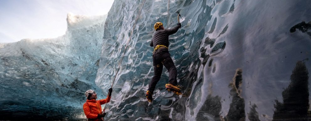
Ice Climbing and Glacier walk
It is unlikely that anyone will ever forget the first time they tried ice climbing. Partners in many parts of the country offer ice-climbing tours.
View
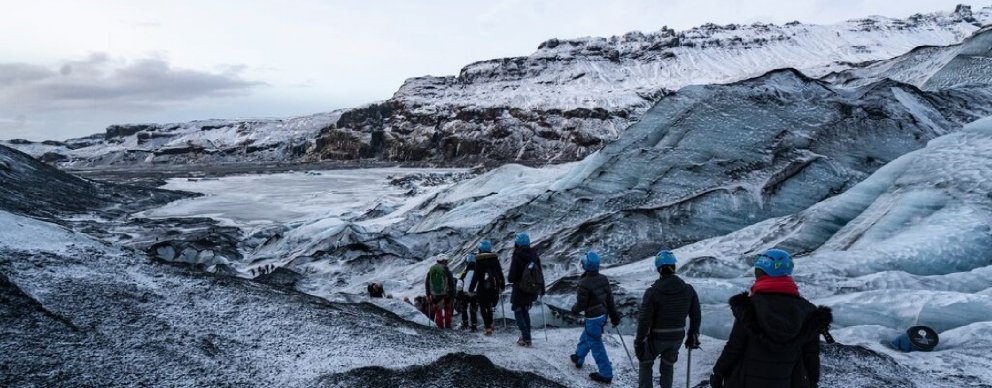
Jeep- & Glacier Tours
Many travel agencies specialize in different kinds of jeep exhibitions. A jeep tour on a glacier with breathtaking views is an unforgettable experience.
View
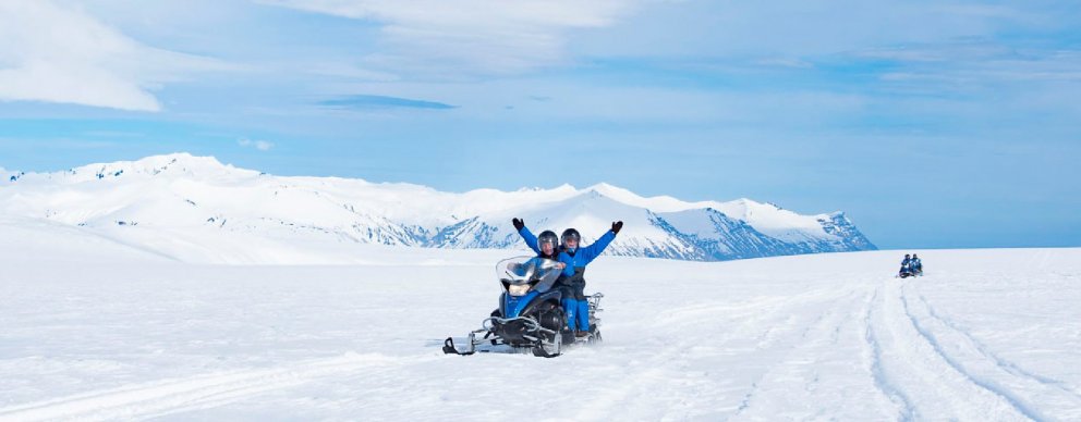
Snowmobile & Snowcat Tours
Many agencies offer snowmobile or ATV tours. They are suitable for anyone looking for a bit of excitement and adventure while on vacation.
View
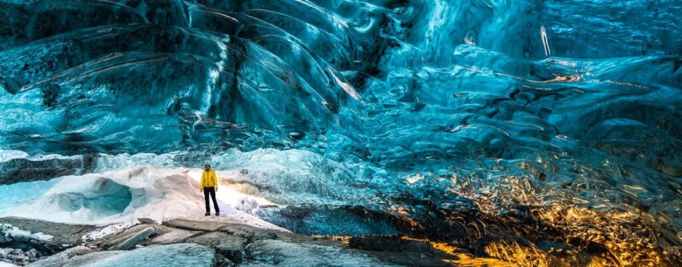
Cave Exploring
For spelunkers and potholers, Iceland has scores of caves, large and small, deep and shallow, to be explored. Some caves may be explored without a guide, and many agencies offer cave exploration tours for others.
View
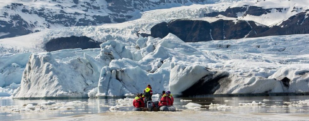
Boat Tours
From whale watching to puffin tours to northern light cruises, coast-hugging trips, and more, they each provide an enjoyable and memorable experience.
View
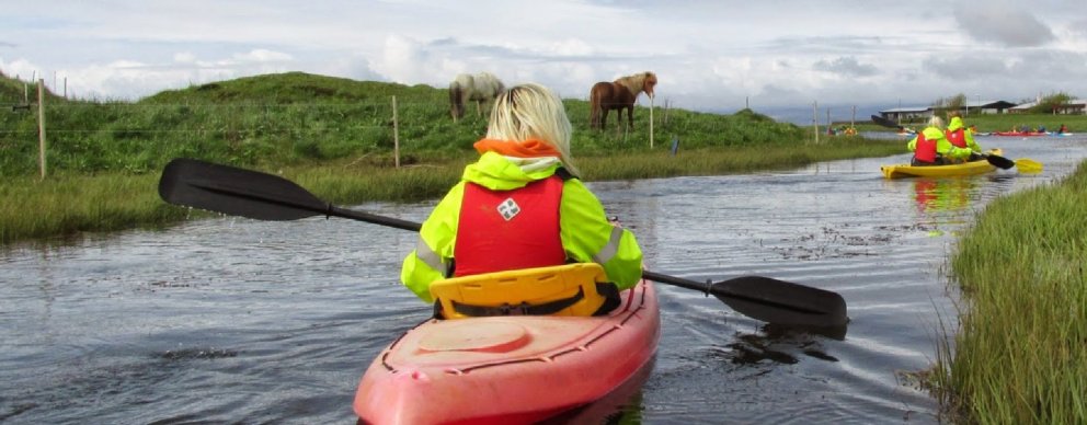
Kayak Tours / Paddleboarding
Kayaking is an exhilarating experience, and many agencies throughout the country offer kayak tours on lakes, ponds, and the ocean.
View
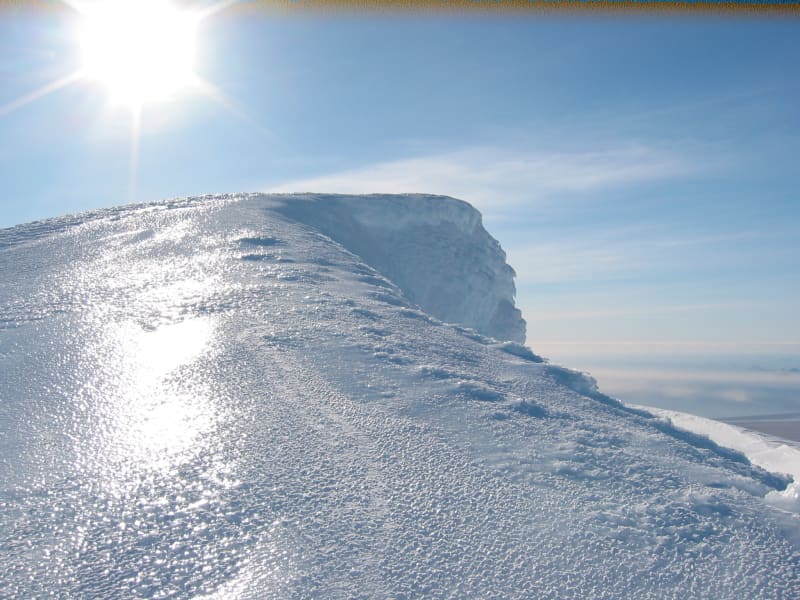
Eyjafjallajökull Glacier
The Eyjafjallajökull glacier is a 1651 m high glacier-capped stratovolcano. It is one of the smaller glaciers of Iceland. It is situated to the north of Skógar and to the south and west of the bigger glacier Mýrdalsjökull. The icecap of the glacier covers a volcano (1651m in height) that has erupted relatively frequently since the Ice Age. The crater of the volcano has a diameter of 3-4 km and the glacier covers an area of about 100 km². In June 1994 an earthquake swarm lasting for nearly a month occurred below the active volcano Eyjafjallajökull in South Iceland. It is otherwise a relatively quiet volcano – although it is not listed as being inactive. Eyjafjallajökull erupted in 1821-1823. The south end of the mountain was once part of the Atlantic coastline. As the sea has since retreated some 5 km, the former coastline has left behind sheer cliffs with a multitude of beautiful waterfalls, the best known of them being Skógafoss and Seljalandsfoss. In strong winds, the water of some of the smaller falls can even be blown up the mountain. It is one of the three glaciers that surround the Thorsmörk area - the other 2 being Myrdalsjökull and Tindfjallajökull. Specialized tours are arranged on the glacier for both skiing, super jeep tour, and hiking. One should never venture onto the glacier without guides and good knowledge of this kind of activity as this is a very dangerous area for inexperienced visitors.
Eyjafjallajökull featured prominently in world news in 2010 when ash from its eruption halted air traffic in Europe. An ice cap with several outlet glaciers covers the caldera of Eyjafjallajökull with a crater diameter 3-4 km wide. The outlet glaciers, Steinholtsjökull and Gígjökull, descend from the main glacier and can be visited by 4x4 trucks along the F-road to Þórsmörk. The area between the glaciers Eyjafjallajökull and Mýrdalsjökull with volcanic craters, Magni and Móði, created in the first stage of the Eyjafjallajökull eruption in April 2010.
View
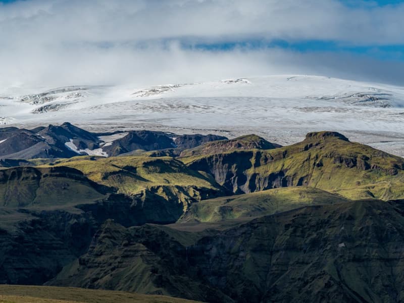
Mýrdalsjökull glacier and Katla
Mýrdalsjökull Glacier and Katla VolcanoMýrdalsjökull is a glacier located in the south of Iceland. It is situated to the north of Vík í Mýrdal and the east of the smaller glacier Eyjafjallajökull. Its peak reaches 1493 m in height, and in 1980, it covered an area of 595 km². The view on a clear day is one of the prettiest in the world.
Guided snow scooters, snowmobiles, Super Jeep, and ice-climbing tours are offered on the Myrdalsjökull glacier. Travelers on the glacier must be cautious about crevasses, and inexperienced travelers should not go alone. Weather conditions shift rapidly high winds, and snowstorms can appear in a flash all year round.
The volcano Katla in the Mýrdalsjökull glacier, the volcano Katla erupts on average every 40 - 60 years. Sixteen eruptions have been recorded since the settlement of Iceland, the last in 1918, but there have probably been more. Katla is one of the most famous volcanoes in the country, and its eruptions usually have very serious consequences. It can be regarded as one of the most powerful volcanoes in the world and probably the largest active volcano in the northern hemisphere.
During the eruption, the glacier above the volcanic vent melts, and the melted water collects under the ice cap until it makes its way out under the edge in a violent flood. These are called "jokulhlaup."The floodwater carries huge amounts of ice, rocks, silt, and sand. Most of the Mýrdalssandur sand plain has been formed by deposits in past floods.
Katla has been showing signs of unrest recently, and some geologists suspect it might erupt soon since it is way overdue to erupt.
Eruptions of Katla have taken place (since known and recognized human settlement): 1918, 1860, 1823, 1755-56, 1721, 1660-61, 1625, 1612, 1580, 1416, 1357, 1311, 1262, 1245, 1177, 950.
View
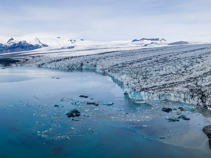
Vatnajökull Glacier
Vatnajökull is the largest glacier in Iceland and the largest glacier by volume in Europe. It covers approx 8 percent of Iceland, measuring an area of 7,700 km² (2021), with an average thickness of 400 m, and the highest point, Hvannadalshnjúkur, measures 2,110 m (6,921 ft.). Vatnajökull has around 30 outlet glaciers flowing from the ice cap, all of which bear a name; glaciers and outlet glaciers all have names that end in "jökull" in Icelandic.
Vatnajökull belongs to the Vatnajökulþjóðgarður (Vatnajökull National Park) and covers a large area surrounding the glacier, including the glacier itself. In 2019, Vatnajökull National Park was inscribed on the UNESCO World Heritage List. The National Park offers numerous exciting sites and is a must for all interested in Geology and beautiful, natural vistas.
View
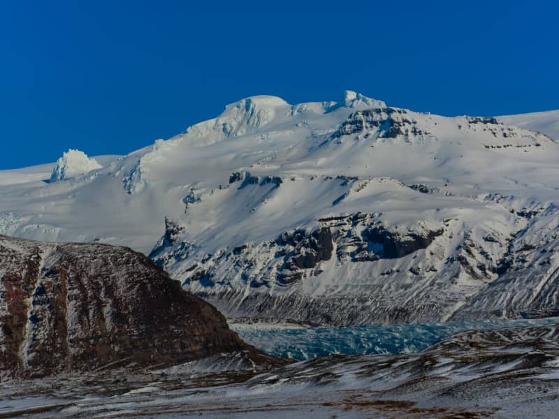
Öræfajökull glacier
Öræfajökull: Iceland’s highest mountainExtending south from the Vatnajökull icecap within Vatnajökull National Park and towering to around 2,110 m (6,922 feet), Öræfajökull is Iceland’s highest mountain. Its height actually varies with the season and the depth of snow and ice, since the peak itself, Hvannadalshnjúkur, is topped by ice which is thickest in spring and thinnest in autumn.
The mountain and surrounding areas offer good skiing in winter and are very popular with walkers and hikers throughout the year.
Vatnajökulsþjóðgarður
View
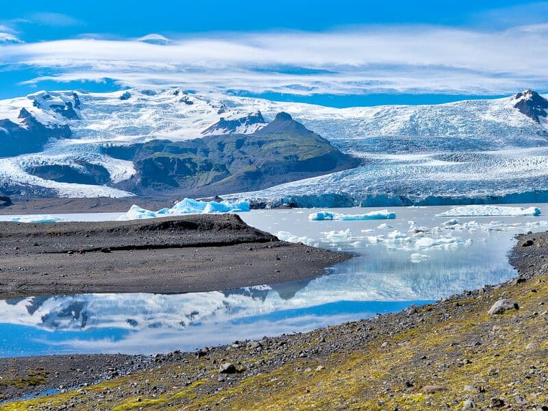
Fjallsárlón glacial lagoon
Fjallsárlón is a glacial lagoon at the southern edge of Vatnajökull glacier, about 10 km west of Jökulsárlón Glacier Lagoon. The lagoon lies within Vatnajökull National Park and is reached from Road 1.
The lagoon sits below Fjallsjökull, a steep glacier tongue that descends from Vatnajökull into the water. Visitors can stop for views of the glacier, floating ice, and the surrounding moraine landscape. Fjallsárlón is often a quieter alternative to nearby Jökulsárlón, although conditions and visitor numbers vary by season.
Boat tours are available on the lagoon, and there is a bistro on site. As with all glacier areas, visitors should stay on marked paths, keep away from unstable ice, and check local conditions before traveling in winter.
View

Jökulsárlón glacial lagoon
Jökulsárlón is a glacial lagoon beside the Ring Road, within Vatnajökull National Park. It is fed by Breiðamerkurjökull, an outlet glacier of Vatnajökull, and is known for the icebergs that drift across the lagoon before floating towards the Atlantic Ocean.
The area is one of the most popular stops in South Iceland, with views of blue-tinted ice, the glacier edge, and the nearby black sand beach where ice is often washed ashore. Seals can sometimes be seen in the lagoon or resting on the ice, but sightings vary by season and conditions.
Jökulsárlón is accessible year-round from Road 1, and there is a café by the lagoon. Visitors can also follow a marked hiking trail between Jökulsárlón and Fjallsárlón. Never step onto floating ice in the lagoon, as it can roll over or break apart without warning.
Vatnajökulsþjóðgarður
View
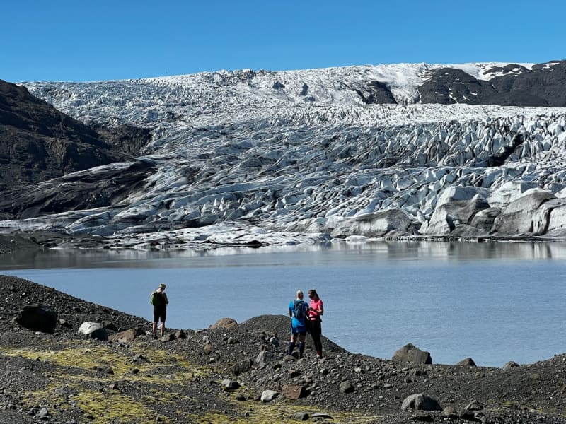
Skálafell – Hjallanes
Skálafell–Hjallanes is a hiking area between Jökulsárlón Glacier Lagoon and Höfn in Hornafjörður, within Vatnajökull National Park. The area gives visitors access to marked walking paths and glacier views in a quieter part of southeast Iceland.
One of the main routes is an 8 km circular hike through the Hjallanes area, leading towards the edge of Vatnajökull glacier. A walking bridge over the river Kolgríma also connects Skálafell with the Heinaberg hiking area, opening up more routes for visitors who want to explore the glacial landscape on foot.
Skálafell is close to Road 1 and can be a good stop for travellers driving between Jökulsárlón and Höfn. Check trail and weather conditions before setting out, and allow around 3–4 hours for the circular hike.
More trail information: Vatnajökull National Park
View
Heinaberg
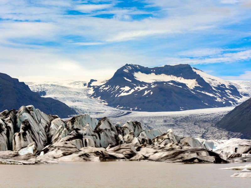
Heinaberg is a beautiful area that consists of Heinabergsjökull glacier, the glacial lagoon Heinabergslón, where you can go kayaking among the icebergs during summer, and stunning landscape. The Heinaberg area is part of Vatnajökull National Park.
The gorgeous glacial lagoon of Heinaberg, Heinabergslón, is accessible by car and is often studded with large chunks of glacier that break off the Heinabergsjökull glacier. The area offers excellent conditions for hikers, as it has several interesting hiking trails, along which one can see waterfalls, ravines, volcanic intrusions, and even, on a lucky day, a reindeer.
The gravel road from road no 1 to the glacial lake is not in service during the winter months. Therefore, one needs to be aware of changes in road conditions and accessibility.
Vatnajökulsþjóðgarður
View
Fláajökull Glacier
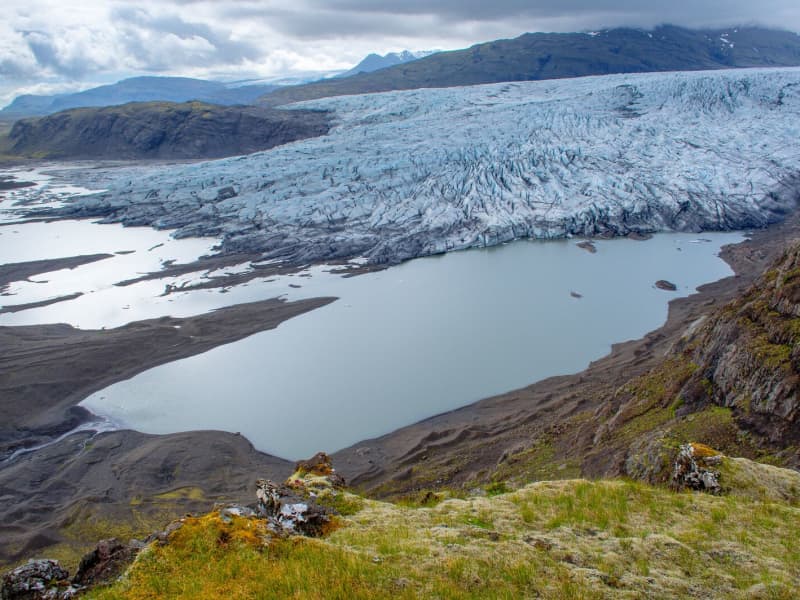
Fláajökull is an outlet glacier of Vatnajökull in the southern part of Vatnajökull National Park, about 40 km west of Höfn. The area can be reached from Road 1 via a side road between Hólmur and Lambleiksstaðir, then a 6 km gravel road to the car park.
The glacier and surrounding landscape clearly show how ice has shaped the lowlands over time. Fláajökull reached its greatest known extent in 1894, after centuries of glacier advance during the colder period known as the Little Ice Age. Today, visitors can explore marked routes and information panels about the area’s history and geology.
There is also access from Haukafell forestry , with a footpath leading towards Fláajökull. Overnight stays are not allowed at the Fláajökull car park, and visitors should check road, trail, and weather conditions before traveling.
View
Hoffell
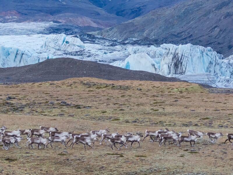
Hoffell is a farmland and glacier area about 20 km from Höfn in southeast Iceland, and partially within Vatnajökull national park. The area is known for Hoffellsjökull, an outlet glacier of Vatnajökull, as well as gabbro rock, geothermal water, rivers, outwash plains, and mountain views.
Visitors can explore several hiking routes around Hoffellsjökull and Geitafellsbjörg, with views of the glacier and its lagoon. From Road 1, a 3 km paved road leads to Hoffell Guesthouse and Hoffell geothermal Baths.
To reach the Hoffellsjökull car park, visitors continue along a 4 km gravel road. The road is rough and can be difficult for ordinary cars, so a four-wheel-drive vehicle is recommended. Overnight stays are not allowed at the Hoffellsjökull car park, and hikers should check trail, road, and weather conditions before setting out.
View
Langjökull Glacier
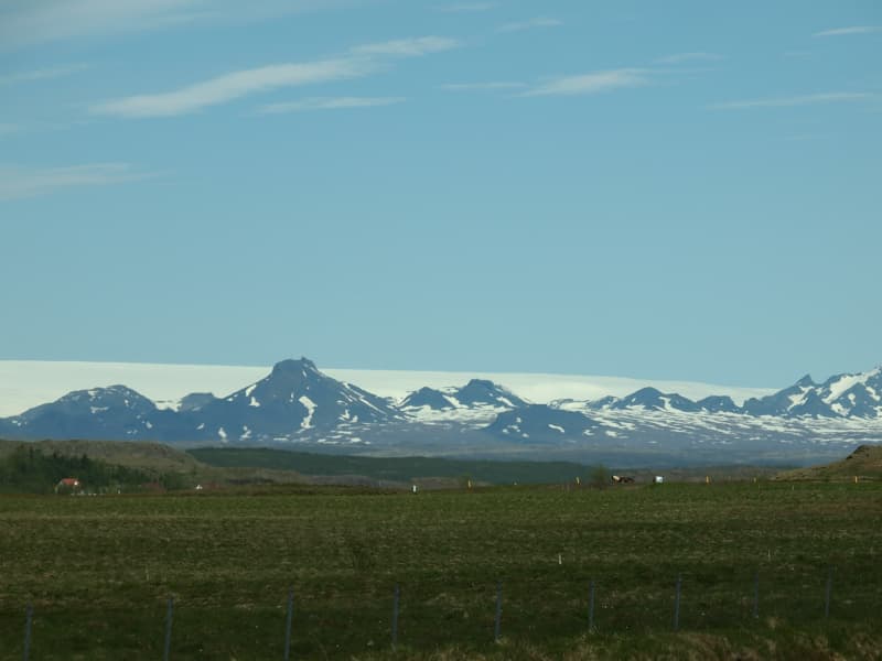
Langjökull is the country's second-largest glacier. Its accessibility is as good as it gets; however, no one should attempt driving up a glacier on their own. Many agencies offer tours that take you up the glacier in specially equipped vehicles with experienced glacier guides. You can choose from jeep excursions, glacier hiking, and snowmobiling.
View