Explore the waterfalls of the South Coast of Iceland
The beautiful waterfalls of South Iceland are numerous and easy to access, so we will list the most popular ones; otherwise, this will be a long blog. Here you can find a list of all the waterfalls. The first one is part of the Golden Circle, and it's the one that the name of the route originates from, Gullfoss, or Golden Waterfall.
Gullfoss
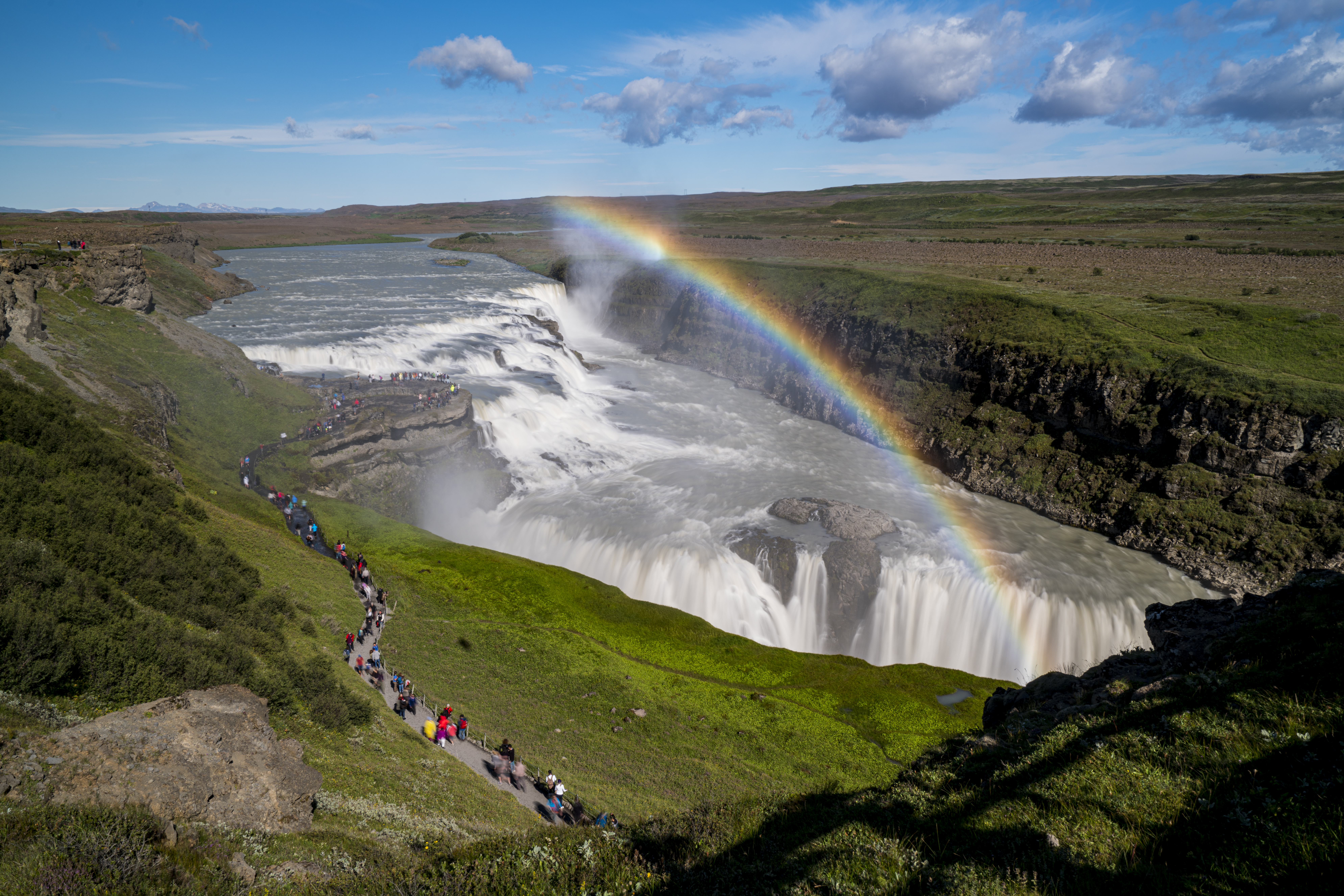
Gullfoss is two separate waterfalls; the upper one has a drop of 11 meters and the lower one 21 meters. The rock of the riverbed was formed during an interglacial period. The waterfall is beautiful, unique, and in a good location.
The trails by Gullfoss can be closed in winter, so it's good to check the conditions before going. To check whether it is open or closed to visitors, check out the website of Safetravel.is.
Urriðafoss
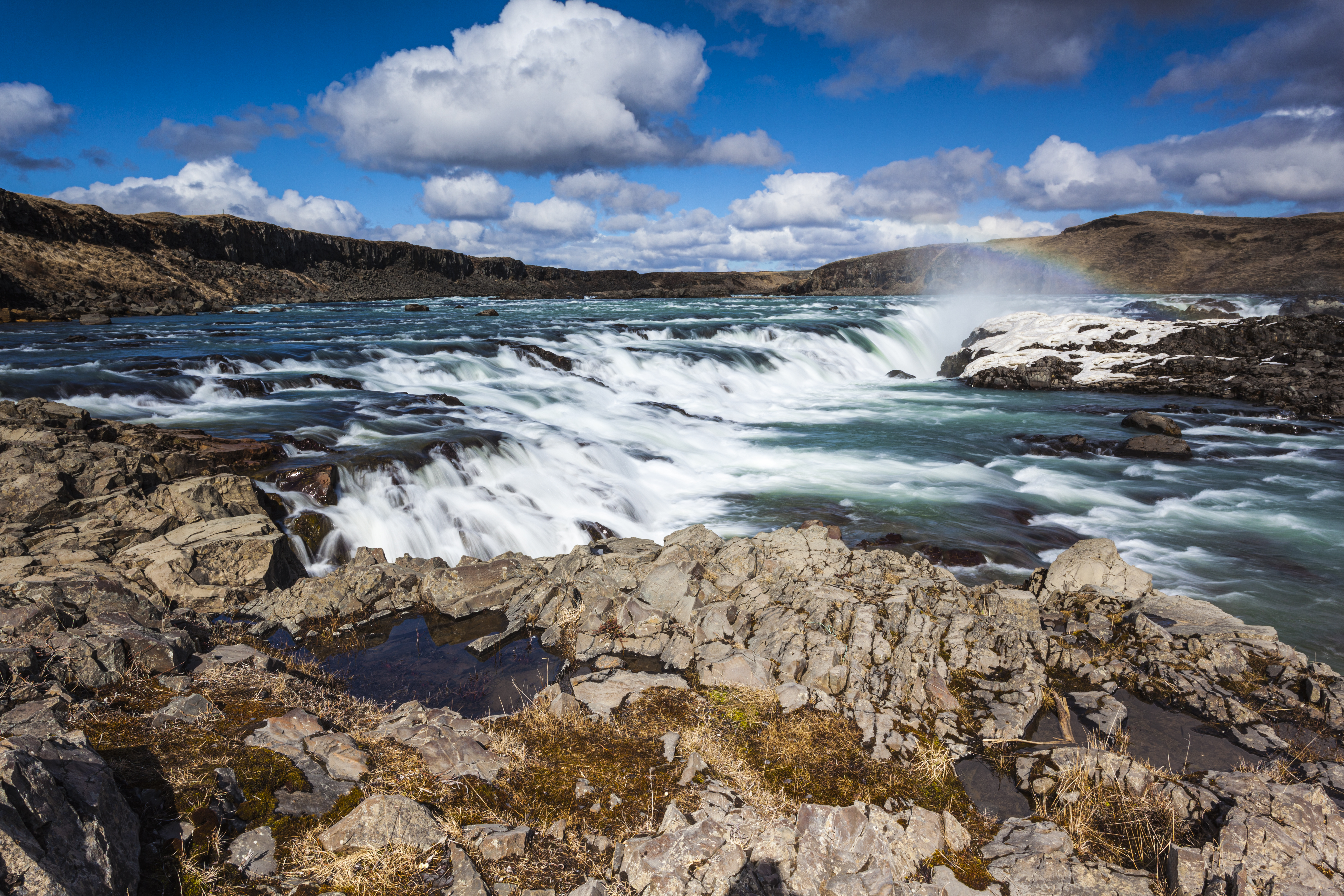
Urriðafoss is a waterfall in the Þjórsá River. Þjórsá is Iceland's longest river, 230 km, and Urriðafoss is the most voluminous waterfall in the country. It is easily accessible by any car in summer, although the road is bumpy. In winter, conditions are trickier. It is charming and secluded and makes for a great stop.
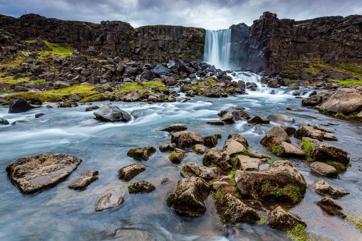
Háifoss
The waterfall Háifoss is situated near the volcano Hekla in the south of Iceland. The river Fossá, a tributary of Þjórsá, drops here from a height of 122 m. Háifoss is the third-highest waterfall on the island. The waterfall makes a great detour on a road trip around the Golden Circle or when driving to Landmannalaugar.
It is possible to hike to the waterfall along the Fossá (6km each way). There is also a parking lot above the waterfall so the hiking can be done in the other direction.
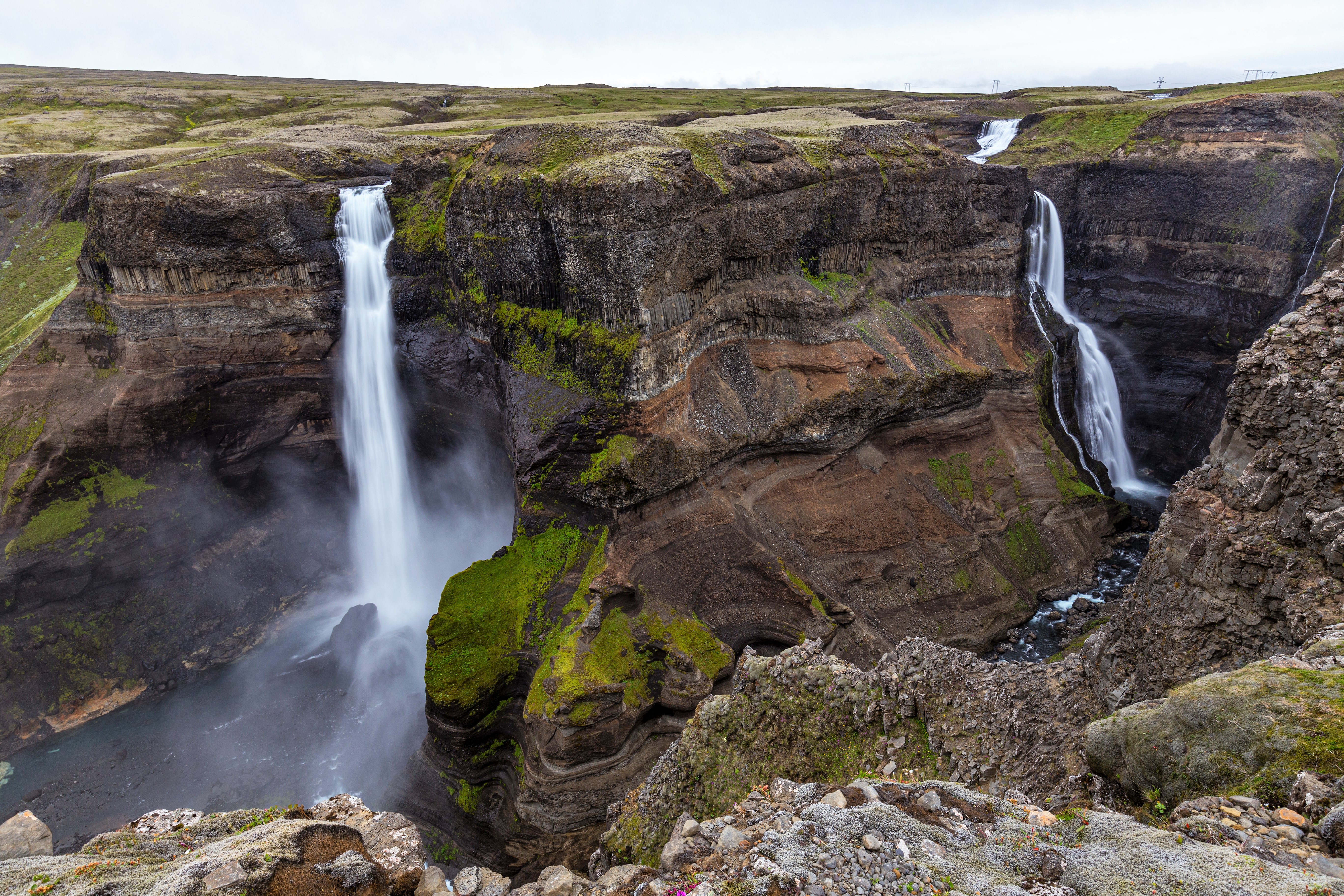
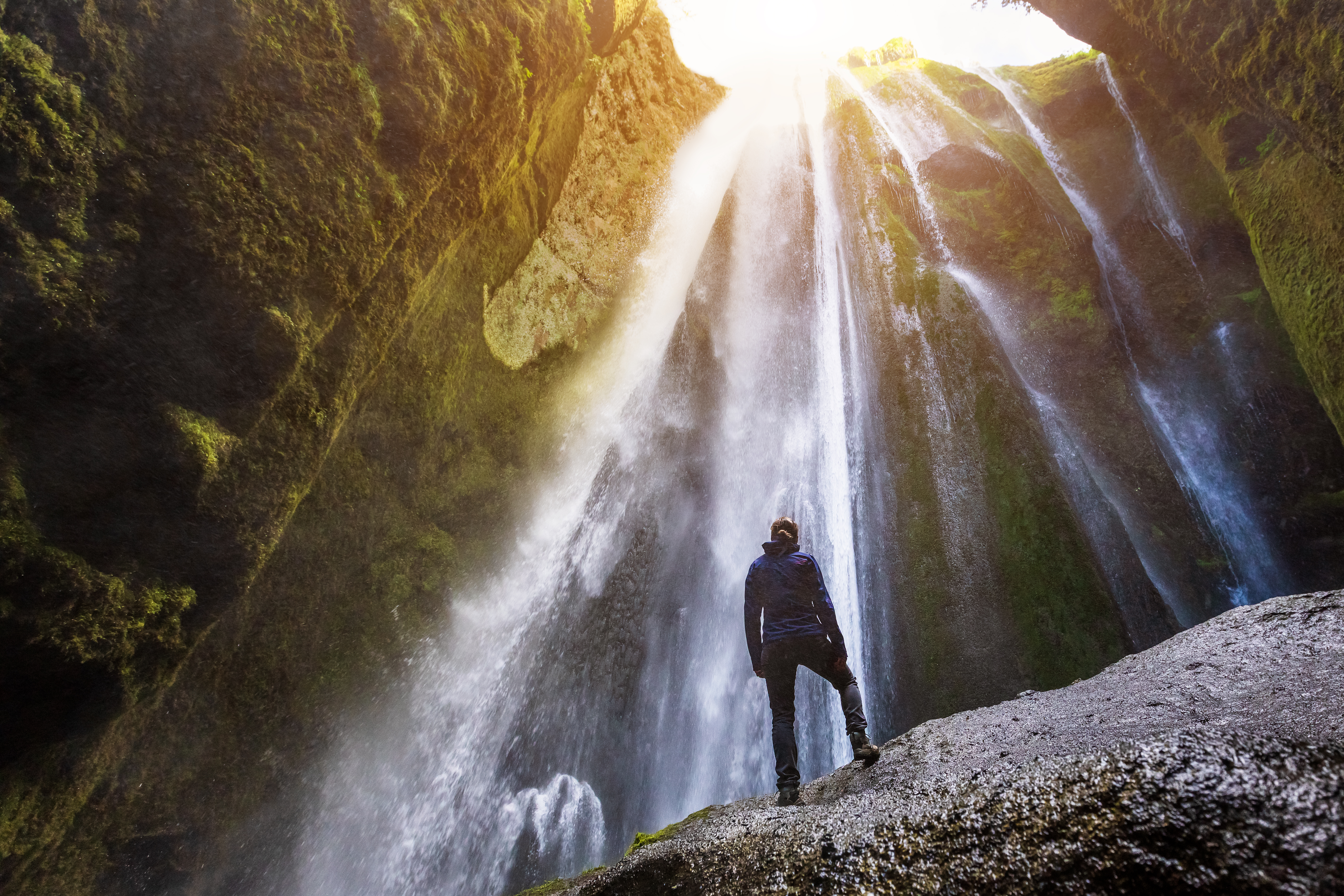
Seljalandsfoss & Gljúfrabúi
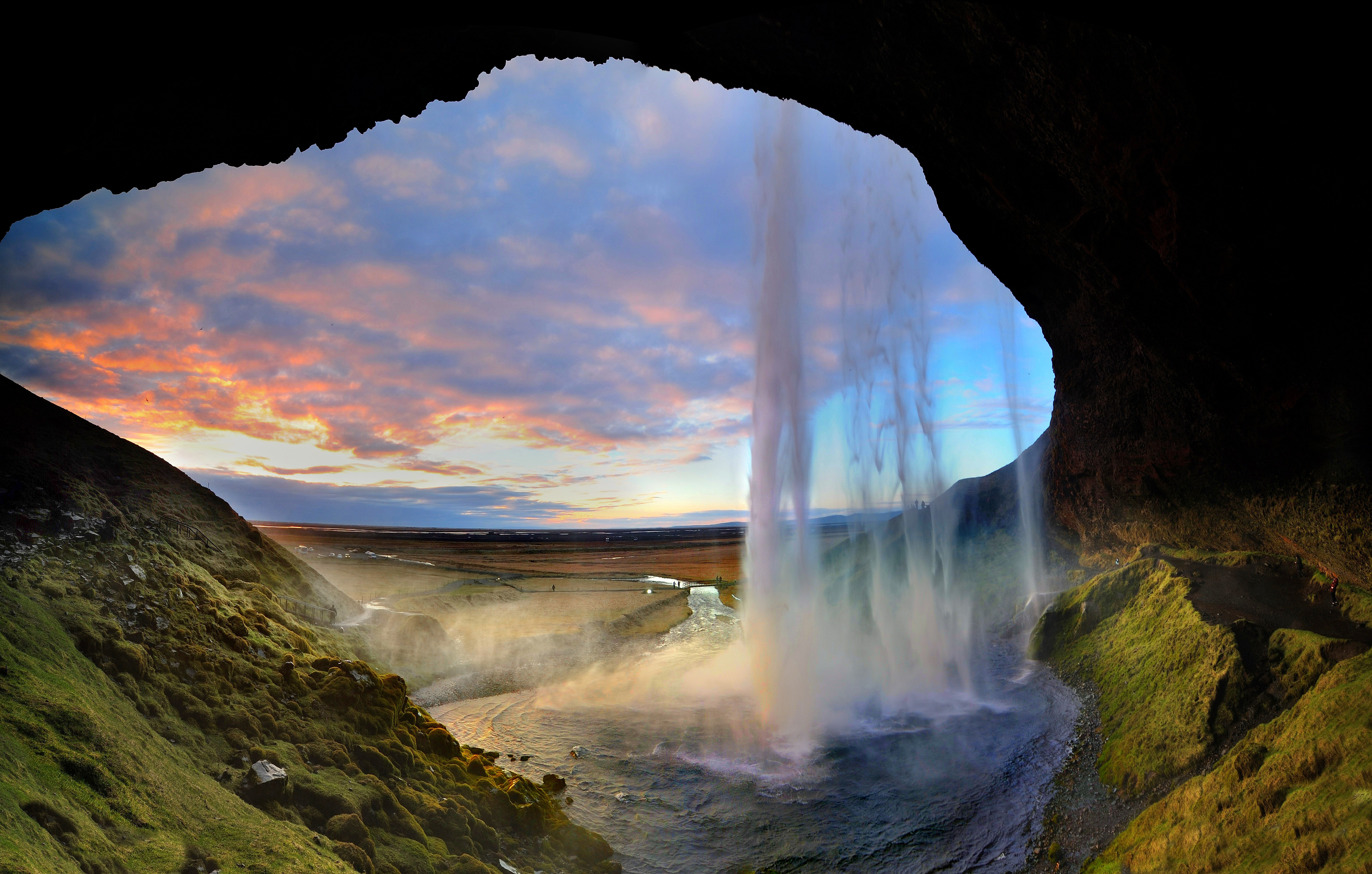
Unique Seljalandsfoss waterfall is one of the best-known waterfalls in Iceland. It is 60 meters high with a footpath behind it at the bottom of the cliff but with a thin cascade. It is the only known waterfall of its kind where it is possible to walk behind it. Yes, it means you will get wet.
During winter, the area around Seljalandsfoss waterfall can be dangerous as paths can be slippery and large pieces of ice fall, making it extremely dangerous to venture too close to the cliffs. People are advised to show caution and respect the closure of the paths.
Access to the waterfall is from the Ring Road, Iceland's main highway. Several other falls a little further to the west, including the interesting Gljúfrabúi, partially masked by its canyon. You can also park at Seljalandsfoss and walk to Gljúfrabúi, it's left of Seljalandsfoss, and the walk takes no more than 10 minutes.
Gljúfrabúi is a 40m tall waterfall, and it has a certain mystique over the waterfall because it falls into a deep chasm, while in front of it, there is palagonite rock that blocks the waterfall, so you only see the top of it. It is also possible to take off your shoes and wade the river down into the canyon. It's an amazing experience. Caution must be taken when traveling in the canyon because there is a risk of falling rocks.
The boulder that blocks the waterfall is called Franskanef. Previously, people believed that it and the surrounding cliffs were the residences of huldufólk or hidden people. It is possible to climb onto Franskanef and see the waterfall from above.
Skógafoss
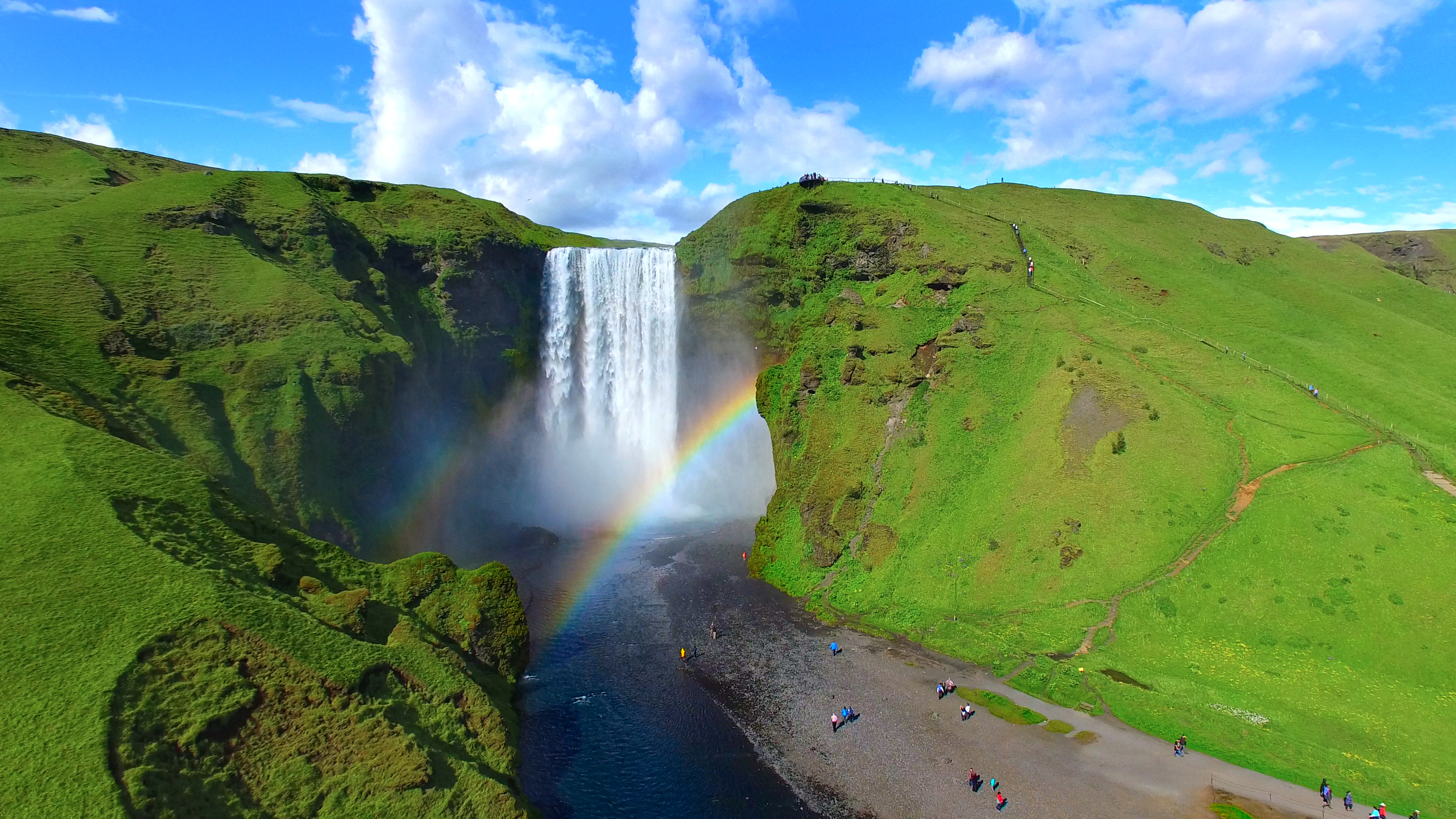
Skógafoss is a 62 m high waterfall located at Skógar. It is considered one of the most magnificent waterfalls in Iceland, especially when a rainbow forms in front of it. Easily accessible in summer and winter. You can walk to the waterfall and feel the water on your face!
The breathtaking view of Skogáfoss waterfall and picturesque surroundings and the snow-capped heights of two towering glaciers are Skógar's major attractions.
There is also a path to the right of the waterfall that will lead to the top. It is not a high climb, but the stairs are tall, making it relatively demanding to walk up. This is the beginning of the trekking trail which leads to the pass Fimmvörðuháls between the glaciers Eyjafjallajökull and Mýrdalsjökull. It goes down to Þórsmörk on the other side and continues as the famous Laugavegur to Landmannalaugar.
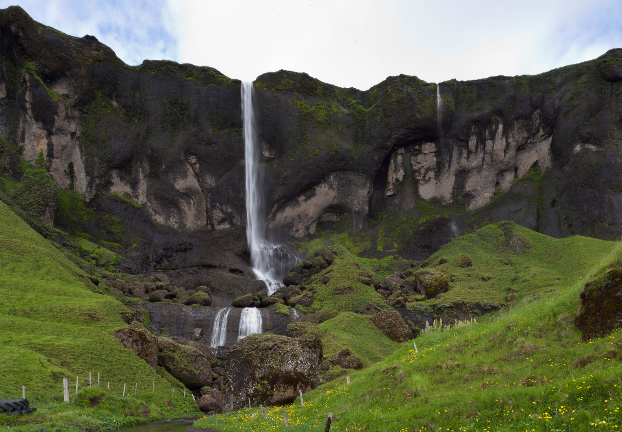
Kvernufoss
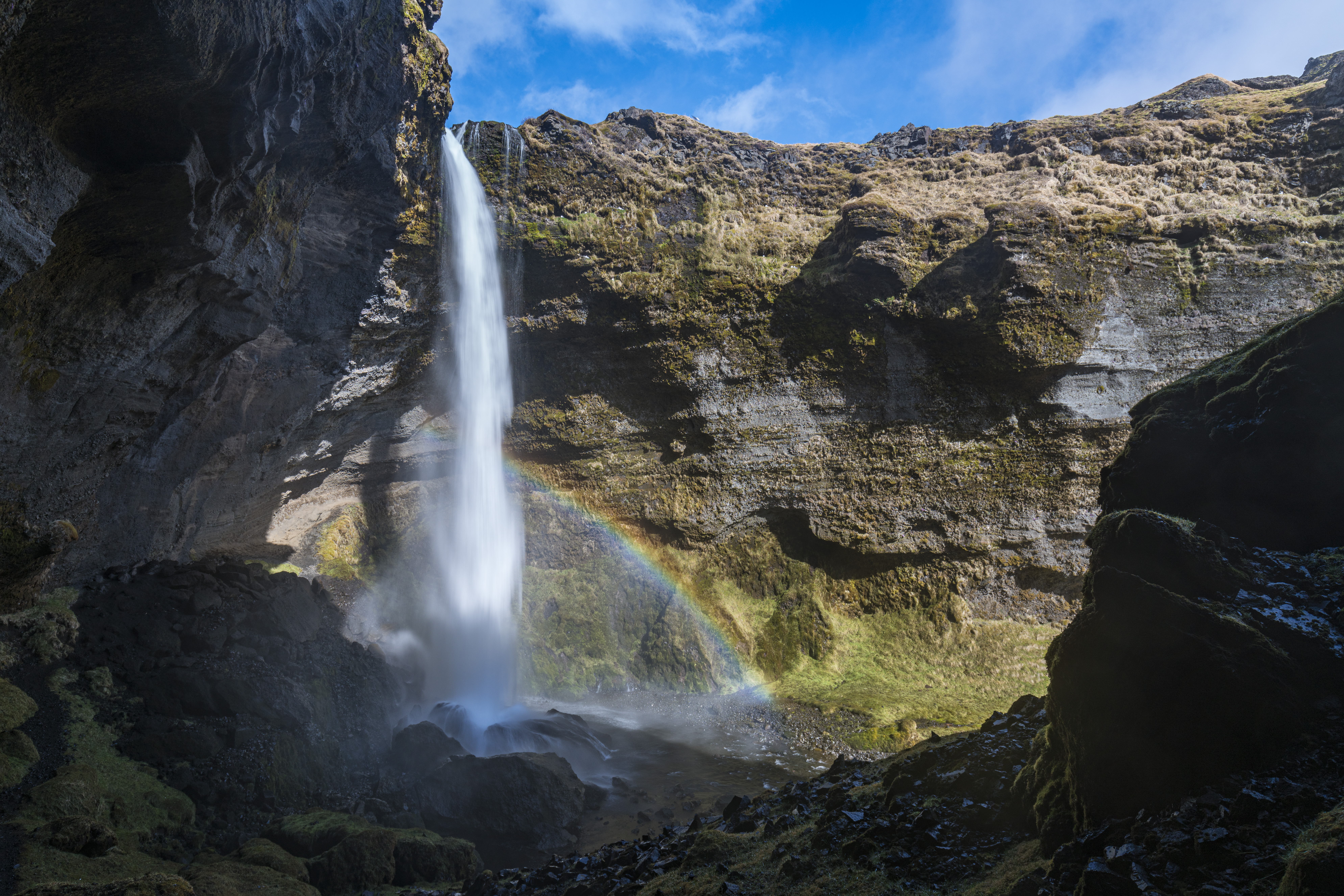
Kvernufoss is in a small canyon 1.5 km to the east of Skógafoss. A hiking path leads up to it from the car park of the museum at Skógar. We recommend checking out the museum along the way, where you can learn about the area's history and how people traversed the glacial rivers before they were bridged.
Systrafoss
Systrafoss is the name of the waterfall where the river Fossá falls from the lake Systravatn, over the mountain edge above Kirkjubæjarklaustur. The waterfall is in a small canyon just on the edge of the town. To get to the waterfall, you first need to drive into town and then west on Klausturvegur road to the western part of the town.
A beautiful hiking trail leads to the top of the mountain and Systravatn. From the mountain edge, the view is breathtaking.
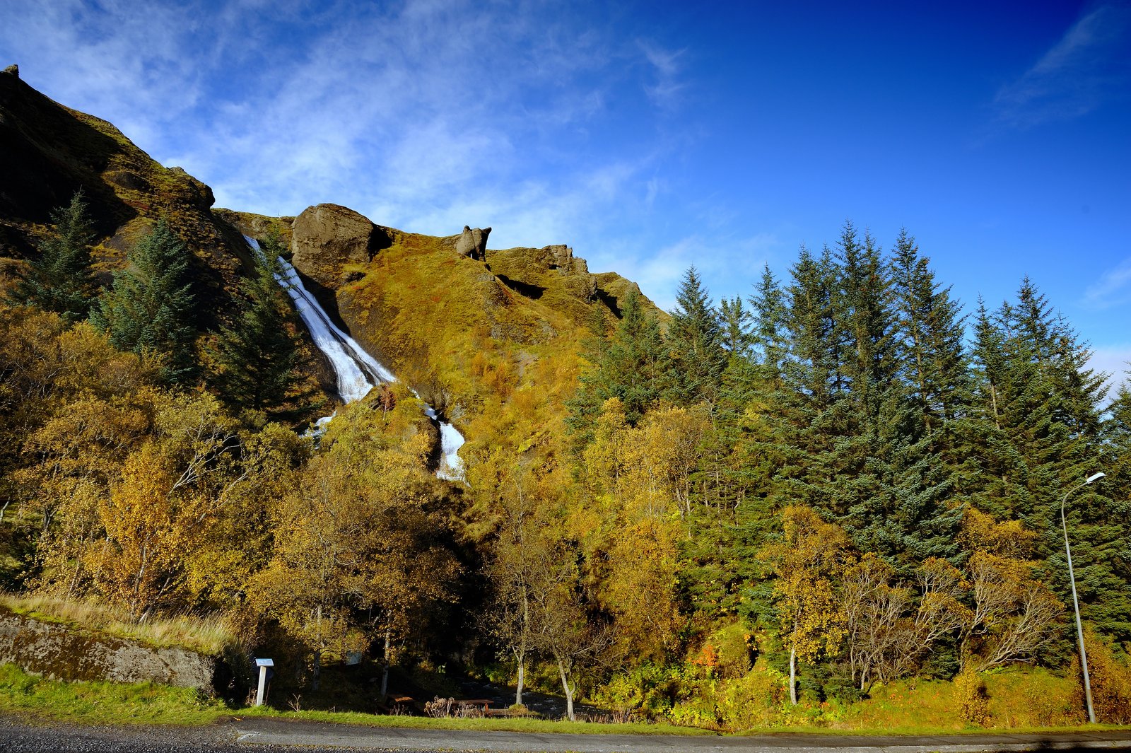
Foss á Síðu
Foss á Síðu is the name of an old farm approximately 10 km east of Kirkjubæjarklaustur. A beautiful waterfall cascades over the cliffs above the farm, which flows from Lake Þórutjörn. This magnificent spectacle catches the eye of everyone that passes by. An easy hiking trail leads up to Lake Þórutjörn, where the view over Síða is amazing.
Svartifoss
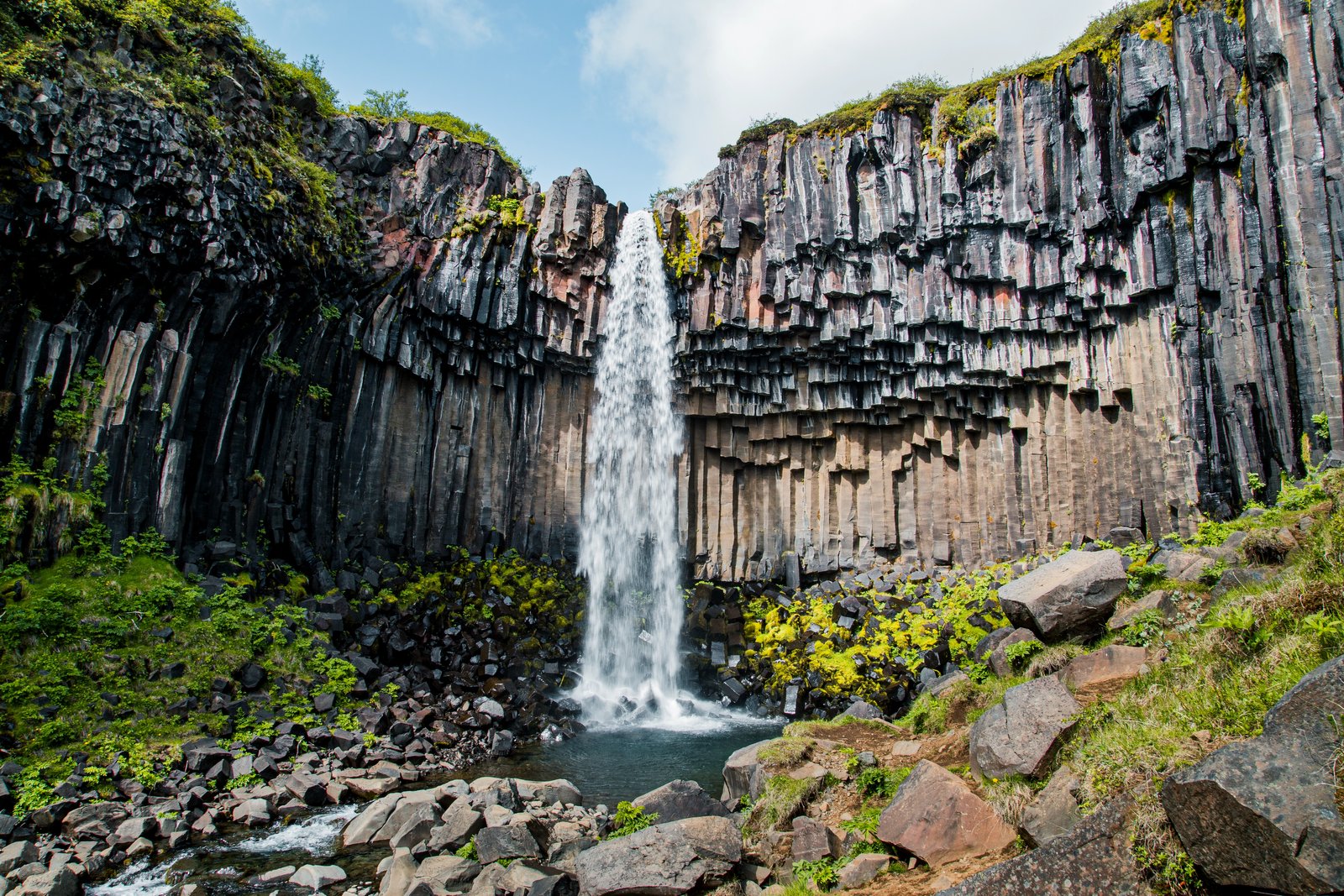
Svartifoss is one of the unique waterfalls in South Iceland. It is situated in Skaftafell, which belongs to Vatnajökull National Park. Svartifoss is 20 meters (80ft) high. It is bordered on both sides by tall black basalt columns.
The hike to Svartifoss starts at the Visitor Centre in Skaftafell. You can also find all sorts of information and advice about the area. The walk is about 1.9 km or 45 minutes (one way).