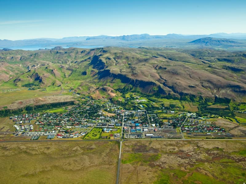
HVERAGERÐI
Hveragerði has long been a famous destination for tourists with many hotels and restaurants. Both summer and winter, Icelanders and foreigners alike have enjoyed visiting the town for decades. With a population of about 3.000 and located only 45 km from Reykjavik, Hveragerði is a town not to be missed. It may be viewed from the vantage point of the Kambar mountain slope, as it spreads out across a 5000-year-old lava field. Throughout the year, pillars of steam may be seen rising from the town – and in summer, it is truly a green community, abounding in trees. A green revolution is taking place as woodland areas in and around Hveragerði expand, with the locals working together to develop their blossoming town further
Indeed, the most precious gem of the town of Hveragerði is its geothermal area – indeed, there are not many communities in the world with hot springs literally in their backyard. The geothermal area is securely fenced off for safety reasons. Still, it can be visited during opening hours listed on the park's Facebook page - https://www.facebook.com/Geothermalpark or by emailing tourinfo@hveragerdi.is for more information and group bookings.
A new hot spring area emerged from the ground in the earthquake that shook Iceland's southern part on 29th May 2008. It is situated on the hillside rising above the town. Several very active hot springs throw colorful mud and clear water up into the air and are a spectacular sight.
Besides the hot springs, Hveragerði has much to offer. Trout and salmon swim in the Varmá river, berries are for picking on the heath to the west of the town, and the area abounds with excellent walking routes, the most famous one being the hike to Reykjadalur valley where one can bathe in a hot river. The swimming pool is a gem in town with hot baths, whirlpools, a natural sauna, and a fitness center. Also, the NLFÍ Health and Rehabilitation Clinic offers opportunities to seek health and happiness.
LÁ Art Museum is situated in Hveragerdi. It is an art museum that preserves a small collection of modern and contemporary art, mainly from Icelandic artists and some international artists' work. Every year, the museum puts up a variation of repeatedly awarded exhibitions.
View
ÖLFUS
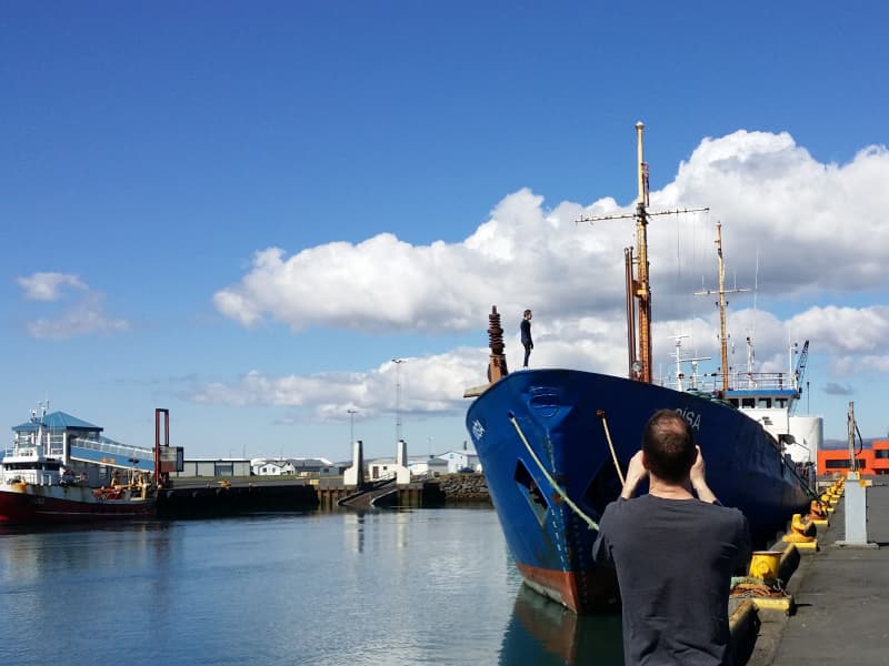
Ölfus municipality is located on the southwest coast of Iceland, approx. 50 km from Reykjavík capital. The population is slightly over 2000 inhabitants and is growing. The fishing village Thorlákshöfn is the largest in the municipality with approx. 1600 inhabitants.
Ölfus offers a wide range of beautiful landscapes with black sand beaches, cliffs, lava formations, caves, geothermal areas, and vivid hot springs.
From Thorlákshöfn village and all over the municipality, you have sensational panoramic views over most of the south coast, e.g., the volcanoes Mt. Hekla and Eyjafjallajökull and the Westman Islands.
In Thorlákshöfn, you can find the best surfing spot in Iceland. The black sand beach is perfect for beginners and advanced surfers, and the waves by the lighthouse are superb.
Ölfus municipality is a popular viewing point for the Northern Lights in the south due to limited light pollution.
The tourist information center is located in the library in Thorlákshöfn and is open from 12:30 to 17:30 on weekdays. The campsite in Thorlákshöfn is next to the church, behind the swimming pool.
The tourist information center in ThorlákshöfnHafnarberg 1815 ThorlákshöfnTel. +354 480 3830
Opening hours: Weekdays from 12:30 – 17:30
View
STOKKSEYRI
STOKKSEYRIStokkseyri, pop. 559 is a charming village renowned for its beautiful seashore, breaking ocean waves and birdlife, and rich in handicrafts and culture. Workshops, galleries, Ghost Center, and the Elves and Northern Lights Museum are all located in a Cultural Centre, Menningarverstöðin, an old fish processing factory that has found a new role due to changes in the fishing industry. The Wildlife Museum is dedicated to hunting and wildlife and contains many mammals and birds. The bunkhouse Þuríðarbúð provides an excellent example of how fishermen had to make use of what nature provided. Stokkseyri also offers one of Iceland's most famous seafood restaurants, an outdoor swimming pool, kayak tours, and a campsite. East of Stokkseyri is Knarrarósviti Lighthouse, built-in 1938 and put into operation a year later. For further information, visit the tourist information at the local Café, Gimli Kaffihús.
ÁRBORGThe Municipality of Árborg was established in 1998. It consists of the town Selfoss, the villages of Eyrarbakki, Stokkseyri, and the Sandvík area. This region offers excellent options for recreation and relaxation, including a wide selection of restaurants, cafés, art galleries, museums, swimming pools, and a 9-hole golf course in Selfoss. A perfect location for any visitor who wants to stay closer to nature and explore unique landscapes such as large lava fields and black sand beaches.
View
EYRARBAKKI
Eyrarbakki, pop. 585 is a friendly village that used to be the largest commercial community and main harbor on the South Coast of Iceland. Many preserved houses from 1890 to 1920 are situated in Eyrarbakki, and a visit is, therefore, like going 100 years back in time. Other great attractions are The Eyrarbakki Maritime Museum and the Árnessýsla Folk Museum, which is located in a building constructed in 1765, famously known as “The House”. Here you can also find a campsite, hostel, guesthouses and a great restaurant. On the rocky shoreline is a fantastic view of the Atlantic Ocean, where you can watch the surf break. It is an ideal spot for hiking and bird watching. Passing the beautiful recreational forest Hallskot northwest of Eyrarbakki, you enter the Flói Bird Reserve. It is a significant nesting area, especially for wetland birds, and is listed as an Important Bird Area (IBA) by BirdLife International.
ÁRBORG
The Municipality of Árborg was established in 1998. It consists of the town Selfoss, the villages of Eyrarbakki, Stokkseyri, and the Sandvík area. This region offers excellent options for recreation and relaxation, including a wide selection of restaurants, cafés, art galleries, museums, swimming pools, and a 9-hole golf course in Selfoss. A perfect location for any visitor who wants to stay closer to nature and explore unique landscapes such as large lava fields and black sand beaches.
View
BORG
Borg in Grímsnes and Grafningshreppur is a growing and vibrant community where services, social life, and outdoor activities come together in one place.
The area offers a wide range of facilities for both residents and visitors, including a school, kindergarten, community center, accommodation, and a campsite.
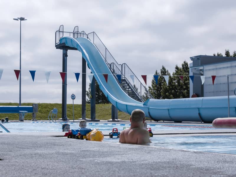
Borg features excellent sports facilities, including a sports hall, a swimming pool with hot tubs, a sauna, and a waterslide, as well as a newly built fitness center that further supports health and wellbeing in the area.
The community center hosts a variety of cultural and social events, reflecting the lively and active nature of the community.
The municipality of Grímsnes and Grafningshreppur is known for being a safe and family-friendly area, with strong emphasis on wellbeing, respect, and quality of life. Education is well supported at Kerhólsskóli, and a wide range of associations provide activities for all age groups.
Borg is located approximately 70 km from Reykjavík and enjoys a central location along the Golden Circle. Nearby are many of Iceland’s most well-known natural attractions, including Kerið crater, Þingvellir, Gullfoss, and Geysir.
The surrounding landscape is diverse and shaped by volcanic activity and glaciers, featuring tuyas, lakes, and scenic outdoor areas. Notable nearby sites include Mt. Hengill, the Sog river, Úlfljótsvatn lake, Þrastaskógur woodland, and Hestvatn lake.
The area offers a variety of activities for all ages, such as the adventure park at Nesjavellir, frisbee golf courses in Borg and Úlfljótsvatn, golf courses at Kiðjaberg, Hraunborgir, and Öndverðarnes, as well as numerous hiking trails and outdoor areas like Yndisskógur woodland near Borg.
Sólheimar, a unique eco-village that attracts visitors from around the world, is also located nearby.
View
SÓLHEIMAR ECO-VILLAGE
Sólheimar is considered the oldest Eco-Village in the world. Sólheimar was established as a children's home in 1930. Still, today, Sólheimar focuses on offering people with special needs varied and creative employment opportunities, jobs in organic horticulture and forestry in a close-knit community that focuses on environmental issues and vivid cultural life. Sólheimar workplaces include six creative art workshops, Ölur - organic forestry, Sunna – organic horticulture, Brekkukot Guesthouse and catering service, and Graena Kannan – organic café. All products are sold in the Vala grocery store and art gallery.
View
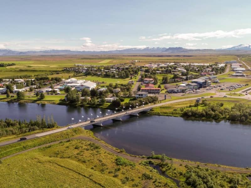
LAUGARVATN
Laugarvatn is a shallow lake, about 2 km2 in size, and is located in the inlands of Árnessýsla, midway between Þingvellir, Gullfoss and Geysir, 100 km from Reykjavík. Under its floor there are hot springs heating the lake so it is warm and suitable for bathing all year round. On its bank rests a village of over 300 inhabitants, also named Laugarvatn.
The Laugarvatnsfjall mountain with its birch-covered slopes on the west shelters the village and also adds to the charm and beauty of the place. Between the mountain and the lake, north of the village, there is a panoramic point (hringsjá) providing a good view over the lake and its surroundings. In addition, amongst the green hills and woods north of the lake the area is suitable for camping, pony-trekking and hiking. Nearby you will find a lot of marked hiking routes.
It is possible to hire a boat or a sailboard to use at lake Laugarvatn. Just outside Laugarvatn there is a golf course and possibilities of angling in lakes and rivers in the area. Laugarvatn is a popular tourist resort for Icelanders, and it is also the site of educational institutions, as for example the Grammar School of Laugarvatn. There are two Edda Hotels located there as well.
View
REYKHOLT
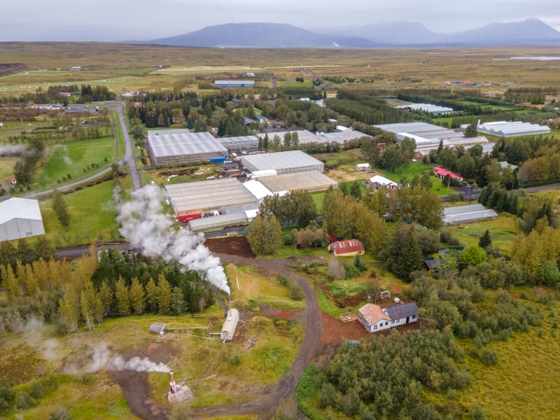
Reykholt in Bláskógabyggð is a rapidly growing village that originally developed around geothermal activity in the early 20th century. It is located approximately 96 km from Reykjavík.
Above the village, a striking plume of steam rises from a hot spring on the hillside—an essential lifeline of the community.
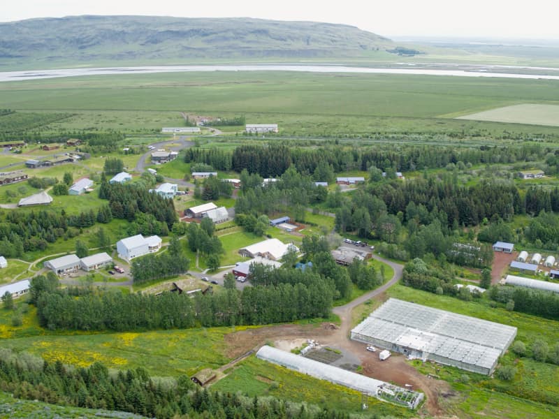
Today, Reykholt is one of Iceland’s most flourishing horticultural villages, and the Uppsveitir region of Árnessýsla is often referred to as the cradle of Icelandic horticulture.
The area is home to several large-scale greenhouse farms producing vegetables, flowers, berries, and shrubs, including Gufuhlíð, Friðheimar, Espiflöt, Jarðarberjaland, and Kvistabær. Visitors can purchase fresh produce and local delicacies directly from farmers at the Little Tomato Shop located in the entrance hall of Friðheimar.
The village offers a kindergarten, primary school, sports hall, a popular campsite, and the community center Aratunga. The local swimming pool is currently undergoing redevelopment and is set to reopen in autumn 2026 with a modern waterslide, children’s pool, steam baths, and upgraded fitness facilities.
Aratunga hosts a variety of cultural events, and many still fondly remember the lively rural dances once held there.
Reykholt offers a wide range of services, including the local store Bjarnabúð, often summed up by the saying: “If you can’t find it at Bjarnabúð, you don’t need it.” Freshly baked geothermal rye bread is among the specialties available.
A variety of accommodation options are available. Blue Vacations offers both a 40-room hotel in the heart of the village and 12 modern cottages just outside town with scenic countryside views. Guesthouses such as Húsið and Hvíta Húsið are also available.
There are three restaurants in the village, each with its own unique character. Restaurant Mika is known for its handcrafted chocolates, Friðheimar offers a unique dining experience inside a greenhouse along with horse shows, and the Friðheimar Wine Bar serves light meals and provides facilities for meetings and events. The Fish and Chips Hub restaurant is located at the village campsite.
A variety of additional activities are available in the area. Reykholt is located along the Golden Circle, with easy access to Iceland’s major natural attractions, including Geysir, Gullfoss, Þingvellir, Skálholt, and many other scenic sites.
Here is video from Reykholt in South Iceland.
View
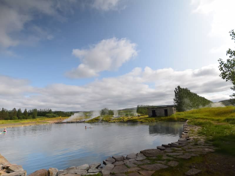
LAUGARÁS
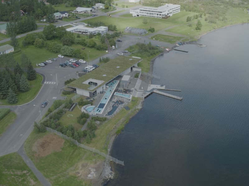
Laugarás is a vibrant village in South Iceland known for its geothermal energy, lush greenhouses and great visitor services. The newly opened Laugarás Lagoon offers a relaxing geothermal bathing experience, with the restaurant Ylja located on-site. Nearby you’ll also find Slakki, a charming petting zoo popular with families.
The area offers a wide range of accommodation options — including campsites, guesthouses and hotels — making it an ideal stop on the Golden Circle. Laugarás is also close to many cultural and natural attractions, such as the historic bishop’s seat Skálholt, one of Iceland’s most important heritage sites.
Fishing enthusiasts will enjoy the proximity to the famous Iða salmon river and the scenic Brúará, both offering memorable angling opportunities.
View
FLÚÐIR
Flúðir is a rapidly growing community in the center of the Hrunamannahreppur district, about 25 minutes off the main Ring Road. The area is considered to be very fertile and beautiful. Litla-Laxá, a clear spring river, runs through the village in an attractive basin. Miðfell, a small mountain, towers over Flúðir and gives the surrounding area a distinctive look. Good walking and riding paths lie to the top of Miðfell. You will find an impressive lake, and from the top, there is an excellent view of the area.
The main sources of employment in Flúðir are services, industry, and horticulture. Geothermal heat is utilized for greenhouses, and there is the biggest mushroom factory in Iceland. The surrounding area is a popular location for summerhouses. Flúðir has excellent services available for visitors. Accommodation, restaurants, grocery store, camping ground, swimming pool, golf course, football golf, horse rental, and The Secret Lagoon.
View

ÁRNES
Árnes is a growing settlement located approximately 100 km from Reykjavík and is part of the Golden Circle region. It offers a range of facilities, including the Árnes community center, Þjórsárskóli school, Neslaug swimming pool, a guesthouse, campsite, and a local store. A new sports hall is expected to be opened around mid-2026. Árnes takes its name from the island of Árnes in the Þjórsá river.
Árnes is the least populated center in the Uppsveitir area of Árnessýsla before heading into parts of the Icelandic Highlands, such as Sprengisandur, Fjallabak, and Landmannalaugar.
Many beautiful natural attractions can be found in the vicinity of Árnes, including Þjórsárdalur valley, Gjáin canyon, Hjálparfoss waterfall, and Háifoss waterfall. There are numerous scenic hiking trails in Þjórsárdalur and the nearby Þjórsárdalur forest, making the area ideal for outdoor recreation.
The area is also rich in history, with sites such as Stöng and the reconstructed Commonwealth-era farm located nearby.
A video introducing the municipality of Skeiða- og Gnúpverjahreppur can be viewed here.
View
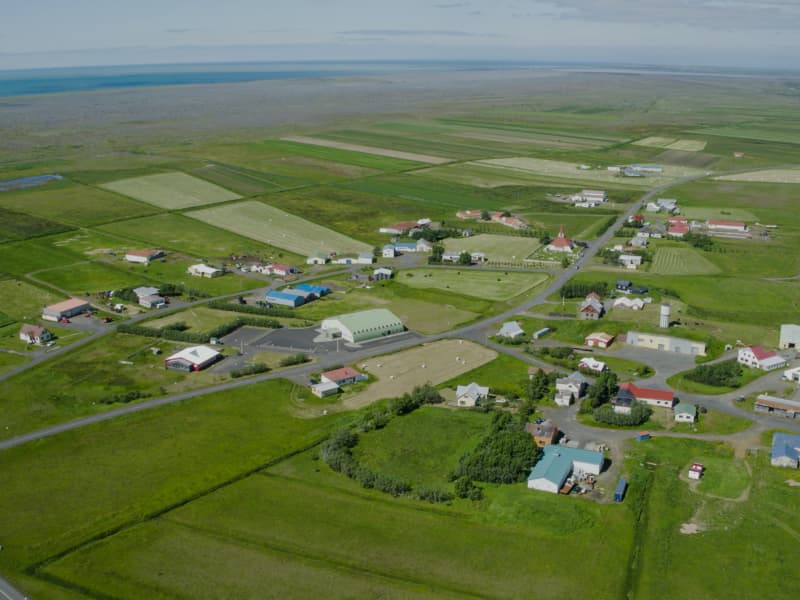
BRAUTARHOLT
Brautarholt is a small, family-friendly settlement located approximately 85 km from Reykjavík. The village offers a kindergarten, a community center, a swimming pool, and apartment-style accommodation.
Skeiðalaug swimming pool was inaugurated in 1975 following a joint community effort. It was renovated in 2024 and now features hot tubs, a cold plunge pool, an infrared sauna, and a steam room. In 2025, further development took place, adding a modern fitness facility next to the pool.
South Central Apartments is located in the village and offers accommodation, while nearby Hestakráin provides both lodging and dining.
Click here here for a video from small town Brautarholt
View
ÞYKKVIBÆR
Residential area by Hólsá and south of Safamýri. Before, Þykkvibær was flooded in every way. People had to wade up to the waist or deeper to get between towns and it was difficult to deal with haymaking. In addition, the lakes broke the land. In 1923, a powerful prelude was built across Djúpós and is now a road along the dam.
The settlement is old in Þykkvabær, first mentioned around 1220. Before that, there was some erosion from the sand. A primary school was established in Þykkvabær in 1892 and it was the first rural school in Rangárvallasýsla. After making the dam for Djúpós, horticulture increased and Þykkvibær is a picturesque place in every way.
Þykkvibær is now known in Iceland for growing potatoes.
View
HELLA
Welcome to Rangárþing ytra, one of Iceland’s largest municipalities in terms of geographical size, with around 2000 residents. It is one of three municipalities in the county of Rangárvallasýsla, which lies across the middle of South Iceland and has many unique natural resources in the lowlands and highlands.
The volcanic zone lies across the municipality, including one of Iceland’s most active volcanoes, Hekla, which stands at 1,491 m above sea level and has erupted six times over the last century, in 1947, 1970, 1980, 1981, 1991, and 2000. Some geothermal heat can be found in the region, not least in the area around Torfajökull, one of Iceland's most geothermally active areas.
The Veiðivötn lakes are located in Landmannaafréttur. Thousands of fishermen descend there every year, as the lakes are rich with Arctic char and trout. The Landmannaafréttur Fishing Association oversees aquaculture in Veiðivötn.
Ytri-Rangá, a popular fishing river, flows through the municipality. It´s one of the best salmon rivers in the country.
Many popular hiking trails can be found in Rangárþing ytra; the best known is Laugavegur. Another hiking trail, less known, is Hellismannaleið. Both are equally interesting.
All general services can be found in Rangárþing ytra, and the level of service is very high. The municipality has two nursery schools and two elementary schools, a healthcare centre, two swimming pools, grocery shops, a bank, auto repair shops, hotels, and a nursing and residential home.
The Icelandic horse has a place of honor in Rangárþing ytra, and activities related to the Icelandic horse are various. Other activities are, e.g., museums, Buggy tours, jeep tours, and fishing.
Further information on interesting places and activities can be found on this website.
View