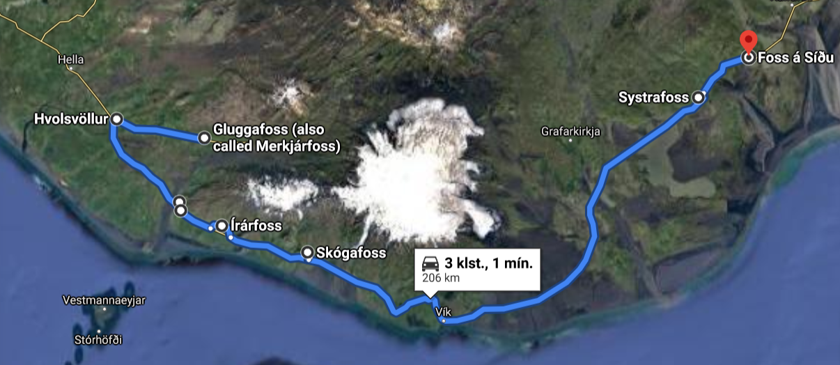
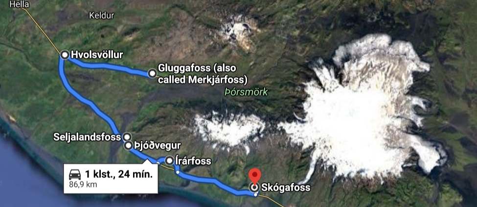
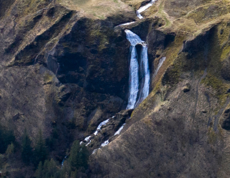
Many beautiful waterfalls are within Katla Geopark and most of them have it in common that they fall off an old sea-cliff line formed at the end of the last glaciation in Iceland when the relative sea level was much higher than it is today. The waterfalls listed here are all close to the ring road (road nr. 1) and are easily accessible for most people. There are also numerous other waterfalls within the Geopark, as are magnificent geosites and museums. The short route lies between the towns of Hvolsvöllur and Vík and the traveling time is about two hours. The longer route goes to the east of the town of Kirkjubæjarklaustur and the traveling time for that route is about four hours. The shorter route is a perfect day tour, while it would be a good idea to stay overnight somewhere if the longer route is taken. There are many hotels, hostels, cabins, and camping sites near the waterfall route, so finding a place to stay should not be difficult.
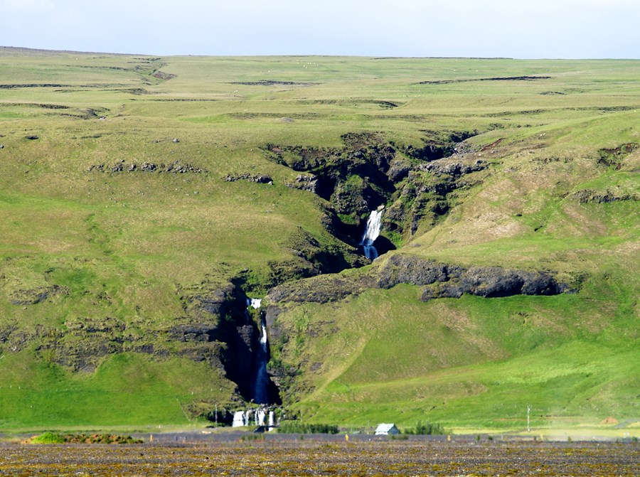
Gluggafoss waterfall
This beautiful waterfall is about 21 km east of the town of Hvolsvöllur. To get to it you will need to drive through the town to road nr. 261 which will take you all the way to the waterfall. On that road, and indeed at the waterfall, there is a gorgeous view of the surroundings.
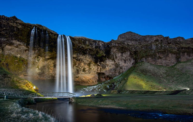
Seljalandsfoss waterfall
Is one of the best-known waterfalls in Iceland, and is one of few waterfalls you can walk behind in Iceland. There is another beautiful waterfall nearby, called Gljúfrabúi, which is about 300meters north of Seljalandsfoss. The waterfalls are close to road nr. 1. You will need to turn to road nr.249 to get to the waterfall, and the turnoff is well marked.
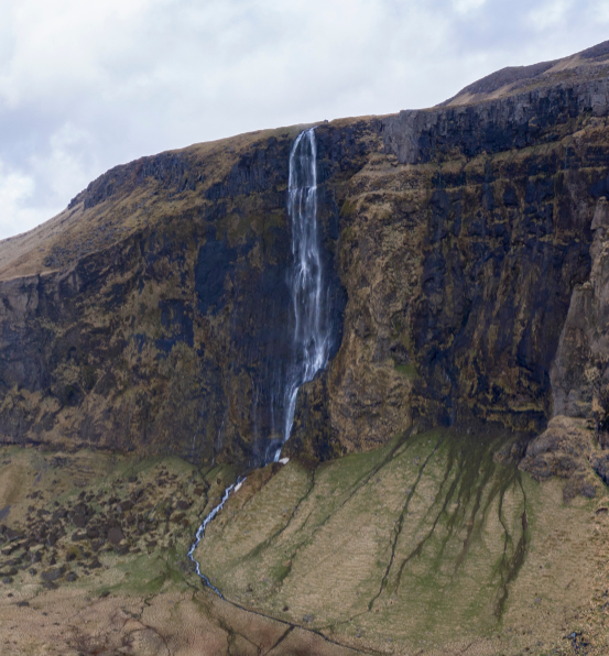
Drífandi waterfall
Is a waterfall in the Eyjafjöll mountain range. The waterfall is famous for the water in it sometimes not being able to reach the ground, as the water is blown away on the way down due to heavy wind. It is close to road nr. 1, and there is a small parking place near a large weather sign shortly after the turn-off to Seljalandsfoss.
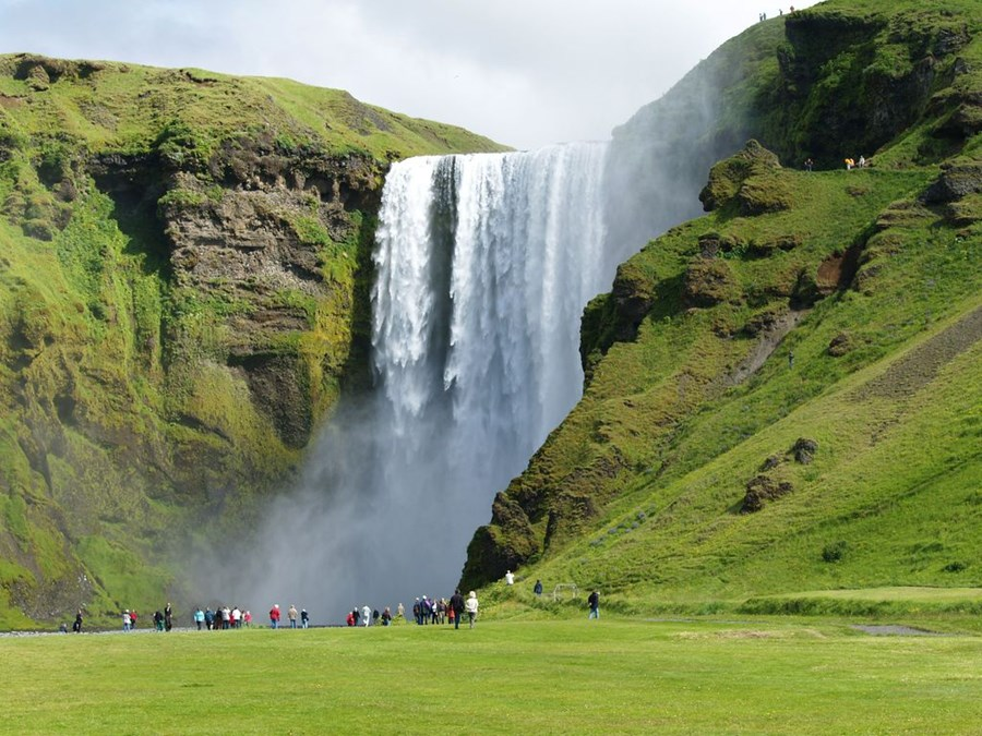
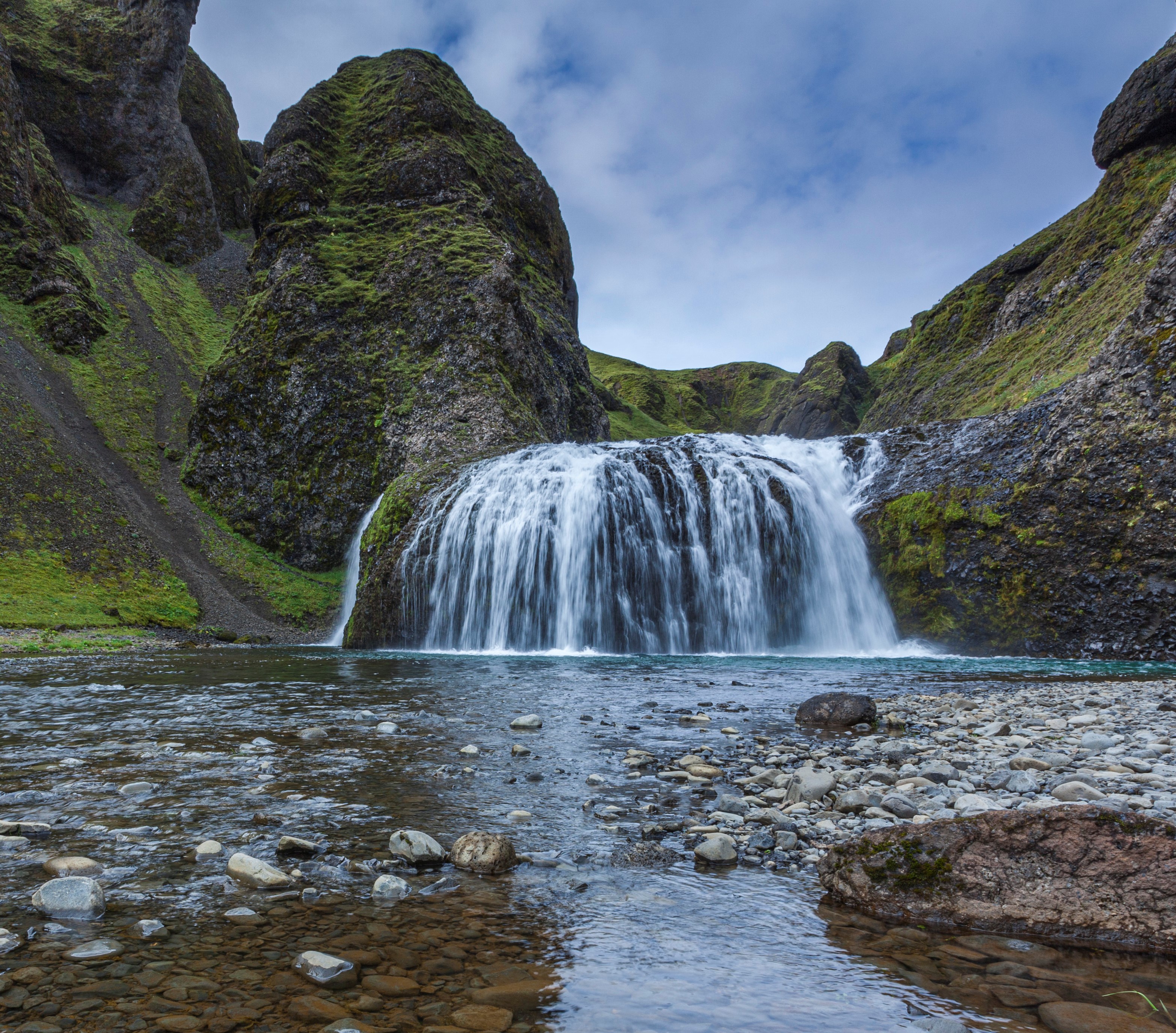
Skógafoss waterfall
Is a 62 m high waterfall located at Skógar. It is considered one of the most magnificent waterfalls in Iceland, especially when a rainbow forms in front of it. It is possible to walk almost all the way up to it, but be careful as the water spray can be powerful. To get to the waterfall, you turn off-road nr. 1 to Skógar and follow the signs to the car park.
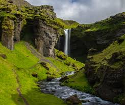
Kvernufoss waterfall
Is in a small canyon 1.5 km to the east of Skógafoss. A hiking path leads up to it from the car park of the museum at Skógar. We recommend checking out the museum along the way, where you can learn about the history of the area and how people traversed the glacial rivers before they were bridged.
Systrafoss waterfall
Is in the river Fossá that flows from Systravatn lake near the town of Kirkjubæjarklaustur. The waterfall is in a small canyon just on the edge of the town. To get to the waterfall, you first need to drive into town, and then west on Klausturvegur road to the western part of the town.
Stjórnarfoss waterfall
Is a small but very beautiful waterfall about 1 km north of Kirkjubæjarklaustur. It is in the river Stjórn which has origins in Geirlandshraun in the highlands further north. A campsite is close to the waterfall, and it is best to park there and then walk the short distance to the waterfall.
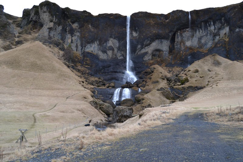
Foss á Síðu waterfall
Is about 10 km east of the town of Kirkjubæjarklaustur. The waterfall is behind a collection of farms in a beautiful setting. The water in the waterfall comes from a lake called Þórutjörn. It is possible to walk up to the lake via a small hiking trail near the waterfall and make sure to take in the beautiful views of the surroundings along the way.
Here you can get a printable version of the route.
For more information about the waterfalls, geosites, and available accommodation, please visit www.katlageopark.com