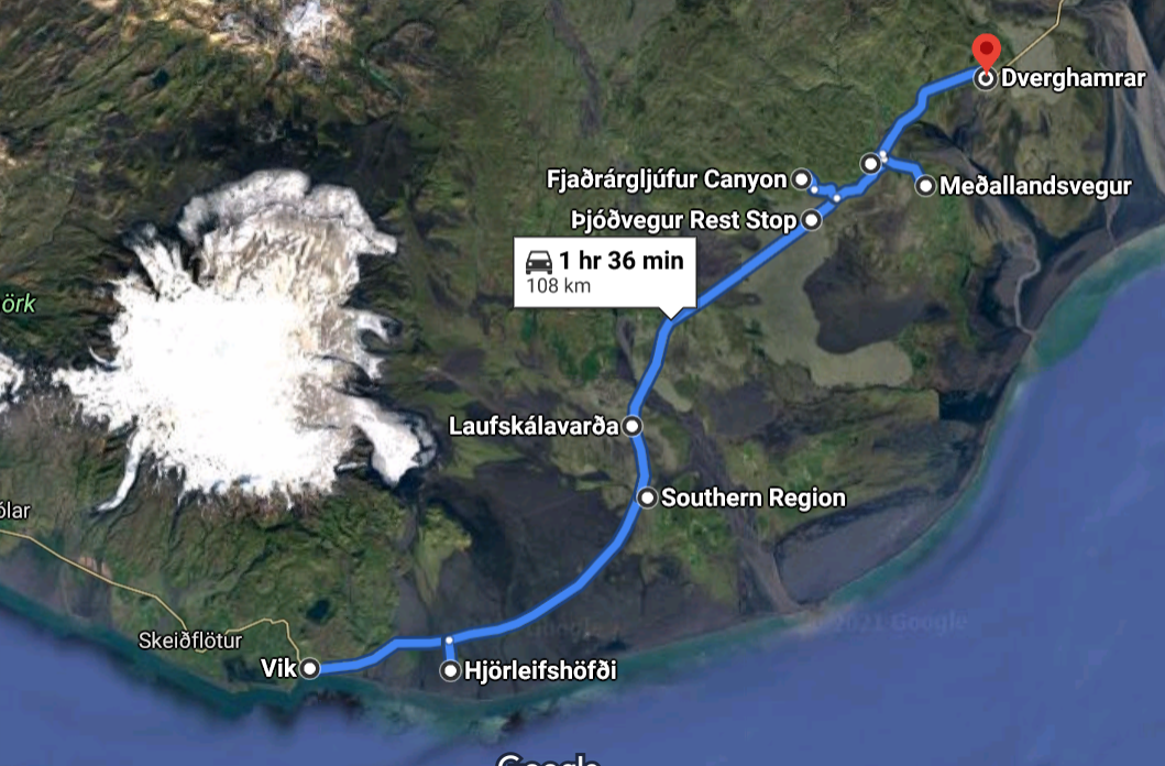
Many exciting geological sites are within Katla Geopark and they offer varied geology and often spectacular views. The sites listed here are all close to the ring road (nr. 1) and are easily accessible for most people. There are also numerous other Geosites within the Geopark that offer insight into the geology and geological processes and are listed on the Geopark's webpage. The Geology trail can be split into two parts, the east, and the west. The west trail lies between the towns of Hvolsvöllur and Vík and the traveling time is about two hours. The eastern trail goes to the east of the town of Kirkjubæjarklaustur and it takes also about 2 hours to drive that trail. Each part of the trail is therefore a perfect day tour, while it would be a good idea to stay overnight somewhere if you plan to do both. There are many hotels, hostels, cabins, and camping sites within the Geopark, so finding a place to stay should not be difficult.
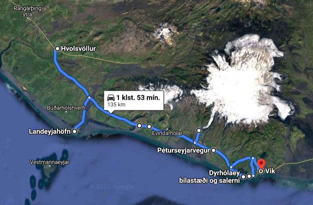
Markarfljót and Landeyjasandur
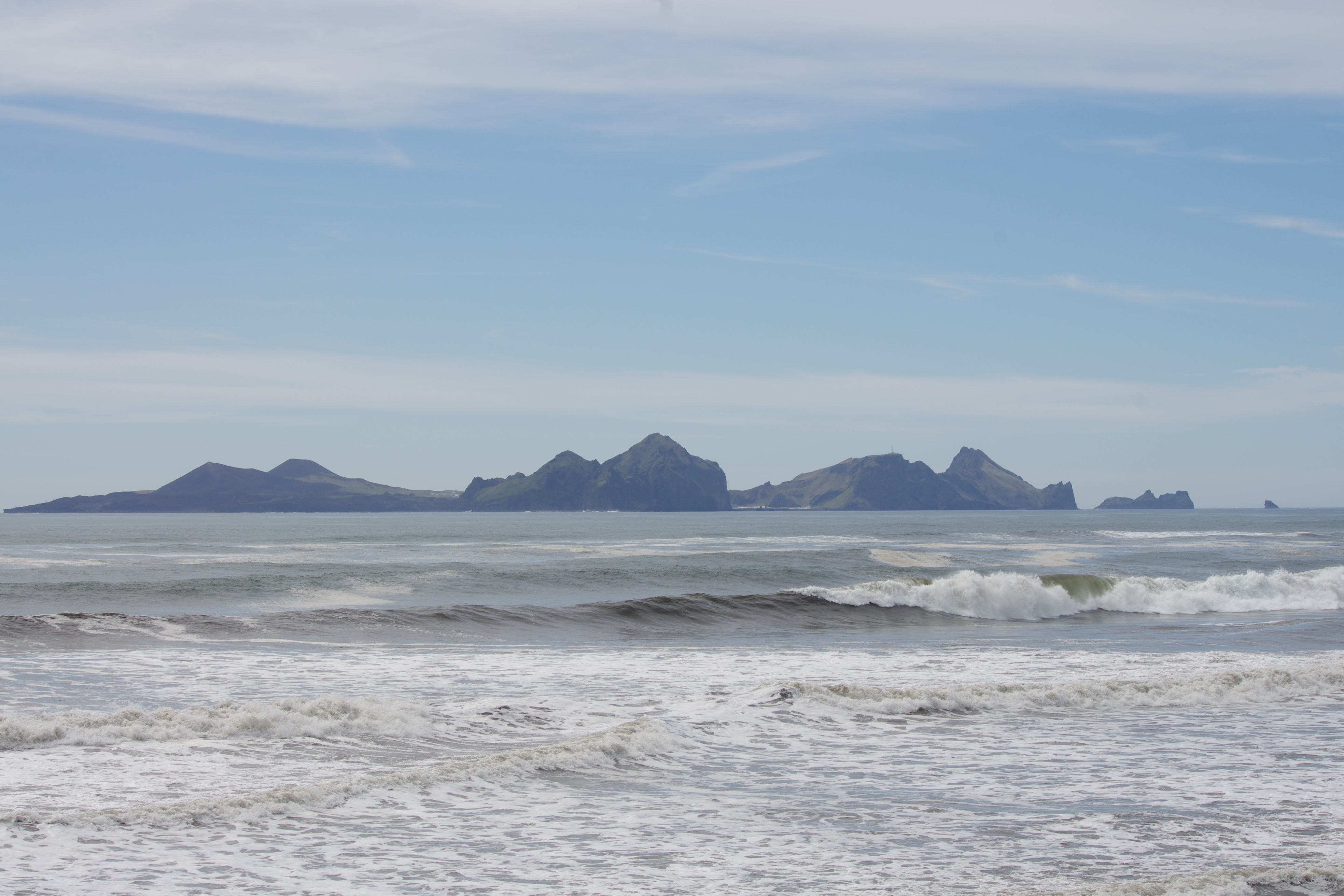
Markarfljót is a glacial river and its delta is known for its power and wildlife. Landeyjarsandur is a spectacular black sand beach. The best way to access it is near the Landeyjarhöfn harbor, and the harbor offers a magnificent view over the Westman islands as well.
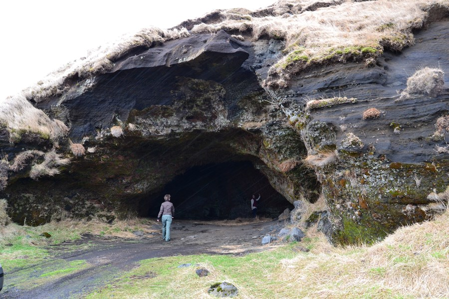
Steinahellir cave
is a small palagonite cave with a long history. The area around the cave is quite spectacular as well, as the surrounding area is littered with large boulders that have fallen off the steep, nearby mountainside. If you walk a short distance to the east from the car park you can view the boulders better. A small estuary is just south of the cave that is worth a visit as well.
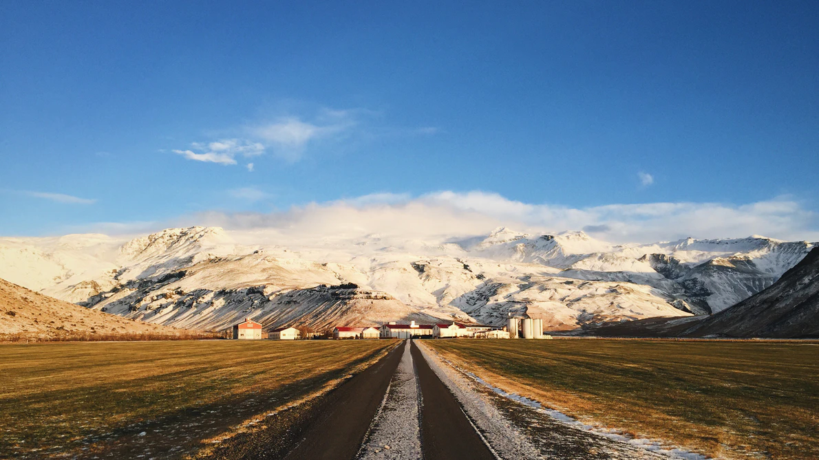
Eyjafjallajökull glacier and volcano
The glacier is especially beautiful when it has fresh snow covering it and the outline of the caldera can be seen underneath the ice. There is a viewpoint on the right-hand side of the road (if you are driving east) shortly after the stop at Steinahellir cave. The view of Steinafjall mountain is very good from the viewpoint as well, where you can see alternating layers of palagonite and lava.
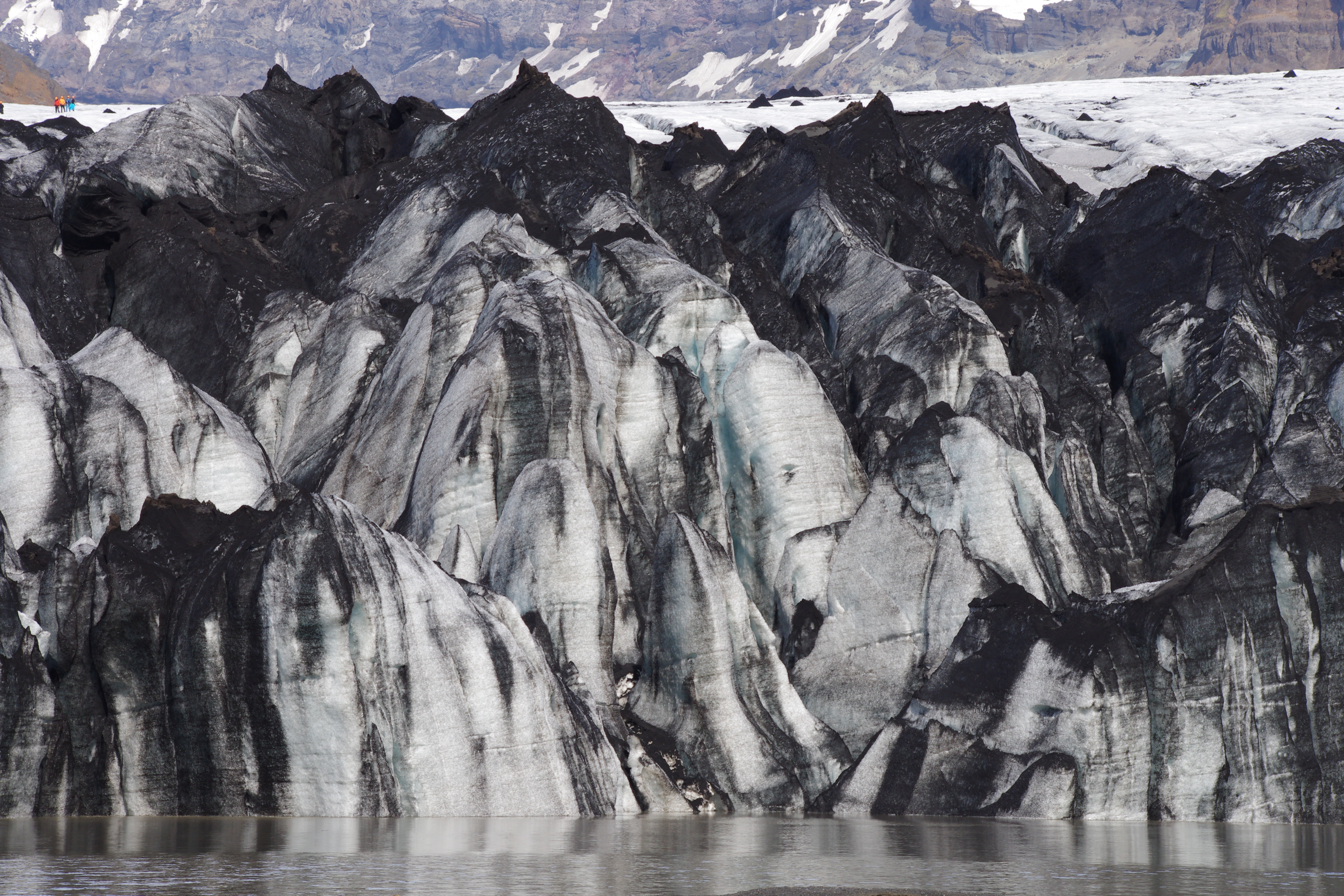
Sólheimajökull outlet glacier
It is possible to walk towards the glacier for a better view. The glacier has been retreating quickly over the last few decades and an ever-growing glacial lagoon has formed in front of it with a few icebergs in it. The glacial landscape around the glacier is breathtaking and a wide variety of glacial formations can be seen on the plain in front of it.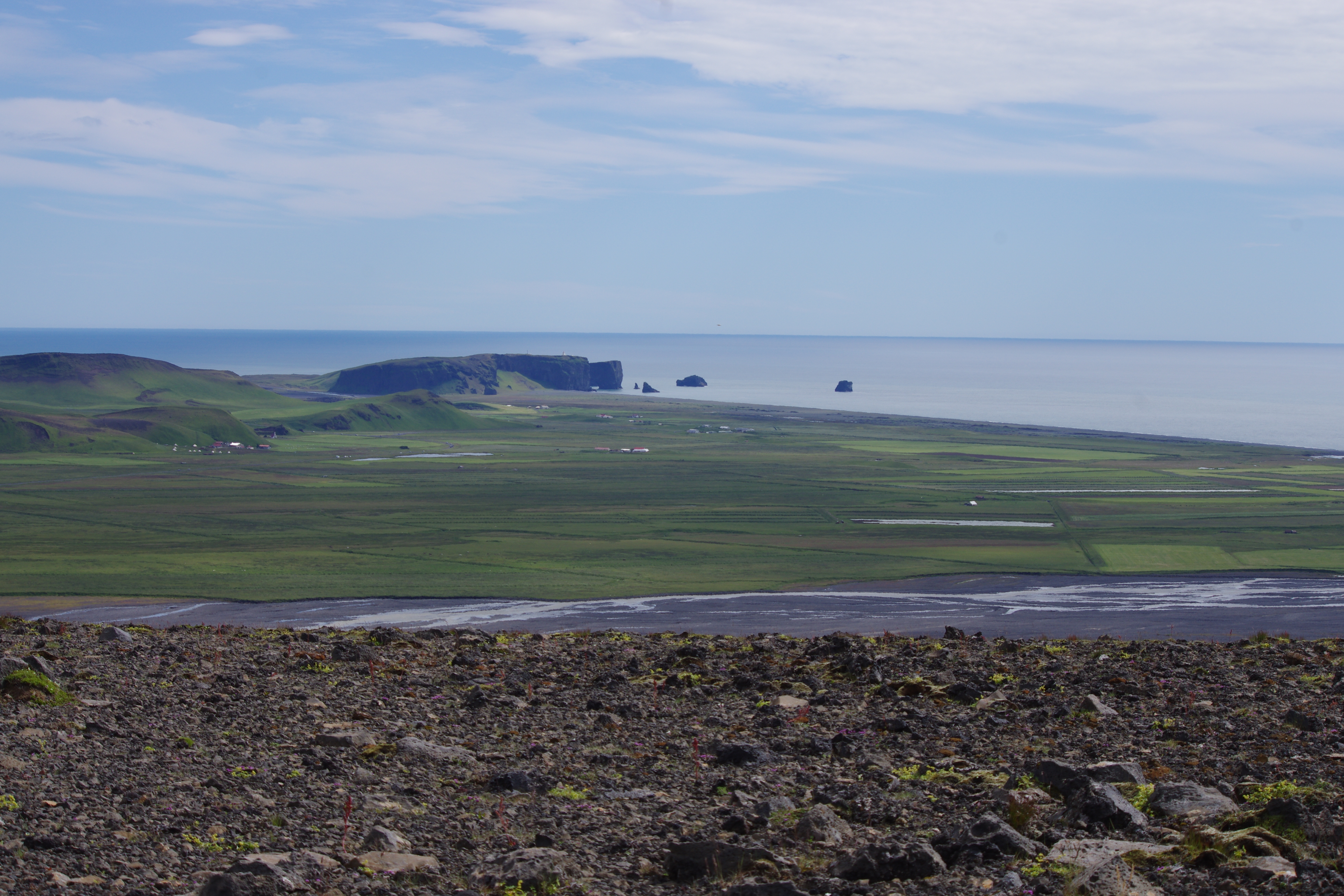
Pétursey Tuya
or the island of Peter is a small tuya on the south coast. It has beautiful palagonite formations on its side and the view from the top is spectacular. An unmarked hiking path goes from a small car park west of the tuya and to the top.
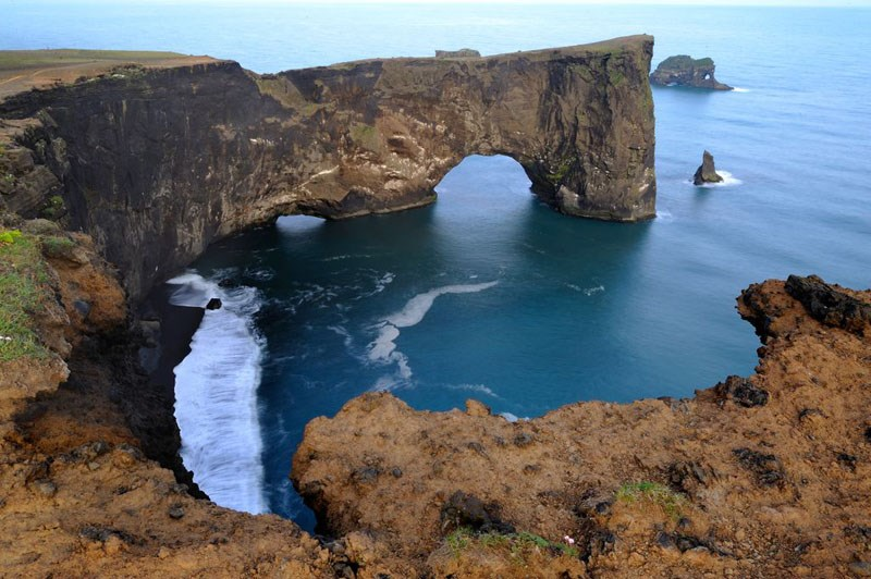
Dyrhólaey Island
The view from there is absolutely gorgeous and during the summertime, a number of puffins nest there. A car park is on the lower island, called Lágey, and from there it is possible to hike up to the higher island. Palagonite, columnar basalt, and coastal erosion are just a few of the things the site has to offer, and the drive to it from road 1 offers some exciting formations as well.
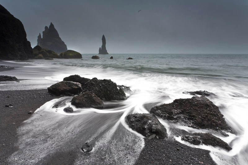
Reynisfjara, black sand beach
is one of the more well-known beaches in Iceland, famous for its black sand. The view from there over the Reynisdrangar sea stacks is very good and there is a beautiful basalt column wall on the side of the nearby mountain, but do not enter the cave as rocks can fall from the ceiling there. The waves on the beach are dangerous, so do not go too close to the sea either!
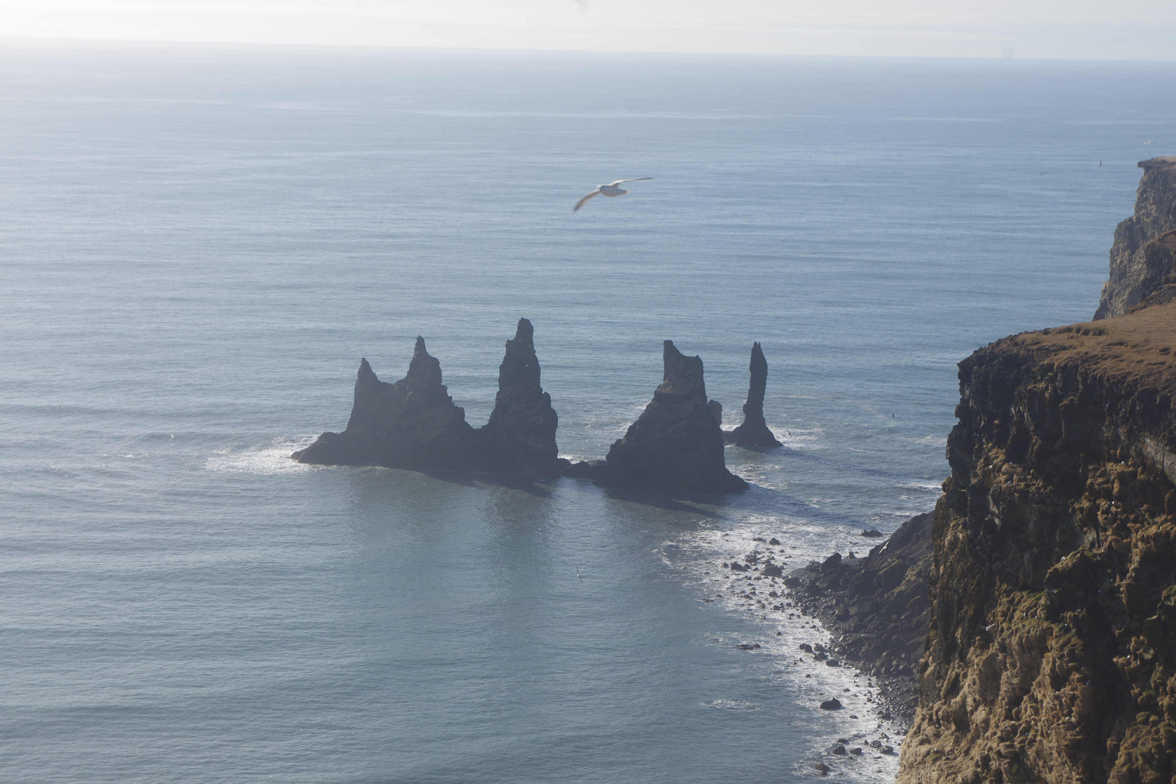
Reynisfjall mountain
is a beautiful palagonite ridge, next to the village of Vík. There is a relatively easy hiking path (road) leading up to the mountain from Vík. The view of Reynisdrangar and Dyrhólaey is otherworldly and palagonite formations and column basalt can be found in many places.
Hjörleifshöfði
is one of the most beautiful tuyas (Table Mountain) in Iceland and has a long history. There is a small car park on the west side, and a nice hiking trail that leads up to the top starts from there. The view from the tuya is great on a sunny day. It is worth checking out a large palagonite cave on the south side of the tuya as well.
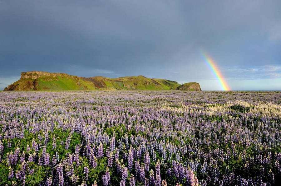
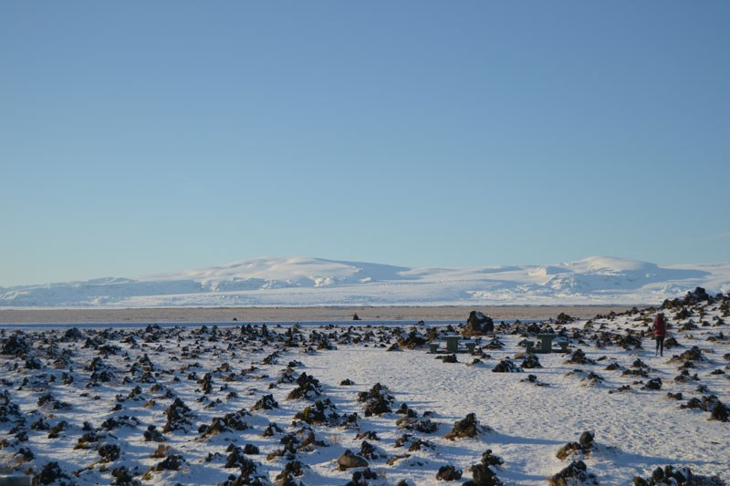
Álftaversgígar
are rootless cones that formed in an eruption from Eldgjá around the year 939. Rootless cones form when lava flows over wetlands, resulting in high steam pressure that eventually breaks its way through the lava, forming a pile on the surface. The site also offers great views over Mýrdalsjökull glacier, Hafursey tuya, and Mýrdalssandur outwash plain.
Laufskálavarða
is a lava ridge with hundreds of small kerns and a beautiful view. The small kerns were made by people who were crossing the Mýrdalssandur sandplain for the first time as it was supposed to bring good luck on the journey. The area is protected, so do not build new kerns or add to the existing ones!
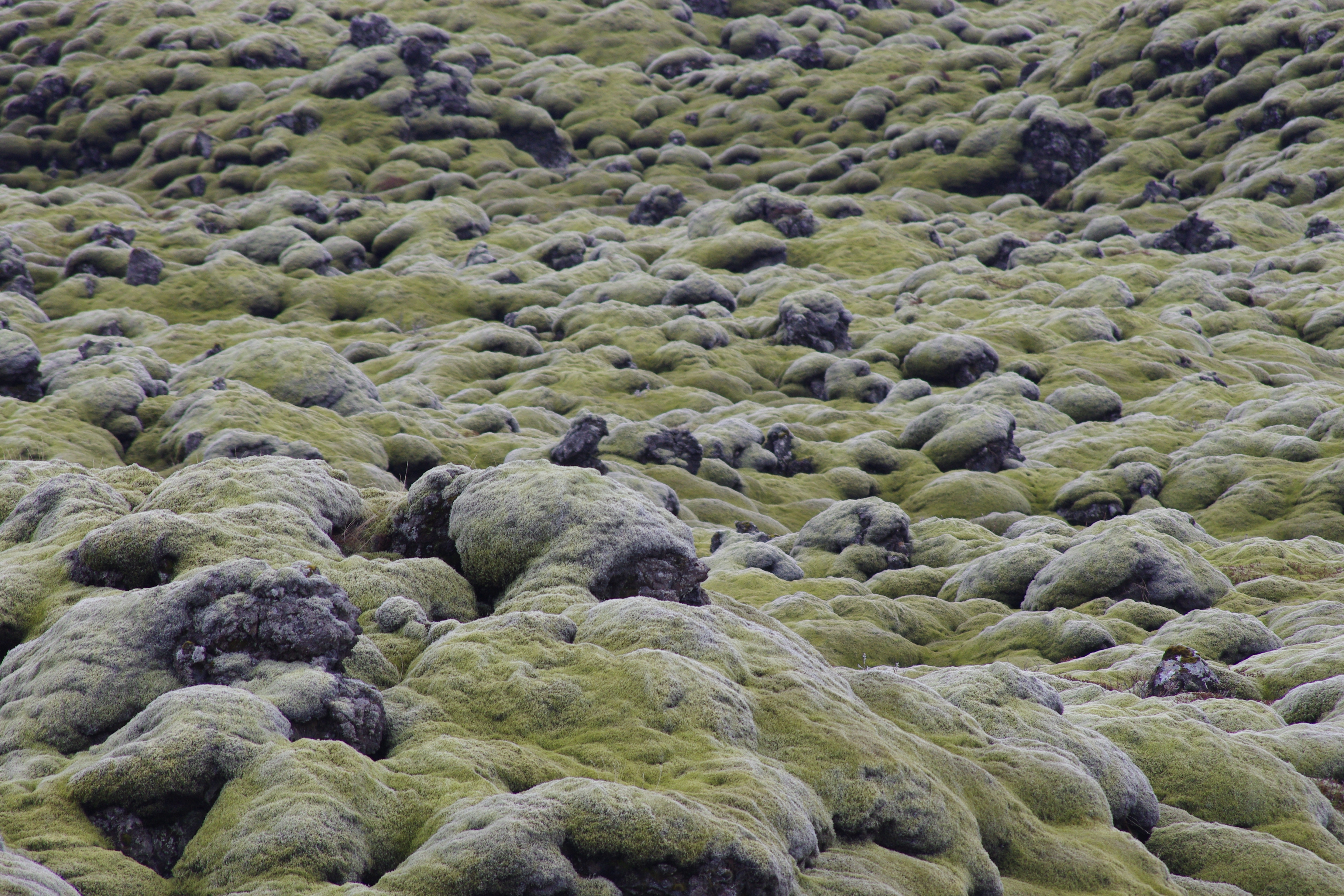
Skaftáreldahraun lava field
is the second-largest lava field formed in the last 1100 years and was formed during the Laki eruption in 1783-84. Most of the lava is covered by moss, giving it a smoother look and a nice color contrast. There is a nice viewing platform at the site, offering great views over the surrounding area.
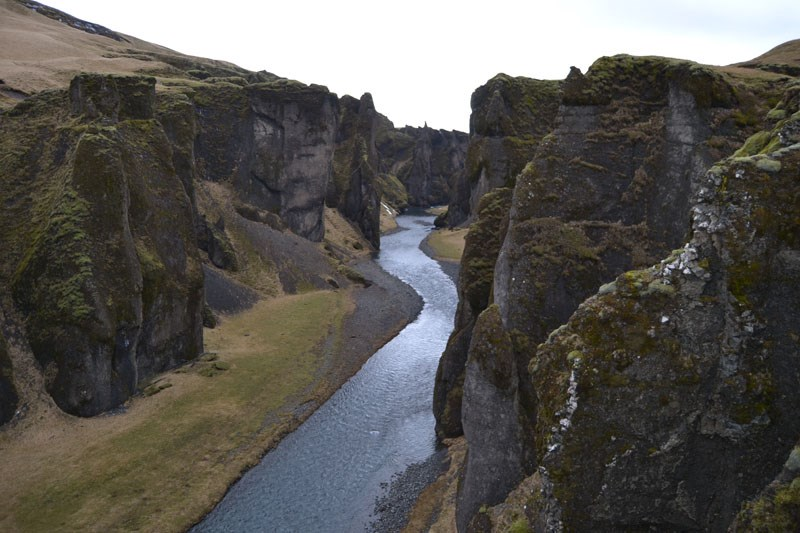
Fjaðrárgljúfur
is a canyon with beautiful palagonite formations. The canyon was formed by glacial rivers eroding the rock face at the end of the last glaciation in the area. it is possible to walk along the edge of the canyon and take in the view from above.
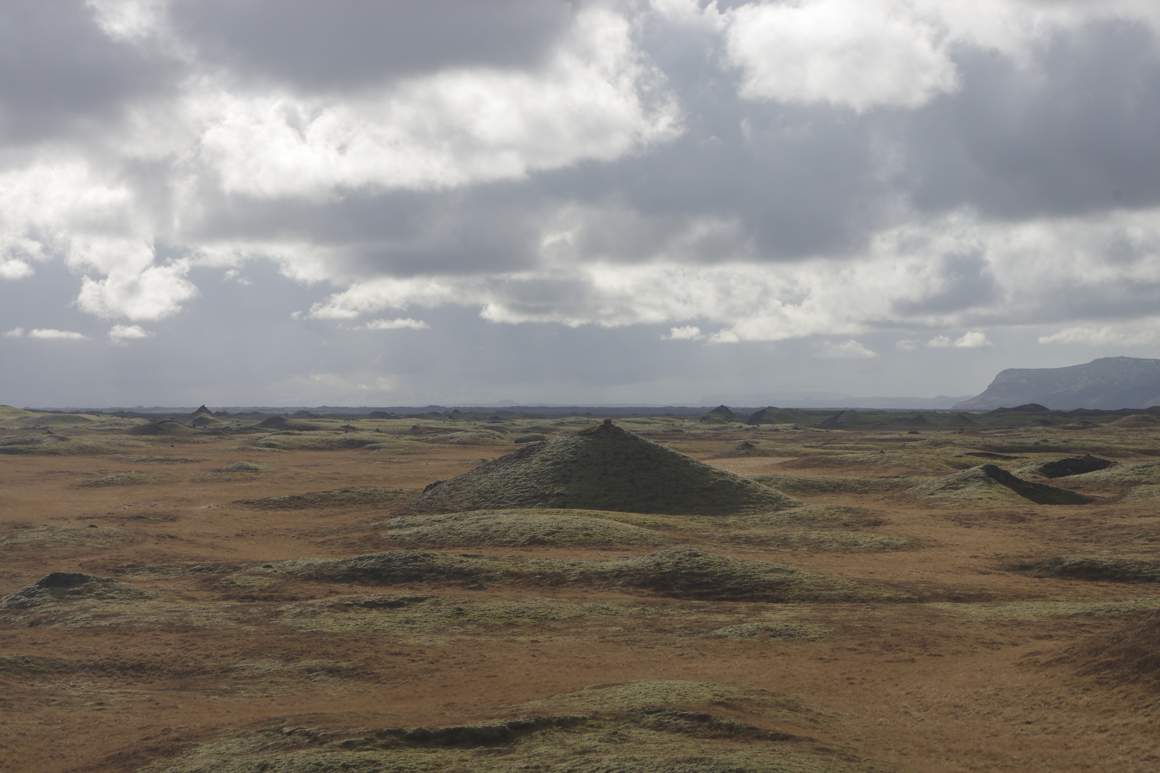
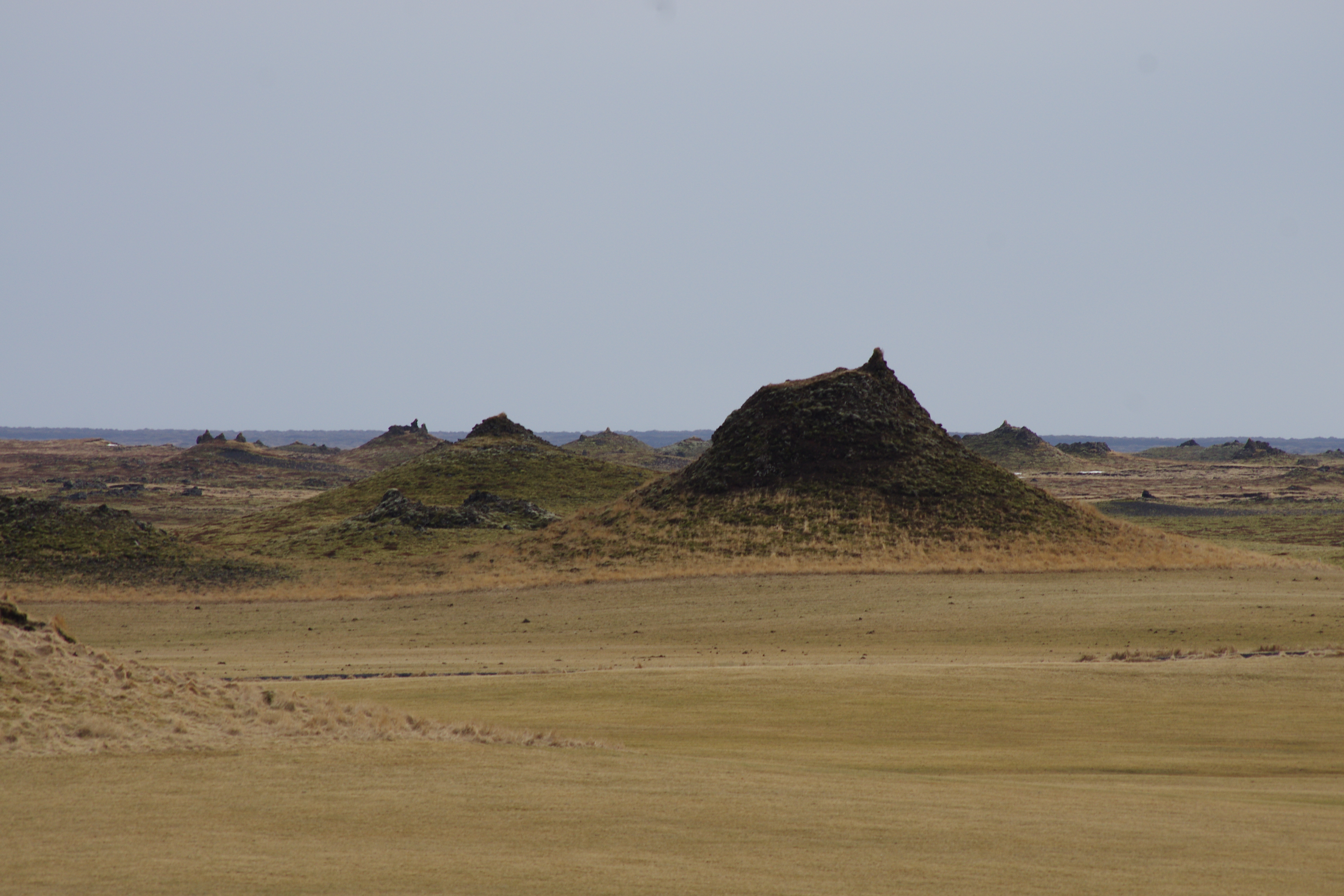
Landbrotshólar
are also rootless cones that formed in an eruption from Eldgjá around the year 939. In this area, the cones are more vegetated and some are more accessible. Skaftá, the nearby glacial river flows close by, and during the summertime you can see a cross-section of an old wall near Hotel Laki, revealing numerous tephra layers.
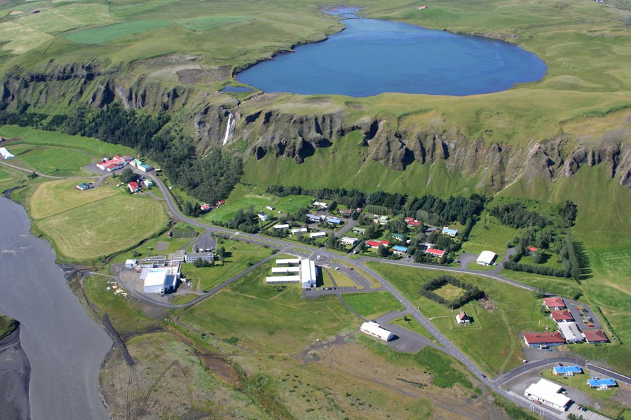
Systravatn
is a small lake on top of the mountain above the town of Kirkjubæjarklaustur. The river Fossá flows from the lake and cascades down the rock face forming a beautiful waterfall called Systrafoss. Near the lake are beautiful formations, old lake coastlines, and a perfect view of the surroundings, including the Skaftá river and its black sands.
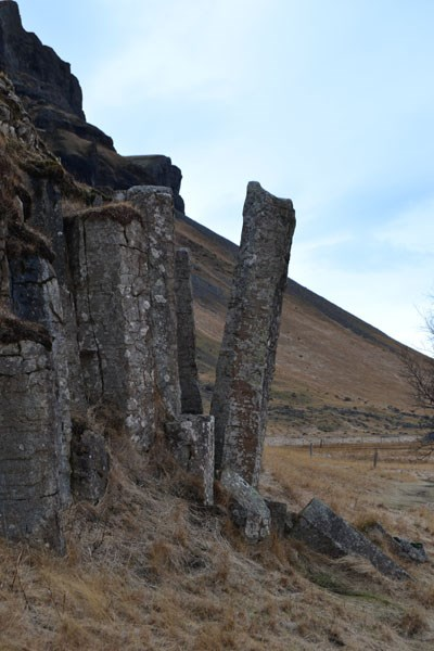
Dverghamrar
is a rock face with peculiar, but magnificent-looking, basalt columns. This area, as large parts of the south coast were, was sculpted by glaciers and then by wave erosion at the end of the last glaciation in Iceland. Block lava sits on top of the columns, forming a nice contrast. Nearby, there is a site called Orustuhóll and it is worth going there as well. In both locations, beautiful palagonite formations can be seen on top of the nearby mountain.
For more information about the waterfalls, Geosites, hiking maps, and available accommodation, please visit www.Katlageopark.com.
Here you can get a printable version of the route.