There are many interesting places in Árborg and Flóahreppur. First and foremost is our local waterfall, Urriðafoss, just a short drive from Selfoss and the route to Vík.
There are a lot of historical buildings in Árborg and Flóahreppur, which can be found in Stokkseyri, Eyrarbakki, and the Selfoss area. The beautiful beach in Stokkseyri and Eyrarbakki, as well as the bird reserve in the area.
The lighthouse (Knarrarósviti) on the coast near Stokkseyri is always a nice place to visit. The Kaldaðarnes airfield was occupied in WWII, is full of history, and deserves a visit. So everybody can find something of interest in this beautiful area.
SELFOSS
Selfoss, pop. 8.832 is the largest town in South Iceland and the main center of trade and industry. The distance from the capital is 57 km, and various options are available for anyone who wants to stay in this friendly town. Many restaurants and cafés are situated in the heart of Selfoss, along with several types of shops. The town also has an outdoor swimming pool with a sauna and hot tubs. North of Selfoss, you will find the recreation forest of Hellisskógur, with interesting footpaths alongside Ölfusá River. On the far side bank of that same river, you can also find a 9-hole golf course. In Selfoss, you can find all types of accommodation.
Further information is given at The Selfoss Area Information Office, located at Austurvegur 2.
ÁRBORG
The Municipality of Árborg was established in 1998. It consists of the town of Selfoss, the villages Eyrarbakki, Stokkseyri, and the Sandvík area. This region offers excellent options for recreation and relaxation, including a wide selection of restaurants, cafés, art galleries, museums, and swimming pools, as well as a 9-hole golf course in Selfoss. A perfect location for any visitor who wants to stay closer to nature and explore unique landscapes such as large lava fields and black sand beaches.
The Árborg area has a population of 10.346 people (September 2020).
View
EYRARBAKKI
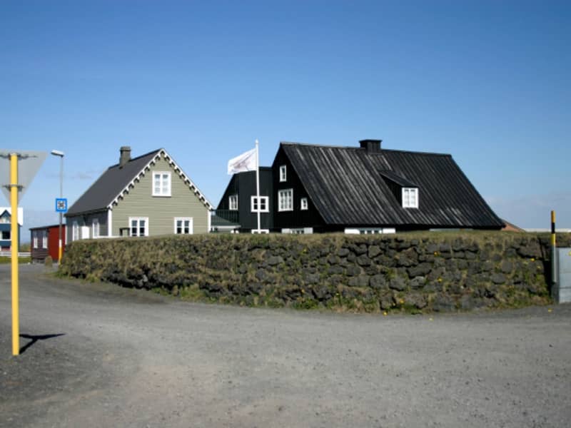
Eyrarbakki, pop. 585 is a friendly village that used to be the largest commercial community and main harbor on the South Coast of Iceland. Many preserved houses from 1890 to 1920 are situated in Eyrarbakki, and a visit is, therefore, like going 100 years back in time. Other great attractions are The Eyrarbakki Maritime Museum and the Árnessýsla Folk Museum, which is located in a building constructed in 1765, famously known as “The House”. Here you can also find a campsite, hostel, guesthouses and a great restaurant. On the rocky shoreline is a fantastic view of the Atlantic Ocean, where you can watch the surf break. It is an ideal spot for hiking and bird watching. Passing the beautiful recreational forest Hallskot northwest of Eyrarbakki, you enter the Flói Bird Reserve. It is a significant nesting area, especially for wetland birds, and is listed as an Important Bird Area (IBA) by BirdLife International.
ÁRBORG
The Municipality of Árborg was established in 1998. It consists of the town Selfoss, the villages of Eyrarbakki, Stokkseyri, and the Sandvík area. This region offers excellent options for recreation and relaxation, including a wide selection of restaurants, cafés, art galleries, museums, swimming pools, and a 9-hole golf course in Selfoss. A perfect location for any visitor who wants to stay closer to nature and explore unique landscapes such as large lava fields and black sand beaches.
View
STOKKSEYRI
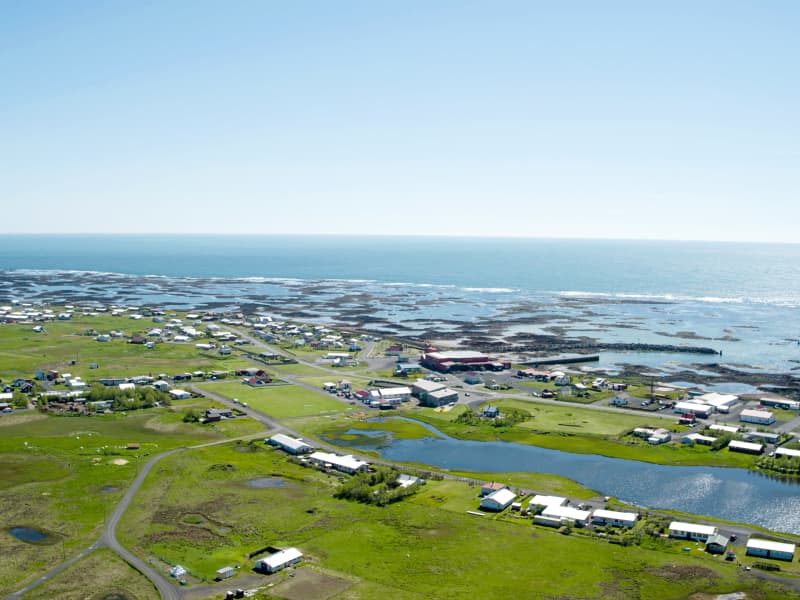
STOKKSEYRIStokkseyri, pop. 559 is a charming village renowned for its beautiful seashore, breaking ocean waves and birdlife, and rich in handicrafts and culture. Workshops, galleries, Ghost Center, and the Elves and Northern Lights Museum are all located in a Cultural Centre, Menningarverstöðin, an old fish processing factory that has found a new role due to changes in the fishing industry. The Wildlife Museum is dedicated to hunting and wildlife and contains many mammals and birds. The bunkhouse Þuríðarbúð provides an excellent example of how fishermen had to make use of what nature provided. Stokkseyri also offers one of Iceland's most famous seafood restaurants, an outdoor swimming pool, kayak tours, and a campsite. East of Stokkseyri is Knarrarósviti Lighthouse, built-in 1938 and put into operation a year later. For further information, visit the tourist information at the local Café, Gimli Kaffihús.
ÁRBORGThe Municipality of Árborg was established in 1998. It consists of the town Selfoss, the villages of Eyrarbakki, Stokkseyri, and the Sandvík area. This region offers excellent options for recreation and relaxation, including a wide selection of restaurants, cafés, art galleries, museums, swimming pools, and a 9-hole golf course in Selfoss. A perfect location for any visitor who wants to stay closer to nature and explore unique landscapes such as large lava fields and black sand beaches.
View

FLÓAHREPPUR
Flóahreppur is a peaceful municipality situated in South Iceland, between the two large Salmon Rivers Hvítá and Þjórsá. Flóahreppur is famous for its wide panorama view in all directions, range of mountains, glaciers, and islands. In the area is Iceland´s most voluminous Waterfall Urriðafoss, where Þjórsá River falls off the margin of Þjórsárhraun a Lava Field that came about 8.000 years ago and is one of the largest known Lava-flows anywhere on Earth. Flóahreppur is a paradise for people who love nature and bird-watching. Bird-life around the area has great variety and is an interesting choice for bird-watchers. Here you can see Icelandic birds in their natural environment without any difficulties. Flóahreppur is also ideal for walking, cycling, and riding.
Culture in the area has historical deep roots and great emphasis is placed on the preservation of cultural heritage, whether it is crafts, inventions, history, traditional farmhouses, or churches. In Flóahreppur you will find a variety of recreational possibilities and services such as accommodations, museums, craft workshops, farm lodgings, and country boutiques – to name a few. Flóahreppur is a vibrant community with a diverse society, which offers a number of events and gatherings, both new and old traditional ones. Flóamanna Saga is one of the Icelandic Sagas and preserves memories of this area.
During the period from mid-September until March/April if you are lucky you might see pink clouds dancing around the sky just like a Symphony Orchestra playing in the sky a breathtaking and unforgettable performance. That´s what we call the Northern Lights some call it Aurora Borealis. That is just one of the Winter-Charms Flóahreppur has to offer. A visit to Flóahreppur is a unique experience that you will not forget. The people of Flóahreppur welcome you to experience our heritage, beautiful and peaceful environment, but first and foremost the wonders of Flóahreppur.
View
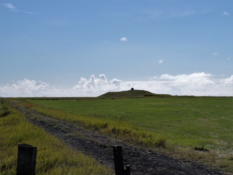
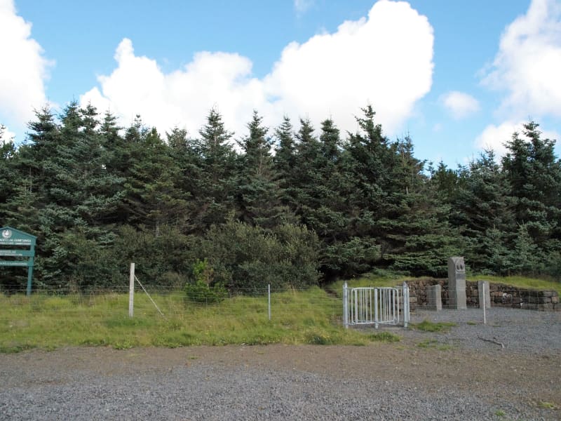
Ásavegur - trail
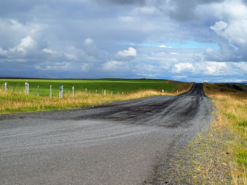
The trail Ásavegur used to be an important highway through the South of Iceland. This centuries-old man-made route would be used by people from different directions to go fishing, for example, or to collect their sheep and cattle from the mountains.
Between Orrustudal and Hnaus is a marked hiking trail along the old Ásavegur trail, about a 6 km walk. On this trail is the highest point of Flóahreppur, with breathtaking views in all directions. Information signs on Orrustudalur (The Valley of Battles), Skotmannshóll (Archer's Hill), and Mannabeinsmelur (The Human Bone Field) are located at different points during the hike.
These locations are a great part of Icelandic history. Here is the stage of Flóamanna-Saga; two big battles were fought in Orrustudalur valley, and from Skotmannshóll or Archer's Hill came one of the greatest bowshots in the saga.
View
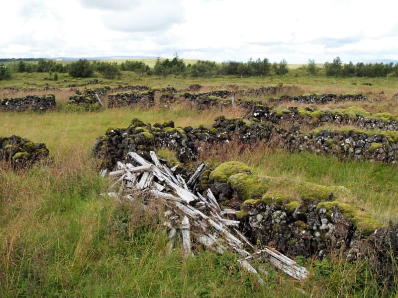
Dælarétt
Dælarétt is a centuries-old sheep pen surrounded by beautiful landscape, built from rocks of the great Þjórsárhraun lava field. Dælarétt is considered to be the oldest sheep pen in the country and has now been preserved. Close by are earthquake fissure; use caution around the fissures.
View
Einbúi, Oddgeirshólar
A beautiful sports and outdoor recreational area on the banks of Hvítá River. The area is owned by the Youth Association Baldur.
View
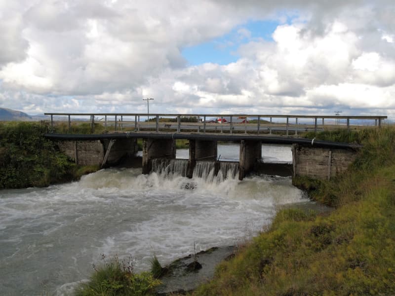
Flóaáveita - canals
Flóaáveitan are canals that run through the entire Flói region, from Ölfusá in the west to Þjórsá River in the east. This monumental construction consisted of 300 km long canals and 900 km of embankments. The Flói irrigation system reached over 12 thousand hectares of land and became a major transition in farming and production in the area at the time. The construction of Flói irrigation system began in 1922 and irrigation began its activities in 1927. When the irrigation was inaugurated in 1927 it was one of the greatest structures in Europe and to this day it plays an important role in transferring water between farms. Beside the sluice gate you will find an information board with more details about the Flói irrigation system. To the east of the sluice gate is a marked hiking trail along Hvítá (about 4,4 km, one way).
View
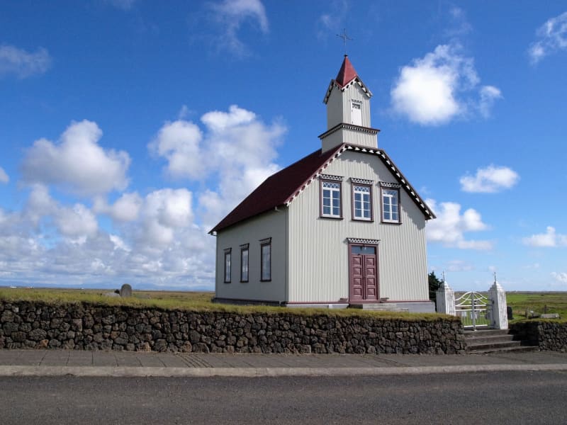
Gaulverjabær church
Gaulverjabær has been a church site and manor since early settlement. Loftur Gamli from Norway was Gaulverjabær's first settler and named the place after people from Gaular in Norway, a province of Sogn and Fjordane. In 1930 a significant collection of 360 silver coins from the first century of Icelandic settlement was discovered at this site. The current church was built in 1909 and has now been preserved.
View
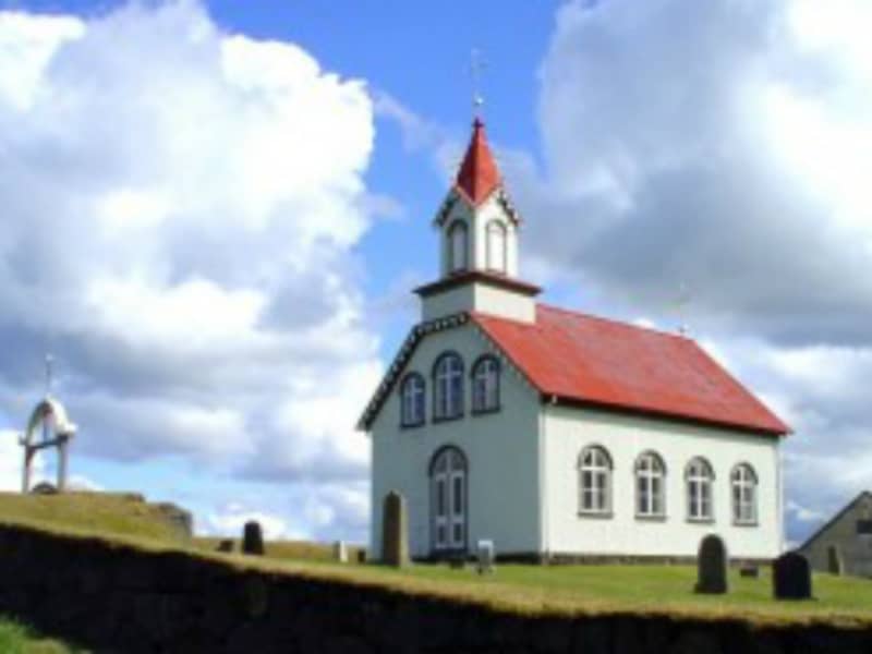
Hraungerdi church
Hraungerði is a church manor and former assembly site. The land once belonged to Hróðgerður the Wise, one of the first settlers and progenitor of the clan Oddverjar. The first mention of a church in Hraungerði is in Bishop Páll’s records from around 1200 AD and since then there have been numerous churches built in Hraungerði. The current church, established in 1902, was designed by architect Eiríkur Gíslason from Bitra and is now preserved.
View
Kambur
A notorious robbery, called Kambsrán, was committed at this spot in 1827. Four men broke into the farm at night, tied up the farmer Hjörtur Jónsson as well as the members of his household and ransacked the house in search of money. They ended up stealing about 1000 state dollars. The thieves left behind some evidence and it was the famous sea captain Þuríður Einarsdóttir who finally solved the case.
View
Kolsgarður
Kolsgarður is a path made from turf believed to be from the 10th century. Kolur from Kolsholt made this path so he could meet a woman called Ragnheiður from Ragnheiðarstaðir since swamps were between their two farms and Kolur did not want to meet Ragnheiður all wet and muddy. To this day the path can be spotted in the landscape.
View
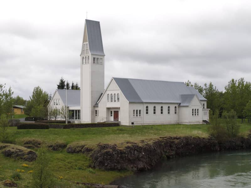
Laugardælir
Laugardælir is a small hamlet near the town of Selfoss. Laugardælir was one of Iceland’s busiest ferry sites until a bridge was built across Ölfusá in Selfoss in 1891. The church at Laugardælir was built in 1965 using mainly concrete and it is 300 m2 in total. In the church cemetery is the burial site of former World Chess Champion Bobby Fischer (1943-2008).
View
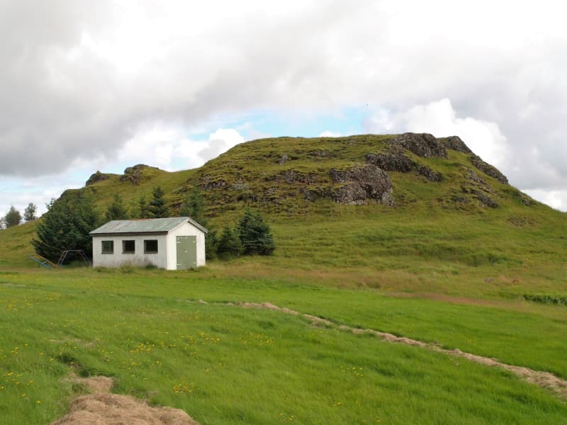
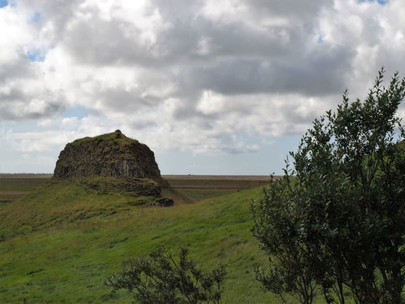
Loftsstaðir
Loftstaðir is a medieval fishing station. A great sorcerer called Galdra-Ögmundur lived there around 1600. On a hill nearby, called Loftstaðahóll, is a huge and age-old stone cairn.
View
Rútsstaða-Suðurkot
The birthplace of the great Icelandic artist and painter Ásgrímur Jónsson (1876-1956). He was a pioneer of Icelandic visual art and the first Icelander to become a professional painter. Ásgrímur studied at the Royal Academy of Art in Copenhagen between 1900 and 1903.
View
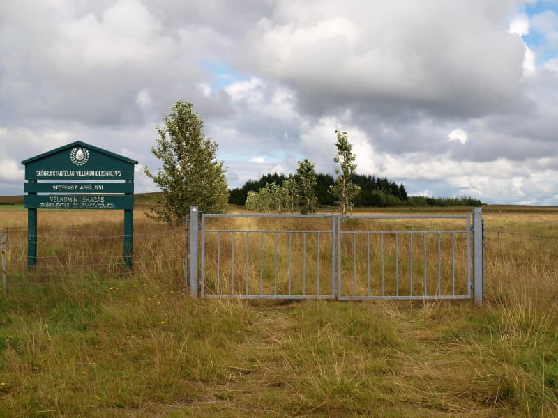
Skagaás grove
Skagás is a beautiful grove in serene surroundings. It’s easily accessible and open for everyone but please take care not to leave any litter behind. Barbequing is allowed only in a specially designated area due to fire hazard.
View
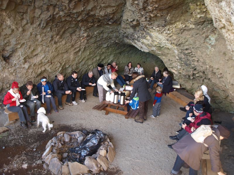
Hellisskógur forest
Hellisskógur is a small forest just outside of the town of Selfoss. In Hellisskógur are roads, walking paths around the area, and benches so visitors can relax and enjoy the site.
The cave in Hellisskógur forest was formed during a latter glacial period by sea erosion. Sea levels have been higher than now several times, and signs of sea erosion can be seen on more cliffs in the area, made of around 0, 7 – 3, 1 million-year-old basalt. The cave was previously used to store hay in the back and as a sheepcote in the front.
It was once believed that the cave was haunted by a ghost wearing a blue scarf. The story tells of a young man who was broken hearted and hung himself in the cave using a long blue scarf.
Here is a map of Hellisskógur
View
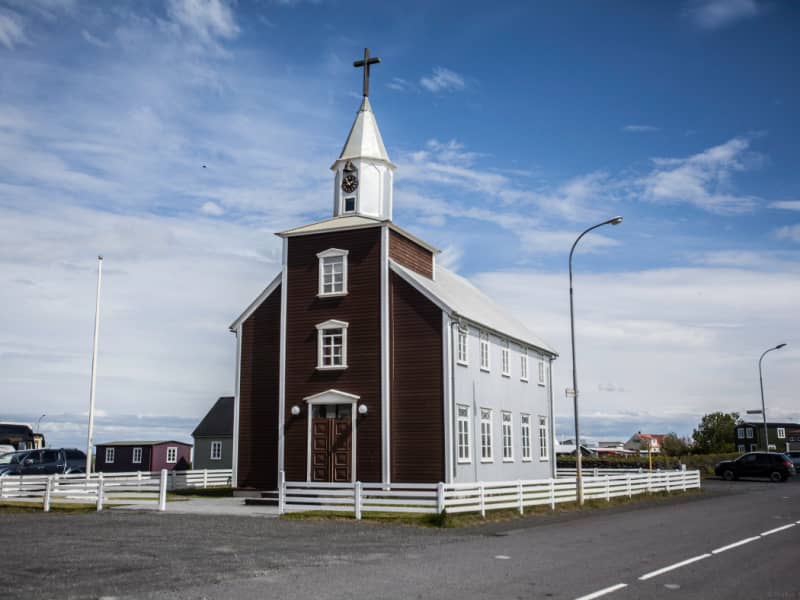
Eyrarbakkakirkja - church
The church in Eyrarbakki was inaugurated in December of 1890. Before that, the people of Eyrarbakki attended services in the neighboring village of Stokkseyri, but as the population of Eyarbakki grew, reaching 702 in 1890, it was time for Eyrarbakki to have its church. The church seats 230-240 people.
The church of Eyrarbakki's main proponent was the Reverend Jón Björnsson, who was a pastor of the church from its opening until 1892. The church was designed by Jóhann Fr. Jónssyni, the chief carpenter in Eyrarbakki from 1880 to 1890, but he died before the church's completion.
One of the main points of interest is the church's altarpiece, which is a painted picture of Jesus talking with the Samaritan woman at Jacob's well (John 4, 13-14). "Whoever drinks of the water that I shall give him, he will never be thirsty." The Reverend Jón Björnsson sailed to Denmark to obtain building materials for the church, and while there, he was given an audience with King Christian IX and Queen Louise. They liked him so well that the queen gave him the church altar she had painted. The altarpiece bears her name and the year 1891.
Other items of interest are the candlesticks from Kaldaðarneskirkja, the church in Kaldaðarnes, which was closed in 1902. The candlesticks, inscribed with the year 1780 and the letters E.S.S. Stjakarnir, are Icelandic craftsmanship and all hand-made. The chandelier also comes from Kaldaðarneskirkja. In 1918, a bell was added to the tower, which rang twice an hour. It was a gift from the Danish merchant James A. Lefolii in memory of the many decades of the Lefolii family in Eyrarbakki.
Extensive renovations to the church were carried out from 1977 to 1979. A new 11-pipe organ by Björgvin Tómasson was put into service on Christmas day, 1995.
View
Selfosskirkja - church
Selfoss Church was built from 1952 to 1956 and consecrated on Palm Sunday, 25 March 1956. It was designed by the headmaster of the Technical College in Selfoss, Bjarni Pálsson (1912-1987). The building was expanded between 1978 and 1984; a tower, porch, and congregation hall with a kitchen and facilities, which now serve the purpose of a convention center, was added to the structure.
View
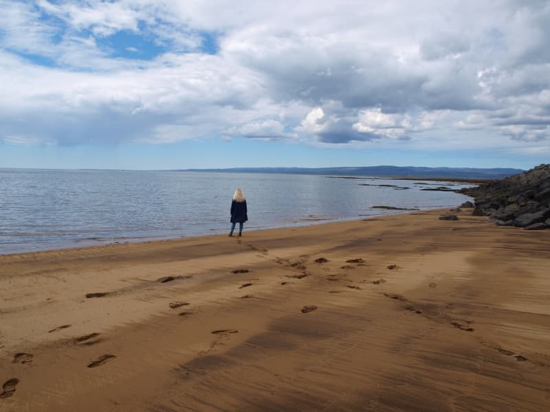
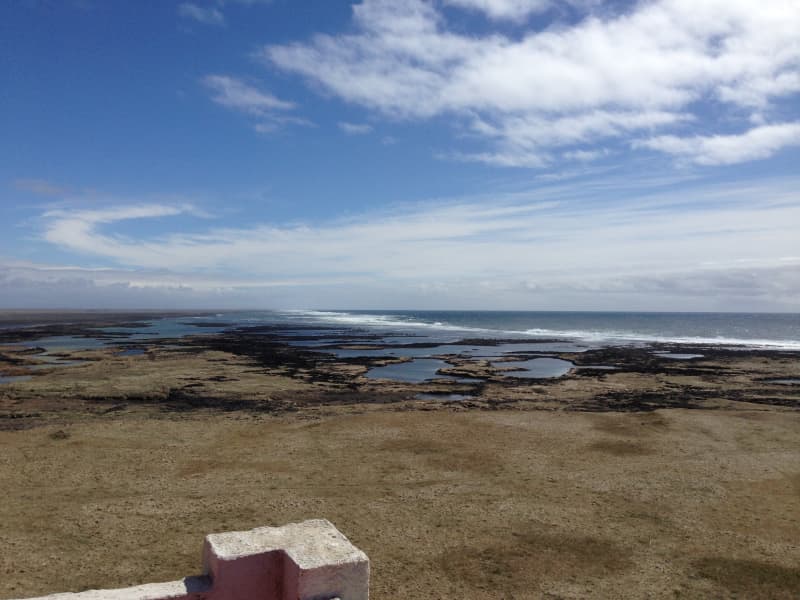
The coastline between Stokkseyri and Eyrarbakki
The coastline between the rivers Þjórsá and Ölfusá (25 km/15 mi) forms the outskirt of the great Þjórsárhraun lava field. Eyrarbakki and Stokkseyri provide easy access to the coastline as well as a path between the two villages where you can see the Atlantic Ocean and marvel at the fact the South Pole is directly to the south. This spot has a great view of both the ocean and mountains. Information signs can be found in both villages as well as an observation platform in Stokkseyri.
View
Þjórsárhraun
Þjórsárhraun is the result of the greatest lava flow on earth since the end of the last Ice Age. The lava came from an enormous eruption around 6700 B.C., possibly in Heljargjá canyon in the Veiðivötn region, in Iceland's highlands. The lava's extreme temperature and fluidity contributed to its flow being at least 140 kilometers (87 mi) until it was stopped by the waves of the North Atlantic Ocean. The lava is well visible by Stokkseyri and Eyrarbakki's coastline. The great Þjórsárhraun lava is approx. 975 square km (376 sq. miles), and its volume is 25 cubic km (6 cubic miles).
View
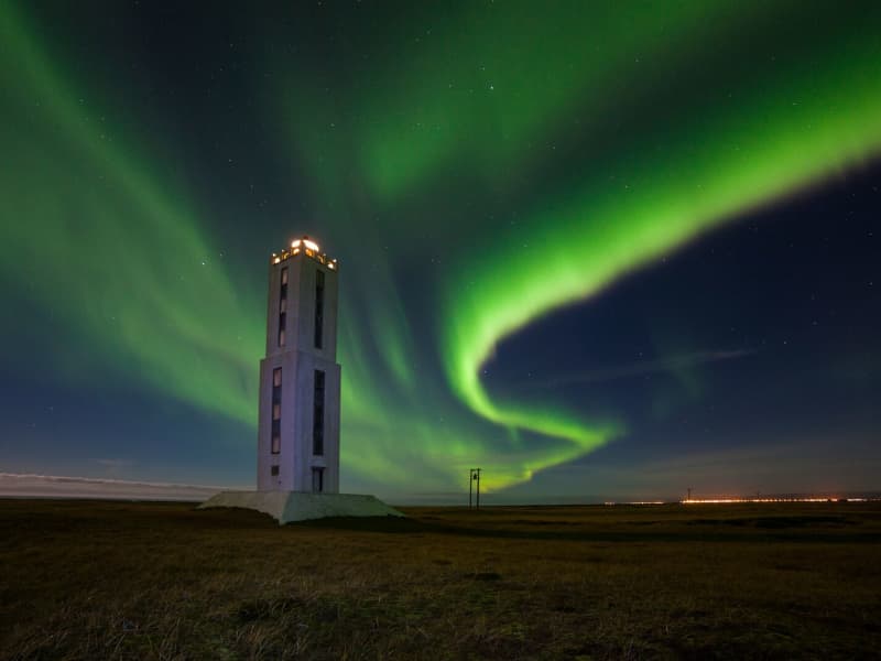
Knarrarósviti Lighthouse
Built-in 1938-1939, the lighthouse was the first one in Iceland to be built out of reinforced concrete. For a long time, the lighthouse was the tallest building in South Iceland, 26,2 meters (86 feet) high. It was designed by the engineer Axel Sveinsson as a blend of functionalism and art nouveau (jugendstil). In summertime (mid of June to start August) the lighthouse is open every day.
Knarrarósviti lighthouse is part of the beautiful South Coast Lighthouse trail that you can find more information about here.
View
Timburhóll - Grove
Timburhóll is a beautiful grove where you can relax and enjoy the surroundings. You could even barbecue using the barbecue facilities provided but use caution with the fire and make sure not to leave any litter. This is also a memorial site of the great Icelandic artist and painter Ásgrímur Jónsson as well as the farmers Guðfinna Guðmundsdóttir and Stefán Jasonarson.
View
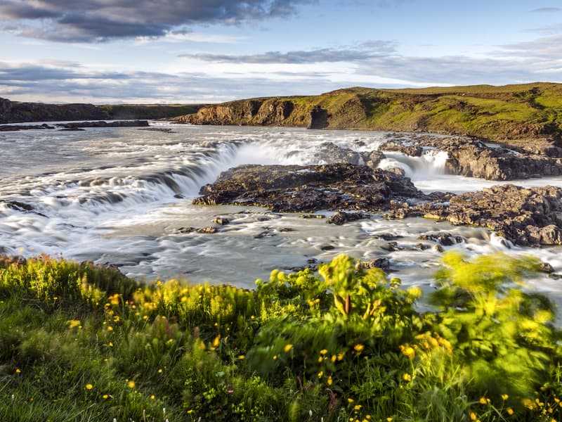
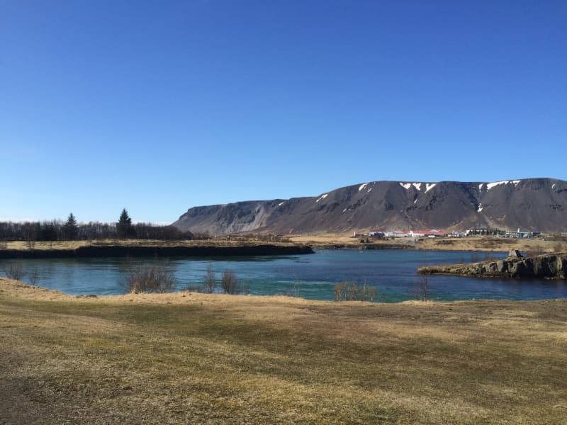
Urridafoss Waterfall
Urriðafoss is a waterfall in the Þjórsá River. Þjórsá is Iceland's longest river, 230 km, and Urriðafoss is the most voluminous waterfall in the country. This mighty river drops down (360 m3/sec) by the edge of the Þjórsárhraun lava field in beautiful and serene surroundings. Þjórsárhraun lava field is the result of the greatest lava flow on earth since the Ice Age. It is located right off highway 1.
View
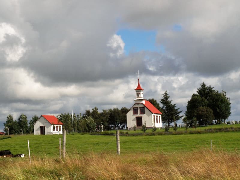
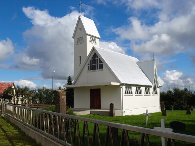
Villingaholt church
A church and farm site and home to the great 17th century saga writer Jón Erlendsson; thanks to his work many of the Icelandic Sagas were preserved that would otherwise have been lost. Later the home of Jón Gestsson (1863-1945) craftsman and farmer who designed and constructed the current church in 1910-1911. The church has a tower, choir loft and seats for 100 people. A little further to the south is a hill next to the school which used to be where the church and farm were located. Due to frequent sandstorms and heavy damage from earthquakes in 1784 they were moved to the current location.
View
Þjórsá river
Þjórsá is the longest river in Iceland, 230 km, with a catchment area of 8000 km². Þjórsá is a glacier river, and its source is the Hofsjökull glacier. On its way to the sea, it falls off some cliffs in many places, forming beautiful waterfalls. Some of these waterfalls are well-known, but others are unknown pearls to discover, especially those in the highlands. The waterfall Þjófafoss in Þjórsá, south of the hill Búrfell, is well known and easy to reach.
In winter, the river can gather vast quantities of ice that has settled at its bottom. In spring, when the ice melts in Þjórsá canyons below Urriðafoss waterfall, the river breaks through the ice, which is a magnificent sight to behold.
View
Ölfusá river
Ölfusá river is the most voluminous in Iceland, with an average flow of 423 m³/sec.
Three large floods occurred in the 20th century, and beside the restaurant, Tryggvaskáli, are lines showing each flood's height. All the floods happened during the wintertime due to heavy rains and high temperatures, which caused the snow to melt unusually fast.
Ölfusá River is relatively short, about 25 km (14 miles) long. About 6 km (4 mi) north of Selfoss are two rivers, Sogið and Hvítá, and combined form Ölfusá.
View
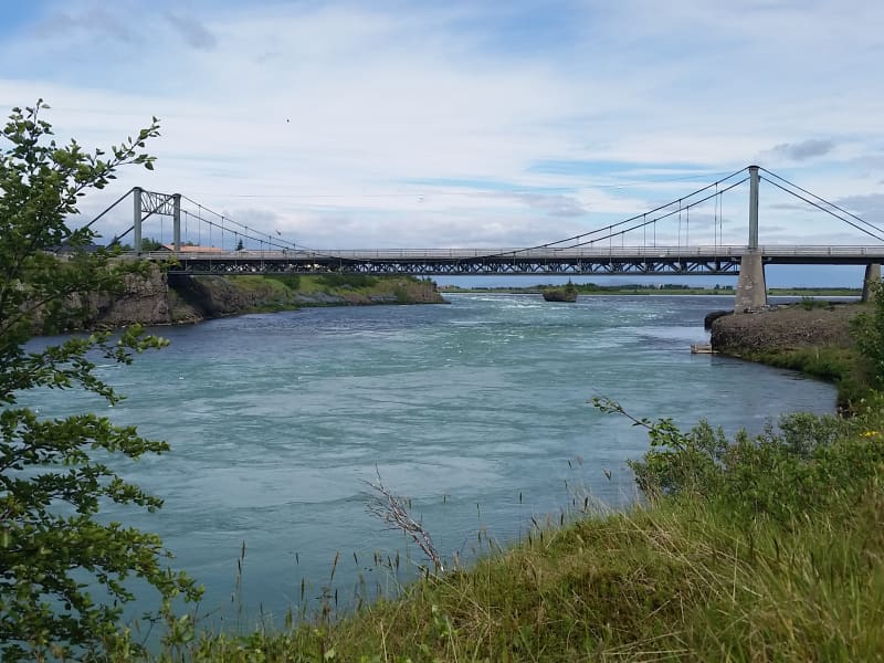
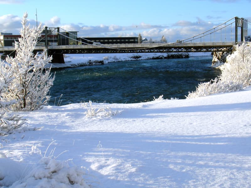
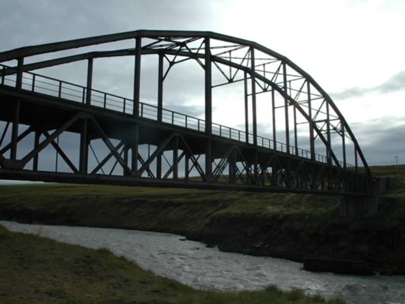
Ölfusárbrú - suspension bridge
Ölfusárbrú is a suspension bridge over the Ölfusá River that was first built in 1891 and became the largest bridge in Iceland at the time. In September 1944, when the bridge had been in use for 53 years, the eastern bearing cables broke due to the weight of two trucks. A new suspension bridge was built in 1945, which only took five and a half months, but while it was being constructed, the old bridge had been fixed for temporary use. The bridge is 84 meters long and is in the town of Selfoss.
View
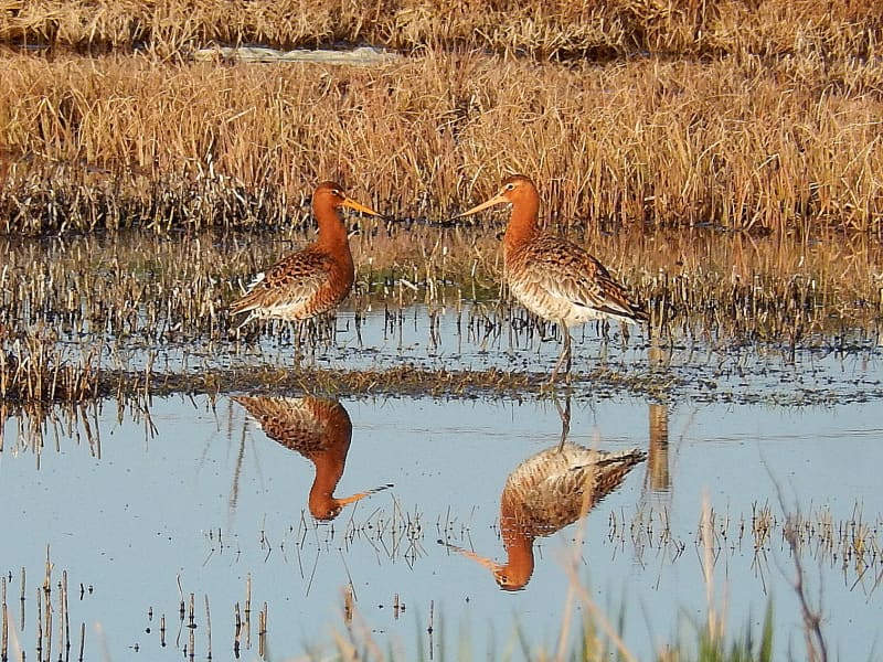
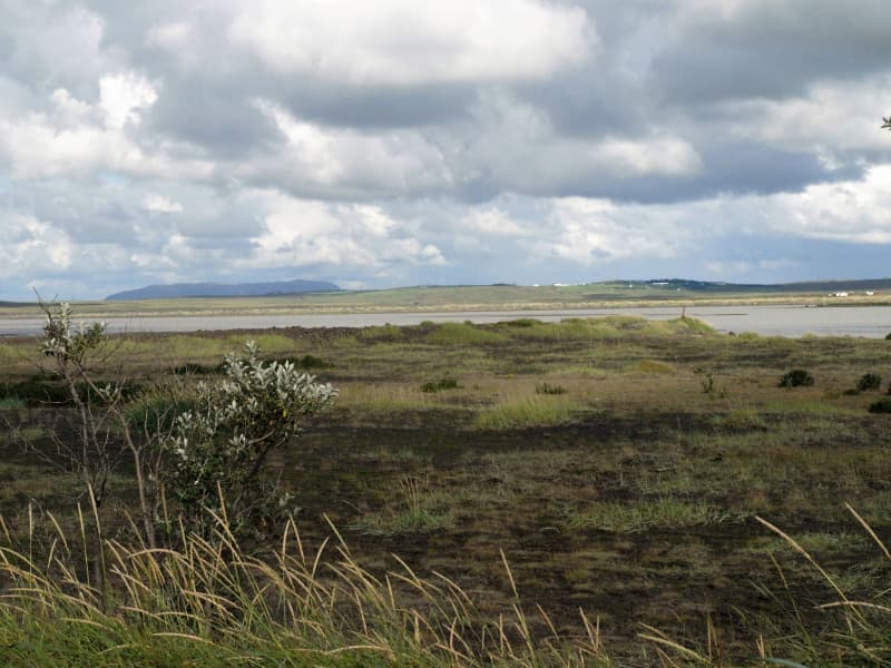
The Flói Bird Reserve
Northwest to the town of Eyrarbakki is a wetland area, rich in birdlife. The reserve has walking paths and a bird hide, an ideal spot for bird watching. The Flói Bird Reserve is listed in the Bird Life international Association. The Reserve is characterized by its flood meadows and numerous small ponds. Approximately 70 species of birds have been recorded in the Reserve. During spring and autumn migration Greylag Geese and White-fronted Geese can be found as well as Wigeon and Tufted Duck and various waders such as Snipe and passerines like Wheatear. During winter, birds, chiefly gulls and sometimes Long-tailed Duck and Common Eider, are concentrated in the estuary of the river Ölfusá. Whooper Swan, Teal, Mallard and Goosander are attracted to open water in winter.
View