
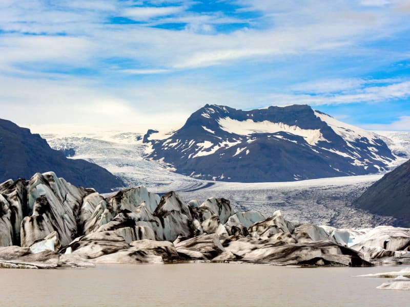
Jökulsárlón Glacier lagoon
Jökulsárlón is a glacial lagoon by the ring road and was recently designated as a part of Vatnajökull National Park. It's still blue waters are a sight not to be missed, as it is dotted with icebergs from the edge of Breiðamerkurjökull, a part of the Vatnajökull glacier. The lagoon flows through a narrow gateway into the Atlantic Ocean, leaving the spectacular sight of the large chunks of ice on the black sandy beach. In wintertime, the fish-filled lagoon hosts a number of seals, which visit the lagoon for an easy meal. Year-round curious seals can be seen basking on the blue-tinted icebergs. The lagoon is accessible from the beach all year round, and so is the café on the banks of Jökulsárlón. For hikers, a marked hiking trail between Jökulsárlón and Fjallsárlón is recommended as a scenic trip through unforgettable surroundings. During the summer, the national park offers interpretive tours with a ranger. Check for information on the park homepage or social media.
A word of warning - don't jump onto the ice floating in the lagoon. Some tourists think it’s okay to do it, but it is dangerous to play, and the ice can capsize, leaving you stuck beneath it in the ice-cold water. So let's be very careful here.
Please heed the advice of the locals and never step on the ice in the lagoon!
Vatnajökulsþjóðgarður
View
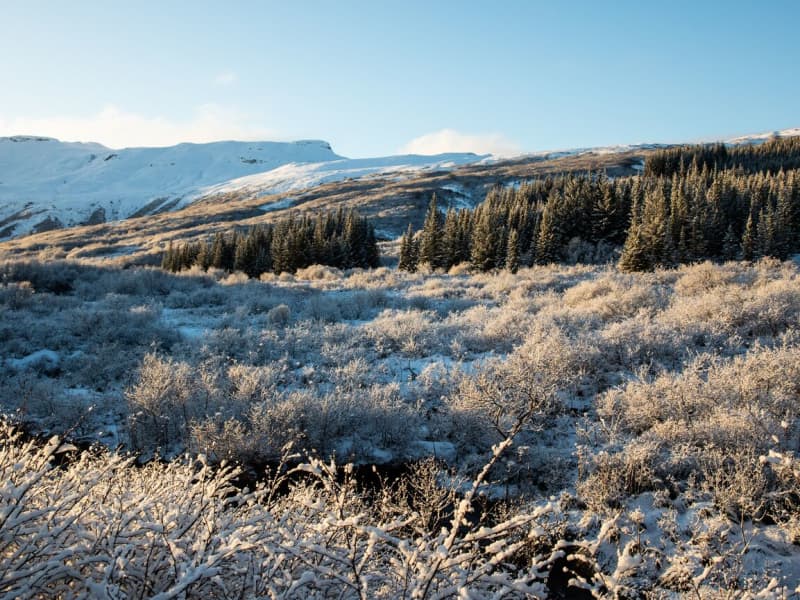
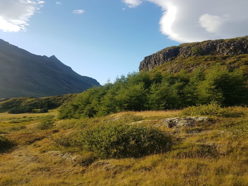
Haukadalsskógur Forest
Haukadalsskógur forest is the most highly cultivated of the national forests in Iceland and one of the biggest national forests in South-Iceland. A great outdoor area, with walking trails for wheelchairs as well.
View
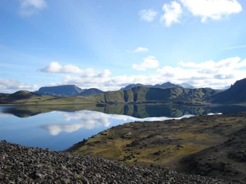
Fishing in Landmannaafréttur
Many other lakes, apart from Veiðivötn, are located south of Tungnaá, and fishing permits for twelve of them can be bought from the wardens at Landmannahellir.
These are the lakes Blautuver, Dómadalsvatn, Eskihlíðarvatn, Frostastaðavatn, Herbjarnarfellsvatn, Hnausapollur (Bláhylur), Hrafnabjargavatn, Kílingavötn, Lifrafjallavatn, Ljótipollur, Löðmundarvatn and Sauðleysuvatn. Ljótipollur and Hnausapollur are the youngest of these lakes, with the former dating from 1477 and the latter from 871.
Most of these are closed lakes, although Helliskvísl flows out from Löðmundarvatn, and Blautuver and Klingavötn are connected to Tungnaá. Only trout is caught in Ljótapollur, Herbjarnarfellsvatn, Lifrarfjallavatn and Dómadalsvatn. Trout and Arctic char is caught in Blautuver, Frostastaðavatn and Kílingavötn, but only Arctic char in other lakes.
View
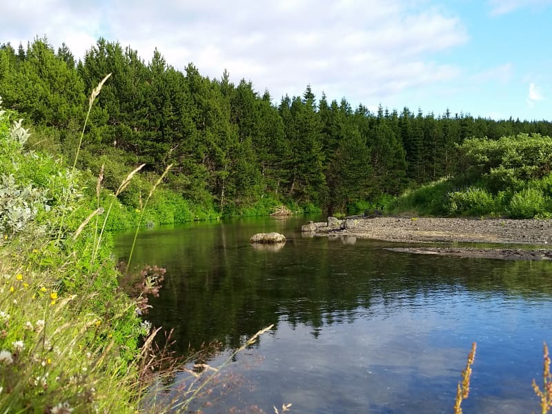
Þjórsárdalsskógur Forest
The natural setting of the forest follows a varied landscape of intense contrasts, from flowering forests to unripe ash hake from Hekla. The forest is mostly birch and spruce, pine, and larch mixed forests. An ideal place for outdoor activities, as there are many marked and unmarked paths and forest roads in the woods.
Þjórsárdalsskógur lies west of Highway 32, where it goes east towards Búrfellsvirkjun. You can get into the forest from Ásólfsstaðir and also via a bridge over Sanda, a short way into the valley. The campsite in Þjórsárdalur is in between and is well marked.
In Þjórsárdalur, the forest stretches far up the slopes, the landscape is beautiful and varied, and it has a true fairytale atmosphere. There are numerous marked and unmarked paths and trails in the forest for travelers and hikers, rivers to swim in, and lava to explore. In the area, there are paths for wheelchairs, good camping, and a swimming pool in Árnes, about 15 kilometers down in the countryside.
Source: skoraekt.is
View
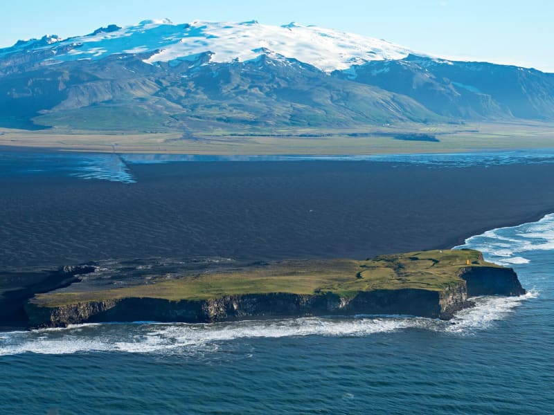
Ingólfshöfði
At the edge of the Atlantic Ocean, Ingólfshöfði is a headland isolated by black sands and perilous rivers from the rest of the mainland.
This historical cape is named after the first settler of Iceland, Ingólfur Arnarson, who spent his first winter there with his family after moving to Iceland, 874-875 A.D.
However, it´s home to thousands of nesting seabirds and gulls, especially puffins and the great skua. Ingólfshöfði is only accessible by organized tours.
View
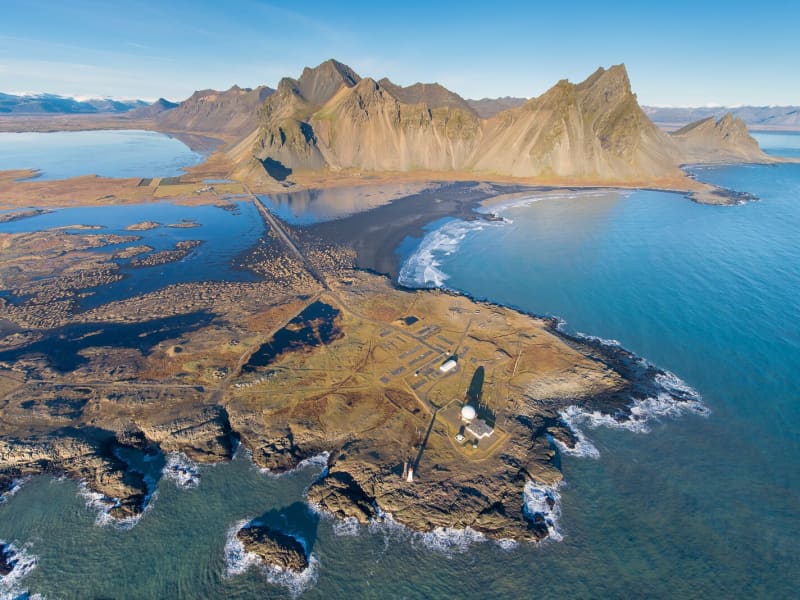
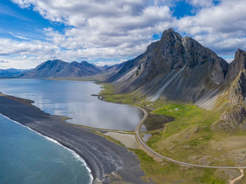
Vestrahorn
In Iceland, one of the first settlement farms was Horn, built by Hrollaugur, son of Rögnvaldur Earl of Møre in Norway. The Hornafjörður Municipality and several natural sites are named after the settlement farm. Horn means the same thing in Icelandic and English.
The area is approximately a ten-minute drive away from Höfn. The Horn area is below Vestra-Horn, a 454-meter-high mountain, and it is an interesting geological site composed of un-stratified plutonic rock, mostly gabbro but with some granophyre. East of the mountain is a strange-shaped outcrop called Brunnhorn that stretches out to sea. Seals also tend to hang out on the stretch of sand, so if you’re lucky, you can also catch a picture of a lazing seal.
During the Second World War, the Horn area became a base for the British army, and later a NATO radar station was set up at Stokksnes, south of Horn. At Stokksnes, you can feel the power of the Atlantic Ocean as the waves hit the rocky shore with massive force.
View
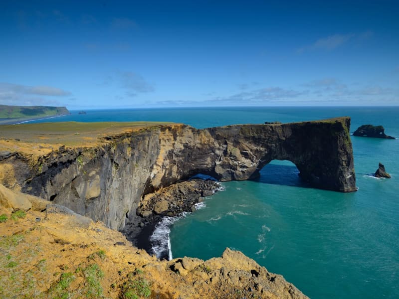
Dyrhólaey
Dyrhólaey is a nature reserve. The protected areas are necessary to ensure protection while ensuring public rights. Some areas are closed for part of the year to preserve wildlife, others are closed all year round due to sensitive natural monuments, traffic is also limited in some areas to people, and others are open all year round.
More information about DyrhólaeyDyrhólaey is a 120-meter high promontory not far from Vík. The place got its name from the massive arch that the sea has eroded from the headland. When the sea is calm, big boats can sail through it. A maniacal daredevil pilot has even flown through the arch with a small-craft airplane!
From the top of Dyrhólaey, there is a great view. The headland is thought to have been made in an underwater volcanic eruption late in the glacial period, not unlike the eruption of Surtsey. Several outcrops are in the sea; the highest one, called Háidrangur ("High column"), is 56 m. high. Dyrhólaey has been a natural reserve since 1978.
The promontory is widely known among sailors as "Portland" and English trawler fishermen beach where one can climb (at your own risk). According to legend, the Reynisdrangar needles were formed when two trolls tried dragging a three-masted ship to land. When daylight broke, they turned to stone. The Needles can be seen clearly from the village of Vík and are 66 meters above sea level at their highest.
In one of the many caves here – there is a local legend about a monster having lived here for many centuries. The monster seems to have disappeared after a landslide over 100 years ago…used to call it a "Blow hole." There are also unique rock formations all along the Birdlife here is abundant, with puffins and eider ducks being the most common species in the area. On top of the cliff, the lighthouse stands impressive and stoic in this often very windy area. Be careful not to go too close to the ledge of this dramatic cliff.
View
Ósland
Ósland is an island accessible by a manmade isthmus (land bridge) and is situated just a few steps from the harbor area. Ósland was once an island but is now connected to the mainland. It is a conservation area popular for hiking.
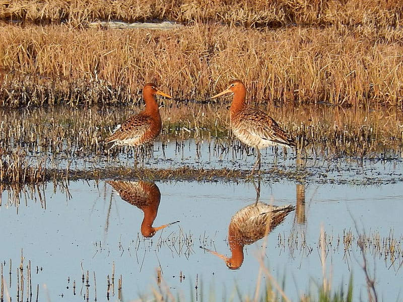
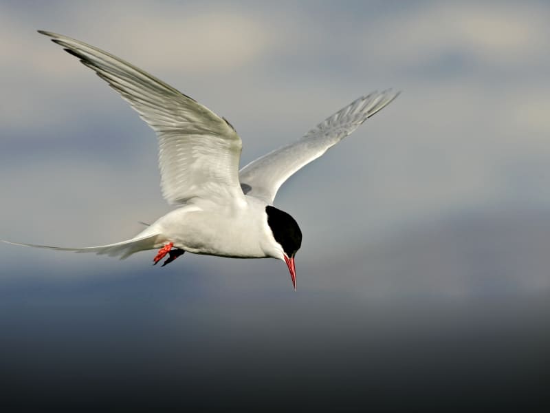
There is rich birdlife, and the Arctic Tern is predominant during the nesting season. Ósland is situated just a few steps from the harbor area in Höfn. Walking trails circle the pond, Óslandstjörn, and are along the shore. On the hill, Óslandshæð is a memorial to the fishermen and an information board about the surrounding natural area.
From Ósland, you can follow the nature trail set up to model the solar system – it's been scaled down and has its sizes and distances in proportion. There are also visible impressions of trees in the basalt rock in the area, trees that have been covered by lava a long time ago.
View
Heinaberg
Heinaberg is a beautiful area that consists of Heinabergsjökull glacier, the glacial lagoon Heinabergslón, where you can go kayaking among the icebergs during summer, and stunning landscape. The Heinaberg area is part of Vatnajökull National Park.
The gorgeous glacial lagoon of Heinaberg, Heinabergslón, is accessible by car and is often studded with large chunks of glacier that break off the Heinabergsjökull glacier. The area offers excellent conditions for hikers, as it has several interesting hiking trails, along which one can see waterfalls, ravines, volcanic intrusions, and even, on a lucky day, a reindeer.
The gravel road from road no 1 to the glacial lake is not in service during the winter months. Therefore, one needs to be aware of changes in road conditions and accessibility.
Vatnajökulsþjóðgarður
View
Haukafell
Haukafell is a forestry project that was launched in 1985 and now offers ample shelter to the low-lying, local vegetation, which mostly consists of berry bushes that are ripe for picking in August. The area is situated east of Fláajökull glacier and is a popular outdoor area for the locals. There are various hiking trails to be enjoyed in the beautiful surroundings and the crispy fresh air. From
Haukafell you find a marked hiking trail to Fláajökull glacier, where you cross a recent walkway over the Kolgrafardalsá river. In Haukafell you find a good campsite in a beautiful area.
View
Hvalnes
Hvalnes is a small peninsula with a black pebble beach stretching for a few kilometers. Sitting on its tip is a picturesque old, yellow lighthouse and an old turf farm with the same name as Hvalnes.
The beach stretches for a few kilometers and would make a nice walk, or you can hang out on the beach and enjoy the view. It is an excellent location for bird watching and photography.
View
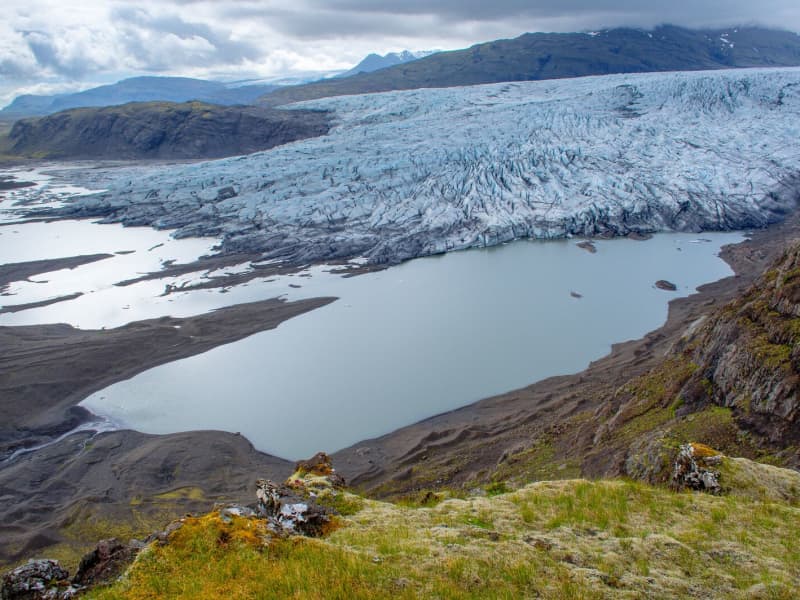
Fláajökull Glacier
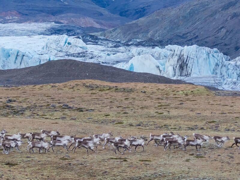
Fláajökull is an outlet glacier from Vatnajökull. The area offers spectacular views of the ever-receding glacier that has receded 2 km during the last one hundred years, leaving a glacial lagoon in its wake. The area is, an excellent destination for all interested in witnessing how the glacier movement shapes the surrounding landscape. A marked hiking path connects the Fláajökull area with the Haukafell forestry project.
View
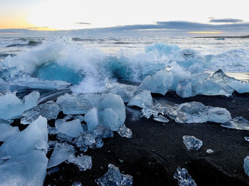
Breiðamerkursandur - Fellsfjara
Next to Jökulsárlón is a less-known attraction within Vatnajökull National Park named -Fellsfjara (Eystri-Fellsfjara on the eastern side of the river and Vestri-Fellsfjara on the western side), which are fields of sand that get strewn with chunks of glacial ice, carried along the river Jökulsá á Breiðamerkursandi, towards the sea and then sent back upon the sands by the tides. The diamond-like pieces of glaciers create a mesmerizing atmosphere in the close mist that often visits the beach. These glistening ice diamonds create an even more spectacular vision in the winter months when the sun comes out and bathes the beach in magical lighting, which reflects off the ice. Waiting around in the darkness for the rising of the sun will be well worth the wait, despite the cold of the Icelandic winter night.
A word of warning: never crawl up on the icebergs and don't choose the ones close to the sea. The photographer must always keep his/her eyes on the sea, or the waves might unexpectedly come in and carry you out to sea.
View
The Flói Bird Reserve
Northwest to the town of Eyrarbakki is a wetland area, rich in birdlife. The reserve has walking paths and a bird hide, an ideal spot for bird watching. The Flói Bird Reserve is listed in the Bird Life international Association. The Reserve is characterized by its flood meadows and numerous small ponds. Approximately 70 species of birds have been recorded in the Reserve. During spring and autumn migration Greylag Geese and White-fronted Geese can be found as well as Wigeon and Tufted Duck and various waders such as Snipe and passerines like Wheatear. During winter, birds, chiefly gulls and sometimes Long-tailed Duck and Common Eider, are concentrated in the estuary of the river Ölfusá. Whooper Swan, Teal, Mallard and Goosander are attracted to open water in winter.
View
Hoffell
Hoffell is a farmland area characterized by a large outlet glacier named Hoffellsjökull and gabbro rock. Gabbro rock originated deep in the earth but is visible in the area due to the uplift of the area and glacial erosion, which gives the environment a greenish hue in the otherwise dark rocks. The Hoffell area is 15 kilometers from the town of Höfn.
Driving or hiking north from Hoffell along the sands of Hoffellssandur, you will enjoy the spectacular scenery of mountain slopes carved out by earlier glaciers. Along the sands of Hoffellssandur, you will enjoy the stunning scenery of mountain slopes carved out by earlier glaciers. Along the way, a borehole is also constructed to extract geothermal water. Finally, you reach the ice of the glacier tongue, Hoffellsjökull, skirted by the numerous hiking trails of the Geitafell mountain.
The area is partly within Vatnajökull National Park, preserved for outdoor recreation and is rich in vegetation, wildlife, and geological variety. The area’s many hiking trails offer a stunning view of the diverse, beautiful wonders it has to offer.
View
Birds of South Iceland
Birds of South Iceland is a program offering excellent year-round services for birdwatchers. South Iceland has a great deal to offer visiting birdwatchers with its wide variety of habitats, including wetlands, seabird colonies, highland oases, and unique coastlines. The largest colonies of puffins, pink-footed geese, and great skuas in the world are located within this region, together with Europe's largest leach's storm-petrel colony. South Iceland has a wide range of accommodation, from campsites to 4-star hotels, some within a short distance from Reykjavik.
More information about Birds and birdwatching in Southern Iceland here.
View